| July 1995 | Thunderstorm Wind | Hawkinsville | 1 killed, $25,000 | Thunderstorm winds knocked a tree down on a home, killing one person inside. Trees and power lines were knocked down throughout the county. (F??PH) |
| August 2003 | Heavy Rain | Hawkinsville | 1 killed | The Pulaski county Emergency Management Director reported that a 14-year old male fell into a rain-swollen drainage ditch. He was subsequently swept away and carried nearly two blocks away from where he fell in. He was killed instantly. Approximately 2.5 inches of rain had fallen in the area in just a 45 to 60 minute period of time. High water was also reported on several roads in the area. |
| May 2009 | Thunderstorm Wind | Hawkinsville | $350,000 | The Pulaski County Emergency Management Director reported extensive wind damage in the northern part of the county from Hawkinsville to just northwest of Mobley Crossing near the Bleckley county line. More than two dozen trees were down in the area and a number of power lines. At least one structure suffered substantial damage when a tree fell on the structure. Several homes on the northwest side of Hawkinsville, especially along Jackson and Dooly streets, sustained minor to moderate roof damage when shingles or portions of the roofs were torn off the homes. |
| June 2008 | Thunderstorm Wind | Hawkinsville | $210,000 | The Pulaski County Emergency Management Director reported that four buildings at the Harness Horse Racing Training Facility sustained significant damage from downburst thunderstorm winds. Damages to the facility exceeded $200,000. At least two trees were also down on power lines in the area of Lower River Road and Woodard Road. |
| June 2010 | Thunderstorm Wind | Hawkinsville | $75,000 | The Pulaski County Emergency Management Director reported that two buildings at an irrigation company off U.S. Highway 129, two miles south of Hawkinsville, were damaged from thunderstorm downburst winds. A pontoon was pushed approximately 100 yards into one of these buildings. Anywhere from six to eight trees and a few power lines and phone lines were also down in this same general area. |
| March 2011 | Hail | Hawkinsville | $63,000 | The Pulaski County Sheriff's Office observed golf ball-sized hail approximately five miles south of Hawkinsville. WSR-88D radar data suggests that quarter to golf ball-sized hail likely fell across the county from west of Hawkinsville to southeast of Hawkinsville. |
| April 1998 | Thunderstorm Wind | Hawkinsville | $50,000 | Sight survey by a NWS employee showed the damage path continued out of Houston county into Pulaski county. Over 150 pecan trees in 2 separate orchards were blown down. Very large oak and pine trees were also knocked down. An unoccupied mobile home was flipped and landed 30 to 40 feet away. It was upright and intact, but destroyed. The EMA director indicated a total of 17 homes were damaged or destroyed. Most of the damage came from falling trees. Power outages also resulted when trees fell on power lines. |
| August 1998 | Thunderstorm Wind | Hawkinsville | $50,000 | A sudden downburst from a thunderstorm peeled the roof off a high school gymnasium. Georgia Emergency Agency reported numerous trees and power lines were downed as well. |
| May 2003 | Thunderstorm Wind | Hawkinsville | $30,000 | The Pulaski county 911 center reported that 30 to 40 trees were blown down, some falling on and causing minor structural damage to homes. One home suffered significant damage when a large oak tree fell on the structure, as well as the two nearby vehicles in the driveway. Five barns at the end of the Harness Track Arena suffered substantial damage as the wind tore off the tin roofs. |
| June 2008 | Lightning | Hawkinsville | $25,000 | The Pulaski County Emergency Management Director reported that lightning strikes ignited two fires in southwest Pulaski county, one to a wheat field and the other to some woods. Nine acres of a wheat field burned and two acres of woods burned before the fires were extinguished. |
| April 1998 | Thunderstorm Wind | Hawkinsville | $25,000 | Numerous trees were downed by thunderstorm winds, some falling on power lines causing power outages. Roofs were taken off houses. Quarter size hail was also reported. |
| June 2015 | Thunderstorm Wind | Hawkinsville | $15,000 | The Pulaski County Emergency Manager reported a brick faade blown off of a business on Commerce Street in Hawkinsville. In addition, several trees were blown down in north Hawkinsville, some onto power lines, and the roof was torn off of a mobile home on Gooseneck Lane southeast of Hawkinsville. |
| June 2007 | Thunderstorm Wind | Hawkinsville | $10,000 | The Pulaski County Emergency Management Director reported that eight trees were down in the Hawkinsville area. One building was also damaged. |
| June 2007 | Thunderstorm Wind | Hawkinsville | $10,000 | The Pulaski County Emergency Management Director reported that the roof was blown off a barn. The debris caused damage to another outbuilding and a nearby home. In addition, three trees were also blown down in the area. Pea-sized hail was also observed. |
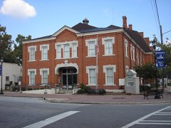
| October 2002 | Lightning | Hawkinsville | $10,000 | The Hawkinsville Dispatch & News reported that lightning struck electrical lines in the downtown area causing an electrical surge that destroyed a number of computer and phone systems in downtown area buildings. The county offices in the courthouse and annex were the hardest hit with every office suffering computer damage and the entire phone system was out in the building. The courthouse clock and the bank clock across the street from the courthouse also stopped when the lightning hit. There were several other businesses affected by the lightning strike in the downtown area including a paint store, the Dispatch & News, an x-ray facility, and a drugstore. Each store suffered varying degrees of damage to computers and phone systems in the buildings. |
| January 2017 | Thunderstorm Wind | Hawkinsville | $5,000 | The Pulaski County Emergency Manager reported damage from thunderstorm winds in the Hawkinsville area including a large tree blown down on Rawls Street and a building on Eastman Highway with roof damage. |
| May 2012 | Lightning | Hawkinsville | $5,000 | The Pulaski County Emergency Manager reported that lightning struck a home near the center of town, catching electrical wires on fire. Overall the home sustained only minor damage, most of which was due to smoke. |
| June 1998 | Thunderstorm Wind | Hawkinsville | $5,000 | 15 to 20 trees were blown down in and around Hawkinsville. |
| June 1994 | Thunderstorm Wind | Hawkinsville | $5,000 | Several trees and power lines were downed by thunderstorm winds. |
| April 1997 | Thunderstorm Wind | Hawkinsville | $5,000 | no account filed |
| April 2020 | Thunderstorm Wind | Hawkinsville | $2,000 | Reports of trees and power lines down on Fale Street, in Hawkinsville. |
| August 2012 | Thunderstorm Wind | Hawkinsville | $2,000 | The Pulaski County Emergency Manager reported that two trees and several power lines were blown down in and just east of Hawkinsville. |
| July 2000 | Thunderstorm Wind | Hawkinsville | $2,000 | The Pulaski county 911 center and the public reported trees down and some trees with broken limbs. |
| June 1997 | Thunderstorm Wind | Hawkinsville | $2,000 | Trees were knocked down on Buck Creek road off of Georgia Highway 247. |
| December 2008 | Thunderstorm Wind | Hawkinsville | $1,000 | The Pulaski County Emergency Management Director reported that three trees were blown down northeast of Hawkinsville. |
| July 2007 | Thunderstorm Wind | Hawkinsville | $1,000 | The Pulaski County 911 Center reported that several trees were down on U.S. Highway 341 south and Lower River Road, southeast of Hawkinsville. |
| August 2004 | Thunderstorm Wind | Hawkinsville | $1,000 | The Pulaski County 911 Center reported that several trees were down in the north central part of the county. |
| August 1999 | Thunderstorm Wind | Hawkinsville | $500 | The Hawkinsville sheriff's office reported several trees blown down. |
| May 2013 | Thunderstorm Wind | Hawkinsville | $250 | Broadcast media relayed a report of a downed tree on Mock Springs Road. |
| March 2023 | Hail | Hawkinsville | - | Quarter sized hail at the intersection of Perry Hwy and Truman Rd. |
| December 2014 | Heavy Rain | Hawkinsville | - | COOP observer reported a 24-hour rainfall total of 4.40 inches. |
| June 2011 | Hail | Hawkinsville | - | The Pulaski County 911 Center relayed reports of nickel to quarter-sized hail from the eastern part of the county, east of Hawkinsville. |
| May 2009 | Hail | Hawkinsville | - | The Pulaski County 911 Center reported nickel-sized hail in the northeast part of the county between Hawkinsville and Mobley Crossing. |
| July 2008 | Hail | Hawkinsville | - | The Pulaski County Emergency Management Director reported that quarter-sized hail was observed. |
| August 2007 | Thunderstorm Wind | Hawkinsville | - | The Pulaski County 911 Center reported that several trees were down in the county. Some power outages were noted in the Hawkinsville area. |
| May 2005 | Hail | Hawkinsville | - | NBC TV Channel Five of Macon relayed a report of golf ball-sized hail near Hawkinsville. The Pulaski County 911 Center reported that they had received several reports of quarter-sized hail in the Hawkinsville area. |
| June 2004 | Heavy Rain | Hawkinsville | - | The public reported that several low water crossings on Georgia Highway 112 were flooded in the Hawkinsville area after receiving 2.30 inches of rain in less than an hour. |
| August 2002 | Hail | Hawkinsville | - | The Pulaski county Emergency Management Director reported dime size hail. |
| June 2001 | Flood | Hawkinsville | - | The Pulaski County 911 center reported that minor street flooding occurred in Hawkinsville on U.S. Highway 129 and Georgia Highway 257/27. |
| July 2000 | Hail | Hawkinsville | - | The Pulaski county 911 center reported quarter size hail. |
| June 1999 | Hail | Hawkinsville | - | The public reported quarter size hail. |
| August 1999 | Hail | Hawkinsville | - | Pulaski county 911 reported quarter size hail. |
| January 1999 | Hail | Hawkinsville | - | The Pulaski county sheriff's office reported dime size hail and 1 tree down. |
| May 1998 | Hail | Hawkinsville | - | Pulaski county 911 received several reports of dime to nickel size hail in and around Hawkinsville. |
| April 1998 | Hail | Hawkinsville | - | no account filed |
| May 1998 | Hail | Hawkinsville | - | no account filed |
| May 1997 | Hail | Hawkinsville | - | no account filed |
| March 1995 | Hail | Hawkinsville | - | no account filed |
 Block