 Block
From the record
One of 27 National Register listings published here for Coweta County · listed in 2005 · category: District.
Sources: the case file at the National Archives · the National Register database, National Park Service
Listed on the National Register of Historic Places in 2005.
One of 27 National Register listings published here for Coweta County · listed in 2005 · category: District.
Sources: the case file at the National Archives · the National Register database, National Park Service
Regional context, not property-specific evidence. The federal wildfire occurrence database lists 272 fires within 5 miles of Sargent Historic District between 1992 and 2019, burning about 675 acres in total. 5 started naturally. 39 were recorded as arson. Distance is straight-line from the map coordinates, so a fire counted here may appear on a neighbouring settlement's page as well.
| Reported cause | Fires |
|---|---|
| Debris and open burning | 175 |
| Arson/incendiarism | 39 |
| Missing data/not specified/undetermined | 16 |
| Equipment and vehicle use | 13 |
| Smoking | 9 |
| Misuse of fire by a minor | 7 |
| Recreation and ceremony | 5 |
| Natural | 5 |
| Railroad operations and maintenance | 3 |
The most recent of them, most recent first, with the day each was reported and the service that recorded it.
| Date | Cause | Size | Reported by | Name on the report |
|---|---|---|---|---|
| 9 September 2019 | Debris and open burning | under an acre | Georgia Forestry Commission | FY2020COWETA001 |
| 5 September 1999 | Arson/incendiarism | under an acre | Georgia Forestry Commission | not named |
| 3 September 1997 | Arson/incendiarism | 2.3 acres | Georgia Forestry Commission | not named |
| 29 September 1993 | Debris and open burning | 1.3 acres | Georgia Forestry Commission | not named |
| 25 September 1993 | Debris and open burning | under an acre | Georgia Forestry Commission | not named |
| 23 September 1997 | Debris and open burning | under an acre | Georgia Forestry Commission | not named |
| 18 September 2019 | Debris and open burning | 1.0 acres | Georgia Forestry Commission | FY2020COWETA006 |
| 5 August 2007 | Debris and open burning | under an acre | Georgia Forestry Commission | not named |
Regional context, not property-specific evidence. The federal mineral resources record lists 1 working within 5 miles of Sargent Historic District: 1 past producer. None of them still produces. What was taken out: Granite. Distance is straight-line from the map coordinates, so a quarry counted here may appear on a neighbouring settlement's page as well.
| Where | Site | Commodity | Status | Recorded |
|---|---|---|---|---|
| Sam Hill Quarry | Granite | Past Producer |
Regional context, not property-specific evidence. The National Weather Service names Sargent, the town this property stands in, in 26 storm reports between 1997 and 2026: 14 thunderstorm wind, 9 hail, 1 lightning, 1 heavy rain. The reports record 1 death and 1 injury. Each account below is quoted exactly as the forecast office filed it, from the NOAA Storm Events Database, and each date opens the federal record of that event.
| When | Event | Place named | Harm | What the report says |
|---|---|---|---|---|
| July 2016 | Thunderstorm Wind | Sargent | 1 killed, 1 hurt, $25,000 | The Coweta County Emergency Manager reported that a large oak tree fell on Sargent Main Street striking a van. The 47 year old driver of the van was killed and his teenaged passenger was injured. |
| April 2011 | Hail | Sargent | $1,080,000 | The public observed golf ball-sized hail approximately five miles southwest of Palmetto near Cannongate near the intersection of Georgia Highway 54 and U.S. Highway 29. |
| April 2008 | Hail | Sargent | $700,000 | The public observed golf ball-sized hail in northern Coweta county, just southwest of Roscoe and half-dollar-sized hail about five miles north of Newnan. A storm spotter observed nickel-sized hail in the Sargent area. |
| January 2007 | Tornado (F1) | Sargent | $250,000 | A storm survey conducted by the National Weather Service, Peachtree City, Georgia, concluded that an F1 tornado had touched down approximately five miles south-southwest of Sargent, between mile marker 6 and 7 on Georgia Highway 34. In this area, the roof of a barn was damaged, a small greenhouse was destroyed, and several large trees were downed. The tornado then travelled northeast causing minor damage to homes and uprooting large trees on Dixon Road just north of Georgia Highway 34. Further northeast along Aspen Lake Drive, F1 damage occurred as homes suffered minor damage to roofs. Eaves and gutters were stripped off a few homes in this area. Several outbuildings were damaged, overturned, or destroyed. A number of large trees were snapped off or uprooted, several of which fell on homes in the area causing significant damage. Along Thigpen Road and further northeast along Welcome-Arnco Road, several more homes received minor damage from downed trees. The tornado track became more intermittent as it traveled northeast from this point, with spotty minor damage to trees and a few homes in the community of Arnco Mills. The final area where damage was observed was approximately two miles east-southeast of Sargent on Witcher Road, where several large trees were snapped or uprooted causing minor damage to a few homes. At least 30 homes sustained minor to moderate damage along the path of this tornado. The tornado was rated an F1 in maximum intensity with a maximum path width of 200 yards. The path length was nearly six miles. |
| June 2018 | Thunderstorm Wind | Sargent | $50,000 | The Coweta County Emergency Manager reported numerous trees and power lines blown down across the county from the Arnco-Sargent area through Newnan to Senoia. Trees fell onto a house on Old Carrollton Road, no injuries were reported. A falling tree damaged a utility pole and a fire hydrant on Gary Summers Road. A small woods fire was ignited along Boone Road when a falling tree brought down power lines. |
| June 2015 | Thunderstorm Wind | Sargent | $25,000 | The Coweta County 911 Center reported numerous trees and power lines blown down across the northern portion of the county from Arnco-Sargent to Cannongate and south of Palmetto. Two trees fell on a workshop next to a residence in the 5400 block of U.S. Highway 29 north. |
| April 2010 | Thunderstorm Wind | Sargent | $25,000 | The Times Herald of Newnan reported that strong winds from showers and isolated thunderstorms blew down a number of trees and several power lines across the county. A home on Fifth Street near downtown sustained minor damage when a large tree fell on the structure. The roof and guttering on the back of the home was damaged. Power was out in the Newnan area for nearly an hour. |
| June 1998 | Thunderstorm Wind | Sargent | $20,000 | Newspaper and public reports stated that 3 houses were damaged by trees falling on them. An elderly was trapped in her home until fire personnel helped her get out. |
| April 2011 | Thunderstorm Wind | Sargent | $15,000 | The Coweta County 911 Center reported widespread tree and power line damage throughout the county. Several dozen trees were down across the county, as well as many power lines. |
| February 2008 | Thunderstorm Wind | Sargent | $10,000 | The Coweta County Emergency Management Director reported that from one to two dozen trees were blown down across the county. Some trees were down on Georgia Highways 154 and 16. The Times Herald of Newnan reported that trees were down in the Thomas Crossroads area, Shenandoah Industrial Park, Roscoe Road at Walt Carmichael Road, Minx Road, and along Georgia Highway 16 near Georgia Highway 54. |
| March 2026 | Thunderstorm Wind | Sargent | $5,000 | Em reports multiple trees down in the arnco mills area generally along ga27 from old carollton rd to witcher rd and welcome sargent rd. |
| March 2013 | Thunderstorm Wind | Sargent | $5,000 | The Coweta County Emergency Manager reported trees down across the northern part of the county. |
| May 1998 | Hail | Sargent | $5,000 | Several public reports were received from across Coweta county of hail ranging from dime size to 2 inches in diameter. At least 1 car was dented. |
| January 2013 | Thunderstorm Wind | Sargent | $2,500 | The Coweta Couty 911 Center reported that multiple trees were blown down across the northern portion of the county. |
| March 2025 | Thunderstorm Wind | Sargent | $1,000 | Tree down near wagers mill and highway 16 . |
| June 2007 | Thunderstorm Wind | Sargent | $1,000 | The Coweta County 911 Center reported that a couple of trees were blown down on power lines along Belt Road near Sargent. Winds were estimated by the public and storm spotters to be in the 45 to 50 mph range in Sharpsburg and Newnan. |
| April 2000 | Lightning | Sargent | $1,000 | Lightning ignited a fire at a shop building on Austin Road. The fire was extinguished with a water hose before the fire department arrived. |
| August 2014 | Thunderstorm Wind | Sargent | $750 | The Coweta County 911 Center reported three trees down, one in Sargent, one in Roscoe and one in Handy. |
| May 2015 | Thunderstorm Wind | Sargent | - | Several trees down northwest of Newnan, on Sewell Mill Road and Mount Carmel Road. |
| June 2010 | Hail | Sargent | - | The public observed quarter-sized hail near Sargent in the northwest part of the county. |
| April 2006 | Hail | Sargent | - | An official with the Sargent fire department observed penny-sized hail in Sargent and an amateur radio operator observed penny-sized hail in Newnan. |
| March 2005 | Hail | Sargent | - | The Sargent Post Office reported penny-sized hail. |
| December 2004 | Hail | Sargent | - | The public reported nickel-sized hail in the Sargent and Arnco Mills areas and penny-sized hail in Newnan. |
| July 2004 | Heavy Rain | Sargent | - | The public reported that heavy rain had flooded a portion of Buddy Road near Roscoe Road just north of Windsor Estates. |
| May 1997 | Hail | Sargent | - | Dime to quarter sized hail was reported. |
| June 1998 | Hail | Sargent | - | no account filed |
No historic map-sheet match is published for this property yet. That does not mean no map exists. This record needs a coordinate-quality review before it can be joined to a sheet boundary. Browse the county's mapped places while that work is pending.
Other National Register properties close enough to walk or drive between, ordered by distance from this one. Both positions come from the same geocoding pass that matched these properties to their map sheets.
| Photograph | Property | Distance | Listed |
|---|---|---|---|
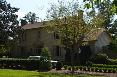 | Vinewood | 3.2 miles | 2011 |
| Platinum Point Historic District | 4.7 miles | 1990 | |
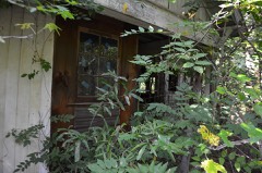 | Powell Chapel School | 4.9 miles | 2003 |
 | Roscoe-Dunaway Gardens Historic District | 5.0 miles | 1996 |
| Oak Hill Cemetery | 5.1 miles | 2012 | |
| Northwest Newnan Residential Historic District | 5.2 miles | 1982 |
| National Archives record | The nomination case file for reference 05000077 in Record Group 79. |
| Coweta County | All 27 listed properties in this county. |