 Block
From the record
One of 7 National Register listings published here for Rabun County · listed in 2008 · category: Building.
Sources: the case file at the National Archives · the National Register database, National Park Service
Listed on the National Register of Historic Places in 2008.
One of 7 National Register listings published here for Rabun County · listed in 2008 · category: Building.
Sources: the case file at the National Archives · the National Register database, National Park Service
Regional context, not property-specific evidence. The federal wildfire occurrence database lists 111 fires within 5 miles of William E. and Sarah Dillard Powell House between 1992 and 2019, burning about 725 acres in total. 1 started naturally. 16 were recorded as arson. Distance is straight-line from the map coordinates, so a fire counted here may appear on a neighbouring settlement's page as well.
| Reported cause | Fires |
|---|---|
| Debris and open burning | 54 |
| Missing data/not specified/undetermined | 21 |
| Arson/incendiarism | 16 |
| Equipment and vehicle use | 5 |
| Misuse of fire by a minor | 5 |
| Smoking | 5 |
| Power generation/transmission/distribution | 2 |
| Recreation and ceremony | 1 |
| Natural | 1 |
| Other causes | 1 |
The most recent of them, most recent first, with the day each was reported and the service that recorded it.
| Date | Cause | Size | Reported by | Name on the report |
|---|---|---|---|---|
| 14 September 2011 | Debris and open burning | under an acre | North Carolina Forest Service | WILD TURKEY RUN |
| 22 July 2002 | Missing data/not specified/undetermined | 2.4 acres | Chattahoochee-Oconee National Forest | MYSTERY |
| 21 July 2008 | Natural | 107 acres | Chattahoochee-Oconee National Forest | WILSON KNOB |
| 6 May 1997 | Debris and open burning | under an acre | North Carolina Forest Service | CABE |
| 3 May 2001 | Arson/incendiarism | under an acre | Chattahoochee-Oconee National Forest | AMERICUS |
| 26 May 2016 | Debris and open burning | under an acre | Georgia Forestry Commission | FY2016-RABUN-009 |
| 19 May 2006 | Misuse of fire by a minor | 1.0 acres | Chattahoochee-Oconee National Forest | WOLFFORK |
| 13 May 1997 | Debris and open burning | under an acre | North Carolina Forest Service | JAMES |
Regional context, not property-specific evidence. The federal mineral resources record lists 5 workings within 5 miles of William E. and Sarah Dillard Powell House: 3 past producers, 1 prospect, 1 producer. 1 still produces. What was taken out: Gold, Silver, Olivine, Asbestos, Vermiculite. Distance is straight-line from the map coordinates, so a quarry counted here may appear on a neighbouring settlement's page as well.
| Where | Site | Commodity | Status | Recorded |
|---|---|---|---|---|
| Dillard/Ledford Placers | Gold, Silver | Past Producer | Stream Placer | |
| National Olivine No 9 Mine | Magnesite | Producer | ||
| Norton Chromite Prospect | Chromium, Iron | Prospect | 1870 | |
| Norton Dunite Deposit | Olivine, Asbestos, Vermiculite | Past Producer | Olivine, Vermiculite | |
| Norton Dunite Deposit | Silica, Asbestos, Magnesite, Vermiculite | Past Producer |
Regional context, not property-specific evidence. The National Weather Service names Dillard, the town this property stands in, in 16 storm reports between 1996 and 2024: 8 thunderstorm wind, 3 hail, 3 flash flood, 2 flood. No death or injury is recorded in these reports. Each account below is quoted exactly as the forecast office filed it, from the NOAA Storm Events Database, and each date opens the federal record of that event.
| When | Event | Place named | Harm | What the report says |
|---|---|---|---|---|
| July 2015 | Thunderstorm Wind | Dillard | $5,000 | County comms reported a tree blown down on a vehicle on White Oak Ln. |
| August 2002 | Flood | Dillard | $5,000 | Water flooded the parking lot at a supermarket, and some water entered the store. |
| February 2020 | Flood | Dillard | $1,000 | Although rainfall tapered off across Rabun County throughout the afternoon, high water conditions persisted across the county due to runoff from the excessive rainfall earlier in the day. |
| December 2015 | Flash Flood | Dillard | $500 | After more than 3 inches of rain fell across the northeast Georgia mountains in just a few hours, public reported Mud Creek was overflowing its banks in the Sky Valley community, with Sky Valley Way being impassable. |
| July 2024 | Thunderstorm Wind | Dillard | - | County comms reported trees blown down on Highway 246 and on Crusher Run Rd. |
| June 2022 | Hail | Dillard | - | Public reported (via Social Media) nickel to quarter sized hail along Spy Glass Circle. |
| July 2012 | Flash Flood | Dillard | - | Around 4 inches of rain fell across northern Rabun County during the early morning hours, causing Sutton Branch Creek to flood Neville Rd. |
| July 2012 | Thunderstorm Wind | Dillard | - | Numerous trees were blown down across the county. |
| July 2012 | Thunderstorm Wind | Dillard | - | Multiple trees were blown down and and minor roof damage was reported in Dillard. |
| November 2011 | Flash Flood | Dillard | - | Greenwood Dr and Lamb Rd were flooded on the north side of Dillard. |
| June 2005 | Hail | Dillard | - | Dime hail and non-specific report of high wind. |
| February 2006 | Thunderstorm Wind | Dillard | - | no account filed |
| August 2002 | Hail | Dillard | - | no account filed |
| February 1997 | Thunderstorm Wind | Dillard | - | no account filed |
| June 1996 | Thunderstorm Wind | Dillard | - | no account filed |
| May 1996 | Thunderstorm Wind | Dillard | - | no account filed |
No historic map-sheet match is published for this property yet. That does not mean no map exists. This record needs a coordinate-quality review before it can be joined to a sheet boundary. Browse the county's mapped places while that work is pending.
Other National Register properties close enough to walk or drive between, ordered by distance from this one. Both positions come from the same geocoding pass that matched these properties to their map sheets.
| Photograph | Property | Distance | Listed |
|---|---|---|---|
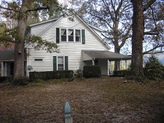 | Asbury and Sallie Hodgson House | 0.6 miles | 2011 |
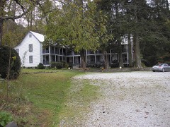 | York House | 2.4 miles | 1982 |
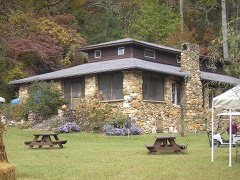 | Hambidge Center Historic District | 3.3 miles | 1982 |
| James Henry and Rachel Kilby House | 6.6 miles | 2005 |
| National Archives record | The nomination case file for reference 07001337 in Record Group 79. |
| Rabun County | All 7 listed properties in this county. |