 Block
From the record
One of 18 National Register listings published here for Gwinnett County · listed in 2013 · category: District.
Sources: the National Register database, National Park Service
Listed on the National Register of Historic Places in 2013.
One of 18 National Register listings published here for Gwinnett County · listed in 2013 · category: District.
Sources: the National Register database, National Park Service
Regional context, not property-specific evidence. The federal wildfire occurrence database lists 89 fires within 5 miles of Suwanee Historic District between 1992 and 2016, burning about 310 acres in total. None started naturally. 37 were recorded as arson. Distance is straight-line from the map coordinates, so a fire counted here may appear on a neighbouring settlement's page as well.
| Reported cause | Fires |
|---|---|
| Arson/incendiarism | 37 |
| Debris and open burning | 24 |
| Misuse of fire by a minor | 9 |
| Equipment and vehicle use | 6 |
| Missing data/not specified/undetermined | 5 |
| Recreation and ceremony | 4 |
| Smoking | 3 |
| Railroad operations and maintenance | 1 |
The most recent of them, most recent first, with the day each was reported and the service that recorded it.
| Date | Cause | Size | Reported by | Name on the report |
|---|---|---|---|---|
| 18 September 1999 | Arson/incendiarism | 1.0 acres | Georgia Forestry Commission | not named |
| 3 August 1998 | Debris and open burning | 5.7 acres | Georgia Forestry Commission | not named |
| 20 August 1999 | Missing data/not specified/undetermined | 2.9 acres | Georgia Forestry Commission | not named |
| 2 August 1992 | Debris and open burning | under an acre | Georgia Forestry Commission | not named |
| 18 August 1995 | Arson/incendiarism | 7.2 acres | Georgia Forestry Commission | not named |
| 18 August 1995 | Arson/incendiarism | 2.7 acres | Georgia Forestry Commission | not named |
| 17 August 1995 | Arson/incendiarism | 6.1 acres | Georgia Forestry Commission | not named |
| 16 August 1995 | Arson/incendiarism | under an acre | Georgia Forestry Commission | not named |
Regional context, not property-specific evidence. The federal mineral resources record lists 7 workings within 5 miles of Suwanee Historic District: 4 past producers, 2 producers, 1 prospect. 2 still produce. What was taken out: Gold, Sand and Gravel, Construction, Stone, Crushed/Broken. Distance is straight-line from the map coordinates, so a quarry counted here may appear on a neighbouring settlement's page as well.
| Where | Site | Commodity | Status | Recorded |
|---|---|---|---|---|
| Galite #1 | Stone, Crushed/Broken | Producer | ||
| Chattahoochee River Plant | Sand and Gravel, Construction | Past Producer | ||
| Shakerag Mine | Sand and Gravel, Construction | Producer | ||
| Collins | Gold | Prospect | Vein | |
| Level Creek Gold Mine | Gold | Past Producer | ||
| Little Property | Gold | Past Producer | Vein | |
| Settles Property | Gold | Past Producer | Vein |
Regional context, not property-specific evidence. The National Weather Service names Suwanee, the town this property stands in, in 33 storm reports between 1998 and 2023: 13 thunderstorm wind, 9 hail, 9 lightning, 1 heavy rain. The reports record 3 injuries. Each account below is quoted exactly as the forecast office filed it, from the NOAA Storm Events Database, and each date opens the federal record of that event.
| When | Event | Place named | Harm | What the report says |
|---|---|---|---|---|
| July 2003 | Thunderstorm Wind | Suwanee | 2 hurt, $75,000 | The Gwinnett county SkyWarn network, along with county 911 center and the public reported that a number of trees and tree limbs were blown down from Suwanee, to Lawrenceville, to Snellville. The Lawrenceville area appeared to be among the hardest hit areas. One home was damaged in Suwanee and several power lines were blown down around Lawrenceville. The Forsyth County News reported that a very large tree fell on a home in Barrett Downs and that numerous trees and power lines were down in the area. The newspaper also reported that trees fell on and injured two people, but no fatalities were reported. Tree debris, mailboxes, and garbage cans were found on some streets following the storm. |
| August 2023 | Thunderstorm Wind | Suwanee | 1 hurt | A portion of a tree fell on a person resulting in minor injuries near the 300 block of Gaines Oak Way. Additional trees reported down on Suwanee Dam Road, nearby. |
| March 2005 | Lightning | Suwanee | $375,000 | The Gwinnett Daily Post of Lawrenceville reported that lightning struck two homes in the county. At 1:13 pm EST lightning struck a 3500 square foot home on Harrogate Court in Grayson. The home was completely destroyed from the resulting fire. At 1:30 pm EST, lightning struck a second home on Vista Lake Drive in Suwanee causing minor damage to the garage and smoke damage to the remainder of the structure. |
| June 2013 | Lightning | Suwanee | $300,000 | Broadcast media reported that a lightning fire destroyed a house on Deville Circle in Suwanee. No one was injured, but the house was destroyed in a matter of minutes. |
| January 2002 | Lightning | Suwanee | $200,000 | The Gwinnett Daily Post of Lawrenceville reported that lightning struck and set on fire a two-story home in Suwanee. The fire caused extensive damage to the home. The house was vacant at the time of the incident. |
| July 2007 | Lightning | Suwanee | $175,000 | The Gwinnett County Emergency Management Director reported that three homes were struck by lightning, one in Lawrenceville on Polarwood Lane Northwest, another on Wildwood Lake Drive Northwest in Suwanee, and a third on Amsterdam Court in Lilburn. The only one which sustained any significant damage was the one on Wildwood Lane in Suwanee. The Gwinnett Daily Post reported that lightning struck a tree next to a home on Coteau Place in Lawrenceville. The tree fell on the roof of the home causing moderate damage. |
| August 2006 | Lightning | Suwanee | $150,000 | The Gwinnett Daily Post reported that lightning struck a home on Calm Water Creek. The resulting fire caused extensive damage to the attic and roof of the home. Smoke and water damage was extensive throughout the home. The home was declared uninhabitable as a result of the incident. |
| June 2010 | Lightning | Suwanee | $125,000 | The Gwinnett Daily Post of Lawrenceville reported that lightning struck the attic of a home on Goldfield Trace in the Forest Plantation subdivision. The attic suffered significant damage from the resulting fire. |
| June 2008 | Lightning | Suwanee | $125,000 | The Gwinnett Daily Post of Lawrenceville reported that lightning struck a home in the 1000 block of Slash Pine Court just south of Interstate-85 between Suwanee and Lawrenceville. The resulting fire caused moderate damage to the roof, chimney, and an exterior wall. |
| July 2017 | Lightning | Suwanee | $100,000 | The Gwinnett County Emergency Manager reported a house fire caused by a lightning strike on Finsbury Park Court in Suwanee. The fire caused extensive damage to the attic with significant water and smoke damage to the remainder of the home. No injuries were reported. |
| January 2007 | Thunderstorm Wind | Suwanee | $75,000 | The Gwinnett Daily Post of Lawrenceville and the public reported that a number of trees and power lines were down in many parts of the county, but especially in the Suwanee and Grayson areas. Much of the damage occurred in the Rivermoore Park Subdivision on Moore Road in Suwanee. Trees fell on a house on Fowler Creek View, causing extensive damage to the second floor of the home. Another tree fell on Suwanee Dam road taking down several power lines. Hutton Drive and Seth Way in Grayson were closed as the result of downed trees and power lines. |
| June 2006 | Thunderstorm Wind | Suwanee | $25,000 | The Atlanta-Journal Constitution reported that a large pine tree fell on and caused extensive damage to a home on Pendleton Place. |
| May 2010 | Flash Flood | Suwanee | $10,000 | Flash flooding was observed along several creeks in Gwinnett county as indicated by USGS stream gages. Crooked Creek at Spalding Drive, three miles northwest of Norcross, reached its flood stage of 11.0 feet at 705 am EDT. The creek crested at 13.1 feet at 915 am EDT. Pew Creek at Paterson Road reached its flood stage of 11.0 feet at 805 am EDT and crested at 11.8 feet at 915 am EDT. Sweetwater Creek at Club Drive reached its flood stage of 11.0 feet at 720 am EDT, then crested at 12.6 feet at noon EDT. Several roads along the creeks were closed for several hours because of the flooding. Water covered the grounds of the driving range at the Sugarloaf Golf Facility in Duluth. Flood damage in Gwinnett county was primarily limited to debris removal and estimated to be $10,000. |
| June 1998 | Thunderstorm Wind | Suwanee | $5,000 | A few trees were knocked down by thunderstorm winds in the parking lot of a shopping center near Buford High School. A tree was blown onto a house near Suwanee. |
| May 2012 | Thunderstorm Wind | Suwanee | $3,000 | The public reported that several trees were downed and snapped at a residence on the east side of Suwanee. |
| June 1998 | Thunderstorm Wind | Suwanee | $3,000 | A spotter and the public reported trees and power lines down. The wind was estimated at 60 mph. |
| December 2021 | Thunderstorm Wind | Suwanee | $2,000 | A tree was reported down on Suwanee Dam Road NW. |
| July 2012 | Thunderstorm Wind | Suwanee | $2,000 | Gwinnett police relayed a report of many trees down in the Suwanee area. |
| July 2002 | Thunderstorm Wind | Suwanee | $2,000 | The public and several amateur radio operators reported that several trees were blown down in at least two different locations in Suwanee. |
| May 1998 | Hail | Suwanee | $2,000 | Several public reports indicated hail ranging from dime to golf ball size fell in Suwanee, Sugar Hill, and Buford. |
| June 2010 | Thunderstorm Wind | Suwanee | $1,000 | The Gwinnett County 911 Center reported that three trees were down in the Buford area. |
| July 2003 | Lightning | Suwanee | $1,000 | The Gwinnett Daily Post of Lawrenceville reported that lightning struck a home on Waterloch Court. No one was home at the time and damage was light. |
| August 2002 | Thunderstorm Wind | Suwanee | $250 | The Gwinnett county Amateur Radio Emergency Services (ARES) reported that at least one tree was blown down. Wind gusts were estimated at 60 mph. |
| April 2015 | Hail | Suwanee | - | A trained spotter reported quarter size hail near McGinnis Ferry Road. |
| June 2009 | Hail | Suwanee | - | The public observed half-dollar-sized hail. |
| August 2007 | Hail | Suwanee | - | The public observed quarter-sized hail near the Mall of Georgia just off Interstate-85 and also near Collins Hill Highschool. A little further south, penny to nickel-sized hail was observed northwest of Lawrenceville. |
| June 2004 | Heavy Rain | Suwanee | - | The coordinator for the Gwinnett County SkyWarn reported that minor street flooding was occurring on Interstate 85 at Interstate 985. As much as six inches of water was standing on the road in spots. |
| July 2002 | Hail | Suwanee | - | Numerous reports of hail, ranging in size from dimes to quarters, were received from the public and several amateur radio operators. |
| July 2002 | Thunderstorm Wind | Suwanee | - | A National Weather Service storm spotter reported that several large tree limbs were blown down. |
| February 2000 | Hail | Suwanee | - | The public reported lots of hail about the size of nickels near the intersection of Fulton, Forsyth, and Gwinnett counties. |
| June 1999 | Hail | Suwanee | - | The public reported dime size hail. |
| June 1998 | Hail | Suwanee | - | Several public reports were received of dime to quarter size hail in Suwanee, Lawrenceville and Dacula. |
| February 1998 | Hail | Suwanee | - | Dime to nickel size hail was reported by the public. |
No historic map-sheet match is published for this property yet. That does not mean no map exists. This record needs a coordinate-quality review before it can be joined to a sheet boundary. Browse the county's mapped places while that work is pending.
Other National Register properties close enough to walk or drive between, ordered by distance from this one. Both positions come from the same geocoding pass that matched these properties to their map sheets.
| Photograph | Property | Distance | Listed |
|---|---|---|---|
 | Bona Allen Shoe and Horse Collar Factory | 5.3 miles | 2005 |
| Buford Public School Auditorium | 5.8 miles | 2009 | |
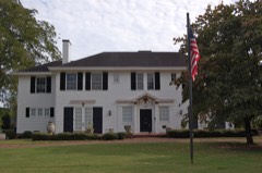 | John Quincy Allen House | 6.2 miles | 1984 |
 | Bona Allen House | 6.3 miles | 1983 |
 | Superb, The | 6.6 miles | 1999 |
| National Archives record | The nomination case file for reference 13000966 in Record Group 79. |
| Gwinnett County | All 18 listed properties in this county. |