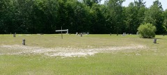
| May 2006 | Thunderstorm Wind | Millen | $100,000 | Several planes overturned by high winds at private landing strip northwest of Millen on Old Lewisville Road. |
| January 2006 | Tornado (F0) | Millen | $50,000 | A tornado briefly touched down severely damaging a mobile home, causing minor damage to another mobile home, and knocking down trees. |
| May 1997 | Thunderstorm Wind | Millen | $20,000 | Trees down. Tree fell on a house. |
| August 2007 | Thunderstorm Wind | Millen | $13,000 | The Jenkins county Emergency Manager reported a tree down on a car at intersection of Highway 17 and Washington Steet. Scattered trees were also reported down across the Millen area. In addition, a structure was also reported to have caught on fire, presumably by a lightning strike. |
| May 2007 | Thunderstorm Wind | Millen | $10,000 | There were reports of power lines down in the city of Millen. A 5 foot diameter tree fell on a trailer near the Jenkins County Hospital. |
| July 2012 | Thunderstorm Wind | Millen | $8,000 | Numerous trees and power lines down in Millen. |
| May 2006 | Thunderstorm Wind | Millen | $5,000 | Trees and powerlines down. |
| June 1994 | Thunderstorm Wind | Millen | $5,000 | Several large trees were downed by thunderstorm winds. |
| June 2010 | Thunderstorm Wind | Millen | $3,500 | Law enforcement reported trees and power lines down in Millen. |
| March 2013 | Thunderstorm Wind | Millen | $2,250 | The Jenkins County 911 Call Center reported a tree limb went through a roof at the 600 block of Walnut Street. |
| August 2018 | Lightning | Millen | $2,000 | A lightning strike resulted in damage at the Jenkins County Sheriff's Office. |
| July 2012 | Thunderstorm Wind | Millen | $2,000 | The public reported one tree and one power line down. |
| June 2008 | Thunderstorm Wind | Millen | $2,000 | Trees and power lines were reported down 2 miles east of Millen, Georgia. |
| May 2006 | Thunderstorm Wind | Millen | $2,000 | Trees down along Highway 17. |
| June 1995 | Thunderstorm Wind | Millen | $2,000 | Thunderstorm winds knocked down several trees. |
| July 1995 | Thunderstorm Wind | Millen | $2,000 | Thunderstorm winds knocked trees down. |
| August 2007 | Thunderstorm Wind | Millen | $1,500 | Three trees were reported down at the intersection of east Highway 21 and Paramore Hill Road. |
| June 2023 | Thunderstorm Wind | Millen | $1,000 | The Jenkins County 911 Call Center reported one tree down on Parks Road in Millen, Georgia. |
| June 2012 | Thunderstorm Wind | Millen | $1,000 | One tree was reported down on Hilltonia Road. |
| June 2009 | Hail | Millen | $1,000 | A trained weather spotter reported penny size hail and numerous tree limbs down in Millen, Georgia. |
| December 2008 | Thunderstorm Wind | Millen | $1,000 | Law enforcement reported a large tree down on a powerline along Highway 17 in Millen, Georgia. |
| May 2007 | Thunderstorm Wind | Millen | $1,000 | There were large limbs reported down in the town of Millen. |
| May 2006 | Thunderstorm Wind | Millen | $1,000 | Trees down along Highway 25 near the Ogeechee River. |
| July 2007 | Thunderstorm Wind | Millen | $500 | One 8-inch diameter tree and a few large tree limbs reported down. |
| August 2007 | Thunderstorm Wind | Millen | $500 | One tree was reported down near the intersection of Highway 17 and Candle Brank Road. |
| May 1994 | Thunderstorm Wind | Millen | $500 | Thunderstorm winds toppled a few large trees along Georgia Highway 25. |
| January 1995 | Thunderstorm Wind | Millen | $100 | Thunderstorms winds knocked down tree limbs onto power lines. The winds were estimated over 60 mph in gusts. |
| June 2024 | Thunderstorm Wind | Millen | - | The Jenkins County 911 Call Center reported a tree down on power lines and a transformer. |
| June 2024 | Thunderstorm Wind | Millen | - | The Jenkins County 911 Call Center reported a tree down on a transformer at 489 South Gray Street in Millen, Georgia. |
| May 2022 | Hail | Millen | - | A trained spotter reported hail up to the size of pennies which lasted for about 3 minutes near Millen. |
| April 2022 | Thunderstorm Wind | Millen | - | A Jenkins County Emergency Manager reported a solar farm on Old Louisville Road sustaining significant wind damage. |
| March 2022 | Hail | Millen | - | Jenkins County dispatch reported quarter sized hail just north of Millen. |
| May 2021 | Hail | Millen | - | A local news station relayed a report of pea to dime sized hail just south of Millen. |
| May 2021 | Thunderstorm Wind | Millen | - | Several trees were reported snapped off near a house on Old Eighty Road near Millen. |
| February 2020 | Thunderstorm Wind | Millen | - | Fire fighters reported several trees down in the city of Millen, GA. |
| April 2020 | Thunderstorm Wind | Millen | - | An emergency manager reported trees down near the intersection of Buttermilk Road and Edenfield Road. |
| April 2020 | Thunderstorm Wind | Millen | - | An emergency manager reported trees down on Terri Drive. |
| April 2020 | Thunderstorm Wind | Millen | - | The Jenkins County 911 Call Center reported trees down near the intersection of Georgia Highway 17 and North Masonic Street. |
| April 2020 | Thunderstorm Wind | Millen | - | An emergency manager reported a tree down on North Masonic Street. |
| April 2020 | Thunderstorm Wind | Millen | - | An emergency manager reported trees down on Godbee Road. |
| March 2017 | Thunderstorm Wind | Millen | - | Jenkins County dispatch reported trees and power lines down on S Masonic Street. |
| July 2015 | Thunderstorm Wind | Millen | - | Jenkins County dispatch reported numerous large limbs, 10 inches or more in diameter, blown onto power lines on Harvey Street. |
| July 2015 | Thunderstorm Wind | Millen | - | Several large tree limbs were blown down on a private lot near Grimm Avenue. |
| May 2014 | Hail | Millen | - | Quarter sized hail fell at the Jenkins County dispatch building. |
| June 2010 | Thunderstorm Wind | Millen | - | A fire department reported a large oak tree fell onto a car and also blocked the intersection of North Masonic Street and East Winthrope Avenue. |
| June 2010 | Flash Flood | Millen | - | The public reported seven inches of rainfall with widespread flooding on roadways in Millen. |
| June 2009 | Hail | Millen | - | The public reported quarter size hail in Millen, Georgia. |
| May 2008 | Hail | Millen | - | Golf ball size hail was reported by a post office employee in Millen, Georgia. |
| March 2005 | Thunderstorm Wind | Millen | - | Thunderstorm winds knocked down trees. |
| July 2005 | Thunderstorm Wind | Millen | - | Large pecan tree down along Charlie Jones Rd. |
| May 2003 | Thunderstorm Wind | Millen | - | Several trees were down. |
| July 2003 | Flash Flood | Millen | - | Very heavy rain caused flooding which washed out Savannah Road and Spencer Road. Highway 25 to the north of Millen was also flooded. |
| July 2002 | Thunderstorm Wind | Millen | - | Large limbs and power lines were blown down by strong thunderstorm winds. |
| July 2002 | Thunderstorm Wind | Millen | - | Trees and power lines were down. |
| September 2002 | Thunderstorm Wind | Millen | - | Several farm buildings were destroyed. Also, several large limbs and power lines were down. |
| March 2001 | Thunderstorm Wind | Millen | - | Coop observer reported several trees and power lines down. |
| August 1999 | Thunderstorm Wind | Millen | - | Numerous trees down across the county and trees blocking roads south of Millen. |
| June 1997 | Thunderstorm Wind | Millen | - | Trees down. |
| June 1997 | Thunderstorm Wind | Millen | - | Several trees down. |
| January 1995 | Thunderstorm Wind | Millen | - | Thunderstorm winds with gusts over 60 mph were reported. |
 Block