 Block
From the record
One of 24 National Register listings published here for Meriwether County · listed in 1973 · category: Building.
Sources: the case file at the National Archives · the National Register database, National Park Service
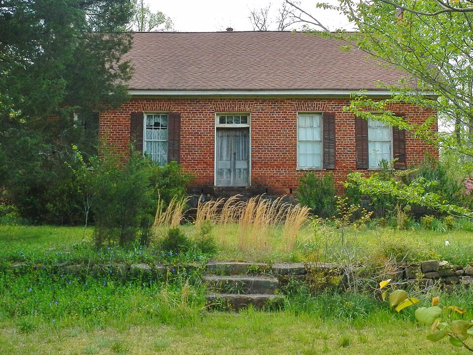
Listed on the National Register of Historic Places in 1973.
One of 24 National Register listings published here for Meriwether County · listed in 1973 · category: Building.
Sources: the case file at the National Archives · the National Register database, National Park Service
Regional context, not property-specific evidence. The federal wildfire occurrence database lists 133 fires within 5 miles of Harman-Watson-Matthews House between 1992 and 2020, burning about 986 acres in total. 6 started naturally. 17 were recorded as arson. Distance is straight-line from the map coordinates, so a fire counted here may appear on a neighbouring settlement's page as well.
| Reported cause | Fires |
|---|---|
| Debris and open burning | 69 |
| Arson/incendiarism | 17 |
| Railroad operations and maintenance | 10 |
| Equipment and vehicle use | 10 |
| Missing data/not specified/undetermined | 9 |
| Smoking | 6 |
| Natural | 6 |
| Misuse of fire by a minor | 3 |
| Recreation and ceremony | 3 |
The most recent of them, most recent first, with the day each was reported and the service that recorded it.
| Date | Cause | Size | Reported by | Name on the report |
|---|---|---|---|---|
| 9 September 1998 | Debris and open burning | 1.6 acres | Georgia Forestry Commission | not named |
| 26 September 2011 | Debris and open burning | 3.4 acres | Georgia Forestry Commission | FY2012-MERIWETHER-009 |
| 20 September 1997 | Smoking | 1.5 acres | Georgia Forestry Commission | not named |
| 2 September 1999 | Railroad operations and maintenance | 5.1 acres | Georgia Forestry Commission | not named |
| 19 September 1997 | Debris and open burning | under an acre | Georgia Forestry Commission | not named |
| 17 September 1999 | Debris and open burning | 4.2 acres | Georgia Forestry Commission | not named |
| 16 September 2010 | Recreation and ceremony | under an acre | Georgia Forestry Commission | FY2011-MERIWETHER-004 |
| 31 August 1999 | Debris and open burning | 2.5 acres | Georgia Forestry Commission | not named |
Regional context, not property-specific evidence. The federal mineral resources record lists 1 working within 5 miles of Harman-Watson-Matthews House: 1 past producer. None of them still produces. What was taken out: Granite. Distance is straight-line from the map coordinates, so a quarry counted here may appear on a neighbouring settlement's page as well.
| Where | Site | Commodity | Status | Recorded |
|---|---|---|---|---|
| The Oddessa Quarry | Granite | Past Producer |
Regional context, not property-specific evidence. The National Weather Service names Greenville, the town this property stands in, in 31 storm reports between 1993 and 2023: 23 thunderstorm wind, 6 hail, 1 heavy rain, 1 flash flood. The reports record 3 injuries. Each account below is quoted exactly as the forecast office filed it, from the NOAA Storm Events Database, and each date opens the federal record of that event.
| When | Event | Place named | Harm | What the report says |
|---|---|---|---|---|
| May 2003 | Thunderstorm Wind | Greenville | 2 hurt, $5,000 | The Meriwether Vindicator of Greenville reported that two men were injured when a tree limb fell on their car during strong thunderstorms with very heavy rain. Both men were treated and released |
| July 2000 | Thunderstorm Wind | Greenville | 1 hurt, $40,000 | The Manchester Star Mercury reported that a Greenville woman was injured when a tree fell on the vehicle she was driving during the thunderstorm. The Manchester Public Works Department also reported numerous trees down just north of Manchester. |
| January 2006 | Hail | Greenville | $300,000 | The Meriwether County 911 Center and Emergency Management Director reported golf ball-sized hail just north of Greenville, while the public reported penny-sized hail near Gay. |
| April 2017 | Thunderstorm Wind | Greenville | $20,000 | The Meriwether County Emergency Manager reported trees blown down onto homes in Greenville. No injuries were reported. |
| June 2019 | Thunderstorm Wind | Greenville | $10,000 | Multiple reports of trees blown down around Greenville, with damage reported near the town square. Additional reports of trees and powerlines down along GA Hwy 85 and Greenville Flat Shoals Road, just south of Gay. |
| July 2020 | Thunderstorm Wind | Greenville | $8,000 | The Meriwether County 911 center reported several trees blown down from Lee Lane east of Greenville to Jefferson Street in Manchester. |
| May 1993 | Thunderstorm Wind | Greenville | $5,000 | Several large trees were blown down. |
| February 2019 | Thunderstorm Wind | Greenville | $4,000 | The Georgia Department of Transportation reported trees and power lines blown down between Terrell Street and Dogwood Circle along Highway 109 on the west side of Greenville. |
| June 2018 | Thunderstorm Wind | Greenville | $3,000 | The public reported large trees blown down blocking Stovall Road near Dogwood Circle in Greenville. |
| June 2011 | Thunderstorm Wind | Greenville | $2,000 | The Meriwether County 911 Center reported that several trees were down across the northwest part of the county between Rocky Mount, Lone Oak, and just south to west of Luthersville. |
| August 2007 | Thunderstorm Wind | Greenville | $2,000 | The Meriwether County Emergency Management Director and 911 Center reported that several trees were blown down west of Greenville. Some power lines were also down in the area. |
| May 2013 | Thunderstorm Wind | Greenville | $1,500 | The Meriwether County 911 Center reported that several trees were blown down in the Greenville area. |
| June 2010 | Thunderstorm Wind | Greenville | $1,000 | The Meriwether County Emergency Management Director reported that three trees were down between Greenville and Woodbury. Some power outages were noted in the area. |
| January 2012 | Thunderstorm Wind | Greenville | $500 | The Meriwether County 911 Center reported that two trees were blown down. |
| July 2004 | Thunderstorm Wind | Greenville | $500 | The Meriwether County 911 center reported that a couple of trees were blown down. |
| July 2002 | Thunderstorm Wind | Greenville | $500 | The Meriwether county 911 center reported that two trees were blown down. |
| May 1994 | Thunderstorm Wind | Greenville | $500 | A couple of large trees and power lines were downed by thunderstorm winds. |
| March 2006 | Thunderstorm Wind | Greenville | $250 | The Meriether County Emergency Managment Director reported that one tree was blown down about halfway between Greenville and Gay. |
| December 2004 | Thunderstorm Wind | Greenville | $250 | The Meriwether County 911 Center reported that one tree was blown down. |
| July 2004 | Thunderstorm Wind | Greenville | $250 | The Meriwether County Emergency Management Director reported that several large tree limbs and part of an entire tree were blown down. |
| July 2001 | Thunderstorm Wind | Greenville | $250 | The Meriwether county 911 center reported that one tree was blown down. |
| March 2023 | Thunderstorm Wind | Greenville | - | Report of a tree down at LaGrange Hwy and Hill Haven Rd. |
| June 2022 | Thunderstorm Wind | Greenville | - | Several trees reported down in the city of Greenville. |
| July 2020 | Hail | Greenville | - | The public reported hail the size of quarters. |
| April 2019 | Flash Flood | Greenville | - | Heavy rainfall and high runoff rates caused Walnut Creek to swell out of its banks, and cover Georgia Highway 18 with water. Radar estimates indicate that six to seven inches occurred over this area in a short period of time. |
| July 2007 | Hail | Greenville | - | The public observed penny-sized hail. |
| March 2005 | Hail | Greenville | - | The Meriwether County Sheriff reported nickel-sized hail. |
| May 2004 | Heavy Rain | Greenville | - | The public reported that very heavy rain had resulted in minor flooding on roadways. Some cars were hydroplaning in the areas of standing water. |
| May 2002 | Thunderstorm Wind | Greenville | - | The National Weather Service's cooperative observer in Greenville reported pea size hail. |
| March 2000 | Hail | Greenville | - | The Greenville sheriff's office reported golf ball size hail. |
| March 1996 | Hail | Greenville | - | no account filed |
No historic map-sheet match is published for this property yet. That does not mean no map exists. This record needs a coordinate-quality review before it can be joined to a sheet boundary. Browse the county's mapped places while that work is pending.
Other National Register properties close enough to walk or drive between, ordered by distance from this one. Both positions come from the same geocoding pass that matched these properties to their map sheets.
| Photograph | Property | Distance | Listed |
|---|---|---|---|
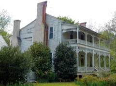 | Jones-Florence Plantation | 2.3 miles | 1984 |
| Mark Hall | 5.0 miles | 1973 | |
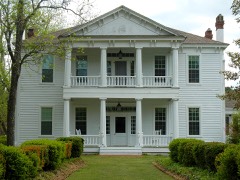 | Clarkland Farms | 6.2 miles | 1974 |
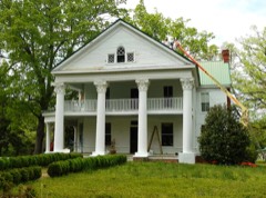 | Burwell O. Hill House | 6.5 miles | 1982 |
| Hiram Warner Hill House | 6.6 miles | 1983 | |
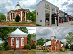 | Greenville Historic District | 7.0 miles | 1990 |
| National Archives record | The nomination case file for reference 73000628 in Record Group 79. |
| Meriwether County | All 24 listed properties in this county. |