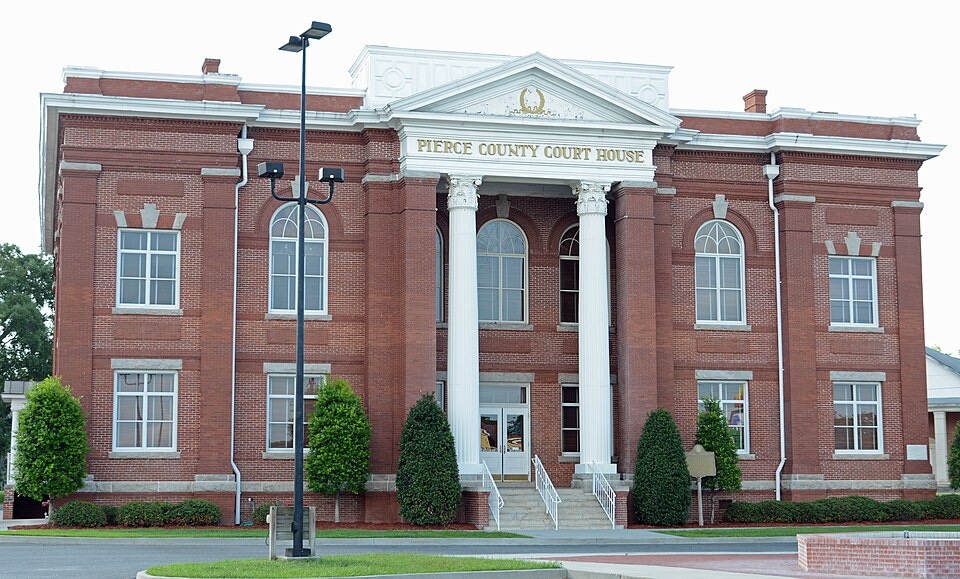
| August 2010 | Lightning | Blackshear | $100,000 | Lightning directly hit the Pierce County Emergency Operations Tower. The strike traveled down the tower and severely damage the center's control box for the tower, its server, radio for both the county EMS and Pierce County jail as well as radios for dispatch stations and telephone lines. The strike also destroyed lightning arrestors which were designed to alleviate impacts from lightning stirkes. |
| October 1993 | Thunderstorm Wind | Blackshear | $50,000 | Thunderstorm winds collapsed a tractor shelter and caused numerous large trees to uproot along Georgia Highway 203. A couple of homes suffered structural damage from fallen trees. |
| January 1999 | Tornado (F0) | Blackshear | $35,000 | Seven residents with minor roof damage, church steeple damaged and a roof was blown off a silo. |
| December 2006 | Thunderstorm Wind | Blackshear | $10,000 | Trees and power lines blown down in Blackshear and Patterson. |
| October 2002 | Thunderstorm Wind | Blackshear | $10,000 | Large trees down on houses. Highway 84 closed due to downed trees. |
| July 2000 | Tornado (F0) | Blackshear | $5,500 | Weak FO. Damages a shed and chicken-house. |
| June 1994 | Thunderstorm Wind | Blackshear | $5,000 | Several large trees and power lines were downed by thunder- storm winds. |
| June 1994 | Thunderstorm Wind | Blackshear | $5,000 | Several large trees were downed by thunderstorm winds along Georgia Highway 15. |
| January 1999 | Thunderstorm Wind | Blackshear | $4,500 | A three block area had large trees and power lines were blown down. |
| July 2024 | Thunderstorm Wind | Blackshear | $4,000 | The EM reported power lines down | and roof damage to building located along | West Carter Ave and Gordon Street near | Downtown Blackshear Georgia. The time of damage was based | off Radar. The cost of damage was unknown, but it was estimated for inclusion of the event in Storm Data. |
| June 1998 | Thunderstorm Wind | Blackshear | $3,000 | Large trees and power lines were blown down. |
| July 1998 | Thunderstorm Wind | Blackshear | $2,500 | Large trees and power lines were blown down. |
| May 2020 | Thunderstorm Wind | Blackshear | $2,000 | Several trees were blown down near Old Alma Road and West Horshoe Road. The time of damage was based on radar. The cost of damage was unknown, but it was estimated for inclusion in Storm Data. |
| June 2010 | Thunderstorm Wind | Blackshear | $2,000 | Several trees and power lines were blown down in Blackshear. The cost of debris removal was estimated. |
| May 1998 | Thunderstorm Wind | Blackshear | $1,500 | Large trees were blown down. |
| May 1998 | Thunderstorm Wind | Blackshear | $1,500 | Large trees were blown down. |
| April 2015 | Lightning | Blackshear | $1,000 | Lightning damaged a transformer off of College Avenue. The cost of damage was estimated for the event to be included in Storm Data. |
| June 1997 | Thunderstorm Wind | Blackshear | $800 | Large trees were blown down. |
| July 2001 | Thunderstorm Wind | Blackshear | $500 | Trees blown down along SR-203. |
| June 2000 | Thunderstorm Wind | Blackshear | $500 | Large trees and power lines were blown down. |
| June 1998 | Thunderstorm Wind | Blackshear | $500 | Large trees were blown down. |
| June 1996 | Thunderstorm Wind | Blackshear | $500 | no account filed |
| June 2018 | Thunderstorm Wind | Blackshear | $100 | Large tree limbs were blown down along Hobbs Street. The time of damage was based on radar. The cost of damage was unknown, but it was estimated for the inclusion of the event in Storm Data. |
| August 2025 | Heavy Rain | Blackshear | - | HADS station ABAG1Alabaha River measured 2.36 inches of rainfall in the past hour. |
| January 2024 | Thunderstorm Wind | Blackshear | - | A carport was blown off. The time of damage was based on radar. |
| September 2023 | Thunderstorm Wind | Blackshear | - | A powerline pole was blown down at the corner of Nichols Street and Brantley Street. |
| September 2023 | Thunderstorm Wind | Blackshear | - | Significant roof damage occurred due to winds at 330 Main Street. |
| June 2023 | Thunderstorm Wind | Blackshear | - | Trees were blown down in Blackshear, extending toward Waycross. |
| June 2022 | Thunderstorm Wind | Blackshear | - | Power lines were down due to thunderstorm winds near old hoboken road and cardinal drive off of state route 121. Time was estimated by radar. |
| April 2020 | Hail | Blackshear | - | Quarter size hail was observed in Blackshear. The time of the event was based on radar. |
| June 2020 | Thunderstorm Wind | Blackshear | - | A tree was blown down and power lines were blown down on Cason Road. |
| February 2020 | Thunderstorm Wind | Blackshear | - | Trees and power lines were blown down along Highway 203 north of Blackshear. |
| February 2020 | Thunderstorm Wind | Blackshear | - | Numerous trees were blown down in Bristol, Patterson & Blackshear. A power line was also blown down. |
| March 2018 | Hail | Blackshear | - | Widespread egg sized hail was reported near Blackshear. |
| December 2018 | Flash Flood | Blackshear | - | At 1106 pm on 12/3, Pierce county law enforcement reported a dam failure was imminent along the Lakeview Country Club Lake. Property threatened from flooding included homes along Edgewood Circle, Lakeview Drive, Fox Trail and Azalea Street along the Baxter/Bernie Branch drainage from the lake. The Department of Transportation closed Highway 121 south of Blackshear due to flood water over the bridge just south of Azalea Street from the Baxter/Bernie branch drainage. At 448 am on 12/4, law enforcement reported that the lake fell about 5 ft (40 acre lake). The Baxter/Bernie branch drainage rose about 8-12 inches in the past 5 hours. No reports of flooding into structures. Dam erosion was still ongoing at the time of the last report. |
| January 2017 | Hail | Blackshear | - | Penny size hail was observed. |
| June 2017 | Heavy Rain | Blackshear | - | The USGS rain gauge at the Alabaha River site recorded a daily rainfall total of 2.02 inches as of 5 pm local time. |
| June 2016 | Thunderstorm Wind | Blackshear | - | Trees were blown down in Blackshear. One tree was blown down along County Road 121 North. |
| June 2015 | Thunderstorm Wind | Blackshear | - | Numerous trees and power lines were blown down. |
| June 2014 | Thunderstorm Wind | Blackshear | - | Widespread tree damage occurred in Blackshear. |
| April 2013 | Thunderstorm Wind | Blackshear | - | Multiple reports of trees across the county were relayed to the NWS. The location of damage was based on radar imagery. |
| June 2010 | Hail | Blackshear | - | A spotter reported penny size hail on Highway 84 just outside of the Blackshear city limits. |
| April 2009 | Thunderstorm Wind | Blackshear | - | The Emergency Manager surveyed the damage and reported several trees down and power poles snapped near Jenkins Street and College Street. |
| April 2009 | Hail | Blackshear | - | The Emergency Manager reported penny sized hail in Blackshear. |
| April 2009 | Flood | Blackshear | - | A local TV meteorologist and amateur radio operator both reported heavy rain in Blackshear with a number of roads closed due to high water. |
| April 2009 | Thunderstorm Wind | Blackshear | - | A storm spotter reported 60 to 70 mph winds and dime size hail in Blackshear. Additionally the possibility of tornado was reported but no confirmation could be made. |
| May 2008 | Funnel Cloud | Blackshear | - | A citizen reported a funnel cloud 1 mile east of Blackshear. |
| May 2008 | Lightning | Blackshear | - | Pierce County Fire-Rescue reported a lightning strike caused a brush fire off of Satilla Road. Georgia Forestry crews were dispatched and the blaze was contained. |
| December 2008 | Tornado (EF0) | Blackshear | - | The tornado touched down near 1421 College Avenue destroying a vinyl storage shed. A more substantial wood shed next to it was undamaged and no significant damage to vegetation was observed in this vicinity. In this area the event was a low level EF-0 event with winds estimated near 65 mph. The system next moved over Burney Branch Lake which allowed the circulation to intensify with winds now closer to an upper end EF-0 and estimated to be near 85 mph. The tornado made landfall near 1101 Lakeview Drive where several trees were snapped. The funnel moved over several lakeside homes and their backyards in this area. A vinyl fence was blown down and a wooden childs backyard play set was uprooted and overturned. At the northeastern edge of the lake the most substantial damage occurred when the roof of a dock was ripped off and blown onto the roof of a home at 919 Edgewood Circle. The homes roof was destroyed opening the contents to the weather. |
| August 2007 | Thunderstorm Wind | Blackshear | - | Power lines were blown down and caused power outages in Blackshear. The 911 Center reported strong winds across the county with frequent lightning strikes. |
| February 2003 | Thunderstorm Wind | Blackshear | - | Large live oak and pine trees uprooted and down across power lines along Highway 82 north of Blackshear. |
| May 2002 | Hail | Blackshear | - | West side of Blackshear and in Patterson. |
| June 2000 | Tornado (F0) | Blackshear | - | No damage. |
| September 2023 | Hail | Blackshear | - | no account filed |
| May 2006 | Hail | Blackshear | - | no account filed |
| May 2006 | Thunderstorm Wind | Blackshear | - | no account filed |
| May 2006 | Thunderstorm Wind | Blackshear | - | no account filed |
| May 2006 | Hail | Blackshear | - | no account filed |
| July 2006 | Thunderstorm Wind | Blackshear | - | no account filed |
| July 2006 | Thunderstorm Wind | Blackshear | - | no account filed |
 Block