 Block
From the record
One of 51 National Register listings published here for Richmond County · listed in 1980 · category: District.
Sources: the case file at the National Archives · the National Register database, National Park Service
Listed on the National Register of Historic Places in 1980.
One of 51 National Register listings published here for Richmond County · listed in 1980 · category: District.
Sources: the case file at the National Archives · the National Register database, National Park Service
Regional context, not property-specific evidence. The federal wildfire occurrence database lists 225 fires within 5 miles of Pinched Gut Historic District between 1992 and 2020, burning about 758 acres in total. 3 started naturally. 39 were recorded as arson. Distance is straight-line from the map coordinates, so a fire counted here may appear on a neighbouring settlement's page as well.
| Reported cause | Fires |
|---|---|
| Missing data/not specified/undetermined | 67 |
| Debris and open burning | 53 |
| Arson/incendiarism | 39 |
| Misuse of fire by a minor | 36 |
| Equipment and vehicle use | 15 |
| Smoking | 4 |
| Natural | 3 |
| Other causes | 3 |
| Recreation and ceremony | 2 |
| Power generation/transmission/distribution | 2 |
| Fireworks | 1 |
The most recent of them, most recent first, with the day each was reported and the service that recorded it.
| Date | Cause | Size | Reported by | Name on the report |
|---|---|---|---|---|
| 7 September 2002 | Debris and open burning | under an acre | Georgia Forestry Commission | FY2003-RICHMOND-015 |
| 6 September 1999 | Misuse of fire by a minor | under an acre | South Carolina Forestry Commission | not named |
| 6 September 1999 | Misuse of fire by a minor | under an acre | South Carolina Forestry Commission | not named |
| 5 September 1997 | Debris and open burning | 3.0 acres | South Carolina Forestry Commission | not named |
| 4 September 1997 | Debris and open burning | 5.0 acres | South Carolina Forestry Commission | not named |
| 24 September 2012 | Debris and open burning | 1.2 acres | Georgia Forestry Commission | FY2013-RICHMOND-002 |
| 2 September 2011 | Arson/incendiarism | 2.7 acres | Georgia Forestry Commission | FY2012-RICHMOND-012 |
| 18 September 2001 | Misuse of fire by a minor | 1.0 acres | South Carolina Forestry Commission | not named |
Regional context, not property-specific evidence. The federal mineral resources record lists 22 workings within 5 miles of Pinched Gut Historic District: 7 past producers, 6 occurrences, 5 unknowns, 4 producers. 4 still produce. What was taken out: Sand and Gravel, Construction, Clay, Brick Clay, Fire Clay (Refractory). Distance is straight-line from the map coordinates, so a quarry counted here may appear on a neighbouring settlement's page as well.
| Where | Site | Commodity | Status | Recorded |
|---|---|---|---|---|
| Clay Preparation Plant | Fire Clay (Refractory) | Past Producer | ||
| Foster's Lane Pit | Brick Clay | Occurrence | ||
| Horse Creek | Titanium, Zirconium, REE, Thorium | Unknown | Placer-Modern-Fluvial | |
| Horse Creek | REE | Past Producer | ||
| Unidentified Mine(Horse Creek Mine) | Zirconium, Sand and Gravel, Construction, REE, Titanium | Past Producer | Sedimentary Kaolin | |
| Dixie Clay Mine West | Clay | Unknown | Sedimentary | |
| Merry Companies Mine | Clay | Producer | ||
| Merry Pit 4 | Clay | Producer | ||
| North Augusta Mine | Clay | Past Producer | ||
| Richmond County Mine | Clay | Past Producer |
Regional context, not property-specific evidence. The National Weather Service names Augusta, the town this property stands in, in 92 storm reports between 1993 and 2025: 54 thunderstorm wind, 27 hail, 7 flash flood, 2 tornado. The reports record 1 death and 44 injuries. Each account below is quoted exactly as the forecast office filed it, from the NOAA Storm Events Database, and each date opens the federal record of that event.
| When | Event | Place named | Harm | What the report says |
|---|---|---|---|---|
| July 2007 | Thunderstorm Wind | Augusta | 1 killed, 4 hurt | Sheriff reported trees and powerlines down. One man died when storms swept across the area. 40-year-old Robert Walker was riding his bike when a tree fell, killing him.|Nearby, there were four others trapped in a store on the corner of 11th and Dugas Street. Inmate crews were out for hours today cleaning up the mess.|The tree that leveled the corner store was completely uprooted. Two men and two children were inside the building and were injured when it collapsed.| |
| June 2011 | Thunderstorm Wind | Augusta | 24 hurt, $12,000 | Sheriff reported trees and powerlines down around the Augusta area. About 24 soldiers at Ft. Gordon were injured from debris crashing into their tents and were taken to the Dwight D. Eisenhower Army Medical Center for treatment. |
| December 2000 | Tornado (F2) | Augusta | 8 hurt | An F2 tornado intermittently touched down along a 2 mile path. Extensive damage was done to the Timberidge subdivision and to other homes and mobile homes along its path. Eight people were injurred, one seriously. There were no deaths. |
| May 1995 | Thunderstorm Wind | Augusta | 4 hurt, $2,000 | Thunderstorm winds knocked over several large tree limbs. Four people suffered minor injuries when a large limb fell on their car. |
| July 2012 | Lightning | Augusta | 3 hurt, $160,000 | Lightning struck the roof of SunBelt Auto Center in Augusta. The lightning rippled through the interior of the facility injuring a few people. Then the wind blew out the cracked windows. Ken Harris, the general manager, was blead out of his arm and a little bit on his head. Harris said he couldn't believe the devastation. |
| May 2002 | Thunderstorm Wind | Augusta | 1 hurt, $18,000 | A tree fell on a vehicle with a woman inside who had minor injuries. The car was totalled. The event occurred on Walton Way. |
| February 2012 | Thunderstorm Wind | Augusta | $120,000 | EM, Sheriff, and SKYWARN spotters reported numerous trees and powerlines down in the Augusta area. Several homes and vehicles had trees on them and 2 people were injured when a tree fell on them. |
| May 1993 | Tornado (F0) | Augusta | $50,000 | A short lived tornado touched down on old trail road along the Richmond-Columbia county line. One home and two cars were damaged by toppled trees. |
| May 1993 | Thunderstorm Wind | Augusta | $50,000 | Numerous large trees were blown down along Interstate 20 with damage to one vehicle and a house. |
| June 2010 | Thunderstorm Wind | Augusta | $40,000 | Augusta Chronicle reported a downburst damaged the Homechoice Partners building on Washington road and also damaged a couple of vehicles. |
| July 2015 | Thunderstorm Wind | Augusta | $24,000 | WRDW reported a tree fell on a home causing some damage. |
| June 1995 | Thunderstorm Wind | South Augusta | $18,000 | Thunderstorm winds blew large limbs and several utility poles down throughout the city. A field light pole at May park was nearly sheared in half by thunderstorm winds. Electricity was knocked out for nearly 6,300 customers for two hours. |
| February 2012 | Hail | Augusta | $15,000 | WJBF reported golf ball size hail in Augusta and the surrounding area. |
| April 1997 | Hail | Augusta | $10,000 | no account filed |
| June 2009 | Thunderstorm Wind | Augusta | $6,000 | SKYWARN spotters reported trees and powerlines down around Augusta, especially on Lumpkin road on the south side of town. |
| June 1994 | Thunderstorm Wind | Augusta | $5,000 | Several large trees were downed by thunderstorm winds. |
| June 1994 | Thunderstorm Wind | Augusta | $5,000 | Numerous trees were downed by thunderstorm winds along Barton Chapel and Deans Bridge Roads. |
| May 1993 | Thunderstorm Wind | Augusta | $5,000 | Several large trees were blown down near Augusta National Golf Course along Interstate 20. |
| May 1993 | Thunderstorm Wind | Augusta | $5,000 | Numerous large trees were blown down along U.S. Highway 78. |
| July 2010 | Thunderstorm Wind | Augusta | $4,000 | Sheriff reported trees down around the city, especially on the north and east side. |
| December 2009 | Thunderstorm Wind | Augusta | $4,000 | Sheriff reported trees down in many loactions. |
| August 2009 | Thunderstorm Wind | Augusta | $2,000 | TV 26 in Augusta reported large limbs down on Broad Street and some trees down on Green street. |
| December 1997 | Flash Flood | Augusta | $2,000 | Flash flooding along several creeks flooded several highways including Richmond Hill road. |
| June 2014 | Flash Flood | Augusta | $1,000 | Public reported flash flooding on Broad and 4th streets temporarily closing them. |
| July 2023 | Flash Flood | Augusta | $500 | Laney Walker Blvd Ext at E Boundary St, and E Boundary St and Sibley St, were closed due to flooding. Time estimated. |
| June 1995 | Thunderstorm Wind | Augusta | $500 | Thunderstorm winds knocked down trees reported by a storm spotter. |
| July 1995 | Thunderstorm Wind | Augusta | $500 | Thunderstorm winds knocked trees and powerlines down within McBean. |
| June 2025 | Thunderstorm Wind | Augusta | - | Richmond County dispatch reported trees down at the intersection of 2nd St and Broad St. Time estimated by radar. |
| September 2017 | Hail | Augusta | - | Dime to quarter size hail reported by the public. Report relayed via adjacent NWS office. |
| July 2016 | Thunderstorm Wind | Augusta | - | A social media report through the media indicated large trees down along the 300 block of Broad Street in Augusta. |
| September 2014 | Heavy Rain | Augusta | - | An automated rain gage at Augusta reported 1.53 inches of rain in an hour. |
| October 2010 | Thunderstorm Wind | Augusta | - | Augusta Chronicle reported large limbs down in the downtown area. |
| July 2010 | Hail | Augusta | - | SKYWARN spotter reported nickel size hail on Reynolds Road. |
| August 2009 | Hail | Augusta | - | EM reported penny size hail downtown. |
| March 2008 | Thunderstorm Wind | Augusta | - | A downburst took the roof off a building and damaged several others. The roof at Josey High School was damaged. There were also took down trees and powerlines. There were no injuries. |
| May 2008 | Hail | Augusta | - | Public reported half dollar size hail in downtown Augusta. |
| May 2008 | Thunderstorm Wind | Augusta | - | Sheriff reported trees and powerlines down in Augusta. |
| June 2008 | Thunderstorm Wind | Augusta | - | EM reported trees down on vehicles in the Country Club Hills area. |
| June 2007 | Hail | Augusta | - | Public reported quarter size hail in the Augusta metro area. |
| February 2007 | Hail | Augusta | - | SKYWARN spotter reported nickel size hail. |
| July 2006 | Thunderstorm Wind | Augusta | - | GA Power reported powerlines down near Martinez. |
| July 2006 | Thunderstorm Wind | Augusta | - | Public reported trees and powerlines down. |
| February 2005 | Hail | Augusta | - | SKYWARN spotter reported nickel size hail. |
| May 2005 | Thunderstorm Wind | Augusta | - | TV26 reported several trees down around the city. |
| April 2005 | Hail | Augusta | - | Public reported 1/2 inch hail on Peach Tree road and Peach Pond road. |
| April 2005 | Thunderstorm Wind | Augusta | - | Public reported couple of trees down and shingles blow off roof. |
| August 2005 | Thunderstorm Wind | Augusta | - | Sheriff reported a couple of trees down just east of Daniel Field. |
| May 2004 | Thunderstorm Wind | Augusta | - | EM reported trees and powerlines down in Augusta. |
| November 2003 | Thunderstorm Wind | Augusta | - | TV meteorologist reported large limbs and power lines down in south Augusta. |
| February 2003 | Thunderstorm Wind | Augusta | - | EOC reported trees and powerlines down in west Augusta. |
| May 2003 | Hail | Augusta | - | DOE employee reported 1 inch hail on Gordon Highway. |
| May 2003 | Thunderstorm Wind | Augusta | - | SKYWARN spotter reported large branches down on Tobacco road in Augusta. |
| May 2003 | Flash Flood | Augusta | - | SKYWARN spotter reported high water covering one area of US 1 and Bobby Jones Highway. |
| July 2003 | Thunderstorm Wind | Augusta | - | Sheriff reported trees down on Brown road. |
| August 2003 | Flash Flood | Augusta | - | Sheriff reported 2 residences flooded on Jennifer Court. Street flooding also occurred throughout the city. |
| March 2002 | Hail | Augusta | - | Spotter reported golf ball size hail in west Augusta. |
| March 2002 | Hail | Augusta | - | General public reported dime size hail in Augusta. |
| March 2002 | Hail | Augusta | - | Spotter reported 3/4 inch hail in Augusta. |
| June 2002 | Hail | Augusta | - | HAM operater reported golf ball size hail in northwest Augusta.along Riverwatch Parkway. |
| May 2002 | Thunderstorm Wind | Augusta | - | Spotter recorded gust to 70mph at home. |
8 papers published in this town, digitised by the Library of Congress and free to read: 5,683 issues, 46,873 pages. Every page is searchable, so a name or a street can be looked for directly in what the town printed about itself at the time.
| Newspaper | Published |
|---|---|
| The Augusta Courier | 1946 to 1974 |
| The Weekly Loyal Georgian | 1867 to 1868 |
| The Colored American | 1865 to 1866 |
| The Loyal Georgian | 1866 to 1867 |
| The Loyal Georgian | 1867 |
| The Augusta Union | 1889 to 19?? |
| Trench and Camp | 1917 to 1919 |
| The Georgia Baptist | 1880 to 1??? |
No historic map-sheet match is published for this property yet. That does not mean no map exists. This record needs a coordinate-quality review before it can be joined to a sheet boundary. Browse the county's mapped places while that work is pending.
Other National Register properties close enough to walk or drive between, ordered by distance from this one. Both positions come from the same geocoding pass that matched these properties to their map sheets.
| Photograph | Property | Distance | Listed |
|---|---|---|---|
 | Old Richmond County Courthouse | 0.4 miles | 1978 |
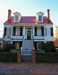 | Brahe House | 0.4 miles | 1973 |
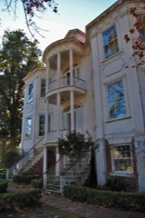 | Gertrude Herbert Art Institute | 0.5 miles | 1973 |
 | Engine Company Number One | 0.5 miles | 1988 |
 | Academy of Richmond County | 0.5 miles | 1973 |
 | Old Medical College Building | 0.6 miles | 1972 |
| National Archives record | The nomination case file for reference 80001228 in Record Group 79. |
| Richmond County | All 51 listed properties in this county. |