 Block
From the record
One of 15 National Register listings published here for Banks County · listed in 1982 · category: Building.
Sources: the case file at the National Archives · the National Register database, National Park Service
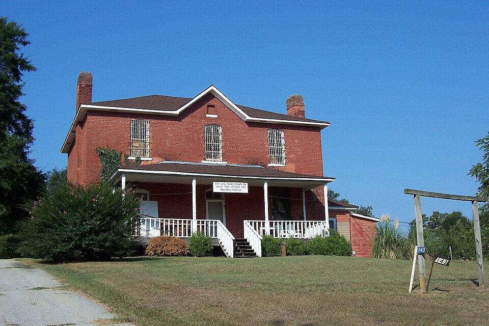
Listed on the National Register of Historic Places in 1982.
One of 15 National Register listings published here for Banks County · listed in 1982 · category: Building.
Sources: the case file at the National Archives · the National Register database, National Park Service
Regional context, not property-specific evidence. The federal wildfire occurrence database lists 104 fires within 5 miles of Banks County Jail between 1992 and 2019, burning about 324 acres in total. 1 started naturally. 12 were recorded as arson. Distance is straight-line from the map coordinates, so a fire counted here may appear on a neighbouring settlement's page as well.
| Reported cause | Fires |
|---|---|
| Debris and open burning | 61 |
| Equipment and vehicle use | 16 |
| Arson/incendiarism | 12 |
| Missing data/not specified/undetermined | 8 |
| Smoking | 3 |
| Misuse of fire by a minor | 2 |
| Recreation and ceremony | 1 |
| Natural | 1 |
The most recent of them, most recent first, with the day each was reported and the service that recorded it.
| Date | Cause | Size | Reported by | Name on the report |
|---|---|---|---|---|
| 4 September 2007 | Equipment and vehicle use | under an acre | Georgia Forestry Commission | not named |
| 25 September 1999 | Debris and open burning | under an acre | Georgia Forestry Commission | not named |
| 21 September 1997 | Arson/incendiarism | 7.6 acres | Georgia Forestry Commission | not named |
| 20 September 1997 | Arson/incendiarism | 44 acres | Georgia Forestry Commission | not named |
| 16 September 2011 | Debris and open burning | under an acre | Georgia Forestry Commission | FY2012-BANKS-002 |
| 26 August 1997 | Debris and open burning | under an acre | Georgia Forestry Commission | not named |
| 25 August 2011 | Debris and open burning | under an acre | Georgia Forestry Commission | FY2012-BANKS-001 |
| 24 August 2007 | Missing data/not specified/undetermined | under an acre | Georgia Forestry Commission | not named |
Regional context, not property-specific evidence. The National Weather Service names Homer, the town this property stands in, in 64 storm reports between 1995 and 2025: 27 thunderstorm wind, 25 hail, 4 funnel cloud, 2 tornado. The reports record 1 injury. Each account below is quoted exactly as the forecast office filed it, from the NOAA Storm Events Database, and each date opens the federal record of that event.
| When | Event | Place named | Harm | What the report says |
|---|---|---|---|---|
| July 2000 | Tornado (F0) | Homer | 1 hurt, $105,000 | An NWS Survey Team concluded that an F0 tornado briefly touched down 5 miles west-southwest of Homer and traveled for 2 miles with an approximate path width of 100 yards to a point approximately 3 miles southwest of Homer. One person was injured, apparently by debris, but little additional information was known. The Banks county newspaper reported that the tornado completely destroyed a chicken breeder/pullet building on Simms Road, which had 11,000 chickens inside. The number of chickens that survived was unknown, but the loss of the chicken house and chickens was estimated at $66,000. At the neighboring residence, a satellite dish was destroyed when a large tree fell on it. Another house on Wellborn Road sustained damage when a large uprooted tree fell on the back portion of the house causing damage. Roads and yards in the area were littered with fallen trees and debris. Several roads were blocked as a consequence. |
| June 2007 | Hail | Homer | $140,000 | The Banks County Emergency Management Director reported golf ball-sized hail in the east and southeast part of the county. |
| May 2014 | Tornado (EF1) | Homer | $50,000 | A National Weather Service survey team determined that an EF-1 tornado touched down to the north of Homer in a heavily wooded area where it snapped the trunks of numerous mature hardwood trees as well as causing minor roof damage to one home. The torando was widest at the beginning of the path. It continued moving quickly to the northeast where more trees were downed and snapped along the track. Four additional homes also received minor roof damage. The tornado produced EF-0 damage to trees before lifting in a wooded area in northeast Banks County.|[05/15/14: Tornado #1, County #1-1, EF1, Banks, 2014:007]. |
| July 2008 | Lightning | Homer | $50,000 | The Banks County Emergency Management Director reported that lightning struck a home on Bell Road and set it on fire. |
| January 2007 | Thunderstorm Wind | Homer | $50,000 | The Banks County Emergency Management Director reported that a number of trees were blown down throughout the county from west to east. A number of power lines were also down. At least 12 roads across the counties were closed as a result of downed trees and power lines. Some of the closed roads included Georgia Highway 15, 98, and 51, Bennett Road, and Willis Road. In addition, two homes were damaged when trees fell on the structures. One of the damaged homes was on Georgia Highway 51 north of Homer where the porch and part of the roof were stripped away by a downed tree. The other was a mobile home on Georgia Highway 98, also north of Homer where a tree fell on a mobile home. |
| July 2003 | Thunderstorm Wind | Homer | $25,000 | The Banks county Emergency Management Director reported that thunderstorm winds blew down several trees in the Homer area and caused minor damage to a construction site and an adjacent restaurant near the Jackson county line, just off U.S. Highway 441. Other trees and some power lines were blown down in Maysville. |
| February 2011 | Thunderstorm Wind | Homer | $20,000 | The Banks County Emergency Management Director reported that a storage building belong to Home Depot was blown onto U.S. Highway 441. A couple of signs were also blown down onto the highway. The Banks County News of Homer reported that at least 16 trees were down with power outages in the Maysville and Gillsville areas. |
| June 2008 | Lightning | Homer | $15,000 | The Banks County Emergency Management Director reported that lightning set a barn on fire in the western part of the county. |
| June 2007 | Thunderstorm Wind | Homer | $15,000 | The Banks County Emergency Management Director reported that up to 15 trees were blown down across the county, mainly the eastern and southern portions. Three trees were down on power lines. A portion of the Old Navy sign at the Banks Crossing Outlet Mall was damaged by the strong winds. |
| August 2003 | Thunderstorm Wind | Homer | $8,000 | The Banks county 911 center reported that a number of trees had been blown down between Homer and Hollingsworth along U.S. Highway 441. Three roads were blocked and closed because of the downed trees. A number of power lines had also been brought down by the fallen trees. |
| March 2008 | Thunderstorm Wind | Homer | $7,000 | The Banks County Emergency Management Director reported several trees and power lines were blown down scattered about the county. One barn was destroyed by the strong winds. |
| June 2018 | Thunderstorm Wind | Homer | $6,000 | The Banks County 911 center reported a large tree down on a home near the 200 block of Woodland Street near Homer. No significant damage or injuries reported. |
| February 2009 | Thunderstorm Wind | Homer | $5,000 | The Banks County 911 Center reported that eight trees and two power lines were blown down between Wilson Shoals and Pinefield Crossroads. A storm spotter reported that 12 trees and a couple of power poles were down near U.S. Highway 441 and Line Creek Road. |
| June 2006 | Flash Flood | Homer | $5,000 | The Banks County Emergency Management Director reported that heavy rainfall on the order of 2-4 inches in a 2-3 hour period had resulted in flooding of Grove Creek in southern Banks county and also in the Banks Crossing area on U.S. Highway 441. Willis Horton Road, a gravel road, was washed out A couple of other roads were closed in the area because of high water. Flooding from Crooked Creek in the area likely also contributed to the incident. |
| November 2004 | Thunderstorm Wind | Homer | $5,000 | The Banks County 911 Center reported that many trees were blown down around six miles north of Homer. The Greer, South Carolina National Weather Service Forecast Office reported that a tree fell on the Banks/Franklin county line near Interstate 85, causing damage to a cell tower located in Franklin county. |
| February 2001 | Thunderstorm Wind | Homer | $5,000 | The Banks county 911 center reported that a barn was destroyed and several trees were blown down in the extreme south central part of the county near Maysville and the Jackson county line. |
| May 1998 | Hail | Homer | $5,000 | The public reported golf ball size hail near highway 52 southwest of Homer and also 4 miles northeast of Homer. |
| July 2024 | Thunderstorm Wind | Homer | $3,000 | Tree reported down on a power line near the intersection of Dogwood Dr and Historic Homer Hwy. Other isolated trees reported down just north of commerce in the same area. |
| July 2003 | Thunderstorm Wind | Homer | $3,000 | The Banks county Emergency Management Director reported that a few trees were down in Homer and some power lines were down near Maysville on the Jackson county line. |
| July 2000 | Thunderstorm Wind | Homer | $3,000 | The public reported trees down. Winds were estimated at 60 mph. |
| June 2019 | Thunderstorm Wind | Homer | $2,000 | A report was received over social media of a large tree blown down and a portable toilet toppled at the Chimney Oaks Golf Club. |
| June 2008 | Thunderstorm Wind | Homer | $2,000 | The Banks County Emergency Management Director reported that at least 10 trees were down north of Homer. Another tree was down on a mobile home west of Homer near the intersection of Georgia Highway 323 and 51. Pea-sized hail was observed in the Maysville area. |
| May 2003 | Thunderstorm Wind | Homer | $2,000 | The Banks county Emergency Management Director reported that some trees were down on at least two roads in the city. |
| May 1998 | Hail | Homer | $2,000 | The public reported dime to golf ball size hail. |
| October 2012 | Thunderstorm Wind | Homer | $1,500 | The Banks County Emergency Manager relayed reports of several downed trees in and near the Homer area, especially between Homer and Highway 441. |
| June 2000 | Thunderstorm Wind | Homer | $1,500 | The Homer police reported three trees down on Hembre Road and one tree down on Fort Lamar Road. |
| June 2025 | Thunderstorm Wind | Homer | $1,000 | Tree down near the intersection of McCoy Bridge Road and Historic Homer Highway. |
| August 2023 | Thunderstorm Wind | Homer | $1,000 | Powerlines reported down near the intersection of hwy 164 and hwy 98. |
| August 2023 | Thunderstorm Wind | Homer | $1,000 | Tree down on Ervin Chambers Rd and Hickory Creek Rd. |
| May 2017 | Thunderstorm Wind | Homer | $1,000 | The Banks County 911 center reported a tree blown down onto Athens Street near the Historic Homer Highway. |
| January 2009 | Flood | Homer | $1,000 | The Banks County Emergency Management Director reported that Webb Creek, approximately four miles southeast of Homer, overflowed its banks at Marshburn Drive. At least six inches of water was flowing over the road at this location for about two hours. Damage was confined to minor debris removal. |
| June 1999 | Thunderstorm Wind | Homer | $1,000 | The public reported dime size hail and a large oak tree and some pine trees blown down. |
| June 1998 | Thunderstorm Wind | Homer | $1,000 | The Banks county EMA reported trees were blown down across roads. |
| June 1995 | Thunderstorm Wind | Homer | $750 | Thunderstorm winds knocked down several trees in north Homer along U.S. Highway 441. |
| May 2002 | Thunderstorm Wind | Homer | $500 | The Banks county 911 center reported that two trees were blown down near the Hall/ Banks county line in the Hickory Flat area near Gillsville. |
| September 1995 | Thunderstorm Wind | Homer | $500 | Thunderstorm winds uprooted several trees with some falling across Highway 184, Damascus Road and Hawkins Road. |
| August 2018 | Funnel Cloud | Homer | - | The Banks County Emergency Manager relayed a report of a funnel cloud west of the Banks County High School, from the Banks County Fire Department. No damage from a tornado touchdown was found. |
| March 2008 | Funnel Cloud | Homer | - | The Banks County Emergency Management Director reported that a funnel cloud was spotted just east of the Banks Crossing area along Interstate-85. |
| March 2008 | Hail | Homer | - | An amateur radio operator reported penny-sized hail in northern Banks county, north of Homer. |
| April 2008 | Hail | Homer | - | The Banks County Emergency Management Director observed penny-sized hail in the Homer area. Penny-sized hail was also observed by the Jackson county Emergency Management Director along the Banks county line in the city of Maysville. |
| May 2006 | Hail | Homer | - | The Banks County 911 Center reported nickel-sized hail in Homer, while the public reported nickel-sized hail in the Lula area. |
| June 2005 | Hail | Homer | - | The public reported quarter-sized hail northwest of Five Points, while the Banks County 911 Center reported nickel-sized hail just south of Homer. |
| August 2005 | Funnel Cloud | Homer | - | The Banks County 911 Center reported sightings of funnel clouds in the Homer area. This was consistent with a definite mesocyclone indication on National Weather Service Doppler radar. |
| December 2004 | Hail | Homer | - | The Banks County Sherrif's Office reported nickel-sized hail on Interstate-85 south of Homer. |
| August 2004 | Hail | Homer | - | The Banks County 911 Center reported quarter-sized hail. |
| August 2003 | Hail | Homer | - | The public reported penny-sized hail. |
| August 2003 | Flash Flood | Homer | - | The Banks county 911 center reported that excessive rainfall from repetitive thunderstorm activity had resulted in several creeks overflowing their banks and flowing across roads. Some of the roads had been rendered impassable because of the flowing water. |
| March 2003 | Hail | Homer | - | The Banks county 911 center reported golf ball size hail. |
| May 2003 | Funnel Cloud | Homer | - | The Banks county Emergency Management Director reported observing a funnel cloud in the area. Another funnel cloud sighting in the same area was also received from the public |
| November 2002 | Flood | Homer | - | The public reported street flooding. |
| May 2002 | Hail | Homer | - | The Banks county 911 center reported nickel size hail. |
| August 2002 | Hail | Homer | - | The Banks county 911 center reported dime size hail. |
| March 2000 | Hail | Homer | - | The Banks county EMA reported golf ball size hail near the Hall-Banks county line northwest of Homer, and also in the south part of the county. |
| May 1998 | Hail | Homer | - | Banks county 911 received a report of quarter size hail accumulating to 2 inches on a deck. |
| June 1999 | Hail | Homer | - | no account filed |
| April 1998 | Hail | Homer | - | no account filed |
| April 1998 | Hail | Homer | - | no account filed |
| April 1998 | Hail | Homer | - | no account filed |
| June 1998 | Hail | Homer | - | no account filed |
| May 1998 | Hail | Homer | - | no account filed |
No historic map-sheet match is published for this property yet. That does not mean no map exists. This record needs a coordinate-quality review before it can be joined to a sheet boundary. Browse the county's mapped places while that work is pending.
Other National Register properties close enough to walk or drive between, ordered by distance from this one. Both positions come from the same geocoding pass that matched these properties to their map sheets.
| Photograph | Property | Distance | Listed |
|---|---|---|---|
| Homer Historic District (Boundary Increase) | 0.4 miles | 1993 | |
| Homer Historic District | 0.5 miles | 1985 | |
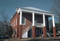 | Banks County Courthouse | 0.6 miles | 1980 |
| Mount Pleasant Historic District | 3.8 miles | 1996 | |
| Turk Family Farm | 4.3 miles | 2003 | |
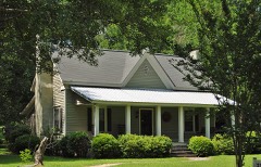 | William Chambers House | 4.6 miles | 1996 |
| National Archives record | The nomination case file for reference 82002382 in Record Group 79. |
| Banks County | All 15 listed properties in this county. |