 Block
From the record
One of 37 National Register listings published here for Habersham County · listed in 1982 · category: Building.
Sources: the case file at the National Archives · the National Register database, National Park Service
Listed on the National Register of Historic Places in 1982.
One of 37 National Register listings published here for Habersham County · listed in 1982 · category: Building.
Sources: the case file at the National Archives · the National Register database, National Park Service
Regional context, not property-specific evidence. The federal wildfire occurrence database lists 258 fires within 5 miles of Church, Cornelius, House between 1992 and 2020, burning about 423 acres in total. 7 started naturally. 25 were recorded as arson. Distance is straight-line from the map coordinates, so a fire counted here may appear on a neighbouring settlement's page as well.
| Reported cause | Fires |
|---|---|
| Debris and open burning | 174 |
| Arson/incendiarism | 25 |
| Missing data/not specified/undetermined | 22 |
| Equipment and vehicle use | 11 |
| Misuse of fire by a minor | 8 |
| Natural | 7 |
| Recreation and ceremony | 6 |
| Smoking | 5 |
The most recent of them, most recent first, with the day each was reported and the service that recorded it.
| Date | Cause | Size | Reported by | Name on the report |
|---|---|---|---|---|
| 8 September 1997 | Smoking | under an acre | Georgia Forestry Commission | not named |
| 6 September 1997 | Debris and open burning | under an acre | Georgia Forestry Commission | not named |
| 25 September 1998 | Debris and open burning | under an acre | Georgia Forestry Commission | not named |
| 25 September 1993 | Arson/incendiarism | under an acre | Georgia Forestry Commission | not named |
| 18 September 1997 | Equipment and vehicle use | under an acre | Georgia Forestry Commission | not named |
| 12 September 1998 | Debris and open burning | 1.9 acres | Georgia Forestry Commission | not named |
| 10 September 1999 | Debris and open burning | under an acre | Georgia Forestry Commission | not named |
| 9 August 1997 | Missing data/not specified/undetermined | under an acre | Georgia Forestry Commission | not named |
Regional context, not property-specific evidence. The federal mineral resources record lists 8 workings within 5 miles of Church, Cornelius, House: 6 past producers, 2 producers. 2 still produce. What was taken out: Stone, Crushed/Broken, Gold, Iron, Kyanite. Distance is straight-line from the map coordinates, so a quarry counted here may appear on a neighbouring settlement's page as well.
| Where | Site | Commodity | Status | Recorded |
|---|---|---|---|---|
| Clarksville District Kyn Occurrence | Kyanite | Past Producer | 1932 | |
| Piedmont College Farm | Iron | Past Producer | Residual | |
| C.T. Willbanks | Gold | Past Producer | Vein | |
| H. Woods | Gold | Past Producer | Stream Placer | |
| Habersham Quarry | Stone, Crushed/Broken | Producer | ||
| Habersham Quarry | Stone, Crushed/Broken | Past Producer | ||
| Nichols Placer | Gold | Past Producer | Stream Placer | |
| Stamborough Quarry | Stone, Crushed/Broken | Producer |
Regional context, not property-specific evidence. The National Weather Service names Clarkesville, the town this property stands in, in 69 storm reports between 1996 and 2024: 25 thunderstorm wind, 21 hail, 11 flood, 10 flash flood. The reports record 2 injuries. Each account below is quoted exactly as the forecast office filed it, from the NOAA Storm Events Database, and each date opens the federal record of that event.
| When | Event | Place named | Harm | What the report says |
|---|---|---|---|---|
| July 1998 | Thunderstorm Wind | Clarkesville | 2 hurt | no account filed |
| August 2000 | Lightning | Clarkesville | $1,000,000 | no account filed |
| October 2020 | Flash Flood | Clarkesville | $200,000 | Stream gauges and emergency manager reported flash flooding developed along the Soque and Chattahoochee River basins after 6 to 7 inches of rain fell in around 24 hours. Multiple roads along the Soque and its tributaries were heavily inundated or washed out, especially close to the White County line. These included Duncan Bridge Rd, Paradise Park Rd, Cross Creek Trail, Soque Trail, and Falling Water Dr. Additionally, a home was inundated on River Way, where the occupants required rescue. |
| August 2005 | Thunderstorm Wind | Clarkesville | $50,000 | Numerous trees down, possibly hundreds, from just west of Clarkesville to the Mud Creek area. Several trees fell on homes. |
| February 2016 | Thunderstorm Wind | Clarkesville | $20,000 | County comms reported a tree blown down on a house on View St. |
| October 2020 | Flood | Clarkesville | $10,000 | Although rain tapered off across Habersham County during the morning hours, flooding continued along the Soque River into the early afternoon as runoff from the 6 to 7 inches of rain that fell across the basin in around 24 hours continued to flow through the basin. Multiple roads remained inundated or damaged and closed during this time. |
| August 2005 | Flash Flood | Clarkesville | $10,000 | Numerous roads closed due to flooding along creeks and streams. Several vehicles became stalled in flood waters. Closed/flooded roads included highway 17, Chase Rd, Savanna Rd, Wilson Rd, and Airport Rd. A guardrail was washed away on Habersham Mills Rd. A spotter in Clarkesville reported 6.5 inches of rain in less than 24 hrs. |
| July 2002 | Thunderstorm Wind | Clarkesville | $10,000 | Trees were blown down and a house was damaged near the Stephens County line. |
| September 2024 | Flash Flood | Clarkesville | $5,000 | A stream gauge on the Soque River in Clarkesville exceeded its established flood stage after 7 to 10 inches of rain fell throughout the basin over a couple of days. Pitts Park in Clarkesville and other low spots were inundated. |
| July 2015 | Thunderstorm Wind | Clarkesville | $5,000 | County comms reported multiple trees blown down, with part of the roof blown off a commercial building in downtown Clarkesvile. A spotter reported additional trees blown down off Highway 197 just south of town. |
| September 2024 | Flood | Clarkesville | $2,000 | Although heavy rain ended across Habersham County by afternoon, high water conditions continued along the Soque River into the evening hours. |
| September 2024 | Tornado (EF0) | Clarkesville | $2,000 | NWS analysis determined that a weak tornado touched down near the Annandale subdivision. A few trees were blown downed along an intermittent path and an outbuilding was destroyed at a sod farm. |
| January 2024 | Flood | Clarkesville | $1,000 | A stream gauge on the Soque River in Clarkesville exceeded its established flood stage after 3 to 5 inches of rain fell throughout the basin in 12 to 18 hours. Pitts Park in Clarkesville was inundated. |
| March 2021 | Flood | Clarkesville | $1,000 | A stream gauge on the Soque River in Clarkesville exceeded its established flood stage after 4 to 7 inches of rain fell throughout the basin, mostly in about 12 hours from the 25th into the early part of the 6th. Pitts Park in Clarkesville was flooded. |
| August 2021 | Flood | Clarkesville | $1,000 | A stream gauge on the Soque River in Clarkesville exceeded its established flood stage after 3 to 5 inches of rain fell throughout the basin, mostly in about 24 hours. Pitts Park in Clarkesville was inundated. |
| July 2002 | Thunderstorm Wind | Clarkesville | $1,000 | Trees and powerlines were blown down. A fence was also blown down. |
| October 2021 | Flood | Clarkesville | $500 | A gauge on the Soque River in Clarkesville exceeded its established flood stage after 3 to 4 inches fell throughout the basin in about a 24-hour period. The main impact was flooding of Pitts Park. |
| February 2020 | Flood | Clarkesville | $500 | Although heavy rain began tapering off across northeast Georgia during the afternoon and evening, a stream gauge on the Soque River in Clarkesville indicated continued flooding along the river through the evening. This indicated flooding of Pitts Park along with multiple roads along the river and some of its tributaries. |
| February 2020 | Flash Flood | Clarkesville | $500 | A stream gauge on the Soque River in Clarkesville exceeded its established flood stage after 3 to 5 inches of rain fell in the basin in less than 18 hours, with the bulk of that falling in about a 6-hour period during the morning of the 6th. Pitts Park in Clarkesville was flooded, as were multiple roads along the river and some of its tributaries. |
| April 2019 | Flood | Clarkesville | $500 | Although heavy rainfall ended across Habersham County during the afternoon, flooding continued along the Soque River in Clarkesville through the evening. The main impact was flooding of Pitts Park. |
| April 2019 | Flash Flood | Clarkesville | $500 | A gauge on the Soque River in Clarkesville exceeded its established flood stage after 4 to 5 inches of rain fell throughout the basin, with most of that falling in around 6 hours. The main impact was flooding of Pitts Park. |
| December 2018 | Flood | Clarkesville | $500 | A stream gauge on the Soque River in Clarkesville exceeded its established flood stage after 4 to 5 inches of rain fell in the basin in about 24 hours. Pitts Park in Clarkesville was flooded, while county comms reported closure of West Water St and Habersham Mill Rd due nto flood water from the Soque or its tributaries. |
| November 2018 | Flood | Clarkesville | $500 | A gauge on the Soquee River in Clarkesville exceeded its established flood stage after 3 to 3.5 inches fell throughout the basin in about a 12-hour period. The main impact was flooding of Pitts Park. |
| March 2003 | Thunderstorm Wind | Clarkesville | $500 | A privacy fence was blown down at a residence. |
| June 2023 | Hail | Clarkesville | - | Public reported quarter size reports at Ellison St and Roper Dr. |
| July 2013 | Thunderstorm Wind | Clarkesville | - | Over a dozen large trees were blown down to the northwest of Clarkesville. |
| March 2011 | Flash Flood | Clarkesville | - | The Soque River left its banks, flooding roads, trails, and some buildings at Pitts Park. |
| March 2011 | Flood | Clarkesville | - | Although heavy rain began to taper off during the late morning, high water conditions persisted along the Soque River near Clarkesville through the afternoon. |
| March 2011 | Flash Flood | Clarkesville | - | For the second time in three days, heavy rain resulted in flash flooding along the Soque River near Clarkesville. Roads, trails and some buildings in Pitts Park were flooded when the river left its banks. |
| June 2010 | Thunderstorm Wind | Clarkesville | - | The awning was blown off a restaurant on highway 441, about a mile north of Demorest. Also, a large tree was uprooted on Demorest-Mt. Airy highway and a very large limb was snapped on Thomas St in Cornelia. |
| March 2008 | Thunderstorm Wind | Clarkesville | - | Widespread damage to trees and power lines across the county. |
| June 2007 | Thunderstorm Wind | Clarkesville | - | Trees blown down. |
| July 2007 | Thunderstorm Wind | Clarkesville | - | Several 3 to 4 inch diameter tree limbs blown down. |
| April 2007 | Thunderstorm Wind | Clarkesville | - | The tin roof was peeled off a produce stand on highway 115, 1.5 miles northwest of Clarkesville, and the roof off of a strip mall on highway 197 1 mile south southeast of town. Other tree damage was reported throughout the city area, including 2 large trees down on Water St. |
| April 2007 | Thunderstorm Wind | Clarkesville | - | Several trees were blown down along New Liberty Rd. |
| May 2006 | Hail | Clarkesville | - | Nickel size hail at Allendale State Prison near Alto. |
| July 2005 | Flash Flood | Clarkesville | - | Flooding of Daisy Creek in Clarkesville, with Daisy Creek Rd under water. Several streets were also flooded due to poor drainage in Clarkesville and Demorest. |
| June 2004 | Flash Flood | Clarkesville | - | Several creeks overflowed their banks, flooding a few roads. |
| August 2004 | Thunderstorm Wind | Clarkesville | - | Numerous trees and power lines were blown down. |
| September 2004 | Flash Flood | Clarkesville | - | Flash flooding developed across the county as the outermost rain bands associated with the remnants of Hurricane Ivan produced intense rainfall rates. A few streams overflowed their banks and flooded adjacent roads. |
| June 2002 | Thunderstorm Wind | Clarkesville | - | Several trees were blown down. |
| July 2002 | Thunderstorm Wind | Clarkesville | - | Trees were blown down across the county. |
| November 2002 | Thunderstorm Wind | Clarkesville | - | A few trees were blown down. |
| June 2001 | Hail | Clarkesville | - | Spotter reported quarter-sized hail. |
| June 2001 | Thunderstorm Wind | Clarkesville | - | Roof torn off an office building, with numerous trees down across the city. Dime-sized hail also reported. |
| August 2001 | Thunderstorm Wind | Clarkesville | - | Trees and power lines blown down at various locations across the county. |
| July 2013 | Hail | Clarkesville | - | no account filed |
| May 2012 | Hail | Clarkesville | - | no account filed |
| March 2010 | Hail | Clarkesville | - | no account filed |
| April 2006 | Hail | Clarkesville | - | no account filed |
| May 2006 | Hail | Clarkesville | - | no account filed |
| July 2003 | Hail | Clarkesville | - | no account filed |
| May 2003 | Hail | Clarkesville | - | no account filed |
| June 2001 | Hail | Clarkesville | - | no account filed |
| July 1999 | Hail | Clarkesville | - | no account filed |
| May 1998 | Hail | Clarkesville | - | no account filed |
| May 1998 | Hail | Clarkesville | - | no account filed |
| May 1998 | Hail | Clarkesville | - | no account filed |
| June 1998 | Hail | Clarkesville | - | no account filed |
| April 1998 | Thunderstorm Wind | Clarkesville | - | no account filed |
No historic map-sheet match is published for this property yet. That does not mean no map exists. This record needs a coordinate-quality review before it can be joined to a sheet boundary. Browse the county's mapped places while that work is pending.
Other National Register properties close enough to walk or drive between, ordered by distance from this one. Both positions come from the same geocoding pass that matched these properties to their map sheets.
| Photograph | Property | Distance | Listed |
|---|---|---|---|
| Clarkesville Garage | under 500 feet | 1982 | |
| Church Furniture Store | under 500 feet | 1982 | |
| Clarkesville Downtown Square Historic District | under 500 feet | 2021 | |
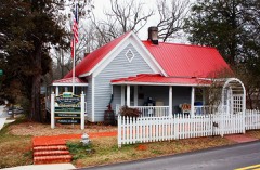 | Mauldin House | under 500 feet | 1982 |
| A. P. Hill House | under 500 feet | 1982 | |
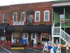 | Jackson Building | under 500 feet | 1982 |
| National Archives record | The nomination case file for reference 82002428 in Record Group 79. |
| Habersham County | All 37 listed properties in this county. |