 Block
From the record
One of 14 National Register listings published here for Harris County · listed in 1982 · category: Building.
Sources: the case file at the National Archives · the National Register database, National Park Service
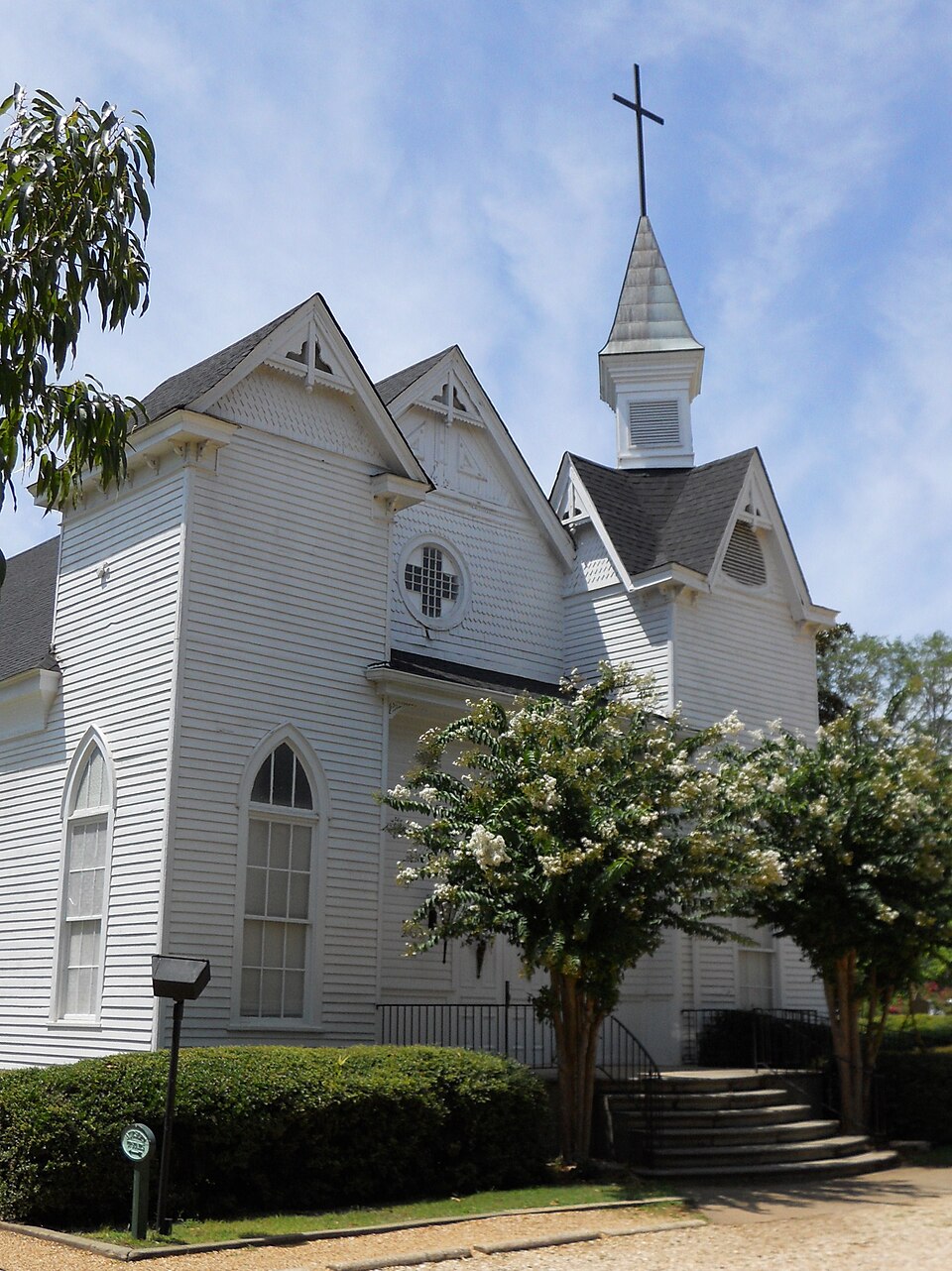
Listed on the National Register of Historic Places in 1982.
One of 14 National Register listings published here for Harris County · listed in 1982 · category: Building.
Sources: the case file at the National Archives · the National Register database, National Park Service
Regional context, not property-specific evidence. The federal wildfire occurrence database lists 159 fires within 5 miles of Hamilton Baptist Church and Pastorium between 1992 and 2019, burning about 661 acres in total. 10 started naturally. 22 were recorded as arson. Distance is straight-line from the map coordinates, so a fire counted here may appear on a neighbouring settlement's page as well.
| Reported cause | Fires |
|---|---|
| Debris and open burning | 100 |
| Arson/incendiarism | 22 |
| Natural | 10 |
| Smoking | 9 |
| Misuse of fire by a minor | 6 |
| Equipment and vehicle use | 5 |
| Missing data/not specified/undetermined | 4 |
| Railroad operations and maintenance | 2 |
| Recreation and ceremony | 1 |
The most recent of them, most recent first, with the day each was reported and the service that recorded it.
| Date | Cause | Size | Reported by | Name on the report |
|---|---|---|---|---|
| 25 September 2005 | Debris and open burning | under an acre | Georgia Forestry Commission | not named |
| 25 September 1998 | Debris and open burning | under an acre | Georgia Forestry Commission | not named |
| 24 September 2005 | Debris and open burning | under an acre | Georgia Forestry Commission | not named |
| 24 September 1997 | Debris and open burning | 2.9 acres | Georgia Forestry Commission | not named |
| 21 September 2001 | Misuse of fire by a minor | under an acre | Georgia Forestry Commission | FY2002-HARRIS-004 |
| 16 September 2006 | Debris and open burning | under an acre | Georgia Forestry Commission | not named |
| 13 September 1998 | Arson/incendiarism | under an acre | Georgia Forestry Commission | not named |
| 6 August 2008 | Natural | 5.7 acres | Georgia Forestry Commission | not named |
Regional context, not property-specific evidence. The National Weather Service names Hamilton, the town this property stands in, in 34 storm reports between 1993 and 2022: 19 thunderstorm wind, 12 hail, 2 lightning, 1 flash flood. No death or injury is recorded in these reports. Each account below is quoted exactly as the forecast office filed it, from the NOAA Storm Events Database, and each date opens the federal record of that event.
| When | Event | Place named | Harm | What the report says |
|---|---|---|---|---|
| March 2019 | Thunderstorm Wind | Hamilton | $25,000 | An amateur radio operator reported trees blown down from Highway 1 south of Hamilton to Highway 85 southwest of Waverly Hall. |
| August 2007 | Lightning | Hamilton | $25,000 | The Columbus Ledger-Inquirer reported that lightning struck near a school complex causing damage to the fire alarm systems and air conditioners at three schools, Carver Middle School, Harris County High School, and Mulberry Creek Elementary school. |
| July 2005 | Thunderstorm Wind | Hamilton | $25,000 | A former National Weather Service employee reported that many trees were blown down two miles east of Pine Mountain. A home in this area was also damaged by the downed trees. The Harris county 911 center reported that several trees were down between Hamilton and Pine Mountain. |
| February 2022 | Flash Flood | Hamilton | $20,000 | The Emergency Manager reported Mobley Road washed out at Little Branch. Radar estimates indicate that between 3 and 5 inches of rain occurred over the area, resulting in the flash flooding. |
| July 2000 | Lightning | Hamilton | $10,000 | The Harris County Journal reported that two lightning strikes, both within a 30 minute time frame, caused considerable damage to the computer modems and the Motorola 911 system used for 911 center dispatching. An exact damage estimate was not available. |
| June 2015 | Thunderstorm Wind | Hamilton | $6,000 | The Harris County Emergency Manager reported several trees blown down in Hamilton. |
| August 2011 | Thunderstorm Wind | Hamilton | $5,000 | A trained storm spotter observed several trees and power lines down between Hamilton and Waverly Hall. |
| August 2011 | Thunderstorm Wind | Hamilton | $5,000 | The Harris County 911 Center, along with the Harris County Sheriff's Office, and Columbus television station WTVM reported that dozens of trees were down from northwest to southeast across the county, five miles northwest of Hamilton to just southeast of Waverly Hall near the Talbot county line. Trees were down on Georgia Highway 85 between Waverly Hall and the Meriwether county line among other areas. |
| March 2001 | Thunderstorm Wind | Hamilton | $5,000 | The Harris county 911 center reported several trees and power lines down. |
| June 1994 | Thunderstorm Wind | Hamilton | $5,000 | Numerous tree limbs and power lines were downed by thunderstorm winds. |
| June 2018 | Thunderstorm Wind | Hamilton | $3,000 | The Harris County Emergency Manager reported a few trees blown down from around Hamilton to Cataula. |
| July 2016 | Thunderstorm Wind | Hamilton | $2,000 | The Harris County 911 center reported several trees blown down along Calhoun Road near Hamilton. |
| July 2012 | Thunderstorm Wind | Hamilton | $2,000 | The Harris County 911 Center reported that several trees were blown down between Hamilton and Lake Harding. Two of the trees were down at the 911 Center. |
| March 1997 | Thunderstorm Wind | Hamilton | $2,000 | no account filed |
| January 2013 | Thunderstorm Wind | Hamilton | $1,500 | The Harris County Sheriff's Office reported that several trees were blown down on U.S. Route 27. |
| August 1999 | Thunderstorm Wind | Hamilton | $1,000 | Harris county 911 reported several trees and power lines down. |
| July 1995 | Thunderstorm Wind | Hamilton | $600 | Thunderstorm winds knocked down three trees. One of the trees was blocking Georgia Highway 129. |
| April 2013 | Thunderstorm Wind | Hamilton | $500 | The Harris County 911 Center reported two trees were blown down across Highway 116. |
| August 1999 | Thunderstorm Wind | Hamilton | $500 | Harris county 911 reported several trees down on the highway. |
| October 1998 | Thunderstorm Wind | Hamilton | $500 | The Harris county sheriff's office reported 3 trees were knocked down on highway 116. |
| August 1995 | Thunderstorm Wind | Hamilton | $500 | Thunderstorm winds knocked several large trees down. |
| August 1993 | Thunderstorm Wind | Hamilton | $500 | A few large tree limbs were downed by thunderstorm winds which caused sporadic power outages. |
| March 2021 | Hail | Hamilton | - | The public reported quarter-size hail in Hamilton. |
| June 2015 | Hail | Hamilton | - | The Harris County Emergency Manager reported penny sized hail in Hamilton. |
| August 2011 | Hail | Hamilton | - | A storm spotter observed quarter-sized hail between Hamilton and Waverly Hall. |
| April 2010 | Hail | Hamilton | - | The Harris County Emergency Management Director relayed reports of penny-sized hail near Hamilton and Pine Mountain Valley. |
| March 2009 | Hail | Hamilton | - | A Harris County Sheriff's Deputy observed penny-sized hail west of Hamilton. Radar data suggests that hail of similar size likely fell across much of southwest, west central and north central Harris county. This is a separate thunderstorm from the storm which also produced penny-sized hail earlier between Hamilton and Pine Mountain Valley. |
| March 2009 | Hail | Hamilton | - | The Harris County 911 Center reported penny-sized hail. The Harris county Emergency Management Director observed less than penny-sized hail just south of Pine Mountain Valley. |
| February 2008 | Hail | Hamilton | - | The Harris County 911 Center observed nickel-sized hail. |
| August 2008 | Hail | Hamilton | - | The Harris County Emergency Management Director reported penny-sized hail. |
| March 2005 | Hail | Hamilton | - | The Harris County 911 center reported quarter-sized hail. |
| June 1998 | Hail | Hamilton | - | A HAM operator reported dime to quarter size hail. |
| July 1998 | Hail | Hamilton | - | Harris county 911 reported dime size hail and several large trees down. |
| November 1997 | Hail | Hamilton | - | The public reported hail ranging from nickel to one inch size. |
No historic map-sheet match is published for this property yet. That does not mean no map exists. This record needs a coordinate-quality review before it can be joined to a sheet boundary. Browse the county's mapped places while that work is pending.
Other National Register properties close enough to walk or drive between, ordered by distance from this one. Both positions come from the same geocoding pass that matched these properties to their map sheets.
| Photograph | Property | Distance | Listed |
|---|---|---|---|
 | Harris County Courthouse | 0.1 miles | 1980 |
| Welcome P. Duke Log House | 1.7 miles | 1999 | |
| Cason and Virginia Callaway House | 3.0 miles | 2002 | |
| Bethlehem Baptist Church Colored School | 6.5 miles | 2008 | |
 | Story-Hadley House | 7.1 miles | 2002 |
 | Sunnyside School-Midway Baptist Church and Midway Cemetery Historic District | 7.6 miles | 1999 |
| National Archives record | The nomination case file for reference 82002448 in Record Group 79. |
| Harris County | All 14 listed properties in this county. |