 Block
From the record
One of 26 National Register listings published here for Stewart County · listed in 1982 · category: Building.
Sources: the case file at the National Archives · the National Register database, National Park Service
Listed on the National Register of Historic Places in 1982.
One of 26 National Register listings published here for Stewart County · listed in 1982 · category: Building.
Sources: the case file at the National Archives · the National Register database, National Park Service
Regional context, not property-specific evidence. The federal wildfire occurrence database lists 247 fires within 5 miles of Dr. Miller's Office between 1992 and 2020, burning about 806 acres in total. 10 started naturally. 11 were recorded as arson. Distance is straight-line from the map coordinates, so a fire counted here may appear on a neighbouring settlement's page as well.
| Reported cause | Fires |
|---|---|
| Debris and open burning | 183 |
| Equipment and vehicle use | 15 |
| Missing data/not specified/undetermined | 13 |
| Arson/incendiarism | 11 |
| Natural | 10 |
| Misuse of fire by a minor | 6 |
| Smoking | 5 |
| Railroad operations and maintenance | 3 |
| Recreation and ceremony | 1 |
The most recent of them, most recent first, with the day each was reported and the service that recorded it.
| Date | Cause | Size | Reported by | Name on the report |
|---|---|---|---|---|
| 8 September 1997 | Equipment and vehicle use | 21 acres | Georgia Forestry Commission | not named |
| 6 September 2016 | Debris and open burning | under an acre | Georgia Forestry Commission | FY2017-STEWART-004 |
| 5 September 1999 | Debris and open burning | 5.5 acres | Georgia Forestry Commission | not named |
| 4 September 1995 | Smoking | 2.9 acres | Georgia Forestry Commission | not named |
| 28 September 2013 | Debris and open burning | under an acre | Georgia Forestry Commission | FY2014-STEWART-001 |
| 26 September 2009 | Equipment and vehicle use | 8.7 acres | Georgia Forestry Commission | not named |
| 21 September 2015 | Debris and open burning | under an acre | Georgia Forestry Commission | FY2016-STEWART-004 |
| 20 September 2005 | Missing data/not specified/undetermined | under an acre | Georgia Forestry Commission | not named |
Regional context, not property-specific evidence. The federal mineral resources record lists 2 workings within 5 miles of Dr. Miller's Office: 2 past producers. None of them still produces. What was taken out: Iron. Distance is straight-line from the map coordinates, so a quarry counted here may appear on a neighbouring settlement's page as well.
| Where | Site | Commodity | Status | Recorded |
|---|---|---|---|---|
| Stewart Mine | Iron | Past Producer | ||
| Stewart Operations | Iron | Past Producer |
Regional context, not property-specific evidence. The National Weather Service names Lumpkin, the town this property stands in, in 25 storm reports between 1993 and 2020: 18 thunderstorm wind, 5 hail, 1 funnel cloud, 1 tornado. No death or injury is recorded in these reports. Each account below is quoted exactly as the forecast office filed it, from the NOAA Storm Events Database, and each date opens the federal record of that event.
| When | Event | Place named | Harm | What the report says |
|---|---|---|---|---|
| March 2005 | Thunderstorm Wind | Lumpkin | $50,000 | The Stewart County Emergency Management Director reported that a thunderstorm microburst tore the roof off the county's Health Department building and damaged an outdoor storage bin at the Emergency Management Director's facility. In addition, some 40 to 50 trees within the same general small area were blown down, uprooted, or torn apart by the strong winds. |
| May 2020 | Thunderstorm Wind | Lumpkin | $10,000 | The Stewart County Emergency Manager reported trees and power lines blown down from Lumpkin to northeast of Louvale. Trees and power lines were down on Valley Road, Liberty Street and Broad Street in Lumpkin and along Moores Store Road northeast of Louvale. |
| November 2014 | Tornado (EF1) | Lumpkin | $5,000 | A NWS storm survey team found that an EF-1 tornado, with maximum wind speeds of 104 MPH, touched down in central Stewart County just southwest of the city of Lumpkin. The tornado tracked north northeast for less than a mile before lifting causing mainly damage to trees along Green Grove Road. [11/23/14: Tornado #2, County #1-1, EF1, Stewart, 2014:019]. |
| July 2004 | Thunderstorm Wind | Lumpkin | $5,000 | The Stewart County Emergency Management Director reported that several large pine trees were blown down, some landing on and causing damage to recreational campers stored on a lot. |
| March 1993 | Thunderstorm Wind | Lumpkin | $5,000 | Several large tree limbs were downed by thunderstorm winds. |
| March 1997 | Hail | Lumpkin | $5,000 | no account filed |
| June 2020 | Thunderstorm Wind | Lumpkin | $4,000 | The public reported trees blown down from Lumpkin to Richland. |
| June 2000 | Thunderstorm Wind | Lumpkin | $3,000 | The Emergency Management Director for Stewart county reported trees down in Lumpkin which also brought down some power lines. In addition, a funnel cloud was sighted in the area. |
| March 2009 | Thunderstorm Wind | Lumpkin | $2,000 | The Stewart County Emergency Management Director reported that a few trees were down south of Lumpkin along with minor structural damage to a building in the far southern part of the county. |
| May 2002 | Thunderstorm Wind | Lumpkin | $2,000 | The Stewart county 911 center reported several trees down on Georgia Highway 27 west of Lumpkin and also near County Line. |
| June 2000 | Thunderstorm Wind | Lumpkin | $2,000 | The public reported two trees down 2 miles south of Lumpkin on Trotman Road and two more trees down on U.S. Highway 27, 3 miles south of Lumpkin. |
| June 2012 | Thunderstorm Wind | Lumpkin | $1,500 | The Stewart County Emergency Manager and 911 Center reported several downed trees east of Lumpkin, including one across Trotman Road and another on Holder Road. |
| April 2017 | Thunderstorm Wind | Lumpkin | $1,000 | The Stewart County Emergency Manager reported trees blown down at Rockwell Street and Hardwick Lane. |
| March 2007 | Thunderstorm Wind | Lumpkin | $1,000 | The Stewart County Emergency Management Director reported that several trees were down along Trotman Road southeast of Lumpkin. |
| November 2001 | Thunderstorm Wind | Lumpkin | $1,000 | The Stewart county 911 center reported that three trees were blown down. |
| June 2014 | Thunderstorm Wind | Lumpkin | $500 | The Stewart County 911 Center reported that a couple of trees were blown down. |
| May 2006 | Thunderstorm Wind | Lumpkin | $500 | The Stewart County Emergency Management Director reported that a couple of trees were blown down. |
| March 2005 | Thunderstorm Wind | Lumpkin | $500 | The Stewart County Sheriff's office reported that a few trees were blown down on the east side of Lumpkin. |
| February 1995 | Thunderstorm Wind | Lumpkin | $500 | Thunderstorm winds knocked several trees and tree limbs onto power lines. |
| November 1993 | Thunderstorm Wind | Lumpkin | $500 | A power line and one old Texaco gas station sign were blown down by thunderstorm winds. |
| January 2006 | Hail | Lumpkin | - | A corrections officer at the state prison facility near Westville reported penny-sized hail. |
| May 2006 | Hail | Lumpkin | - | An amateur radio operator reported penny-sized hail. |
| April 2005 | Hail | Lumpkin | - | The Stewart county Sheriff's office reported penny-sized hail. |
| April 2003 | Hail | Lumpkin | - | The Stewart county Emergency Management Director reported nickel-sized hail. |
| September 1998 | Funnel Cloud | Lumpkin | - | A funnel cloud was reported near Lumpkin. |
No historic map-sheet match is published for this property yet. That does not mean no map exists. This record needs a coordinate-quality review before it can be joined to a sheet boundary. Browse the county's mapped places while that work is pending.
Other National Register properties close enough to walk or drive between, ordered by distance from this one. Both positions come from the same geocoding pass that matched these properties to their map sheets.
| Photograph | Property | Distance | Listed |
|---|---|---|---|
| Jared Irwin House | under 500 feet | 1982 | |
| Mathis House | under 500 feet | 1982 | |
| Bush-Usher House | under 500 feet | 1982 | |
| East Main Street Residential Historic District | under 500 feet | 1982 | |
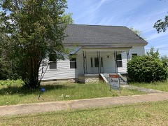 | Armstrong House | under 500 feet | 1982 |
 | Stewart County Courthouse | 0.2 miles | 1980 |
| National Archives record | The nomination case file for reference 82002468 in Record Group 79. |
| Stewart County | All 26 listed properties in this county. |