 Block
From the record
One of 48 National Register listings published here for Cobb County · listed in 1983 · category: Building.
Sources: the case file at the National Archives · the National Register database, National Park Service
Listed on the National Register of Historic Places in 1983.
One of 48 National Register listings published here for Cobb County · listed in 1983 · category: Building.
Sources: the case file at the National Archives · the National Register database, National Park Service
Regional context, not property-specific evidence. The federal wildfire occurrence database lists 26 fires within 5 miles of John W. Rice Summer Cottage between 1993 and 2015, burning about 67 acres in total. 1 started naturally. 5 were recorded as arson. Distance is straight-line from the map coordinates, so a fire counted here may appear on a neighbouring settlement's page as well.
| Reported cause | Fires |
|---|---|
| Debris and open burning | 9 |
| Missing data/not specified/undetermined | 8 |
| Arson/incendiarism | 5 |
| Misuse of fire by a minor | 3 |
| Natural | 1 |
The most recent of them, most recent first, with the day each was reported and the service that recorded it.
| Date | Cause | Size | Reported by | Name on the report |
|---|---|---|---|---|
| 16 September 1997 | Missing data/not specified/undetermined | 1.0 acres | Georgia Forestry Commission | not named |
| 19 August 1993 | Missing data/not specified/undetermined | 4.0 acres | Georgia Forestry Commission | not named |
| 7 July 2002 | Missing data/not specified/undetermined | under an acre | Georgia Forestry Commission | FY2003-LINCOLN-001 |
| 16 July 1995 | Debris and open burning | 1.0 acres | Georgia Forestry Commission | not named |
| 12 July 1993 | Missing data/not specified/undetermined | 3.0 acres | Georgia Forestry Commission | not named |
| 3 June 1994 | Missing data/not specified/undetermined | 1.0 acres | Georgia Forestry Commission | not named |
| 12 June 1993 | Misuse of fire by a minor | 5.0 acres | Georgia Forestry Commission | not named |
| 12 June 1993 | Misuse of fire by a minor | 2.0 acres | Georgia Forestry Commission | not named |
Regional context, not property-specific evidence. The federal mineral resources record lists 3 workings within 5 miles of John W. Rice Summer Cottage: 2 past producers, 1 producer. 1 still produces. What was taken out: Sand and Gravel, Construction, Clay, Sulfur. Distance is straight-line from the map coordinates, so a quarry counted here may appear on a neighbouring settlement's page as well.
| Where | Site | Commodity | Status | Recorded |
|---|---|---|---|---|
| Kramper Property | Sulfur | Past Producer | ||
| Plant No. 7 | Clay | Past Producer | ||
| Stamps Mine No 2 | Sand and Gravel, Construction | Producer |
Regional context, not property-specific evidence. The National Weather Service names Smyrna, the town this property stands in, in 32 storm reports between 1993 and 2013: 16 hail, 11 thunderstorm wind, 2 tornado, 2 lightning. The reports record 4 deaths and 250 injuries. Each account below is quoted exactly as the forecast office filed it, from the NOAA Storm Events Database, and each date opens the federal record of that event.
| When | Event | Place named | Harm | What the report says |
|---|---|---|---|---|
| June 1995 | Tornado (F1) | Smyrna | 4 killed, 250 hurt | A preliminary survey confirmed a small F1 tornado touched down for less than 30 seconds. Path width 30 yards...Length 100 yards. A Dairy Queen sustained the worst damage, as the roof was completely destroyed. A pay phone on the southeast side of the building held the roof up, sparing the lives of the 30 people inside. Four of the occupants sustained minor injuries. A business sign next door to the restaurant was knocked over. A Chevy van was picked up and moved although there appeared to be only slight cosmetic damage to it. |
| April 1998 | Tornado (F2) | Smyrna | $15,000,000 | The same supercell that had tracked from Alabama across Haralson and Paulding counties spawned another tornado in Smyrna. The touchdown was along Windy Hill Road just west of Cobb Parkway where a commercial building sustained heavy damage. A filling station and car dealership less than a block east also sustained heavy damage. There was $500,000 to $750,000 in damage to new cars. Trees over a foot in diameter were snapped or uprooted. In total, 59 buildings were damaged, but no injuries were reported. Aerial and ground surveys by NWS employees showed the path varied from 100 to 200 yards wide with a length of about 3 miles. The tornado crossed just into Fulton county near I-285 and the Chattahoochee River. Dime to quarter size hail and other wind damage were also reported in north and central Cobb county. |
| August 2006 | Lightning | Smyrna | $50,000 | The Cobb County 911 Center reported that lightning set a home on fire on Queen Ann Drive in the southwest part of Smyrna. |
| April 2011 | Thunderstorm Wind | Smyrna | $15,000 | Amateur radio operators relayed reports that dozens of trees were down in the east central part of Cobb county near Mount Bethel. Green Forest Parkway was closed at South Cobb Drive and South Atlanta Road. |
| May 2001 | Thunderstorm Wind | Smyrna | $5,000 | The public reported two trees down on South Atlanta Road in Smyrna, north of Interstate 285. The fallen trees damaged two cars which subsequently resulted in an automobile accident. |
| September 2004 | Heavy Rain | Smyrna | $2,500 | The East Cobb Neighbor reported that very heavy rain caused an awning at a shopping center in Smyrna to collapse. Debris from the damaged awning was spread across the sidewalk. |
| July 2005 | Thunderstorm Wind | Smyrna | $2,000 | An amateur radio operator and the public reported that several trees and power lines were down between Smyrna and Powder Springs in southern Cobb county. |
| June 2003 | Lightning | Smyrna | $2,000 | The public reported that lightning struck a residence. While no fire resulted, damage to computer and other electrical equipment resulted. |
| July 2002 | Thunderstorm Wind | Smyrna | $2,000 | The Marietta Daily Journal and a tree service company reported that numerous trees were blown down. |
| June 2013 | Thunderstorm Wind | Smyrna | $1,000 | Smyrna Police reported that a tree and power lines were down across Spring Road. Another tree was down across the road near Paces Ferry. |
| April 1996 | Thunderstorm Wind | Smyrna | $600 | no account filed |
| July 2001 | Thunderstorm Wind | Smyrna | $500 | The public reported that a large tree was blown down at a private residence. |
| July 1999 | Thunderstorm Wind | Smyrna | $500 | The Smyrna police reported trees down on power lines. |
| April 1993 | Thunderstorm Wind | Smyrna | $500 | Thunderstorm winds blew down a few power lines in Smyrna. |
| August 1996 | Thunderstorm Wind | Smyrna | $500 | no account filed |
| August 1995 | Thunderstorm Wind | Smyrna | $250 | Thunderstorm winds gusted to 55 kt and split an eight-inch diameter pine tree in half. |
| June 2011 | Hail | Smyrna | - | The public observed quarter-sized hail near and just south of Smyrna. |
| April 2011 | Hail | Smyrna | - | The public observed quarter-sized hail across the east central part of the county near Mount Bethel. |
| July 2011 | Hail | Smyrna | - | A trained storm spotter observed penny to nickel-sized hail on Concord Road near South Cobb Drive in Smyrna. WSR-88D radar data suggests that similar-sized hail likely fell eastward toward the Fulton county line and the Vinings area. Two trees were also blown down in the Marietta area from this same thunderstorm. |
| April 2010 | Hail | Smyrna | - | The public observed penny-sized hail just east and southeast of Smyrna, especially near the intersection of Interstate-75 and Interstate-285. Most of the hail was pea size. |
| February 2008 | Hail | Smyrna | - | The public reported penny-sized hail. |
| July 2002 | Hail | Smyrna | - | The public reported dime size hail. |
| July 2002 | Hail | Smyrna | - | A storm spotter reported dime size hail. |
| May 1999 | Hail | Smyrna | - | A couple of public reports indicated hail up to 1 inch in diameter. |
| May 1999 | Hail | Smyrna | - | The public reported dime size hail. |
| April 1998 | Hail | Smyrna | - | no account filed |
| May 1996 | Hail | Smyrna | - | no account filed |
| March 1996 | Hail | Smyrna | - | no account filed |
| March 1996 | Hail | Smyrna | - | no account filed |
| April 1996 | Hail | Smyrna | - | no account filed |
| February 1993 | Hail | Smyrna | - | no account filed |
| April 1993 | Hail | Smyrna | - | no account filed |
No historic map-sheet match is published for this property yet. That does not mean no map exists. This record needs a coordinate-quality review before it can be joined to a sheet boundary. Browse the county's mapped places while that work is pending.
Other National Register properties close enough to walk or drive between, ordered by distance from this one. Both positions come from the same geocoding pass that matched these properties to their map sheets.
| Photograph | Property | Distance | Listed |
|---|---|---|---|
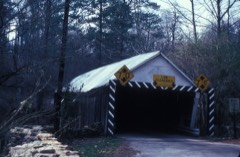 | Ruff's Mill and Concord Covered Bridge | under 500 feet | 1980 |
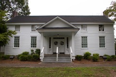 | Robert Mable House and Cemetery | 1.8 miles | 1988 |
| Taylor-Brawner House and Brawner Sanitarium | 3.5 miles | 2012 | |
| Union Field Fortifications at Henderson Road | 3.8 miles | 2015 | |
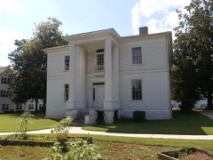 | Andrew J. Cheney House | 4.2 miles | 1979 |
| J. H. Carmichael Farm and General Store | 4.4 miles | 1980 |
| National Archives record | The nomination case file for reference 83000189 in Record Group 79. |
| Cobb County | All 48 listed properties in this county. |