 Block
From the record
One of 17 National Register listings published here for Carroll County · listed in 1984 · category: District.
Sources: the case file at the National Archives · the National Register database, National Park Service
Listed on the National Register of Historic Places in 1984.
One of 17 National Register listings published here for Carroll County · listed in 1984 · category: District.
Sources: the case file at the National Archives · the National Register database, National Park Service
Regional context, not property-specific evidence. The federal wildfire occurrence database lists 228 fires within 5 miles of South Carrollton Residential Historic District between 1992 and 2019, burning about 634 acres in total. 12 started naturally. 55 were recorded as arson. Distance is straight-line from the map coordinates, so a fire counted here may appear on a neighbouring settlement's page as well.
| Reported cause | Fires |
|---|---|
| Debris and open burning | 91 |
| Arson/incendiarism | 55 |
| Missing data/not specified/undetermined | 20 |
| Equipment and vehicle use | 18 |
| Recreation and ceremony | 13 |
| Natural | 12 |
| Misuse of fire by a minor | 10 |
| Smoking | 8 |
| Railroad operations and maintenance | 1 |
The most recent of them, most recent first, with the day each was reported and the service that recorded it.
| Date | Cause | Size | Reported by | Name on the report |
|---|---|---|---|---|
| 8 September 1998 | Debris and open burning | under an acre | Georgia Forestry Commission | not named |
| 4 September 1999 | Debris and open burning | 3.3 acres | Georgia Forestry Commission | not named |
| 29 September 2016 | Arson/incendiarism | under an acre | Georgia Forestry Commission | FY2017-CARROLL-006 |
| 28 September 1998 | Arson/incendiarism | 1.5 acres | Georgia Forestry Commission | not named |
| 2 September 1993 | Debris and open burning | under an acre | Georgia Forestry Commission | not named |
| 17 September 2010 | Smoking | under an acre | Georgia Forestry Commission | FY2011-CARROLL-007 |
| 16 September 1999 | Missing data/not specified/undetermined | under an acre | Georgia Forestry Commission | not named |
| 13 September 1999 | Arson/incendiarism | 2.2 acres | Georgia Forestry Commission | not named |
Regional context, not property-specific evidence. The federal mineral resources record lists 3 workings within 5 miles of South Carrollton Residential Historic District: 1 past producer, 1 plant, 1 unknown. 1 still produces. What was taken out: Gold, Copper, Iron. Distance is straight-line from the map coordinates, so a quarry counted here may appear on a neighbouring settlement's page as well.
| Where | Site | Commodity | Status | Recorded |
|---|---|---|---|---|
| (Facility) Carrollton Copper Smelter | Copper | Plant | ||
| Stacy Mine | Gold | Past Producer | Vein | |
| Unnamed | Iron | Unknown |
Regional context, not property-specific evidence. The National Weather Service names Carrollton, the town this property stands in, in 102 storm reports between 1994 and 2025: 47 thunderstorm wind, 32 hail, 10 lightning, 6 flash flood. The reports record 2 injuries. Each account below is quoted exactly as the forecast office filed it, from the NOAA Storm Events Database, and each date opens the federal record of that event.
| When | Event | Place named | Harm | What the report says |
|---|---|---|---|---|
| February 2008 | Tornado (EF1) | Carrollton | 1 hurt, $7,000,000 | A damage survey conducted by the National Weather Service Forecast Office in Peachtree City, Georgia and the Carrollton County Emergency Management Director confirmed that yet another tornado touched down in eastern Carroll county spawned by the same squall line of thunderstorms that just a few minutes earlier had resulted in an EF3 tornado in western Carroll county. This tornado was rated an EF1, touching down three miles east of Carrollton and tracking to a point five miles east of Carrollton. The path length was two miles long with a maximum path width of 100 yards. Maximum wind speeds with the tornado were estimated at 90 mph. A total of 24 structures sustained minor damage. The majority of the damage was in the form of roof and siding damage to homes. Numerous trees and power lines were also blown down along this tornado track as well. A man was injured when a tree limb went through his automobile and impaled his body. |
| December 2002 | Thunderstorm Wind | Carrollton | 1 hurt, $10,000 | A reporter with an Atlanta Television news station reported that numerous trees were blown down across the county. In Carrollton, one of the downed trees landed on a home causing damage to the structure and injuring a young girl that lived at the residence. |
| May 2008 | Tornado (EF2) | Carrollton | $7,000,000 | A survey conducted by the National Weather Service Forecast Office in Peachtree City, Georgia confirmed that yet a second brief spinup tornado, spawned by the same parent thunderstorm, touched down in Carroll county. This tornado affected eastern Carroll county, touching down near the Diamond Court Subdivision off Cross Plains-Hulett Road, about three miles south of Hulett. Again, this tornado was embedded within a much larger and extensive area of straight-line wind damage that tracked across much of central Carroll county from near Bowden to the Douglas county line, southeast of Hulett. One home was completely destroyed by this second tornado and another received significant damage. A number of other homes sustained minor to moderate roof damage. Again, the path length and path width of this tornado were also only 100 yards.||The combined damage from the two tornadoes and straight-line wind damage within Carroll county caused damages in excess of $10 million. Damages consisted of the destruction of three mobile homes, 18 mobile homes with major damage, and 16 mobile homes with minor damage. Thirty-five single family dwellings were destroyed, 211 single-family dwellings sustained major damage, and another 346 suffered minor damage. In addition, a total of four businesses were destroyed, 133 more which had major damage, and 31 suffering minor damage. A public works building was also destoyed. Finally, at least $800,000 in damages was reported to electric utility poles in Carroll county. |
| April 2008 | Hail | Carrollton | $400,000 | A storm spotter reported that hail the size of quarters began at 725 pm EDT on the northwest side of Carrollton and increased to the size of golf balls over a five-minute period. The storm continued to drift and build southwestward with time with penny-sized hail reported one mile southeast of Bowdon at 745 pm. Radar supported that hail of similar size or larger continued until after 800 pm EDT in the southwest part of the county, south of Bowdon and near the Alabama border. |
| July 2010 | Lightning | Carrollton | $300,000 | The Times Georgian of Carrollton reported that lightning struck a propane tank at Lyle Enterprises near Carrollton. The lightning strike caused an explosion which set a 2400 square foot workshop on fire. This fire in turn set an adjacent mobile home, that was used for storage, four trucks, a tractor, some lawn mowers, and other miscellaneous supplies on fire. All of this property was destroyed as a result. |
| July 2007 | Lightning | Carrollton | $100,000 | The Carroll County Emergency Management Director reported that a home was struck by lightning causing significant damage to the structure. |
| July 2012 | Thunderstorm Wind | Carrollton | $55,000 | The Carroll County Emergency Manager reported that at least six trees and several power lines were blown down just north of Carrollton near Spence Road. One tree fell on a house. |
| February 2025 | Thunderstorm Wind | Carrollton | $50,000 | Numerous trees and powerlines down across the city of Carrollton. One tree fell on a vehicle on Tus Carrollton Rd and two trees fell on homes near Lake Carroll. |
| April 2017 | Tornado (EF1) | Carrollton | $50,000 | A National Weather Service survey team found that a brief EF-1 tornado with maximum wind speeds of 90 MPH and a maximum path width of 300 yards touched down over central Carroll County, near the University of West Georgia. The tornado tracked northeast then turned more easterly before dissipating near Highway 27 in Carrollton. Much of the tornado damage was snapped and uprooted trees, however, significant structural damage occurred to a fire station off Brumbelow Road. A Styrofoam-core metal roof was pulled off of the building and in the process, a portion of a concrete exterior wall was destroyed. Numerous large trees were snapped or uprooted across the street from this location. Based on this damage, estimated|winds were around 90 mph which resulted in an EF-1 rating for this tornado. No injuries were reported. [04/03/17: Tornado #1, County #1/1, EF-1, Carroll, 2017:033]. |
| July 2018 | Flash Flood | Carrollton | $45,000 | Carroll County Emergency Management reported flooding near the intersection of Maple Street and Highway 27 in Carrollton. As a result, several cars were submerged up to their windows. Radar estimates indicate rainfall amounts of 2 to 2.5 inches, with locally higher amounts, occurred over a short period of time. |
| July 2018 | Flash Flood | Carrollton | $40,000 | Carroll County Emergency Management reported rising water from a creek entered homes on Carroll Circle. Radar estimates indicate rainfall amounts of 2 to 2.5 inches, with locally higher amounts, occurred over a short period of time. |
| March 2013 | Thunderstorm Wind | Carrollton | $30,000 | The public reported that roof was blown off an auto sales store. |
| May 1995 | Thunderstorm Wind | Carrollton | $30,000 | Thunderstorm winds knocked down numerous trees along the southern portion of the county, especially in Carrollton. Winds also were responsible for tearing down a portion of a high school's roof in Carrollton. |
| August 2007 | Lightning | Carrollton | $25,000 | The Carroll County EMA Director reported that lightning struck a home on Timber Ridge Trail, just of Georgia Highway 166 west-southwest of Carrollton, causing damage to the structure. South of Carrollton, just of U.S. Highway 27 on Memory Springs Road, the electrical meter of a mobile home was struck, causing minor damage to the structure. |
| November 2004 | Lightning | Carrollton | $25,000 | The Carroll County Emergency Management Director reported that a residential fire was caused by a lightning strike. |
| March 2020 | Thunderstorm Wind | Carrollton | $20,000 | The Carroll County Emergency Manager reported a tree blown onto and damaging a house near the intersection of Cedar Street and Stewart Street. |
| April 2014 | Flash Flood | Carrollton | $15,000 | The Carroll County Emergency Manager reported around ten roads closed due to flooding from nearby creeks or streams. Two of the roads had structural damage needing repairs. The area primarily affected was from Carrollton to Whitesburg to Roopville. |
| March 2001 | Lightning | Carrollton | $15,000 | The Times Georgian newspaper in Carrollton reported that lightning struck the First Baptist Church on Dixie Street in Carrollton. The lightning struck the church steeple and blew out several small stained glass windows and also damaged the stained glass protective cover over the front door. The sound system and organ were also damaged. In addition, the lightning damaged some galvanized pipe in the office, which caused a water leak and subsequent damage to the office area. It was also apparent that a fire had been started by the lightning, but heavy rain which followed quickly doused the fire. |
| April 2017 | Thunderstorm Wind | Carrollton | $10,000 | An amateur radio operator reported multiple trees blown down at the intersection of Highway 166 and Cedar Street. |
| April 2005 | Lightning | Carrollton | $10,000 | The Times Georgian of Carrollton reported that lightning struck a tree next to the Starting Block Learning Center sending smoke into the building. The building was evacuated as a result. In addition, lightning struck an underground service entrance to a Target store, causing a high voltage transformer to burn. |
| August 1998 | Thunderstorm Wind | Carrollton | $10,000 | Carroll county 911 reported numerous trees down, some falling on a house. |
| January 2020 | Thunderstorm Wind | Carrollton | $8,000 | The Carroll County Emergency Manager reported trees down across the northern portions of the county from around Carrollton to near Draketown. |
| June 2025 | Thunderstorm Wind | Carrollton | $7,000 | Numerous trees down on powerlines per EM across northern and northeastern parts of city of Carrollton. Locations include 100 block of Pawn Dr 100 Block of Watson St 300 block of Cliff st 500 block of Frashier rd and 100 block of Kingsbridge. |
| July 2024 | Thunderstorm Wind | Carrollton | $7,000 | Five trees down on roadways in Carollton City limits. |
| June 2016 | Thunderstorm Wind | Carrollton | $6,000 | The Carroll County Emergency Manager reported multiple trees blown down across the Carrollton area. |
| March 2025 | Thunderstorm Wind | Carrollton | $5,000 | Multiple trees down in the city of carrollton. |
| April 2025 | Thunderstorm Wind | Carrollton | $5,000 | Multiple reports of downed trees in carrollton, ga. |
| December 2024 | Thunderstorm Wind | Carrollton | $5,000 | Multiple trees down on the north side of Carrollton. |
| May 2024 | Thunderstorm Wind | Carrollton | $5,000 | EM reports 5 trees down on roadways across the city of Carrollton. |
| July 2018 | Thunderstorm Wind | Carrollton | $5,000 | The Carroll County Emergency Manager reported several trees blown along Horsley Mill Road between Folds Road and Pleasant Hill Road. |
| June 2007 | Lightning | Carrollton | $5,000 | The Carroll County Emergency Management Director reported that lightning struck a church and set it on fire. |
| April 2005 | Thunderstorm Wind | Carrollton | $5,000 | The Times Georgian of Carrollton reported that thunderstorm winds downed a number of trees and power lines in the city. |
| February 2001 | Thunderstorm Wind | Carrollton | $5,000 | An amateur radio operator reported trees down on Georgia Highway 166 in Carrollton and Villa Rica. The public reported a large 50 foot billboard broken in half by the wind at exit 5 on Interstate 20 near Villa Rica. |
| May 2024 | Thunderstorm Wind | Carrollton | $3,000 | EM reports 3 trees down on roadways within the city limits of Carrollton. |
| June 2016 | Thunderstorm Wind | Carrollton | $3,000 | The Carroll County Emergency Manager reported several trees blown down near the Douglas County line. |
| February 2008 | Thunderstorm Wind | Carrollton | $3,000 | An amateur radio operator reported that three trees were blown down near Lake Carroll, about one mile northeast of Carrollton. The public reported that two trees were down on a road in Villa Rica near the Douglas/Carroll county line. |
| June 2008 | Thunderstorm Wind | Carrollton | $3,000 | The Carroll County 911 Center reported that several trees and power lines were down on the bypass around Carrollton. A few trees were also down just northeast of Roopville in southern Carroll county. |
| May 2003 | Heavy Rain | Carrollton | $3,000 | The Carroll county Emergency Management Director reported that a home sustained minor damage because of high water caused by excessive rainfall of 1 to 2 inches in less than one hour and poor drainage conditions. |
| January 2000 | Thunderstorm Wind | Carrollton | $3,000 | Thunderstorm winds knocked down several trees on houses and power lines. There were power outages. |
| May 2025 | Thunderstorm Wind | Carrollton | $2,000 | Emergency manager reported a tree down on a power line at the 500 block of Willie N St near the intersection with N Alma St. |
| June 2023 | Thunderstorm Wind | Carrollton | $2,000 | Emergency manager reported a tree and powerlines down on Mill Pond Crossing, leading to a power outage in the subdivision. |
| July 2022 | Thunderstorm Wind | Carrollton | $2,000 | Tree down on Maple Street near Howell Road. |
| February 2011 | Thunderstorm Wind | Carrollton | $2,000 | The Carroll County 911 Center reported that two trees were down, also bringing down two power lines. |
| May 1998 | Hail | Carrollton | $2,000 | The public reported dime size and golf ball size hail. |
| July 1997 | Flash Flood | Carrollton | $2,000 | The remnants of Hurricane Danny dumped 1 to 2 inches of rainfall over parts of the county within a couple of hours. Several roads had to be closed due to low lying flooding. |
| April 1997 | Thunderstorm Wind | Carrollton | $2,000 | no account filed |
| June 2025 | Thunderstorm Wind | Carrollton | $1,000 | Trees downed along Linda Lane on the north side of Carrollton. |
| June 2025 | Thunderstorm Wind | Carrollton | $1,000 | Tree on home along 300 block of Northside Dr in Carrollton. |
| July 2024 | Thunderstorm Wind | Carrollton | $1,000 | Tree down on road at intersection of Beulah Church Road and Old Breman Road. |
| August 2023 | Thunderstorm Wind | Carrollton | $1,000 | Tree and powerlines downed along Timber Ridge Pl. |
| May 2010 | Lightning | Carrollton | $1,000 | The Carroll county Emergency Management Director reported that lightning struck a gas main in the Grove Park subdivision igniting a fire. No other damage or related incidents were reported. |
| June 2010 | Thunderstorm Wind | Carrollton | $1,000 | The Carroll County 911 Center reported that two trees and two power lines were down southeast of Carrollton. |
| July 2003 | Thunderstorm Wind | Carrollton | $1,000 | The Carroll county 911 center reported that a few trees were blown down. |
| July 2001 | Thunderstorm Wind | Carrollton | $1,000 | The public reported that a tree fell on a house. Damage was believed to be relatively minor. |
| July 1999 | Thunderstorm Wind | Carrollton | $1,000 | Greystone EMC reported trees down on power lines. |
| July 1999 | Thunderstorm Wind | Carrollton | $1,000 | Carroll county 911 reported trees and power lines down. |
| June 1994 | Thunderstorm Wind | Carrollton | $500 | A few large trees were blown down in Carrollton by thunderstorm winds. |
| August 1995 | Thunderstorm Wind | Carrollton | $300 | Thunderstorm winds knocked down a large tree and several large limbs. |
| December 2004 | Thunderstorm Wind | Carrollton | $250 | The public reported that a tree was snapped in half by strong winds on the University of West Georgia Campus. |
| June 2025 | Thunderstorm Wind | Carrollton | - | Tree down on home along 100 block of Joshua Marbry St in Carrollton. |
No historic map-sheet match is published for this property yet. That does not mean no map exists. This record needs a coordinate-quality review before it can be joined to a sheet boundary. Browse the county's mapped places while that work is pending.
Other National Register properties close enough to walk or drive between, ordered by distance from this one. Both positions come from the same geocoding pass that matched these properties to their map sheets.
| Photograph | Property | Distance | Listed |
|---|---|---|---|
 | Carroll County Courthouse | 0.3 miles | 1980 |
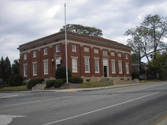 | U.S. Post Office | 0.4 miles | 1983 |
 | Lawler Hosiery Mill | 0.4 miles | 2005 |
| Carrollton Downtown Historic District | 0.4 miles | 2007 | |
| Mandeville Mills and Mill Village Historic District | 1.1 miles | 2006 | |
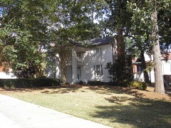 | Bonner-Sharp-Gunn House | 1.6 miles | 1970 |
| National Archives record | The nomination case file for reference 84000947 in Record Group 79. |
| Carroll County | All 17 listed properties in this county. |