 Block
From the record
One of 17 National Register listings published here for Barrow County · listed in 1985 · category: Building.
Sources: the case file at the National Archives · the National Register database, National Park Service
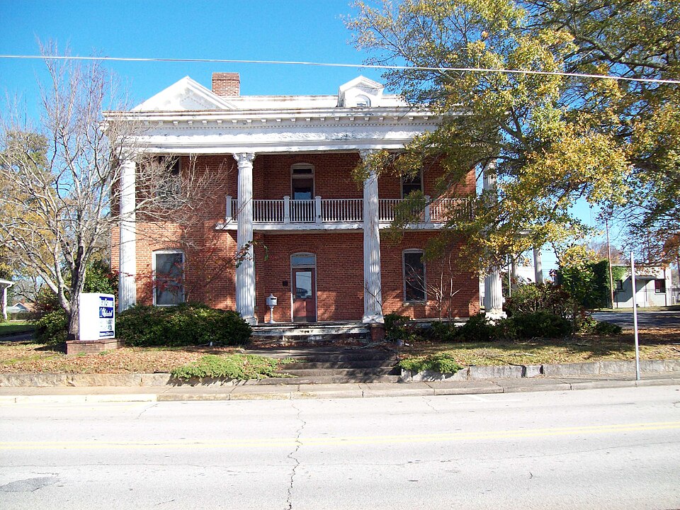
Listed on the National Register of Historic Places in 1985.
One of 17 National Register listings published here for Barrow County · listed in 1985 · category: Building.
Sources: the case file at the National Archives · the National Register database, National Park Service
Regional context, not property-specific evidence. The federal wildfire occurrence database lists 141 fires within 5 miles of Jackson-Johns House between 1992 and 2020, burning about 266 acres in total. 6 started naturally. 30 were recorded as arson. Distance is straight-line from the map coordinates, so a fire counted here may appear on a neighbouring settlement's page as well.
| Reported cause | Fires |
|---|---|
| Debris and open burning | 60 |
| Arson/incendiarism | 30 |
| Misuse of fire by a minor | 15 |
| Equipment and vehicle use | 12 |
| Missing data/not specified/undetermined | 7 |
| Natural | 6 |
| Recreation and ceremony | 6 |
| Smoking | 5 |
The most recent of them, most recent first, with the day each was reported and the service that recorded it.
| Date | Cause | Size | Reported by | Name on the report |
|---|---|---|---|---|
| 7 September 1999 | Debris and open burning | under an acre | Georgia Forestry Commission | not named |
| 30 September 2008 | Arson/incendiarism | under an acre | Georgia Forestry Commission | not named |
| 17 September 1998 | Arson/incendiarism | 2.3 acres | Georgia Forestry Commission | not named |
| 15 September 1998 | Arson/incendiarism | under an acre | Georgia Forestry Commission | not named |
| 7 August 2008 | Natural | 3.7 acres | Georgia Forestry Commission | not named |
| 4 August 2008 | Equipment and vehicle use | under an acre | Georgia Forestry Commission | not named |
| 4 August 1999 | Arson/incendiarism | 1.1 acres | Georgia Forestry Commission | not named |
| 30 August 1999 | Equipment and vehicle use | 1.0 acres | Georgia Forestry Commission | not named |
Regional context, not property-specific evidence. The National Weather Service names Winder, the town this property stands in, in 57 storm reports between 1995 and 2017: 24 thunderstorm wind, 23 hail, 7 lightning, 1 flood. No death or injury is recorded in these reports. Each account below is quoted exactly as the forecast office filed it, from the NOAA Storm Events Database, and each date opens the federal record of that event.
| When | Event | Place named | Harm | What the report says |
|---|---|---|---|---|
| July 2012 | Lightning | Winder | $3,000,000 | A historic church, built in 1904, was completely destroyed by a lightning strike and resulting fire at 71 West Candler Street. The church was the oldest in Winder and had recently undergone over $700,000 worth of restoration and renovation, with only $10,000 left of repairs to go before it was fully restored. As it was, the historic church was worth millions. Firefighters were able to contain the blaze to the church alone, although other homes along the block were evacuated as a precaution. |
| April 2009 | Hail | Winder | $900,000 | The Barrow County 911 Center reported golf ball-sized hail in the Winder area. |
| March 2008 | Hail | Winder | $400,000 | An amateur radio operator reported penny golf ball-sized hail from the Winder area. Most of the hail was penny size. |
| July 2004 | Lightning | Winder | $250,000 | The Atlanta Journal-Constitution reported that lightning struck the Holsenbeck Elementary School causing extensive damage to the media center and the administrative offices. Heat from the fire also burst a large pipe causing flooding in the school as well. |
| August 2003 | Lightning | Winder | $175,000 | Local newspapers out of Winder reported a number of lightning related incidents that resulted in significant damage. Two homes in Winder were struck by lightning, one on Lisa Circle, which suffered significant fire damage to an upstairs bonus room, while another home on Flanagan Mill Road suffered severe fire damage throughout. A chicken house on Georgia Highway 124 in the far north part of the county was struck and burned completely, while a power pole on Georgia Highway 82 just east of Winder burned when it was struck by lightning. No injuries or fatalities were reported during these incidents. |
| August 2005 | Tornado (F0) | Winder | $150,000 | A damage survey conducted by the National Weather Service confirmed that an F0 tornado had torn a 1.5 mile long and 100 yard wide path through Fort Yargo State Park, just southwest of Winder. The tornado began roughly in the middle of the park, traveled northwest across Masseys Lake, and terminated near the west entrance to the park on Georgia Highway 81. From 800 to 900 trees in the park were uprooted or blown over. Some minor damage occurred to camp sites and park benches within the park. A vehicle and a camper were also damaged from downed trees. Nearby in Bethlehem, several chicken houses and outbuildings suffered minor to moderate damage and minor roof damage was also reported to a Kentucky Fried Chicken restaurant. |
| May 1998 | Thunderstorm Wind | Winder | $150,000 | Severe thunderstorm winds damaged a number of houses and mobile homes. One trailer was moved 5 inches off its foundation. Numerous trees were downed, some falling onto houses. At least 6 chicken houses were severely damaged and over 60,000 chickens were killed. Power lines and power poles were also knocked down, causing power outages. The EMA office found no evidence of tornadoes and said the damge was in paths from downdrafts. |
| April 2005 | Thunderstorm Wind | Winder | $100,000 | The public and the Barrow County 911 Center reported that two buildings on Athens Street, three blocks from the court house, suffered significant damage from thunderstorm winds. The roof of a large commercial building , the historic Winder Rug Mill, was lifted off the structure and left in the street. Sheet metal from the Winder Rug Mill roof was scattered around parts of the town. A home nearby also sustained some roof damage. Several trees in the area were uprooted. |
| July 2005 | Flash Flood | Winder | $50,000 | The Barrow County News reported that a brief, but strong thunderstorm, dumped rainfall of 1.5 to 2.0 inches in less than an hour on saturated ground. This resulted in flash flooding when a creek overflowed its banks and washed out a portion of King Street. After the road was washed out, two people were injured when they drove their vehicle into the hole left by the washed out road. |
| May 2006 | Lightning | Winder | $25,000 | The Barrow County 911 Center reported that a home was struck and set on fire by lightning. The exact damage amount was indeterminable. |
| July 2003 | Thunderstorm Wind | Winder | $15,000 | The Gwinnett Daily-Post of Lawrenceville reported that a large, 60-foot tree fell on a Toyata, crushing the vehicle, but leaving the person inside uninjured. |
| November 2002 | Lightning | Winder | $15,000 | The Barrow County News reported that a lightning strike on Patrick Mill Road caused something in the house to smoke, prompting a call to the 911 center. A mobile unit at Hope Christian School also caught fire, which was believed to be lightning related as well. |
| April 2015 | Thunderstorm Wind | Winder | $10,000 | The Barrow County Emergency Manager reported a large tree uprooted on Candler Street that fell on a home. Additional smaller trees were also blown down and hail of an unknown size fell in the Winder area. |
| May 2000 | Thunderstorm Wind | Winder | $10,000 | The Barrow county 911 center reported damage to a chicken house and a food bin blown over on Highway 11near Winder. |
| March 1996 | Thunderstorm Wind | Winder | $10,000 | no account filed |
| January 2013 | Thunderstorm Wind | Winder | $5,000 | The Barrow County 911 Center reported that numerous trees and power lines were blown down near Winder. |
| August 2005 | Lightning | Winder | $5,000 | The public reported that lightning struck a tree adjacent to a home. Minor damage was reported to the home as a result. |
| May 1998 | Hail | Winder | $5,000 | The Barrow county EMA director reported golf ball size hail damaged cars. |
| November 1997 | Thunderstorm Wind | Winder | $5,000 | Three chicken houses were blown over by thunderstorm winds. |
| August 2011 | Thunderstorm Wind | Winder | $4,000 | The Barrow County 911 Center reported that a few trees were down on power lines in the area around Mulberry and Rockwell Church Roads approximately four miles north of Winder. |
| July 2011 | Thunderstorm Wind | Winder | $4,000 | The Barrow County 911 Center reported that several trees and a few power lines were down in the western part of the county between Winder and the Gwinnett county border. |
| July 2012 | Thunderstorm Wind | Winder | $3,000 | The Barrow County 911 Center reported that several trees and power lines were blown down in the Winder area. |
| May 2002 | Hail | Winder | $3,000 | An amateur radio operator relayed a report of dime to quarter size hail between Winder and Statham. A truck was dented by the hail. |
| August 2002 | Thunderstorm Wind | Winder | $2,000 | The public reported that several trees were down between Winder and Statham, blocking Georgia Highway 8. |
| April 2000 | Thunderstorm Wind | Winder | $2,000 | Barrow county 911 reported trees knocked down which damaged 2 buildings. |
| March 1996 | Hail | Winder | $2,000 | no account filed |
| April 2013 | Thunderstorm Wind | Winder | $1,500 | The Barrow County Emergency Manager and a local newspaper reported that several trees were blown down in Winder. |
| August 2010 | Thunderstorm Wind | Winder | $1,500 | The Barrow County 911 Center reported that five trees were down around Winder. |
| June 2001 | Thunderstorm Wind | Winder | $1,500 | The Barrow County 911 center reported that eleven trees were blown down. |
| September 2014 | Thunderstorm Wind | Winder | $1,000 | The 911 center reported several trees down around Winder, including on bush Chapel Road, west Main Street and Alexander Street. |
| August 2007 | Lightning | Winder | $1,000 | The Barrow County 911 Center reported that two power lines were down as the result of lightning strikes. |
| May 2001 | Thunderstorm Wind | Winder | $1,000 | The public reported a few trees down. |
| April 1998 | Thunderstorm Wind | Winder | $1,000 | Barrow 911 reported trees were knocked down and blocking a road. |
| July 2003 | Thunderstorm Wind | Winder | $500 | The Barrow county 911 center reported that two trees had been blown down. |
| May 2002 | Thunderstorm Wind | Winder | $500 | The Barrow county 911 center reported that two trees were blown down. |
| September 1995 | Thunderstorm Wind | Winder | $500 | Thunderstorm winds knocked down two trees near Holsenbeck. |
| May 2006 | Thunderstorm Wind | Winder | $250 | The Barrow County 911 Center reported that one tree was blown down on Atlanta Highway. |
| April 1995 | Thunderstorm Wind | Winder | $250 | Thunderstorms winds knocked over a 75 foot tree. |
| March 2017 | Hail | Winder | - | The broadcast media reported quarter size hail in Winder. |
| March 2011 | Hail | Winder | - | The public observed penny-sized hail near Winder. |
| April 2008 | Hail | Winder | - | The Barrow County 911 Center observed penny-sized hail. |
| May 2008 | Hail | Winder | - | A storm spotter reported nickel-sized hail in the Winder area. |
| June 2007 | Hail | Winder | - | The public observed penny to quarter-sized hail. |
| May 2006 | Hail | Winder | - | The public reported penny-sized hail. |
| May 2006 | Hail | Winder | - | The public reported pea to penny-sized hail. |
| December 2005 | Hail | Winder | - | A storm spotter reported penny-sized hail two miles east of Winder, while the Barrow County 911 Center reported nickel to quarter-sized hail in Winder. |
| September 2002 | Flood | Winder | - | The Gwinnett Daily Post newspaper of Lawrenceville reported that significant flooding occurred to two offices, one housing the Gwinnett Daily Post Winder bureau and the other an Automation Packaging plant. The Gwinnett Daily Post suffered the most damage with standing water up to one foot deep in part of the building. A concrete slab, five inches thick, was floating in the water and 2,300 sections of paper and advertisements were soaked. Mud and other debris was also reported in the two buildings. The water was the result of runoff from a neighboring construction site and overnight heavy rain, associated with the remnants of Tropical Storm Isidore. |
| June 2000 | Hail | Winder | - | The public reported dime size hail. |
| August 2000 | Hail | Winder | - | The Barrow county 911 center reported penny size hail. |
| September 1999 | Hail | Winder | - | The public reported quarter size hail. |
| April 1998 | Hail | Winder | - | Several public reports indicated dime size hail. It was an inch deep on the ground in some areas. |
| April 1998 | Hail | Winder | - | Several reports of dime to nickel size hail were received. |
| May 1998 | Hail | Winder | - | no account filed |
| May 1998 | Hail | Winder | - | no account filed |
| September 1997 | Hail | Winder | - | no account filed |
| May 1996 | Hail | Winder | - | no account filed |
| April 1995 | Hail | Winder | - | no account filed |
No historic map-sheet match is published for this property yet. That does not mean no map exists. This record needs a coordinate-quality review before it can be joined to a sheet boundary. Browse the county's mapped places while that work is pending.
Other National Register properties close enough to walk or drive between, ordered by distance from this one. Both positions come from the same geocoding pass that matched these properties to their map sheets.
| Photograph | Property | Distance | Listed |
|---|---|---|---|
| Broad Street Commercial Historic District | under 500 feet | 1984 | |
 | Barrow County Courthouse | 0.1 miles | 1980 |
| Jackson Street Commercial Historic District | 0.1 miles | 1984 | |
| Downtown Winder Historic District (Boundary Increase) | 0.2 miles | 1994 | |
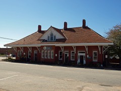 | Winder Depot | 0.2 miles | 1979 |
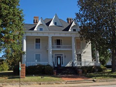 | North Broad Street Residential Historic District | 0.2 miles | 1984 |
| National Archives record | The nomination case file for reference 85000847 in Record Group 79. |
| Barrow County | All 17 listed properties in this county. |