 Block
From the record
One of 24 National Register listings published here for Greene County · listed in 1987 · category: District.
Sources: the case file at the National Archives · the National Register database, National Park Service
Listed on the National Register of Historic Places in 1987.
One of 24 National Register listings published here for Greene County · listed in 1987 · category: District.
Sources: the case file at the National Archives · the National Register database, National Park Service
Regional context, not property-specific evidence. The federal wildfire occurrence database lists 175 fires within 5 miles of South Street-Broad Street-Main Street-Laurel Street Historic District between 1992 and 2019, burning about 378 acres in total. 6 started naturally. 19 were recorded as arson. Distance is straight-line from the map coordinates, so a fire counted here may appear on a neighbouring settlement's page as well.
| Reported cause | Fires |
|---|---|
| Debris and open burning | 73 |
| Equipment and vehicle use | 25 |
| Arson/incendiarism | 19 |
| Smoking | 17 |
| Missing data/not specified/undetermined | 16 |
| Recreation and ceremony | 10 |
| Misuse of fire by a minor | 7 |
| Natural | 6 |
| Railroad operations and maintenance | 2 |
The most recent of them, most recent first, with the day each was reported and the service that recorded it.
| Date | Cause | Size | Reported by | Name on the report |
|---|---|---|---|---|
| 8 September 1997 | Arson/incendiarism | under an acre | Georgia Forestry Commission | not named |
| 8 September 1997 | Arson/incendiarism | under an acre | Georgia Forestry Commission | not named |
| 8 September 1997 | Arson/incendiarism | under an acre | Georgia Forestry Commission | not named |
| 7 September 1998 | Debris and open burning | under an acre | Georgia Forestry Commission | not named |
| 6 September 2010 | Smoking | under an acre | Georgia Forestry Commission | FY2011-GREENE-005 |
| 6 September 2005 | Misuse of fire by a minor | under an acre | Georgia Forestry Commission | not named |
| 5 September 2008 | Debris and open burning | under an acre | Georgia Forestry Commission | not named |
| 5 September 2005 | Debris and open burning | under an acre | Georgia Forestry Commission | not named |
Regional context, not property-specific evidence. The National Weather Service names Greensboro, the town this property stands in, in 44 storm reports between 1994 and 2016: 26 thunderstorm wind, 16 hail, 2 lightning. No death or injury is recorded in these reports. Each account below is quoted exactly as the forecast office filed it, from the NOAA Storm Events Database, and each date opens the federal record of that event.
| When | Event | Place named | Harm | What the report says |
|---|---|---|---|---|
| January 1998 | Thunderstorm Wind | Greensboro | $2,000,000 | A severe thunderstorm caused damage in downtown Greensboro, mainly in a 2 block by 3 block area around the intersection of State Roads 15 and 44. A total of 23 businesses were damaged. Two homes sustained minor damage. Roofs being damaged or blown off and windows being blown out accounted for much of the damage. Other damage came from debris being blown around and water damage inside stores and shops where the roofs were blown off. One car was destroyed by falling bricks. Witnesses said there were roaring sounds, but sight survey by a NWS employee indicated the damage was by straight-line winds from a downburst. Luckily, there were no injuries or deaths, since most businesses close early on Wednesday evenings. |
| June 2010 | Thunderstorm Wind | Greensboro | $150,000 | The Greene County Emergency Management Director reported that up to 125 trees were down between Greensboro and Union Point. Several homes and barns sustained roof damage from downed trees and wind gusts in the area of Penfield and Hensley Roads. Up to 15 trees were down within the city of Greensboro alone. Radar data suggests that a strong thunderstorm downburst affected this area. |
| November 2002 | Thunderstorm Wind | Greensboro | $100,000 | The Greene county Emergency Management Director reported that extensive wind damage occurred to a school. The roof sustained significant damage and the gymnasium suffered extensive damage. |
| May 2008 | Thunderstorm Wind | Greensboro | $25,000 | The Greene County Emergency Management Director reported that over two dozen trees were down along and either side of Interstate-20 from the western border with Morgan county to south of Greensboro. One tree fell down on a home on the west side of the city of Greensboro. |
| October 2006 | Lightning | Greensboro | $25,000 | The Greene County Emergency Management Director reported that a home was set on fire by lightning. Specific details were not provided. |
| June 2009 | Thunderstorm Wind | Greensboro | $15,000 | The Greene County 911 Center reported that over a dozen trees were down in the western part of the county from southwest of Greensboro to southwest of Veazey. Some power lines were also down in the area as a result. At least one tree was down on Georgia Highway 44 southwest of Greensboro. |
| August 2003 | Lightning | Greensboro | $5,000 | The Greene county 911 center reported that lightning struck a building and set it on fire. Damage estimates were inconclusive. |
| August 2003 | Thunderstorm Wind | Greensboro | $5,000 | The Greene county 911 center reported that several trees and power lines were down. |
| June 1994 | Thunderstorm Wind | Greensboro | $5,000 | Several large trees were downed by thunderstorm winds. |
| June 2012 | Thunderstorm Wind | Greensboro | $3,000 | The Greene County 911 Center reported that a few power lines were downed in Greensboro. |
| August 2014 | Thunderstorm Wind | Greensboro | $2,000 | The Greene County 911 Center reported many trees down and vehicle accidents countywide. |
| February 2012 | Thunderstorm Wind | Greensboro | $2,000 | The Greene County 911 Center reported that a few power lines were blown down along Willow Run Road. |
| June 2008 | Thunderstorm Wind | Greensboro | $2,000 | The Greene County Emergency Management Director and the county 911 Center reported that up to nine trees were down from west of Greensboro on Madison Highway to southeast of Greensboro. |
| May 2003 | Thunderstorm Wind | Greensboro | $2,000 | The Greene county 911 center reported that a number of trees were blown down. |
| May 2002 | Thunderstorm Wind | Greensboro | $2,000 | The Greene county 911 center reported that one tree and some power lines were blown down. |
| August 2000 | Thunderstorm Wind | Greensboro | $2,000 | The Greene county 911 center reported trees down in Greshamville, while the public reported a tree down near the southern end of Lake Oconee, about 8 miles west of Greensboro at Swords Landing. |
| July 2003 | Thunderstorm Wind | Greensboro | $1,500 | The Greene county 911 center reported that around five trees had been blown down. |
| June 1999 | Thunderstorm Wind | Greensboro | $1,000 | The public reported some trees were down and others bent. |
| July 1997 | Thunderstorm Wind | Greensboro | $1,000 | Several trees were knocked down on Georgia highway 44 south of town. Several large tree limbs and power lines were knocked down in the same general area. |
| June 2016 | Thunderstorm Wind | Greensboro | $800 | The Greene County Emergency Manager reported a tree blown down on State Highway 15 on the north side of Greensboro. |
| September 1997 | Thunderstorm Wind | Greensboro | $750 | Rayle EMC reported thunderstorm winds downed power lines in two locations. |
| August 2016 | Thunderstorm Wind | Greensboro | $500 | The Greene County 911 center reported a tree blown down around mile marker 132 on I-20. The tree blocked part of the highway. |
| August 2002 | Thunderstorm Wind | Greensboro | $500 | The Greene county Emergency Management Director reported that a few trees were blown down. |
| August 2001 | Thunderstorm Wind | Greensboro | $500 | The public reported that a large oak tree was blown down on U.S. Highway 278. |
| May 1999 | Thunderstorm Wind | Greensboro | $500 | Greene county 911 reported a couple of trees down across Penfield highway. |
| July 1995 | Thunderstorm Wind | Greensboro | $500 | Thunderstorm winds knocked trees down on Highway 78. |
| February 2003 | Thunderstorm Wind | Greensboro | $250 | The Greene county 911 center reported that one tree was blown down. |
| June 2008 | Hail | Greensboro | - | The Greene County Emergency Management Director observed penny-sized hail southeast of Greensboro. |
| May 2008 | Hail | Greensboro | - | The Greene County Emergency Management Director observed penny-sized hail approximately two miles south of Greensboro along Interstate-20. Radar data supports that hail of similar size, perhaps larger, fell across much of the southern half of the Greensboro, generally south of Interstate-20, from the western border southeastward toward Veazy and White Plains. However, no specific reports were received from these later two areas. |
| March 2008 | Hail | Greensboro | - | The public reported penny-sized hail. |
| August 2007 | Hail | Greensboro | - | The public reported penny-sized hail. |
| October 2006 | Hail | Greensboro | - | The Greene County Emergency Management Director reported a substantial amount of hail in the southern part of the county, including the Reynolds Plantation area. |
| February 2005 | Hail | Greensboro | - | The public reported quarter-sized hail. |
| December 2005 | Hail | Greensboro | - | The Greene County Emergency Management Director reported penny-sized hail. |
| August 2003 | Hail | Greensboro | - | The Greene county 911 center reported penny-sized hail. |
| May 2002 | Hail | Greensboro | - | The public reported golf ball size hail. |
| June 2002 | Thunderstorm Wind | Greensboro | - | The Greene county 911 center reported that one tree was blown down. |
| May 2000 | Hail | Greensboro | - | The public reported dime size hail in Greensboro. |
| August 2000 | Hail | Greensboro | - | The public reported nickel size hail 8 miles west of Greensboro at the southern end of Lake Oconee. |
| June 1999 | Hail | Greensboro | - | no account filed |
| June 1999 | Hail | Greensboro | - | no account filed |
| June 1999 | Hail | Greensboro | - | no account filed |
| April 1998 | Hail | Greensboro | - | no account filed |
| January 1995 | Hail | Greensboro | - | no account filed |
No historic map-sheet match is published for this property yet. That does not mean no map exists. This record needs a coordinate-quality review before it can be joined to a sheet boundary. Browse the county's mapped places while that work is pending.
Other National Register properties close enough to walk or drive between, ordered by distance from this one. Both positions come from the same geocoding pass that matched these properties to their map sheets.
| Photograph | Property | Distance | Listed |
|---|---|---|---|
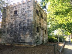 | Greensboro Commercial Historic District | 0.4 miles | 1987 |
| Greensboro Depot | 0.4 miles | 1987 | |
| Mary Leila Cotton Mill and Village | 0.4 miles | 1987 | |
 | Greene County Courthouse | 0.4 miles | 1980 |
| King-Knowles-Gheesling House | 0.5 miles | 1987 | |
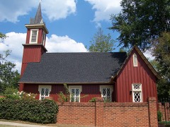 | Church of the Redeemer | 0.5 miles | 1987 |
| National Archives record | The nomination case file for reference 87001450 in Record Group 79. |
| Greene County | All 24 listed properties in this county. |