 Block
From the record
One of 14 National Register listings published here for Whitfield County · listed in 1992 · category: District.
Sources: the case file at the National Archives · the National Register database, National Park Service
Listed on the National Register of Historic Places in 1992.
One of 14 National Register listings published here for Whitfield County · listed in 1992 · category: District.
Sources: the case file at the National Archives · the National Register database, National Park Service
Regional context, not property-specific evidence. The federal wildfire occurrence database lists 347 fires within 5 miles of Thornton Avenue-Murray Hill Historic District between 1992 and 2020, burning about 1,994 acres in total. 3 started naturally. 54 were recorded as arson. Distance is straight-line from the map coordinates, so a fire counted here may appear on a neighbouring settlement's page as well.
| Reported cause | Fires |
|---|---|
| Debris and open burning | 189 |
| Arson/incendiarism | 54 |
| Misuse of fire by a minor | 33 |
| Equipment and vehicle use | 20 |
| Missing data/not specified/undetermined | 18 |
| Recreation and ceremony | 18 |
| Smoking | 9 |
| Railroad operations and maintenance | 3 |
| Natural | 3 |
The most recent of them, most recent first, with the day each was reported and the service that recorded it.
| Date | Cause | Size | Reported by | Name on the report |
|---|---|---|---|---|
| 8 September 2006 | Debris and open burning | under an acre | Georgia Forestry Commission | not named |
| 8 September 1999 | Debris and open burning | under an acre | Georgia Forestry Commission | not named |
| 8 September 1997 | Missing data/not specified/undetermined | under an acre | Georgia Forestry Commission | not named |
| 7 September 1998 | Misuse of fire by a minor | 2.2 acres | Georgia Forestry Commission | not named |
| 5 September 2007 | Debris and open burning | under an acre | Georgia Forestry Commission | not named |
| 5 September 1999 | Debris and open burning | under an acre | Georgia Forestry Commission | not named |
| 5 September 1999 | Debris and open burning | under an acre | Georgia Forestry Commission | not named |
| 4 September 1993 | Debris and open burning | under an acre | Georgia Forestry Commission | not named |
Regional context, not property-specific evidence. The federal mineral resources record lists 6 workings within 5 miles of Thornton Avenue-Murray Hill Historic District: 3 past producers, 2 plants, 1 producer. 3 still produce. What was taken out: Stone, Crushed/Broken, Aluminum, Clay, Marble, Dimension. Distance is straight-line from the map coordinates, so a quarry counted here may appear on a neighbouring settlement's page as well.
| Where | Site | Commodity | Status | Recorded |
|---|---|---|---|---|
| Dalton Brick and Tile Co Pits | Clay | Past Producer | ||
| Dalton Plant Dixie Chem | Aluminum | Plant | ||
| Jet Black Marble Co Quarry | Marble, Dimension | Past Producer | ||
| Dalton City Quarry | Stone, Crushed/Broken | Past Producer | ||
| Dalton Plant | Stone, Crushed/Broken | Producer | ||
| H & S Industries Inc | Stone, Crushed/Broken | Plant |
Regional context, not property-specific evidence. The National Weather Service names Dalton, the town this property stands in, in 80 storm reports between 1995 and 2025: 41 thunderstorm wind, 22 hail, 8 flash flood, 5 heavy rain. No death or injury is recorded in these reports. Each account below is quoted exactly as the forecast office filed it, from the NOAA Storm Events Database, and each date opens the federal record of that event.
| When | Event | Place named | Harm | What the report says |
|---|---|---|---|---|
| March 2008 | Heavy Rain | Dalton | $300,000 | The Whitfield County Emergency Management Director reported that the older of two pillow manufacturing facility buildings collapsed as a result of the weight of rain water runoff on the roof of the two adjacent buildings. The older building was in need of repair. The wash-out effect caused by the water runoff resulted in the collapse of a wall on the older of the two buildings, which result in the roof caving in as well. Because of the age and condition of the building, it was considered a total loss. |
| November 2003 | Heavy Rain | Dalton | $125,000 | A storm spotter for the National Weather Service reported that a poorly, yet recently constructed building housing a graphic printing company, collapsed during a heavy rain event. The heavy rain caused the poorly anchored concrete support pillars to collapse. The building was a total loss. |
| July 2000 | Thunderstorm Wind | Dalton | $85,000 | The public and an amateur radio operator reported numerous trees down throughout the city of Dalton and just east of Dalton in the Lakeview Estates area. The Dalton Public Works Department reported that about 12 homes were damaged in Dalton when trees fell on them. |
| April 2020 | Flash Flood | Dalton | $50,000 | The Emergency Manager reported a couple homes flooded on Coker Drive in Dalton. Radar estimates indicate that 4 to 6 inches of rain occurred in the area in a short period of time, resulting in flash flooding. |
| August 2011 | Thunderstorm Wind | Dalton | $50,000 | The Whitfield County Emergency Management Director reported that a couple of large trees were blown down on homes in Dalton, one on Oak Stone Way and another on Rio Vista Drive. The structures sustained minor to moderate damage from the downed trees. |
| June 2008 | Thunderstorm Wind | Dalton | $50,000 | A damage survey conducted by the National Weather Service Forecast Office in Peachtree City, Georgia determined that strong straight-line wind of 70 to 80 mph affected a small area of southern Whitfield county, approximately three miles southwest of Dalton. Damage was concentrated along a 100 yard long and 250 yard wide path along Brookview Lane. Several trees were snapped and hundreds of large limbs were ripped from trees. Some power lines were down in the area as well. Several fences were damaged from the downed trees and tree limbs and minor to moderate roof damage was observed to three homes and one outbuilding in the area. |
| June 2002 | Thunderstorm Wind | Dalton | $35,000 | The Whitfield county 911 center and the Dalton Daily Citizen reported that a number of large trees were blown down or uprooted in the city, causing damage to several homes. A number of power lines were also brought down. One large tree fell on a home, another residence lost several trees causing only minimal damage to a home, and at yet another residence one large tree was uprooted in the back yard and front yard each. At another location, several very large trees fell on and leveled a trailer home. Power outages affected homes and business for many hours, up to 18 hours at one location, causing several businesses to close their doors for a time. |
| June 2009 | Lightning | Dalton | $25,000 | The Whitfield County Emergency Management Director reported that lightning struck a home northeast of Dalton in the Pleasant Grove community. The structure suffered at least minor damage. |
| July 2003 | Flash Flood | Dalton | $25,000 | The Dalton Fire and Rescue Department, along with the county 911 center and the public reported that extensive and major flooding was occurring in a relatively small 10 mile by 10 mile wide area just north of Dalton. Rainfall in excess of five inches occurred between 7 pm and midnight EDT within this area. Several roads were completely flooded, rendered impassable, and closed. In addition, several people became stranded in the area and required rescues. |
| June 1995 | Thunderstorm Wind | Dalton | $20,000 | Thunderstorm winds knocked several trees down on roads. A tree, which had fallen, caused damage to one home. |
| June 2016 | Thunderstorm Wind | Dalton | $15,000 | The Whitfield County Emergency Manager reported numerous trees blown down across southern portions of the city of Dalton, including one blown down on a house on Liberty Drive. |
| July 2003 | Flash Flood | Dalton | $15,000 | The Whitfield county 911 center reported that several roads were flooded, along with several buildings in the city. |
| July 1997 | Thunderstorm Wind | Dalton | $15,000 | Several trees were knocked down by thunderstorm winds. A tree fell across power lines and a car in Dalton. |
| July 2024 | Thunderstorm Wind | Dalton | $13,000 | At least 13 trees reported down across Dalton. |
| June 2009 | Lightning | Dalton | $10,000 | The Daily Citizen of Dalton reported that lightning caused serious injuries to a horse located at a private residence on Charlotte Drive in Dalton. The lightning struck a tree next to which the horse was huddled during the thunderstorm. |
| May 2003 | Thunderstorm Wind | Dalton | $10,000 | The Morristown, Tennessee National Weather Service Office relayed a measured wind gust of 70 mph from Dalton. Local newspapers reported that a number of trees and power lines were knocked down across the county. |
| May 1997 | Thunderstorm Wind | Dalton | $10,000 | Thunderstorm winds completely destroyed a two story apartment complex under construction. |
| April 2020 | Thunderstorm Wind | Dalton | $5,000 | Large tree down on a structure on Ridgeleigh Circle. |
| July 2003 | Thunderstorm Wind | Dalton | $5,000 | The Whitfield county 911 center reported that several trees and power lines were blown down. |
| July 2003 | Lightning | Dalton | $5,000 | The Daily Citizen of Dalton reported that lightning struck a barn on Old Federal road and set it on fire. The barn was a total loss. |
| June 2001 | Thunderstorm Wind | Dalton | $5,000 | The Whitfield County 911 center reported that some power lines were down. |
| May 1997 | Flash Flood | Dalton | $5,000 | no account filed |
| April 1998 | Flash Flood | Dalton | $4,000 | Several homes on Old Grade on the east side of Dalton had water in them. |
| June 2025 | Thunderstorm Wind | Dalton | $3,000 | Tree down in the road at the 1400 block of Riverbend Rd. Trees likely more easily felled by heavy rainfall. |
| July 2024 | Thunderstorm Wind | Dalton | $3,000 | Tree on home on 600 block of Hannah Court . |
| June 2023 | Thunderstorm Wind | Dalton | $3,000 | Multiple trees reported down roughly 1 miles nw of downtown Dalton. |
| August 2011 | Thunderstorm Wind | Dalton | $3,000 | The Whitfield County Emergency Management Director reported that a second round of thunderstorms just north of Dalton, moving mainly between Runnel Hill and Dawnville, blew down a few more trees on the north side of the city. Four trees total were down, one each on Maple Grove Drive, Wendel Street, Frontier Trail, and Mountainview Drive. |
| May 2003 | Thunderstorm Wind | Dalton | $3,000 | The public reported that some trees and power lines had been blown down. |
| May 2000 | Thunderstorm Wind | Dalton | $2,500 | A ham radio operator reported a front awning and a front wall blown off a building 6.5 miles south of Dalton. |
| July 2024 | Thunderstorm Wind | Dalton | $2,000 | Tree and powerlines down at N Thornton Ave and W Tyler Street. |
| June 2018 | Thunderstorm Wind | Dalton | $2,000 | The Whitfield County 911 center reported trees and power lines blown down around the intersection of West Walnut Avenue and West Lakeshore Drive. |
| August 2006 | Thunderstorm Wind | Dalton | $2,000 | A storm spotter reported that several trees were blown down in and around Dalton. Most of the damage to trees was reported in the historic parts of the city. About five large oak trees were down in the area between Walnut Avenue and Glenwood Avenue. A couple of traffic signals and a mailbox were damaged by the downed trees. |
| July 1999 | Thunderstorm Wind | Dalton | $2,000 | A HAM radio operator reported trees and power lines down in the northeast and east part of the county. |
| June 1998 | Thunderstorm Wind | Dalton | $2,000 | A spotter reported a few trees were downed next to the Dalton High School. He estimated winds at 60 mph. |
| May 1997 | Thunderstorm Wind | Dalton | $2,000 | no account filed |
| July 2024 | Thunderstorm Wind | Dalton | $1,000 | Tree down at Riverbend Road and Henton Road . |
| August 2023 | Thunderstorm Wind | Dalton | $1,000 | Emergency manager reports a tree down on power lines and a truck on Skylark Pl. |
| April 2020 | Thunderstorm Wind | Dalton | $1,000 | Tree down on roadway at Van Buren Drive and E Morris Street. |
| April 2020 | Thunderstorm Wind | Dalton | $1,000 | Tree reported down along Carbondale Road. |
| June 2011 | Thunderstorm Wind | Dalton | $1,000 | The Whtifield County Emergency Management Director reported that a tree was blown down onto a power lines on Greenridge Drive on the east side of Dalton. |
| July 2008 | Thunderstorm Wind | Dalton | $1,000 | The Whitfield County 911 Center reported that a couple of trees and one power line were down near Dalton. |
| August 2006 | Thunderstorm Wind | Dalton | $1,000 | The Daily Citizen of Dalton reported that a tree fell on a power line on Dug Gap Battle Road. This resulted in a power outage to the North Georgia Trade and Convention Center during an ongoing soccer game. |
| July 2005 | Lightning | Dalton | $1,000 | The Whitfield County Emergency Management Director reported that a couple of trees were down because of a lightning strike. In addition, wind gusts in the area were estimated at 50 to 60 mph. |
| April 2000 | Hail | Dalton | $1,000 | A HAM radio operator reported nickel size hail in Dalton with possible minor damage to a car. |
| July 1997 | Thunderstorm Wind | Dalton | $1,000 | Thunderstorm winds knocked several trees down countywide. |
| July 2004 | Thunderstorm Wind | Dalton | $750 | A trained spotter and cooperative observer for the National Weather Service reported that three trees were down. |
| June 2013 | Thunderstorm Wind | Dalton | $500 | The Whitfield County 911 Center reported that two trees were downed just north of downtown Dalton near North Thornton Avenue and West Tyler Street. |
| September 2007 | Heavy Rain | Dalton | $500 | The Whitfield County 911 Center reported that heavy rain, on the order of three to four inches across the area in a four hour period, had resulted in road closures in the north part of Dalton, specifically Willowdale Road at U.S. Highway 41, and also a little further north along Georgia Highway 71, Cleveland Highway, near Wailing Road. |
| April 2000 | Thunderstorm Wind | Dalton | $500 | North Georgia Electric reported thunderstorm winds knocked down a tree in Dalton. The tree knocked down a power line. |
| July 1999 | Thunderstorm Wind | Dalton | $200 | Dalton public works reported trees down. |
| August 2023 | Thunderstorm Wind | Dalton | - | A tree was downed onto a home in the 500 block of Davidson Drive. |
| August 2023 | Thunderstorm Wind | Dalton | - | Emergency manager reports a tree down on a carport and cars on the 400 block of Moore St. |
| August 2023 | Thunderstorm Wind | Dalton | - | Emergency manager reported trees down on vehicles near Northstar School. |
| March 2021 | Flash Flood | Dalton | - | The Emergency Manager reported water over the road near the intersection of Olivia Drive and James Street. Radar estimates indicate that rainfall in the area ranged between 3 and 5 inches, resulting in the flash flooding. |
| April 2020 | Flash Flood | Dalton | - | Emergency Manager reported water flowing over the roadway at Veterans Drive and Morning Side Drive due to high water on Mill Creek and a Mill Creek tributary. Radar estimates indicate that 4 to 6 inches of rain occurred over the area, causing flash flooding. |
| July 2018 | Flash Flood | Dalton | - | A trained spotter reported flash flooding approximately half a mile west of Cleveland Highway and the north bypass, near Legion Drive in Whitfield County. A water rescue also occurred in this area. Radar estimates indicate that 2 to 2.5 inches of rain occurred in this area over a short period of time. |
| January 2012 | Hail | Dalton | - | A member of the general public reported 0.88 inch hail on Corporate Drive in Dalton. |
| April 2011 | Hail | Dalton | - | The Whitfield County 911 Center relayed several reports of penny to quarter-sized hail from the Dalton area. |
| August 2006 | Hail | Dalton | - | The Whitfield County Emergency Management Director reported quarter-sized hail northwest of Dalton and the public reported penny-sized hail in Dalton. |
| February 2005 | Hail | Dalton | - | A trained spotter and cooperative observer for the National Weather Service reported nickel-sized hail. |
No historic map-sheet match is published for this property yet. That does not mean no map exists. This record needs a coordinate-quality review before it can be joined to a sheet boundary. Browse the county's mapped places while that work is pending.
Other National Register properties close enough to walk or drive between, ordered by distance from this one. Both positions come from the same geocoding pass that matched these properties to their map sheets.
| Photograph | Property | Distance | Listed |
|---|---|---|---|
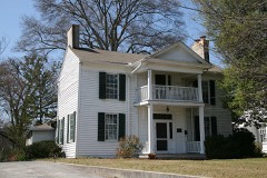 | Ainsworth E. Blunt House | 0.2 miles | 1980 |
 | William C. Martin House | 0.4 miles | 1982 |
 | Masonic Lodge No. 238 | 0.5 miles | 1996 |
| Dalton Commercial Historic District (Boundary Increase) | 0.5 miles | 2006 | |
| McCarty Subdivision Historic District | 0.5 miles | 2002 | |
 | Dalton Commercial Historic District | 0.6 miles | 1988 |
| National Archives record | The nomination case file for reference 92000669 in Record Group 79. |
| Whitfield County | All 14 listed properties in this county. |