 Block
From the record
One of 8 National Register listings published here for Lamar County · listed in 1995 · category: District.
Sources: the case file at the National Archives · the National Register database, National Park Service
Listed on the National Register of Historic Places in 1995.
One of 8 National Register listings published here for Lamar County · listed in 1995 · category: District.
Sources: the case file at the National Archives · the National Register database, National Park Service
Regional context, not property-specific evidence. The federal wildfire occurrence database lists 231 fires within 5 miles of Barnesville Commercial Historic District between 1992 and 2020, burning about 642 acres in total. 6 started naturally. 30 were recorded as arson. Distance is straight-line from the map coordinates, so a fire counted here may appear on a neighbouring settlement's page as well.
| Reported cause | Fires |
|---|---|
| Debris and open burning | 145 |
| Arson/incendiarism | 30 |
| Missing data/not specified/undetermined | 20 |
| Equipment and vehicle use | 13 |
| Misuse of fire by a minor | 10 |
| Natural | 6 |
| Recreation and ceremony | 3 |
| Railroad operations and maintenance | 3 |
| Smoking | 1 |
The most recent of them, most recent first, with the day each was reported and the service that recorded it.
| Date | Cause | Size | Reported by | Name on the report |
|---|---|---|---|---|
| 8 September 2005 | Equipment and vehicle use | under an acre | Georgia Forestry Commission | not named |
| 6 September 1997 | Debris and open burning | 1.4 acres | Georgia Forestry Commission | not named |
| 3 September 2002 | Debris and open burning | under an acre | Georgia Forestry Commission | FY2003-LAMAR-002 |
| 29 September 1993 | Arson/incendiarism | under an acre | Georgia Forestry Commission | not named |
| 2 September 1997 | Debris and open burning | under an acre | Georgia Forestry Commission | not named |
| 19 September 1997 | Arson/incendiarism | 16 acres | Georgia Forestry Commission | not named |
| 16 September 1999 | Missing data/not specified/undetermined | under an acre | Georgia Forestry Commission | not named |
| 15 September 2019 | Debris and open burning | under an acre | Georgia Forestry Commission | FY2020LAMAR004 |
Regional context, not property-specific evidence. The federal mineral resources record lists 7 workings within 5 miles of Barnesville Commercial Historic District: 4 prospects, 3 past producers. None of them still produces. What was taken out: Mica. Distance is straight-line from the map coordinates, so a quarry counted here may appear on a neighbouring settlement's page as well.
| Where | Site | Commodity | Status | Recorded |
|---|---|---|---|---|
| Clay Creek Mine | Mica | Past Producer | ||
| Early Vaughn Mine | Mica | Past Producer | ||
| H S Worsham Prospect | Mica | Prospect | ||
| Howard Mine | Mica | Past Producer | ||
| Means Prospect | Mica | Prospect | ||
| Perdue Prospect | Mica | Prospect | ||
| Williams & Holmes Prospects | Mica | Prospect |
Regional context, not property-specific evidence. The National Weather Service names Barnesville, the town this property stands in, in 45 storm reports between 1993 and 2024: 26 thunderstorm wind, 14 hail, 2 funnel cloud, 2 flash flood. No death or injury is recorded in these reports. Each account below is quoted exactly as the forecast office filed it, from the NOAA Storm Events Database, and each date opens the federal record of that event.
| When | Event | Place named | Harm | What the report says |
|---|---|---|---|---|
| January 2012 | Hail | Barnesville | $240,000 | The Lamar County 911 Center reported hail between 1.00 and 1.75 inches across Barnesville. |
| June 2014 | Thunderstorm Wind | Barnesville | $100,000 | Broadcast media reported that the roof of the Harris Building, housing the school's athletic and JROTC programs, collapsed. |
| May 1998 | Thunderstorm Wind | Barnesville | $75,000 | Severe thunderstorm winds knocked down 3 chicken houses and damaged the roof and shingles of 3 homes. A well house was blown away and large tree tops were twisted off. A funnel cloud was spotted over the area about 30 feet off the ground. |
| July 1998 | Thunderstorm Wind | Barnesville | $15,000 | Lamar county 911 reported numerous trees were blown down by thunderstorms winds. There were numerous power outages as well. |
| May 2003 | Flash Flood | Barnesville | $10,000 | The Herald-Gazette of Barnesville reported that several streets in the city were flooded, especially in the downtown area. Flooding was also reported in at least one home. |
| July 2009 | Thunderstorm Wind | Barnesville | $5,000 | The Lamar County 911 Center reported that a structure suffered minor damage from thunderstorm winds. One power line was also blown down. |
| November 2002 | Hail | Barnesville | $5,000 | The public reported that quarter size hail fell. Some cars were damaged. |
| July 2000 | Thunderstorm Wind | Barnesville | $5,000 | The public reported that several trees and power lines were blown down. There were also reports received of cars being blown off the road by the strong thunderstorm winds. |
| March 1996 | Thunderstorm Wind | Barnesville | $5,000 | no account filed |
| June 2019 | Thunderstorm Wind | Barnesville | $4,000 | The Lamar County 911 center reported a tree down along Holmes Street and Forsyth Street in Barnesville. |
| July 2024 | Thunderstorm Wind | Barnesville | $2,000 | Power line reported down the intersection of college drive and veterans pkwy and tree down on house off of Cradley Circle. |
| August 2023 | Thunderstorm Wind | Barnesville | $2,000 | Tree down on powerline near Lambdin Cir. |
| January 2012 | Thunderstorm Wind | Barnesville | $2,000 | The Lamar County 911 Center reported that three trees and a power line were down on a transformer in Barnesville. |
| June 2002 | Thunderstorm Wind | Barnesville | $2,000 | The public reported that trees were blown down at two separate locations in the county. In one instance there appeared to be a path of destruction to the trees. Some shingles were also blown off the roof and some yard items, such as a plastic swimming pool and barbeque grill were missing. |
| July 1998 | Thunderstorm Wind | Barnesville | $2,000 | The public reported trees knocked down. |
| July 1997 | Thunderstorm Wind | Barnesville | $2,000 | Thunderstorm winds blew down a couple of large tree limbs. |
| June 2022 | Thunderstorm Wind | Barnesville | $1,000 | A large tree was reported down across Thomaston St near Tyler St. |
| January 2013 | Thunderstorm Wind | Barnesville | $1,000 | A local newspaper reported that a masonry sign was blown over at a dentist's office on the southeast side of Barnesville. |
| May 2003 | Thunderstorm Wind | Barnesville | $1,000 | The Herald-Gazette of Barnesville reported that a very large oak tree was blown down at a residence in the city. |
| May 2003 | Thunderstorm Wind | Barnesville | $1,000 | The Lamar county 911 center reported that some trees were down. |
| July 1995 | Thunderstorm Wind | Barnesville | $1,000 | Thunderstorm winds knocked several trees down in Barnesvile as well as in the eastern part of the county. Power outages were reported within Barnesville. |
| August 1999 | Thunderstorm Wind | Barnesville | $500 | Lamar county 911 reported trees down on power lines. |
| February 1993 | Thunderstorm Wind | Barnesville | $500 | Numerous large tree limbs were blown down |
| August 1995 | Thunderstorm Wind | Barnesville | $450 | Thunderstorm winds knocked down three trees. |
| May 2004 | Thunderstorm Wind | Barnesville | $250 | The Lamar county 911 center reported that one tree was blown down on Georgia Highway 18. |
| October 1997 | Thunderstorm Wind | Barnesville | $200 | Lamar county sheriff reported two trees were blown down. |
| January 1996 | Thunderstorm Wind | Barnesville | $200 | no account filed |
| March 2023 | Flash Flood | Barnesville | - | The Emergency Manager reported flooding of Roberts Road. Radar estimates indicate that 1.5 to 2.5 inches of rain fell over the area the day prior, with an additional 6 to 8 inches accumulating on March 27, resulting in the flash flooding. |
| April 2011 | Hail | Barnesville | - | The Lamar County 911 Center reported penny-sized hail near Barnesville. WSR-88D radar data suggests that similar-sized hail likely fell from the southwest corner of the county, south of Piedmont, to just southeast of Johnstonville in the east central part of the county. |
| July 2008 | Hail | Barnesville | - | The public observed penny-sized hail south of Barnesville. Radar data supports that hail of similar size likely occurred just west and especially to the east of this location. |
| January 2006 | Hail | Barnesville | - | The Lamar County 911 Center reported quarter-sized hail. |
| March 2005 | Thunderstorm Wind | Barnesville | - | The Herald Gazette of Barnesville reported that a few trees were blown down near the county high school. |
| March 2005 | Hail | Barnesville | - | A deputy with the Lamar County Sheriff's Office reported quarter to golf ball-sized hail in Barnesville on Carafax Road. The public and the Herald Gazette of Barnesville reported nickel to quarter-sized hail at the Lamar County High School. |
| August 2005 | Funnel Cloud | Barnesville | - | An amateur radio operator reported sighting a funnel cloud in the vicinity of Barnesville. National Weather Service Doppler radar did detect a mesocyclonic circulation in the area at the time. |
| September 2004 | Hail | Barnesville | - | The public reported penny-sized hail. |
| May 2003 | Hail | Barnesville | - | The public reported penny-sized hail. |
| May 2003 | Hail | Barnesville | - | The Lamar county Sheriff's Office reported penny-sized hail. |
| June 2003 | Hail | Barnesville | - | The public reported penny-sized hail. |
| April 2002 | Hail | Barnesville | - | The Lamar county 911 center reported dime size hail. |
| November 2002 | Funnel Cloud | Barnesville | - | The Lamar county sheriff sighted a possible funnel cloud near the Lamar/Monroe county line. |
| July 2000 | Hail | Barnesville | - | The public reported dime size hail near Barnesville. |
| June 1998 | Thunderstorm Wind | Barnesville | - | A HAM operator reported small trees were knocked down along highway 41. |
| May 1997 | Hail | Barnesville | - | Nickel to quarter sized hail reported. |
| October 1997 | Tornado (F0) | Barnesville | - | HAM radio operators reported tornadoes 5 miles south and 4.5 miles northeast of Barnesville. There was no reported damage from the intermittent touchdowns. |
| December 1996 | Hail | Barnesville | - | no account filed |
No historic map-sheet match is published for this property yet. That does not mean no map exists. This record needs a coordinate-quality review before it can be joined to a sheet boundary. Browse the county's mapped places while that work is pending.
Other National Register properties close enough to walk or drive between, ordered by distance from this one. Both positions come from the same geocoding pass that matched these properties to their map sheets.
| Photograph | Property | Distance | Listed |
|---|---|---|---|
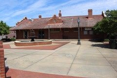 | Barnesville Depot | 0.2 miles | 1986 |
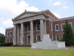 | Lamar County Courthouse | 0.3 miles | 1980 |
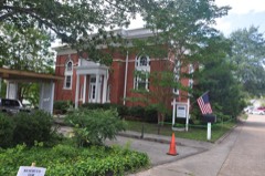 | Carnegie Library of Barnesville | 0.3 miles | 1987 |
| Thomaston Street Historic District | 0.7 miles | 1995 | |
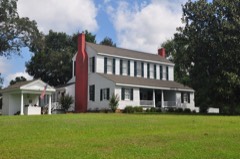 | Benjamin Gachet House | 3.4 miles | 1997 |
| Johnstonville-Goggins Historic District | 4.9 miles | 2000 |
| National Archives record | The nomination case file for reference 95000733 in Record Group 79. |
| Lamar County | All 8 listed properties in this county. |