 Block
From the record
One of 17 National Register listings published here for Barrow County · listed in 1997 · category: District.
Sources: the case file at the National Archives · the National Register database, National Park Service
Listed on the National Register of Historic Places in 1997.
One of 17 National Register listings published here for Barrow County · listed in 1997 · category: District.
Sources: the case file at the National Archives · the National Register database, National Park Service
Regional context, not property-specific evidence. The federal wildfire occurrence database lists 141 fires within 5 miles of Auburn Historic District between 1992 and 2020, burning about 432 acres in total. 3 started naturally. 31 were recorded as arson. Distance is straight-line from the map coordinates, so a fire counted here may appear on a neighbouring settlement's page as well.
| Reported cause | Fires |
|---|---|
| Debris and open burning | 65 |
| Arson/incendiarism | 31 |
| Misuse of fire by a minor | 14 |
| Smoking | 8 |
| Equipment and vehicle use | 7 |
| Missing data/not specified/undetermined | 6 |
| Recreation and ceremony | 4 |
| Railroad operations and maintenance | 3 |
| Natural | 3 |
The most recent of them, most recent first, with the day each was reported and the service that recorded it.
| Date | Cause | Size | Reported by | Name on the report |
|---|---|---|---|---|
| 30 September 2008 | Arson/incendiarism | under an acre | Georgia Forestry Commission | not named |
| 3 September 2014 | Debris and open burning | under an acre | Georgia Forestry Commission | FY2015-GWINNETT-001 |
| 25 September 2010 | Recreation and ceremony | under an acre | Georgia Forestry Commission | FY2011-BARROW-004 |
| 19 September 2010 | Arson/incendiarism | 4.0 acres | Georgia Forestry Commission | FY2011-GWINNETT NORTH-001 |
| 18 September 1999 | Arson/incendiarism | under an acre | Georgia Forestry Commission | not named |
| 16 September 1998 | Arson/incendiarism | 7.3 acres | Georgia Forestry Commission | not named |
| 12 September 2002 | Missing data/not specified/undetermined | under an acre | Georgia Forestry Commission | FY2003-BARROW-004 |
| 11 September 2002 | Missing data/not specified/undetermined | under an acre | Georgia Forestry Commission | FY2003-BARROW-003 |
Regional context, not property-specific evidence. The federal mineral resources record lists 1 working within 5 miles of Auburn Historic District: 1 producer. All of them still produce. What was taken out: Stone, Crushed/Broken. Distance is straight-line from the map coordinates, so a quarry counted here may appear on a neighbouring settlement's page as well.
| Where | Site | Commodity | Status | Recorded |
|---|---|---|---|---|
| Barrow Stone Co | Stone, Crushed/Broken | Producer |
Regional context, not property-specific evidence. The National Weather Service names Auburn, the town this property stands in, in 23 storm reports between 1996 and 2018: 11 hail, 8 thunderstorm wind, 4 lightning. No death or injury is recorded in these reports. Each account below is quoted exactly as the forecast office filed it, from the NOAA Storm Events Database, and each date opens the federal record of that event.
| When | Event | Place named | Harm | What the report says |
|---|---|---|---|---|
| April 2009 | Hail | Auburn | $900,000 | The public observed quarter to golf ball-sized hail in the far western part of Barrow county, especially in the Auburn area. They reported that it hailed for up to 10 minutes in the Auburn area. The public also reported nickel-sized hail in the Bethlehem area. |
| July 2008 | Hail | Auburn | $800,000 | Two separate embedded thunderstorms, less than 10 miles apart, produced large hail. The public observed golf ball-sized hail in the Thompsons Mill/Braselton area, while several reports of penny-sized hail were received from the public in the far western and northwestern part of the county near the Gwinnett county line in the Auburn and Carl areas. |
| June 2003 | Lightning | Auburn | $150,000 | The Barrow County News reported that lightning struck a pine tree adjacent to a home and set both the tree and the home on fire. The second floor of the home was a complete loss and the first floor suffered extensive water damage. |
| April 2011 | Thunderstorm Wind | Auburn | $50,000 | The Barrow County Emergency Management Director reported dozens of trees and power lines down throughout the county, with the worst damage in the Auburn and Winder areas. Two homes in Winder sustained significant damage from downed trees. The Barrow County Administrative Building suffered minor to moderate wind damage. The County Health Building was closed because of this damage. Georgia Highway 11 was closed between Pumpkin Junction and Watson Road as a result of numerous downed trees and power lines affecting the roadway. Wind gusts of 58 mph were measured both by the public and an amateur radio operator in Auburn. |
| August 2003 | Thunderstorm Wind | Auburn | $45,000 | A storm spotter for the National Weather Service (NWS) reported that strong straight-line thunderstorm winds, or a possible microburst or downburst, had resulted in considerable damage to a farm near the intersection of Dee Kennedy Road and Harmony Church Road in northwest Barrow county near the Gwinnett county line. All together three to five structures were damaged or destroyed and some farm equipment was turned completely over. Two barns were completely destroyed and the roof was torn off a chicken house. The debris from the damage was scattered over a fairly large area. Several trees were also blown down in the same area |
| June 2011 | Lightning | Auburn | $25,000 | The Barrow County 911 Center reported that a home was struck by lightning in Auburn. Specific details regarding damages were not provided. |
| June 2018 | Thunderstorm Wind | Auburn | $15,000 | The Barrow County Emergency Manager reported numerous trees down across the county from Auburn to Winder, Bethlehem and Statham. |
| February 2011 | Thunderstorm Wind | Auburn | $3,000 | The Barrow County 911 Center reported that three trees and at least two power lines were down. The power lines were down on Rockwell Church Road and Jefferson Highway while the trees were down blocking Bridge Road at U.S. Highway 211. |
| July 2008 | Thunderstorm Wind | Auburn | $3,000 | The Barrow County Emergency Management Director reported that several trees and power lines were down in the western part of the county along U.S. Highway 29/Georgia Highway 8. |
| August 2002 | Hail | Auburn | $3,000 | The public reported dime to quarter size hail. The hail lasted for a duration of eight minutes at one location and the ground was covered with hail. The hail put dents in a resident's vehicle and stripped leaves from trees. |
| February 2005 | Thunderstorm Wind | Auburn | $2,000 | The Barrow County Emergency Management Director reported that lots of pine trees were down near Georgia Highway 211, just south of the city of County Line. |
| February 2005 | Lightning | Auburn | $2,000 | The Gwinett Daily Post of Lawrenceville reported that lightning struck two homes in western Barrow county causing just minor damage. No fire resulted. |
| May 1998 | Hail | Auburn | $2,000 | The public reported dime to golf ball size hail. |
| July 2017 | Lightning | Auburn | $1,000 | The Barrow County 911 center reported a house was struck by lightning on Meadow Trace Drive. |
| June 2011 | Thunderstorm Wind | Auburn | $1,000 | The Barrow County 911 Center reported that three trees were down in the Auburn area. |
| April 1998 | Thunderstorm Wind | Auburn | $1,000 | Thunderstorm winds knocked trees down on power lines. |
| April 2017 | Hail | Auburn | - | The public reported ping pong ball size hail in Auburn. |
| April 2005 | Hail | Auburn | - | The public reported nickel-sized hail. |
| May 2000 | Hail | Auburn | - | The public reported dime to quarter size hail from Auburn to Carl to Winder. |
| May 1999 | Hail | Auburn | - | The public reported dime size hail. |
| May 1999 | Hail | Auburn | - | The public reported dime and half dollar size hail. |
| February 1998 | Hail | Auburn | - | no account filed |
| March 1996 | Hail | Auburn | - | no account filed |
No historic map-sheet match is published for this property yet. That does not mean no map exists. This record needs a coordinate-quality review before it can be joined to a sheet boundary. Browse the county's mapped places while that work is pending.
Other National Register properties close enough to walk or drive between, ordered by distance from this one. Both positions come from the same geocoding pass that matched these properties to their map sheets.
| Photograph | Property | Distance | Listed |
|---|---|---|---|
| Carlyle-Blakey Farm | 3.8 miles | 2008 | |
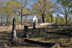 | Omer Christian Church and Cemetery | 5.6 miles | 2000 |
| Athens-Candler-Church Street Historic District | 5.9 miles | 1986 | |
 | Winder Depot | 6.2 miles | 1979 |
 | Barrow County Courthouse | 6.2 miles | 1980 |
| Broad Street Commercial Historic District | 6.2 miles | 1984 |
| National Archives record | The nomination case file for reference 97000527 in Record Group 79. |
| Barrow County | All 17 listed properties in this county. |