 Block
From the record
One of 9 National Register listings published here for Cherokee County · listed in 1997 · category: Building.
Sources: the case file at the National Archives · the National Register database, National Park Service
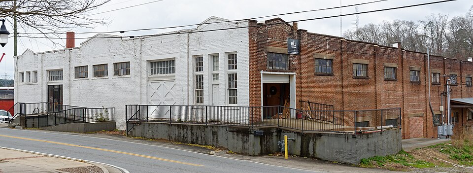
Listed on the National Register of Historic Places in 1997.
One of 9 National Register listings published here for Cherokee County · listed in 1997 · category: Building.
Sources: the case file at the National Archives · the National Register database, National Park Service
Regional context, not property-specific evidence. The federal wildfire occurrence database lists 360 fires within 5 miles of Canton Wholesale Company Building between 1992 and 2020, burning about 782 acres in total. 5 started naturally. 86 were recorded as arson. Distance is straight-line from the map coordinates, so a fire counted here may appear on a neighbouring settlement's page as well.
| Reported cause | Fires |
|---|---|
| Debris and open burning | 144 |
| Arson/incendiarism | 86 |
| Railroad operations and maintenance | 28 |
| Missing data/not specified/undetermined | 26 |
| Misuse of fire by a minor | 24 |
| Equipment and vehicle use | 22 |
| Smoking | 17 |
| Recreation and ceremony | 8 |
| Natural | 5 |
The most recent of them, most recent first, with the day each was reported and the service that recorded it.
| Date | Cause | Size | Reported by | Name on the report |
|---|---|---|---|---|
| 7 September 2016 | Debris and open burning | under an acre | Georgia Forestry Commission | FY2017-CHEROKEE-003 |
| 6 September 2016 | Debris and open burning | 9.6 acres | Georgia Forestry Commission | FY2017-CHEROKEE-002 |
| 6 September 1997 | Missing data/not specified/undetermined | 1.7 acres | Georgia Forestry Commission | not named |
| 5 September 1999 | Equipment and vehicle use | under an acre | Georgia Forestry Commission | not named |
| 4 September 1998 | Arson/incendiarism | 1.0 acres | Georgia Forestry Commission | not named |
| 4 September 1997 | Arson/incendiarism | 50 acres | Georgia Forestry Commission | not named |
| 30 September 2016 | Debris and open burning | 2.0 acres | Georgia Forestry Commission | FY2017-CHEROKEE-004 |
| 3 September 2011 | Debris and open burning | 2.0 acres | Georgia Forestry Commission | FY2012-CHEROKEE-007 |
Regional context, not property-specific evidence. The federal mineral resources record lists 24 workings within 5 miles of Canton Wholesale Company Building: 13 past producers, 6 occurrences, 3 prospects, 2 producers. 2 still produce. What was taken out: Iron, Gold, Sand and Gravel, Construction, Mica. Distance is straight-line from the map coordinates, so a quarry counted here may appear on a neighbouring settlement's page as well.
| Where | Site | Commodity | Status | Recorded |
|---|---|---|---|---|
| Brady Mine | Talc-Soapstone | Past Producer | ||
| J B Wheeler Prospect | Mica | Prospect | ||
| Rich Mine | Sulfur-Pyrite, Lead, Zinc | Past Producer | ||
| Rich Mine (Canton Mine) | Copper, Iron-Pyrite | Occurrence | Chalcopyrite | |
| White Property | Barium-Barite | Occurrence | ||
| Blankenship Sand Dredge | Sand and Gravel, Construction | Past Producer | ||
| Blankenship Sand Dredge | Sand and Gravel, Construction | Producer | ||
| Lawson & Quarles Sand | Sand and Gravel, Construction | Producer | ||
| Sand & Gravel Division | Sand and Gravel, Construction | Past Producer | ||
| Clarkson Mine | Gold | Past Producer |
Regional context, not property-specific evidence. The National Weather Service names Canton, the town this property stands in, in 112 storm reports between 1994 and 2025: 55 thunderstorm wind, 31 hail, 16 lightning, 4 flash flood. The reports record 4 injuries. Each account below is quoted exactly as the forecast office filed it, from the NOAA Storm Events Database, and each date opens the federal record of that event.
| When | Event | Place named | Harm | What the report says |
|---|---|---|---|---|
| July 2004 | Lightning | Canton | 1 hurt, $400,000 | The Cherokee Tribune reported that a male was struck by lightning. The man was treated and released. Elsewhere in the county, lightning struck three homes as well as the building which houses the 911 center and jail. The 911 center and jail suffered major damage when lightning struck the facility. Damages to these facilities alone was estimated at $200,000. A house on Shotwell Drive was struck by lightning and the attic set on fire. Another home on Bradshaw Club Drive suffered major damage to the roof and second floor from a lightning strike and resulting fire. A third home on Tribal Trail took a direct hit from lightning. The garage suffered considerable damage when it was set on fire. Much of Canton was without power for several hours during the intense lightning storm. |
| August 2008 | Lightning | Canton | 1 hurt, $350,000 | The Cherokee County Emergency Management Director reported that an individual was struck by lightning seven miles southwest of Canton and sustained non life-threatening injuries. In addition, two homes in the southwest and southern part of the county were struck by lightning and set on fire, One of the homes was in the Towne Lake Subdivision on Players Court and was totally destroyed. The Cherokee Tribune reported that up to 134 homes in the area sustained at least minor damage from wind and/or lightning. |
| August 2008 | Thunderstorm Wind | Canton | 1 hurt, $150,000 | The Cherokee County Emergency Management Director reported that thunderstorm downburst winds blew down dozens of trees on the east and north side of Lake Allatoona. A number of trees were also down between the eastern side of Lake Allatoona and Woodstock as well. Several campers were damaged at the Sweetwater Campground and one person at the campground sustained non-life threatening injuries when a large tree fell on their tent. In addition, playground equipment was damaged at a park in Woodstock from a large downed tree. Several roads were blocked from downed trees and many power lines and also down in the area. Up to 25,000 people in the area were left without power for several hours following the storm. The Cherokee Tribune reported that up to 134 homes in the area sustained at least minor damage from wind and/or lightning. |
| September 2014 | Thunderstorm Wind | Canton | 1 hurt, $2,000 | The Cherokee County Emergency Manager reported a tree blown down on a house on Killian Road with one minor injury to an occupant of the house. |
| February 2005 | Hail | Canton | $4,500,000 | The Cherokee County Emergency Management Director, along with numerous reports from the public, confirmed that a wide swath of large and very damaging hail fell across much of the central portion of Cherokee county from three miles west of Canton to Hickory Flat, southeast of Canton. There were many reports of hail better than 2.0 inches in diameter, with measured hail stones of 2.75 inches from residents along Georgia Highway 140 near Lower Burris Road in Canton. So much large hail fell, that even 15 hours after the event, hail still lined some streets in the Canton area. The public works department had to be called out to clear ice from roadways. Extensive damage to roofs, vegetation, and automobiles were reported throughout the area. On Liberty Boulevard in the northern section of Canton, three very large car dealerships reported that their entire inventory had been damaged with damages in this area alone around $3.0 million. Over 100 privately owned vehicles were damaged at a Wal Mart parking lot located near this location. The city of Canton Police Department reported damages to their vehicles exceeding $40,000. Total damage estimate to homes, vehicles, and vegetation in the area was $4.5 million. This event ranked as the second most costly hail storm in Cherokee County's history. |
| June 2015 | Hail | North Canton | $2,300,000 | The Cherokee County Emergency Manager reported golf ball sized hail at Reinhardt College Parkway and North Etowah Drive. |
| March 2021 | Hail | South Canton | $2,000,000 | The Cherokee County Emergency manager reported hail the size of golf balls 3 miles southwest of Canton. |
| November 2004 | Thunderstorm Wind | Canton | $1,700,000 | The Cherokee County Emergency Management Director and associated personnel conducted a damage survey and found a broken path of extensive damage to trees, power lines, structures, and vehicles across central Cherokee county from 6 miles west of Canton to 2.5 miles east of Canton, mostly along and near Georgia Highway 20. Most of the damage was consistent with strong straight-lined winds, with the possible exception of one small area in downtown Canton along Chamblee Street where possible F0 tornado damage was observed. The damage path began near the intersection of Fields Chapel Road and Sweet Water Creek Trail west of Canton where mostly tree damage was observed The damage path continued through the Field Stone Subdivision, where extensive damage to homes and trees was observed. Many homes in this area suffered major damage when large oak trees fell on the structures. Siding was blown off some of the homes and several vehicles in the area were destroyed when large trees fell on them. The damage path then continued eastward along Oak Dale Road in Canton, where several more homes, vehicles, and out buildings were damaged and a number of trees were blown down. In addition, the softball facility at the Cherokee County High School Complex suffered major damage when the roof of the dugout was blown off and 200 feet of a chain link fence was flattened. The damage then continued to Main Street and Brown Street in Canton, where a large downed tree crushed and destroyed 11 vehicles. Shortly beyond this point is where the possible F0 tornado occurred. The damage then continued east of Canton terminating in the Brooke Park Development, where again dozens of large trees were blown down onto homes and vehicles. All together, 115 homes sustained damage, 10 of which incurred major damage, 13 vehicles were destroyed, three others sustained some damage, and 8 outbuildings were damaged, of which four were destroyed. |
| August 2000 | Lightning | Canton | $1,400,000 | The Atlanta Journal and Constitution and the Cherokee county Sheriff's department reported that eight homes were set on fire by lightning. The fires were concentrated in Canton, Holly Springs, and Cherokee. Three of the homes were so badly damaged that they were declared to be uninhabitable. |
| April 2006 | Thunderstorm Wind | Canton | $650,000 | The Cherokee County Emergency Management Director reported that 35 homes sustained minor to moderate damage along a 2-mile wide path from downtown Woodstock to seven miles east of Woodstock. Two additional homes were damaged southwest of Canton, where a substantial portion of the roof was blown off one home seven miles southwest of Canton. Debris from the damaged homes near Woodstock was found on Interstate-575 at Exit 16, causing the interstate to be closed until the debris could be cleared from the roadway. |
| June 1994 | Thunderstorm Wind | Canton | $500,000 | Thunderstorm winds caused extensive damage to six to eight cottages and downed numerous pine trees along the shores of Lake Allatoona. |
| June 2001 | Flash Flood | Canton | $400,000 | The Cherokee County Emergency Management Director, as well as the Atlanta Journal-Constitution and the Cherokee Tribune newspapers, reported that repeated slow-moving thunderstorms dumped excessive rainfall of over 4 inches in a 2 hour period across northern Cherokee County. The rain began around 9 pm EDT and continued until just after midnight, with the heaviest rain occurring between 9:30 pm EDT and midnight. The excessive rain caused flooding of creeks and several roads from Canton to Waleska. Puckett Creek flooded and washed out Shoal Creek Road, the only access road to the Rock Creek Estates subdivision in Canton, along with a six inch water main. Residents were left without water and no vehicle access to their subdivision for over 24 hours. In Waleska, residents on Sardis Road were left without drinking water for over 24 hours as yet another 6-inch water main was ruptured by the flood waters of a nearby creek. Other roads damaged include Fate Conn Road, with major damage to the shoulder, and Hickory Nut Road near Georgia Highway 140, with damage to the shoulder and drainage pipe. Debris caused by high water was also observed on several roads including Land, Worley, Smith, Long, Puckett Creek, Soap Creek, and Damascus Roads. |
| August 2010 | Thunderstorm Wind | Canton | $300,000 | The Cherokee County Emergency Management Director reported that three commercial buildings in the John T. Pettit Drive area sustained roof damage. One of the buildings lost nearly its entire roof. The other two only sustained minor shingle damage. Eight residential structures sustained minor damage. The garage of one home suffered major damage when a large tree fell on the structure. One vehicle was also destroyed by a large downed tree. Dozens of large old hardwood trees were snapped off in the downtown Canton area, including several near Canton City Hall and on the grounds of the Board of Education Administrative Complex. Many other small trees and tree limbs were also down in the area. Widespread power outages were observed. Much of the city of Canton was left without power. The damage was the clearly the result of a pulse thunderstorm downburst. |
| August 2010 | Lightning | Canton | $300,000 | The Cherokee County Emergency Management Director reported that three homes in unincorporated Cherokee county were struck by lightning and sustained minor to moderate damage. The public reported that a 60 foot live oak tree at the Department of Education building was struck by lightning. The lightning strike caused the tree to fall on an adjacent Nissan Xterra, crushing the vehicle. |
| June 2001 | Lightning | Canton | $250,000 | The Marietta Daily Journal reported that lightning struck and ignited a home on Oakdale road. The home was completely destroyed by the ensuing fire. |
| February 1995 | Thunderstorm Wind | Canton | $204,000 | Straightline winds blew an industrial sized air conditioner across the roof of a Kroger shopping center. The winds also blew a roof off of a chicken house at Seaboard farms. Numerous trees were knocked down at the intersection of Interstate 575 and Georgia Highway 5. |
| June 2001 | Flash Flood | Canton | $200,000 | The Cherokee County Emergency Management Director, along with the Atlanta Journal-Constitution, reported that thunderstorms once again dumped excessive rainfall in a two to three hour period in some of the same areas of north and northwest Cherokee county that were affected the previous night. Additional rainfall amounts of 3 to 4 inches occurred in the Canton and Waleska areas. The temporary road that was constructed to replace that portion of Sardis Road washed out by Puckett Creek on Wednesday the 27'th, was itself washed out by the flood waters from Puckett Creek. Sardis road is the only road access to the Rock Creek Estates subdivision. In addition, repairs to the water main were also delayed because of the additional flooding. Numerous other roads in the area were once again flooded causing damage, washing out drainage pipes, and covering the roads with debris. Georgia Highways 20 and 140 were both under water in several places. The excessive rainfall caused the Etowah river to crest near 18 feet, which is 1 foot above flood stage and the highest stage observed in over 3 years. |
| September 2000 | Lightning | Canton | $200,000 | The Cherokee Tribune reported that lightning struck a home on Canton Street. The lightning was believed to have started a fire in the kitchen. The resulting fire completely destroyed the entire home and all of its contents. All of the residents escaped injury. |
| August 2006 | Lightning | Canton | $175,000 | The Cherokee County Emergency Management Director reported that several homes and one business were struck by lightning as late afternoon thunderstorms moved through the county from the northwest to the southeast. Incidents involved a home one mile north of Canton with $10K in losses, a business two miles west of Woodstock with $1K in damages, another home six miles east of Canton with $10K in damages, another home two miles east of Woodstock with $1K in damages, and finally a home seven miles east of Canton was a total loss with $150K in damages. |
| August 2006 | Lightning | Canton | $175,000 | The Cherokee County Emergency Management Director reported that lightning struck and set a home on fire in the eastern part of the county. The structure was a total loss. |
| June 2006 | Lightning | Canton | $150,000 | The Cherokee County Emergency Management Director reported that a home in the Bridgemill Community was destroyed as a result of a lightning strike. |
| June 2013 | Thunderstorm Wind | North Canton | $75,000 | The Cherokee County Emergency Manager reported that a tree fell on a house on Kennett Street. A tree also fell on a vehicle nearby. |
| March 2013 | Thunderstorm Wind | North Canton | $55,000 | The Cherokee County Emergency Manager reported that a couple of trees were blown along Dr. John T Petit Street in Canton. One tree fell on a house. |
| July 2015 | Thunderstorm Wind | North Canton | $50,000 | The Cherokee County Emergency Manager and numerous members of the public reported a large number of trees blown down across Cherokee County. The hardest hit area was in and around the Orange Shoals subdivision, but damage was reported from North Etowah Drive in Canton to Trenton Lane in Lathemtown. |
| July 2015 | Lightning | South Canton | $40,000 | The Cherokee County Emergency Manager reported a house fire started by lightning on Arbor Lake Drive at Lower Scott Mill Road. |
| June 2006 | Lightning | Canton | $35,000 | The Cherokee County Emergency Management Director reported that a lightning strike to a home in the Keithburg Community resulted in a fire causing significant damage to the structure. |
| June 2013 | Thunderstorm Wind | North Canton | $30,000 | The Cherokee County Emergency Manager reported that a tree fell on a house on McClain Street in Canton. |
| August 2008 | Thunderstorm Wind | Canton | $25,000 | The Cherokee County Emergency Management Director reported that several trees were down across the county from two miles southwest of Canton, to seven miles southeast of Canton to Ballground in the northern part of the county. Power lines were brought down with the trees in several instances and several roads were blocked as a result. Wind gusts of 49 mph were measured at the Canton Emergency Operations Center at 845 am EDT. All together at least six trees and at least four power lines were downed. A home was damaged two miles southwest of Canton when a large tree fell onto the structure. A large tree was down on power lines in downtown Ballground blocking the road. A large tree was also down on power lines seven miles southeast of Canton blocking a road. Trees were also down on power lines five miles southeast of Canton. Two large trees were down on a power line five miles north of Canton, also blocking the road. Finally, a large tree was down four miles northwest of Canton. |
| July 2005 | Flash Flood | North Canton | $25,000 | The Cherokee County Emergency Management Director reported that heavy rain caused flash flooding on Sope and Shoal Creeks, which washed out a couple of county roads. One vehicle was washed away into Shoal Creek. The occupant had to be rescued, but no injuries were reported. |
| May 2003 | Thunderstorm Wind | Canton | $25,000 | The Cherokee county Emergency Management Director reported that a large tree, blown down by thunderstorm winds, fell on a house just west of Canton, causing considerable damage to the structure. |
| June 2017 | Thunderstorm Wind | South Canton | $20,000 | The Cherokee County Emergency Manager reported numerous trees and some power lines blown down in the Canton area, including Knox Bridge Highway at Beverly Drive, Killian Road between Celebration Song and Brick Mill Road, W. Haynes Road near Oakdale Road, Cartersville Street at McLain Street, and I-575 at Cumming Highway. |
| July 2003 | Thunderstorm Wind | Canton | $20,000 | The public reported a number of trees blown down in Canton, Woodstock, and Arnold Mill. A vehicle in Canton suffered extensive damage when trees fell on it. The public measured a wind gust of 60 mph in Hickory Flat on their home weather station. |
| April 1998 | Lightning | Canton | $20,000 | Two separate lightning strikes caused a house fire and a small fire at a church daycare center. |
| May 1998 | Hail | Canton | $20,000 | Numerous public and spotter reports indicated dime to golf ball size hail fell across the south half of Cherokee county. Cars and roof tops were damaged a mile south of Holly Springs, where 2 inch hail was reported. Nickel size hail covered the ground 2 inches deep southwest of Canton. |
| August 2009 | Thunderstorm Wind | Canton | $15,000 | The Atlanta Journal-Constitution reported that gusty winds associated with a band of south to north moving thunderstorms blew a tree down on a vehicle. A very large tree fell on a Chevrolet Malibu as a 27-year old female was traveling along Railroad Street in Canton. The individual escaped without injury, but the vehicle was destroyed. |
| May 2002 | Thunderstorm Wind | Canton | $15,000 | Several reports of downed trees and power lines were received. The Cherokee county 911 center reported that several trees were down from 1 mile east of Canton to 3 miles east of Woodstock and trees were down on power lines in Holly Springs. The public reported that several large oak trees had been blown down in Canton near Georgia Highway 20. |
| May 1996 | Thunderstorm Wind | Canton | $15,000 | no account filed |
| April 2017 | Thunderstorm Wind | Canton | $12,000 | The Cherokee County Emergency Manager reported trees and power lines blown down from Oakdale Road north of Knox Bridge Highway to Riverside Road at Marietta Highway. |
| September 2015 | Lightning | Canton | $12,000 | Lightning struck a house on Overlook Trail causing an attic fire. |
| July 1995 | Thunderstorm Wind | Canton | $10,000 | Thunderstorm winds blew a roof off a building. Trees and power lines down all over the city. |
| June 2025 | Thunderstorm Wind | Canton | $8,000 | The Emergency Manager relayed reports of trees down at several locations around Canton, including Heritage Drive, Riverstone Parkway, Cartersville Street, Lawson Drive, Governors Walk Drive at Blake Way, Great Sky Parkway at Reinhardt College Park. |
| August 2015 | Thunderstorm Wind | South Canton | $8,000 | The Cherokee County Emergency Manager reported multiple trees down on the south side of Canton. |
| September 2002 | Thunderstorm Wind | Canton | $8,000 | The Cherokee county 911 center reported that numerous trees and power lines were down from Canton to Woodstock. |
| July 2006 | Thunderstorm Wind | Canton | $6,000 | The Cherokee County Emergency Management Director reported that more than three dozen trees were blown down along a 1.5 mile path in the Hickory Flat Community southeast of Canton. The damage was likely the result of a thunderstorm downburst. The damage path was approximately 1.5 miles long and 250 yards wide. Downed trees included small to medium-sized oak, pine, other hardwoods, and a few Bradford pear trees. The majority of the damage occurred within and near the Bradshaw Farms Country Club. The Emergency Manager estimated the wind gusts at 60 mph based on the amount and type of damage in the area. |
| June 2025 | Thunderstorm Wind | Canton | $5,000 | Multiple trees down across Canton GA from about Marietta Highway to Scott Rd. |
| July 2024 | Thunderstorm Wind | North Canton | $5,000 | Multiple trees down in the canton area . |
| July 2017 | Thunderstorm Wind | North Canton | $5,000 | The Cherokee County Emergency Manager reported a tree blown down onto a building near the intersection of Shoal Creek Road and Waleska Road. |
| July 2011 | Lightning | Canton | $5,000 | The Cherokee County Emergency Management Director reported that lightning struck a home just southwest of Canton. Minor damage was reported to the structure. |
| August 2008 | Thunderstorm Wind | Canton | $5,000 | The Cherokee County Emergency Management Director reported that several trees were down on power lines and blocking at least one road west and southwest of Canton. |
| April 2007 | Thunderstorm Wind | Canton | $5,000 | The Cherokee County Emergency Management Director reported that a couple of trees and power lines were down in a subdivision north of Canton. One of the downed trees caused some minor structural damage to a home in the subdivision. |
| July 2005 | Flash Flood | Canton | $5,000 | The Cherokee County Emergency Management Director reported flash flooding in downtown Canton. Thunderstorms had dumped two to three inches of rain in approximately 1.5 hours. Six streets in downtown Canton were closed because of flooding. A restaurant at the intersection of Marietta Highway and Georgia Highway 140 suffered flood damage when water rose up to one foot deep in the facility. |
| May 1998 | Lightning | Canton | $5,000 | Four homes in Cherokee county sustained minor damage when struck by lightning. |
| May 1998 | Hail | Canton | $5,000 | A spotter reported quarter size hail and public reports indicated hail ranging in size from dime to as large as a baseball fell across west and north Cherokee county. |
| February 2024 | Thunderstorm Wind | North Canton | $4,000 | Several reports of trees down around Canton Ga. Pearidge Rd and Pine Grove Rd, Marietta Rd and Bells Ferry Rd, York Dr, N Brooke Dr and River Estates Pkwy, and Scott Rd and Spring Rd. |
| July 2020 | Thunderstorm Wind | North Canton | $4,000 | The public reported trees blown down from Matthew Drive on the northeast side of Canton to Tom Hulsey Drive and Sweetbriar Court southeast of Canton. |
| August 2024 | Thunderstorm Wind | North Canton | $3,000 | Several trees down in city of canton, including on structure along 300 block of shoals creek rd. |
| July 2024 | Thunderstorm Wind | South Canton | $3,000 | A tree was downed onto a home in the 3000 block of Cherokee Overlook Drive. |
| May 2024 | Thunderstorm Wind | North Canton | $3,000 | A tree was downed on a house in the 600 block of Waleska Rd. Additional trees were also downed along the 500 block of Waleska Rd and Lakeview Dr. |
| June 2019 | Thunderstorm Wind | North Canton | $3,000 | The Cherokee County Emergency Manager reported trees and power lines blown down across the northern half of the county, including around Lucky Street and Waleska Road in Canton and along Pleasant Union Road. |
| June 2018 | Thunderstorm Wind | South Canton | $3,000 | The Cherokee County Emergency Manager reported trees and power lines blown down from around exit 16 on I-575 near Canton to east of Woodstock along Neese Road. |
No historic map-sheet match is published for this property yet. That does not mean no map exists. This record needs a coordinate-quality review before it can be joined to a sheet boundary. Browse the county's mapped places while that work is pending.
Other National Register properties close enough to walk or drive between, ordered by distance from this one. Both positions come from the same geocoding pass that matched these properties to their map sheets.
| Photograph | Property | Distance | Listed |
|---|---|---|---|
 | Canton Cotton Mills No. 2 | 0.2 miles | 2002 |
 | Cherokee County Courthouse | 0.7 miles | 1981 |
 | Canton Historic District | 0.7 miles | 2010 |
 | Canton Commercial Historic District | 0.7 miles | 1984 |
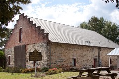 | Crescent Farm | 1.0 miles | 1989 |
| National Archives record | The nomination case file for reference 97001421 in Record Group 79. |
| Cherokee County | All 9 listed properties in this county. |