 Block
From the record
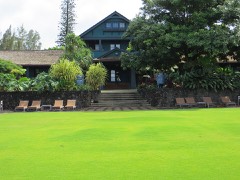
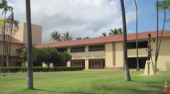
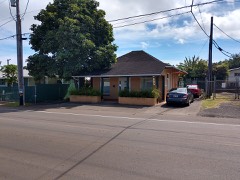
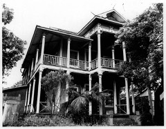
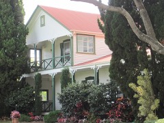
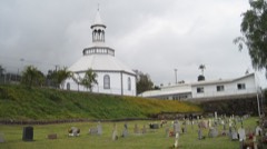
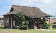
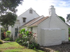
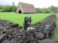
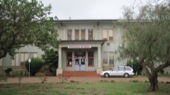
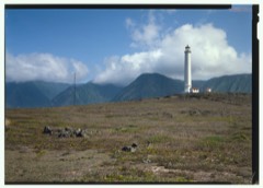
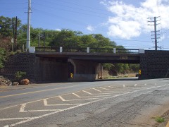
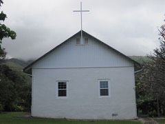
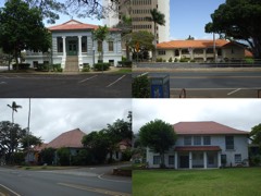
41 National Register listings published here, 4 of them National Historic Landmarks.
Sources: the National Register database, National Park Service
102 topographic sheets cover 161 settlements here, and 41 properties are on the National Register of Historic Places.
41 National Register listings published here, 4 of them National Historic Landmarks.
Sources: the National Register database, National Park Service
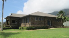
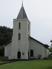
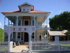
Every property in this county listed on the National Register of Historic Places, with the year it was listed and the federal nomination document.
Every wildfire the federal occurrence database records inside this county: 1,020 of them, burning about 99,902 acres. None started naturally and 3 were recorded as arson. Each settlement page carries the fires within five miles of it.
| Reported cause | Fires |
|---|---|
| Missing data/not specified/undetermined | 1000 |
| Recreation and ceremony | 7 |
| Equipment and vehicle use | 4 |
| Arson/incendiarism | 3 |
| Smoking | 2 |
| Debris and open burning | 2 |
| Fireworks | 1 |
| Other causes | 1 |
The five largest, by the area the report gives. Two of them were set deliberately.
| Date | Cause | Size | Reported by | Name on the report |
|---|---|---|---|---|
| 23 August 1998 | Missing data/not specified/undetermined | 12,453 acres | State of Hawaii | not named |
| 11 July 2019 | Missing data/not specified/undetermined | 9,200 acres | State of Hawaii | EMERGENCY RESPONSE WAIKO FIRE |
| 29 August 2009 | Missing data/not specified/undetermined | 7,800 acres | State of Hawaii | not named |
| 11 July 2019 | Arson/incendiarism | 7,658 acres | Kealia Pond National Wildlife Refuge | CENTRAL MAUI |
| 7 June 2010 | Missing data/not specified/undetermined | 6,200 acres | State of Hawaii | not named |
| 15 February 2016 | Arson/incendiarism | 5,800 acres | State of Hawaii | KAHIKINUI FIRE |
| 2 July 2016 | Equipment and vehicle use | 4,700 acres | State of Hawaii | MAALAEA NUI FIRE |
| 8 July 2020 | Recreation and ceremony | 4,300 acres | State of Hawaii | HALIIMAILE FIRE 2020 |
Every settlement page carries the fires within five miles of it - see the settlement index below.
The NOAA Storm Events Database holds 881 reports for this county, causing 5 deaths, 10 injuries and about $49,388,500 in recorded property damage. Each settlement page carries the reports that name it.
| Kind of event | Reports |
|---|---|
| Heavy Rain | 627 |
| Flash Flood | 131 |
| Flood | 58 |
| Wildfire | 15 |
| Lightning | 10 |
| Funnel Cloud | 10 |
| Waterspout | 9 |
| Thunderstorm Wind | 9 |
| Tornado | 5 |
| Hail | 3 |
| Dust Devil | 2 |
| Debris Flow | 2 |
The most serious of them, by death, then injury, then recorded damage. The accounts are quoted exactly as the forecast office filed them.
| When | Event | Place named | Harm | What the report says |
|---|---|---|---|---|
| November 2009 | Heavy Rain | Wailua | 2 killed | Heavy rain caused the Honomaele Stream to rise above its normal level. A married couple from Hana, Maui, apparently tried to cross the stream when it was flowing rapidly with the heavy rain waters. Their vehicle was located the next day downstream, but the man and wife were not found. |
| April 2003 | Flash Flood | Kipahulu | 2 killed | no account filed |
| January 2023 | Flash Flood | I Kihei | 1 killed | Flash flooding closed Pulehu Road was above the landfill, South Kihei Road near Kulanihakoi Gulch, and Piilani Highway near Nuu. A firefighter helping to clear flood waters was swept into a storm drain and carried about 800 yards to the ocean at around 1 pm HST. He succumbed to injuries on February 4, 2023. |
| August 2003 | Wildfire | Kaunakakai | 4 hurt, $10,000 | no account filed |
| January 2001 | Wildfire | Olowalu | 3 hurt | no account filed |
| July 2013 | Lightning | Haiku | 1 hurt | A man was struck by lightning in Haiku. |
| December 2007 | Flash Flood | Keokea | 1 hurt | A home was washed off its foundation in Keokea in Upcountry Maui by flood waters, and two persons were then rescued by helicopter. Another individual was injured in this event. |
| June 2003 | Wildfire | Maunaloa | 1 hurt | no account filed |
| March 2026 | Flash Flood | Honokohau | $20,000,000 | On March 13, heavy rain began to fall and quickly led to extensive damage across Maui. This damage included widespread infrastructure damage, property and home losses, and emergency rescues. At 1030 AM HST, heavy rain washed away Lower Kula Road near Ohala Place, and all of South Kihei Road closed due to severe flooding. On March 14, 40 people were reportedly stranded in Hana due to flooding. Honoapiilani Hwy (Hwy 30) was closed from Kuihelani Hwy to the Olowalu dump due to flooding, swift water, and the integrity of the Ukuhehame bridge. At approximately 3:45 pm on March 14, a section of South Kihei Road collapsed. Many other roads across Maui were also closed. A home in Iao Valley collapsed into the Iao River. A Target store in Kahului reported severe flooding with several inches of water inisde the store. |
| March 2021 | Flash Flood | Haiku | $14,300,000 | Hana Highway was closed from Peahi Road near Haiku to Keanae in windward East Maui due to flooding. A dam failure in the same area was a possibility as water topped the Kaupakulua Dam upstream from the Haiku and Pauwela communities. The dam survived the downpours, however. |
| March 2026 | Flash Flood | Ilio Point | $10,000,000 | Heavy rain moved over Molokai and led to numerous impacts. A landslide closed road from mile marker 7 to 12 at Kamehameha V Highway with flood water, mud, and boulders up to 4 feet deep. Kamehameha V Highway was then closed from Kapaakea Loop eastward due to flooding. On March 22 early in the morning, homes and vehicles in the Kalamaula Homesteads became flooded from heavy rain and thunderstorms. Residents also reported leaking roofs and lost goods, appliances, and other property damages. |
| January 2002 | Flash Flood | Countywide | $2,500,000 | no account filed |
| May 2022 | Flash Flood | Makena | $1,200,000 | Piilani Highway between mile markers 31 and 39 became impassable after heavy rain, and a culvert was washed out at the Lelekea Culvert crossing. |
| January 1997 | Flash Flood | Lahaina | $536,000 | no account filed |
| April 2026 | Flash Flood | Nahiku | $250,000 | Heavy rain developed over the eastern slopes of Maui. Emergency management and the local news reported multiple impacts. Hawaii News Now reported Hana High & Elementary School was temporarily closed on Tuesday April 7 due to flooding. The Department of Education said some classrooms had water damage. Water was also reported on Hana Highway. |
| March 2026 | Flash Flood | Honokohau | $100,000 | Early in the morning of March 22nd, heavy rain moved over Maui and led to flooding across the island. Many roads were flooded and landslides were reported. Keawe St. was closed in both directions between Kupuohi St. and Kuhua St. due to flooding. Both lanes of Honoapiilani Highway were blocked near mile marker 33 due to a landslide. Kahekili Highway was closed from 2120 Kahekili Highway to Kahakuloa due to flooding. Kapunakea St. and Front St. intersection was closed due to flooding. Kahekili Highway was closed from 2120 Kahekili Hwy to Kahakuloa due to flooding. Hana Highway/Hanakai St. to Hanakai Alamaha St. was closed due to flooding. Many other roads across Maui were closed due to the flooding. |
| January 2025 | Thunderstorm Wind | Kanaha Bp | $100,000 | A parked plane was blown into another parked plane. The nose of one plane pierced the bottom of a plane parked perpendicular to it. Damage cost was estimated. |
| October 2002 | Flash Flood | Wailea | $90,000 | no account filed |
| October 2002 | Flash Flood | Kaunakakai | $70,000 | no account filed |
| February 2026 | Flash Flood | Waianapanapa Sp | $50,000 | The Hana Police Department reported a landslide on the Hana Highway. The roadway was |temporarily closed to remove rock and debris. A nearby resort in the Hana area also reported trees downed from landslides. |
| July 1997 | Flash Flood | East Portion | $49,000 | High water washed away a culvert bridge leaving a 20 foot gap in Waha Place road leading to a cul-de-sac off of Ulumalu Road between the Hana Highway and Five Corners. 10 families living in homes around the cul-de-sac were stranded for about 9 hours. At 2:30 a.m., a house was severely flooded by a debris blocked stream in the Honopua area on the mountain side of Hana Highway just before Twin Falls. Contents of the house and a pickup truck were destroyed. The Hana Highway was blocked in several spots by landslides, and the Piilani Highway was closed due to high water and damage by erosion between Kipahulu and Kaupo. |
| March 2012 | Thunderstorm Wind | Hana | $25,000 | Strong winds destroyed a portion of the roof on the Hana Hotel on Maui. |
| January 1997 | Flood | Kaunakakai | $24,000 | no account filed |
| February 2026 | Flash Flood | Happy Valley | $20,000 | A River/Creek reportedly overflowed and flooded cropland, a yard, and a basement. |
| July 2013 | Lightning | Kaunakakai | $20,000 | A lightning strike to a power plant on Molokai near Kaunakakai took out power to the island. |
| May 2012 | Dust Devil | Kihei | $20,000 | no account filed |
| January 1996 | Lightning | Haleakala | $10,000 | no account filed |
| October 2002 | Flash Flood | Lanai City | $8,000 | no account filed |
| April 1967 | Tornado | not stated | $2,500 | no account filed |
| July 2013 | Lightning | Puunene | $2,000 | Lightning created a five-inch diameter hole in the roof of a home in Kahului. |
| July 2013 | Lightning | Happy Valley | $1,000 | Nearly 10,000 customers went without power, including residents in Upper Olinda, from Paia to Kuau, from Huelo to Hana, and along the East Maui coast. |
| July 2013 | Lightning | Puunene | $1,000 | Because of a lightning strike, backup power was used at Kahului Airport for about an hour. |
| March 2026 | Flash Flood | Kahului | - | Hanakai Street was completely closed between Hana Highway and Alamaha St due to flooding. |
| March 2026 | Flash Flood | Kaunakakai | - | A landslide was reported at mile marker 16.5 of Kamehameha V Highway. On March 13, Flash flooding was also reported at Kawela Gulch on Molokai with water flowing over Kamehameha Highway Bridge. |
| March 2026 | Heavy Rain | Shipwreck Beach | - | Hawaii News Now posted a video received from the public of gushing water along hillsides and roads on Lanai. HNN also reported water on Manele Rd between mile marker 8 and mile marker 9. |
| February 2026 | Flash Flood | Waianapanapa Sp | - | Waikoloa Road in Hana was closed due to rising river water and flooding. |
| January 2026 | Flood | Hp Baldwin Bp | - | Two hikers were rescued by helicopter near mile marker 5 of the Hana Highway due to rising stream levels cutting them off from the rest of their group. |
| January 2025 | Flood | I Kihei | - | South Kihei Road was closed at multiple locations due to flooding. Numerous businesses and residences in Kihei were impacted by the flooding as several gulches became overwhelmed and overflowed their banks. |
| January 2025 | Thunderstorm Wind | Nahiku | - | Trees down near mile marker 26 and mile marker 27 along Nahiku Road. |
| January 2025 | Thunderstorm Wind | Pulehu | - | Trees down in the vicinity of Rice Park. |
| January 2025 | Thunderstorm Wind | Pulehu | - | Trees down along Kula Highway near Kula Elementary School. |
| January 2024 | Flood | I Kihei | - | South Kihei Road was closed between Kaonoulu and Ohukai. The west bound lanes were closed due to heavy flooding. Emergency managers reported a swift water rescue. |
| January 2024 | Flood | Lahaina | - | Keawe St between Honoapiilani Highway and Komo Mai St had standing water 6 to 8 inches deep. |
| January 2024 | Flood | I Kihei | - | S Kihei Road near Kaonoulu St was closed due to flooding on roadways. |
| January 2024 | Flood | I Kihei | - | There was a road closure in both directions near the old Sudas Road near Uwapo Rd. This was due to water on the road. |
| January 2023 | Flash Flood | Kokomo | - | Makawao Avenue was closed at Maliko Gulch between Kee Road and Kokomo Road. |
| January 2023 | Flash Flood | Kaunakakai | - | Kamehameha V Highway near Kaunakakai was closed due to flash flooding. There were rapid rises on the Kawela Gulch and the Kaunakakai Gulch stream gauges and homes were flooded in the Kawela Gulch area. |
| January 2023 | Flash Flood | Kihei | - | South Kihei Road was closed due to flooding. |
| November 2023 | Flood | Koali | - | Periods of heavy rainfall lead to an accumulation of water on the roadways which led to the closure of Piilani highway from mile marker 29-31, as well as mile marker 16. Hana Highway was also closed near mile marker 40. |
| December 2023 | Flood | Pauwela | - | Hana Highway was closed near mile marker 40. And Piilani Highway was closed near mile marker 16, and 29-31. |
| September 2022 | Flash Flood | Kihei | - | Flooding forced the closure of South Kihei Road at Kalani Road in Kihei on Maui. More inundation was reported near Kalama Park in the area of Waimahaihai Street and Keala Place. |
| November 2022 | Heavy Rain | Makena | - | Radar rainfall estimates were obtained from NWS Doppler. |
| December 2022 | Flash Flood | I Kihei | - | South Kihei Road was closed between Kulanihakoi Street and Kanoulu Street, as well as south to Kulanihakoi Street. |
| December 2022 | Flash Flood | Koali | - | Pillani Highway was closed from the town of Kipahulu to Ulupalakua due to heavy rainfall. Additionally, in the Kaupo/Kipahulu area, the road was washed out about a mile east of Kaupo Gulch. |
| January 2021 | Flash Flood | Honokohau | - | Debris (large boulders) on Honoapiilani Highway in West Maui near mile marker 35 caused a road closure after heavy downpours. |
| January 2021 | Flash Flood | Kamalo | - | Heavy rain caused flooding, and road closures, over portions of Kamehameha Highway V near Kamalo and Pukoo on the island of Molokai. |
| February 2021 | Heavy Rain | Kahakuloa | - | A 26-year-old woman died when she was swept out to sea after the place where she was swimming near Hana became swollen by rainwater that had fallen over the upper slopes of Haleakala. |
| February 2021 | Heavy Rain | Waihee | - | Two hikers went missing along the Waikamoi Trail in East Maui. As of this writing, the body of one hiker had been found, apparently swept out to sea over a waterfall in the area. The other hiker remained unaccounted for, but he likely perished as well. |
| March 2021 | Debris Flow | Keanae | - | Hana Highway was closed between mile post 10 and mile post 13, about 2 miles west-northwest of Keanae in windward East Maui. The closure was caused by large boulders blocking the roadway. |
| March 2021 | Flash Flood | Waianapanapa Sp | - | Hana Highway in windward East Maui became impassable because of high water. Later, near Kahului, water from heavy rain was flowing into a few homes due to storm drains being overwhelmed by the downpours. |
The Survey's mineral resources record lists 18 workings inside this county. 2 still produce and 16 are closed or unrecorded. Each settlement page carries the workings within five miles of it.
| Commodity | Workings |
|---|---|
| Stone, Crushed/Broken | 7 |
| Sand and Gravel, Construction | 3 |
| Aluminum | 2 |
| Stone | 2 |
| Pumice | 2 |
| Titanium, Metal, Aluminum | 1 |
| Iron, Phosphorus-Phosphates, Silica, Titanium, Water, Free | 1 |
| Calcium | 1 |
The least common of them first, because a county's hundredth gravel pit says nothing its first ten did not.
| Where | Site | Commodity | Status | Recorded |
|---|---|---|---|---|
| Hcs Lime Pit and Mill | Calcium | Past Producer | ||
| Maui Bauxite Deposit | Titanium, Metal, Aluminum | Occurrence | Bauxite, Ilmenite | |
| Maui Ferruginous Bauxites | Aluminum, Iron, Phosphorus-Phosphates, Silica, Titanium, Water, Free | Prospect | 1949 | |
| Hawaii Bauxite | Aluminum | Occurrence | Bauxite, Gibbsite | |
| Manawaunui Quarry and Mill | Stone | Past Producer | ||
| Olowalu Cinder Pit | Pumice | Past Producer | ||
| Unnamed Cinder Pit | Pumice | Past Producer | ||
| Wailea Mill | Stone | Past Producer | ||
| Happy Valley Pit and Mill | Sand and Gravel, Construction | Past Producer | ||
| Pahopaku Sand Pit | Sand and Gravel, Construction | Past Producer | ||
| Waikapu Pit and Mill | Sand and Gravel, Construction | Producer | ||
| Kaunakakai Pits | Stone, Crushed/Broken | Past Producer | ||
| Khmalo Mill | Stone, Crushed/Broken | Past Producer | ||
| Manawainui Quarry | Stone, Crushed/Broken | Past Producer | ||
| Maui Block Mill | Stone, Crushed/Broken | Producer | ||
| Mayer Quarry | Stone, Crushed/Broken | Past Producer | ||
| Red Hill Pit | Stone, Crushed/Broken | Past Producer | ||
| Waiele Pit and Mill | Stone, Crushed/Broken | Past Producer |
Named settlements recorded in the Geographic Names Information System, each with the topographic sheets covering it. Villages, hamlets and abandoned places alike. Each is shown with the nearest named watercourse or landform and the survey quadrangle it falls on.
Puunene census division · 96732 · Near Pūlehu Gulch · Wailuku quadrangle
10 sheets, 1954 to 1997
No longer a settlement
Kihei census division · 96753 · Near Pūlehu Gulch · Puu O Kali quadrangle
8 sheets, 1954 to 1992
No longer a settlement
Puunene census division · 96732 · Paia quadrangle
9 sheets, 1954 to 1997
No longer a settlement
Spreckelsville census division · 96779 · Near Puʻunēnē · Paia quadrangle
9 sheets, 1954 to 1997
No longer a settlement
Lahaina census division · 96761 · Near Puʻulaina · Lahaina quadrangle
8 sheets, 1954 to 1992
Wailuku census division · 96793 · Near ʻĪao Valley · Wailuku quadrangle
10 sheets, 1954 to 1997
Spreckelsville census division · 96779 · Near Puʻunēnē · Paia quadrangle
9 sheets, 1954 to 1997
No longer a settlement
Makawao-Paia census division · 96779 · Near Olopua · Paia quadrangle
9 sheets, 1954 to 1997
No longer a settlement
Haiku-Pauwela census division · 96708 · Near Liliko Gulch · Haiku quadrangle
10 sheets, 1954 to 1992
Lahaina census division · 96761 · Near Puakahuahua · Napili quadrangle
10 sheets, 1954 to 1997
Lahaina census division · 96761 · On Honokōhau Stream · Napili quadrangle
10 sheets, 1954 to 1997
Lahaina census division · 96761 · On Honokōwai Stream · Lahaina quadrangle
8 sheets, 1954 to 1992
Lahaina census division · 96761 · Near Kahauiki Gulch · Napili quadrangle
10 sheets, 1954 to 1997
No longer a settlement
Hana census division · 96713 · Near Oilowai Gulch · Hana quadrangle
9 sheets, 1954 to 1992
No longer a settlement
Wailuku census division · 96793 · Near ʻĪao Valley · Wailuku quadrangle
10 sheets, 1954 to 1997
No longer a settlement
West Molokai census division · 96729 · Near Puʻukapeʻelua · Kaunakakai quadrangle
7 sheets, 1952 to 1993
Haiku-Pauwela census division · 96708 · On Huelo Stream · Haiku quadrangle
10 sheets, 1954 to 1992
Waihee-Waikapu census division · 96793 · Near Ooawa Kilika Gulch · Wailuku quadrangle
10 sheets, 1954 to 1997
No longer a settlement
East Molokai census division · 96748 · On Hālawa Stream · Halawa quadrangle
8 sheets, 1952 to 1983
West Molokai census division · 96770 · In Hālena Gulch · Ilio Point quadrangle
6 sheets, 1952 to 1974
Makawao-Paia census division · 96768 · Near Kamole · Paia quadrangle
9 sheets, 1954 to 1997
Makawao-Paia census division · 96768 · Near Puu o Umi · Paia quadrangle
9 sheets, 1954 to 1997
No longer a settlement
Hana census division · 96713 · Near Pukuilua Gulch · Kipahulu quadrangle
9 sheets, 1954 to 1995
Spreckelsville census division · 96779 · Near Puʻunēnē · Paia quadrangle
9 sheets, 1954 to 1997
No longer a settlement
Waihee-Waikapu census division · 96793 · On Kahakuloa Stream · Kahakuloa quadrangle
7 sheets, 1954 to 1997
Lahaina census division · 96761 · On Kahana Stream · Napili quadrangle
10 sheets, 1954 to 1997
Kahului census division · 96732 · Near Sand Hills · Wailuku quadrangle
10 sheets, 1954 to 1997
Haiku-Pauwela census division · 96708 · Near Puʻukūkae · Haiku quadrangle
10 sheets, 1954 to 1992
Makawao-Paia census division · Near Puʻuokaiʻa · Paia quadrangle
9 sheets, 1954 to 1997
No longer a settlement
West Molokai census division · 96757 · Near Hahaeule · Kaunakakai quadrangle
7 sheets, 1952 to 1993
East Molokai census division · 96748 · Near Pahukauila Gulch · Halawa OE S quadrangle
8 sheets, 1952 to 1983
East Molokai census division · 96748 · In Kamalō Gulch · Kamalo OE S quadrangle
8 sheets, 1952 to 1983
East Molokai census division · 96748 · In Kamiloloa Gulch · Kaunakakai quadrangle
9 sheets, 1952 to 1993
Kula census division · 96753 · Near Kalua o Lapa · Makena quadrangle
9 sheets, 1954 to 1995
Lahaina census division · 96761 · Near Mokupeʻa Gulch · Napili quadrangle
10 sheets, 1954 to 1997
East Molokai census division · 96748 · Near Kamiloloa Gulch · Kaunakakai quadrangle
7 sheets, 1952 to 1993
No longer a settlement
Lahaina census division · 96761 · On Kahoma Stream · Lahaina quadrangle
8 sheets, 1954 to 1992
Lanai census division · 96763 · Near Kaumalapaʻu Gulch · Lanai South OE W quadrangle
9 sheets, 1923 to 1992
East Molokai census division · 96748 · In Kaunakakai Gulch · Kaunakakai quadrangle
7 sheets, 1952 to 1993
Haiku-Pauwela census division · 96708 · Near Huluhulunui Gulch · Haiku quadrangle
10 sheets, 1954 to 1992
East Molokai census division · 96748 · In Kawela Gulch · Kaunakakai OE S quadrangle
9 sheets, 1952 to 1993
Hana census division · 96713 · Near Honomāʻele Gulch · Hana quadrangle
9 sheets, 1954 to 1992
Haiku-Pauwela census division · 96708 · Near Waiohiwi Gulch · Haiku quadrangle
10 sheets, 1954 to 1992
No longer a settlement
Kula census division · 96790 · Near Kaipoioi Gulch · Puu O Kali quadrangle
8 sheets, 1954 to 1992
No longer a settlement
Kihei census division · 96753 · Makena quadrangle
9 sheets, 1954 to 1995
No longer a settlement
Lahaina census division · 96761 · On Kanahā Stream · Lahaina quadrangle
8 sheets, 1954 to 1992
Lanai census division · 96763 · Near Pohoula · Lanai North quadrangle
9 sheets, 1923 to 1992
No longer a settlement
Kula census division · 96753 · Near Puu o Kanaloa · Makena quadrangle
9 sheets, 1954 to 1995
West Molokai census division · 96770 · Near Kakaʻako Gulch · Ilio Point quadrangle
6 sheets, 1952 to 1974
Spreckelsville census division · Near Puʻuokaiʻa · Paia quadrangle
9 sheets, 1954 to 1997
No longer a settlement
Hana census division · 96713 · On Palauhulu Stream · Keanae quadrangle
8 sheets, 1954 to 1992
Hana census division · 96713 · Near Alaalaula Gulch · Kipahulu quadrangle
9 sheets, 1954 to 1995
West Molokai census division · 96757 · On Kualapuʻu · Kaunakakai quadrangle
7 sheets, 1952 to 1993
Makawao-Paia census division · 96779 · Near Olopua · Paia quadrangle
9 sheets, 1954 to 1997
No longer a settlement
Lahaina census division · 96761 · Near Puʻu Kekaʻa · Lahaina quadrangle
8 sheets, 1954 to 1992
Lahaina census division · 96761 · Near Puʻu Kekaʻa · Lahaina quadrangle
8 sheets, 1954 to 1992
Kihei census division · 96753 · Near Waipuʻilani Gulch · Puu O Kali quadrangle
8 sheets, 1954 to 1992
Hana census division · 96713 · On Kalena Stream · Kipahulu quadrangle
9 sheets, 1954 to 1995
West Molokai census division · 96757 · Near Kauluwai · Kaunakakai quadrangle
7 sheets, 1952 to 1993
East Molokai census division · 96748 · Near Puʻumaninikolo · Kaunakakai quadrangle
7 sheets, 1952 to 1993
Lanai census division · 96763 · Near Iwiʻ ole Gulch · Lanai North quadrangle
9 sheets, 1923 to 1992
No longer a settlement
Lahaina census division · 96761 · Near Mokuʻula Island (historical) · Lahaina quadrangle
8 sheets, 1954 to 1992
Lahaina census division · 96761 · On Kanahā Stream · Lahaina quadrangle
8 sheets, 1954 to 1992
Lahaina census division · 96761 · Near Puʻumāhanaluanui · Lahaina quadrangle
8 sheets, 1954 to 1992
Makawao-Paia census division · 96779 · Near Kailua Gulch · Paia quadrangle
9 sheets, 1954 to 1997
Spreckelsville census division · 96732 · Near Kalialinui Gulch · Paia quadrangle
9 sheets, 1954 to 1997
No longer a settlement
Lanai census division · 96763 · Near Keaakū Gulch · Lanai South quadrangle
9 sheets, 1923 to 1992
Lanai census division · 96763 · Near Nīniniwai Hill · Lanai South OE W quadrangle
9 sheets, 1923 to 1992
Lanai census division · 96763 · In Lōpā Gulch · Lanai South OE E quadrangle
9 sheets, 1923 to 1992
West Molokai census division · 96729 · Near Puʻunānā · Molokai Airport quadrangle
8 sheets, 1952 to 1993
No longer a settlement
Lahaina census division · 96761 · Near Pulepule Gulch · Lahaina quadrangle
8 sheets, 1954 to 1992
No longer a settlement
Makawao-Paia census division · 96768 · Near Piʻiholo · Haiku quadrangle
10 sheets, 1954 to 1992
East Molokai census division · 96748 · Near Kaunakakai Gulch · Kaunakakai quadrangle
7 sheets, 1952 to 1993
No longer a settlement
West Molokai census division · 96770 · Near Kopala · Ilio Point quadrangle
6 sheets, 1952 to 1974
West Molokai census division · 96757 · Near Puʻuanoano · Kaunakakai quadrangle
7 sheets, 1952 to 1993
Puunene census division · 96732 · Wailuku quadrangle
10 sheets, 1954 to 1997
No longer a settlement
Spreckelsville census division · 96779 · Near Kalialinui Gulch · Paia quadrangle
9 sheets, 1954 to 1997
No longer a settlement
Hana census division · 96713 · Near Mikimiki Gulch · Kaupo quadrangle
8 sheets, 1954 to 1996
West Molokai census division · 96729 · Near Kakaʻaʻuʻuku Gulch · Molokai Airport quadrangle
8 sheets, 1952 to 1993
Kihei census division · 96793 · Near Malalowaiaole Gulch · Maalaea quadrangle
9 sheets, 1954 to 1996
Hana census division · 96713 · Near Alaalaula Gulch · Kipahulu quadrangle
9 sheets, 1954 to 1995
Lahaina census division · 96761 · Near Paʻupaʻu · Lahaina quadrangle
8 sheets, 1954 to 1992
No longer a settlement
Makawao-Paia census division · 96779 · Near Olopua · Paia quadrangle
9 sheets, 1954 to 1997
No longer a settlement
East Molokai census division · 96748 · Near Mālaʻe Gulch · Kamalo OE S quadrangle
8 sheets, 1952 to 1983
No longer a settlement
Hana census division · 96713 · Near Hāwelewele Gulch · Kaupo quadrangle
8 sheets, 1954 to 1996
No longer a settlement
Lahaina census division · 96761 · Near Kaʻōpala Gulch · Napili quadrangle
10 sheets, 1954 to 1997
Makawao-Paia census division · 96768 · Near Puʻuʻalaea · Kilohana quadrangle
9 sheets, 1954 to 1991
Hana census division · 96713 · Near Papaloa · Hana quadrangle
9 sheets, 1954 to 1992
No longer a settlement
Lahaina census division · 96761 · On Olowalu Stream · Olowalu quadrangle
9 sheets, 1954 to 1992
Kula census division · 96753 · Near Kalua o Lapa · Makena quadrangle
9 sheets, 1954 to 1995
No longer a settlement
Lahaina census division · 96761 · Near Hāhākea Gulch · Lahaina quadrangle
8 sheets, 1954 to 1992
No longer a settlement
Makawao-Paia census division · 96768 · Near Kamole · Paia quadrangle
9 sheets, 1954 to 1997
No longer a settlement
Wailuku census division · 96793 · On Wailuku River · Wailuku quadrangle
10 sheets, 1954 to 1997
East Molokai census division · 96748 · Near Kawaikapu Gulch · Halawa quadrangle
8 sheets, 1952 to 1983
Haiku-Pauwela census division · 96708 · In Paʻuwela Gulch · Haiku quadrangle
10 sheets, 1954 to 1992
Haiku-Pauwela census division · 96708 · Near Kuloli · Haiku quadrangle
10 sheets, 1954 to 1992
No longer a settlement
Makawao-Paia census division · 96768 · Near Kaluapulani Gulch · Paia quadrangle
9 sheets, 1954 to 1997
Lahaina census division · 96761 · Near Puʻu Kekaʻa · Lahaina quadrangle
8 sheets, 1954 to 1992
Lahaina census division · 96761 · On Kahoma Stream · Lahaina quadrangle
8 sheets, 1954 to 1992
Hana census division · 96713 · On Waiohonu Stream · Kipahulu quadrangle
9 sheets, 1954 to 1995
Wailuku census division · 96793 · Near ʻĪao Valley · Wailuku quadrangle
10 sheets, 1954 to 1997
East Molokai census division · 96748 · Near Alanuipuhipaka Ridge · Halawa quadrangle
8 sheets, 1952 to 1983
East Molokai census division · 96748 · In Pūkoʻo Gulch · Halawa OE S quadrangle
8 sheets, 1952 to 1983
Kula census division · 96790 · Near Pōhakuokalā Gulch · Kilohana quadrangle
9 sheets, 1954 to 1991
East Molokai census division · 96748 · Near Kaunakakai Gulch · Kaunakakai quadrangle
7 sheets, 1952 to 1993
No longer a settlement
Spreckelsville census division · 96732 · Near Kalialinui Gulch · Paia quadrangle
9 sheets, 1954 to 1997
No longer a settlement
Puunene census division · 96732 · Paia quadrangle
9 sheets, 1954 to 1997
No longer a settlement
Makawao-Paia census division · 96779 · Near Olopua · Paia quadrangle
9 sheets, 1954 to 1997
No longer a settlement
Puunene census division · 96732 · Paia quadrangle
9 sheets, 1954 to 1997
No longer a settlement
Spreckelsville census division · 96779 · Near Puʻunēnē · Paia quadrangle
9 sheets, 1954 to 1997
Makawao-Paia census division · 96779 · Near Olopua · Paia quadrangle
9 sheets, 1954 to 1997
No longer a settlement
Haiku-Pauwela census division · 96708 · Near Kapuai o Kamehameha · Haiku quadrangle
10 sheets, 1954 to 1992
Hana census division · 96708 · Near Waioni Gulch · Hana quadrangle
9 sheets, 1954 to 1992
Spreckelsville census division · 96779 · Near Kalialinui Gulch · Paia quadrangle
9 sheets, 1954 to 1997
Spreckelsville census division · Paia quadrangle
9 sheets, 1954 to 1997
No longer a settlement
Puunene census division · 96732 · Near Pūlehu Gulch · Wailuku quadrangle
9 sheets, 1954 to 1997
No longer a settlement
Spreckelsville census division · 96732 · Paia quadrangle
9 sheets, 1954 to 1997
No longer a settlement
Kihei census division · 96793 · Near Pūlehu Gulch · Wailuku quadrangle
10 sheets, 1954 to 1997
No longer a settlement
Spreckelsville census division · Paia quadrangle
9 sheets, 1954 to 1997
No longer a settlement
Kihei census division · 96753 · Near Pūlehu Gulch · Paia quadrangle
9 sheets, 1954 to 1997
No longer a settlement
Spreckelsville census division · 96779 · Near Puʻunēnē · Paia quadrangle
9 sheets, 1954 to 1997
No longer a settlement
West Molokai census division · 96770 · Near Pāpōhaku Gulch · Ilio Point quadrangle
6 sheets, 1952 to 1974
Kula census division · 96790 · Near Pōhakuokalā Gulch · Kilohana quadrangle
9 sheets, 1954 to 1991
East Molokai census division · 96748 · On Waialua Stream · Halawa quadrangle
8 sheets, 1952 to 1983
Waihee-Waikapu census division · 96793 · On Waiehu Stream · Wailuku quadrangle
10 sheets, 1954 to 1997
Waihee-Waikapu census division · 96793 · On South Waiehu Stream · Wailuku quadrangle
10 sheets, 1954 to 1997
Waihee-Waikapu census division · 96793 · On South Waiehu Stream · Wailuku quadrangle
10 sheets, 1954 to 1997
Waihee-Waikapu census division · 96793 · Near Kālepa Gulch · Wailuku quadrangle
10 sheets, 1954 to 1997
Waihee-Waikapu census division · 96793 · In Waikapū Valley · Wailuku quadrangle
10 sheets, 1954 to 1997
East Molokai census division · 96748 · On Kahawaiiki Stream · Kamalo quadrangle
8 sheets, 1952 to 1983
No longer a settlement
Wailuku census division · 96793 · Near Sand Hills · Wailuku quadrangle
10 sheets, 1954 to 1997
Wailuku census division · 96793 · Near ʻĪao Valley · Wailuku quadrangle
10 sheets, 1954 to 1997
Lahaina census division · 96761 · Near Mokuʻula Island (historical) · Lahaina quadrangle
8 sheets, 1954 to 1992
Puunene census division · 96732 · Paia quadrangle
9 sheets, 1954 to 1997
No longer a settlement
East Molokai census division · 96748 · Near Kiʻinohu Gulch · Kamalo OE S quadrangle
8 sheets, 1952 to 1983
Hana census division · 96708 · On Heleleʻikeʻōhā Stream · Hana quadrangle
9 sheets, 1954 to 1992
No longer a settlement
Kula census division · 96790 · Near Puʻukaʻeo · Makena quadrangle
9 sheets, 1954 to 1995
East Molokai census division · 96748 · Near Puʻuokahanui · Kaunakakai quadrangle
7 sheets, 1952 to 1993
Kula census division · 96790 · Near Waiʻale Gulch · Kilohana quadrangle
9 sheets, 1954 to 1991
The vanished settlements of Maui County: the places named above that are no longer on the map.