 Block
From the record
One of 41 National Register listings published here for Maui County · listed in 2016 · category: Building.
Sources: the National Register database, National Park Service

Listed on the National Register of Historic Places in 2016.
One of 41 National Register listings published here for Maui County · listed in 2016 · category: Building.
Sources: the National Register database, National Park Service
Regional context, not property-specific evidence. The federal wildfire occurrence database lists 237 fires within 5 miles of Kahului Railroad Administration Building between 2004 and 2019, burning about 17,073 acres in total. None started naturally. 1 was recorded as arson. Distance is straight-line from the map coordinates, so a fire counted here may appear on a neighbouring settlement's page as well.
| Reported cause | Fires |
|---|---|
| Missing data/not specified/undetermined | 236 |
| Arson/incendiarism | 1 |
The most recent of them, most recent first, with the day each was reported and the service that recorded it.
| Date | Cause | Size | Reported by | Name on the report |
|---|---|---|---|---|
| 8 September 2005 | Missing data/not specified/undetermined | 5.0 acres | County of Maui | not named |
| 5 September 2012 | Missing data/not specified/undetermined | under an acre | County of Maui | not named |
| 4 September 2012 | Missing data/not specified/undetermined | under an acre | County of Maui | not named |
| 4 September 2004 | Missing data/not specified/undetermined | under an acre | County of Maui | not named |
| 3 September 2006 | Missing data/not specified/undetermined | 4.0 acres | County of Maui | not named |
| 29 September 2009 | Missing data/not specified/undetermined | under an acre | County of Maui | not named |
| 28 September 2011 | Missing data/not specified/undetermined | under an acre | County of Maui | not named |
| 23 September 2010 | Missing data/not specified/undetermined | under an acre | County of Maui | not named |
Regional context, not property-specific evidence. The federal mineral resources record lists 4 workings within 5 miles of Kahului Railroad Administration Building: 2 producers, 2 past producers. 2 still produce. What was taken out: Sand and Gravel, Construction, Stone, Crushed/Broken, Calcium. Distance is straight-line from the map coordinates, so a quarry counted here may appear on a neighbouring settlement's page as well.
| Where | Site | Commodity | Status | Recorded |
|---|---|---|---|---|
| Hcs Lime Pit and Mill | Calcium | Past Producer | ||
| Maui Block Mill | Stone, Crushed/Broken | Producer | ||
| Happy Valley Pit and Mill | Sand and Gravel, Construction | Past Producer | ||
| Waikapu Pit and Mill | Sand and Gravel, Construction | Producer |
Regional context, not property-specific evidence. The National Weather Service names Kahului, the town this property stands in, in 9 storm reports between 1997 and 2026: 3 wildfire, 3 flash flood, 2 heavy rain, 1 funnel cloud. No death or injury is recorded in these reports. Each account below is quoted exactly as the forecast office filed it, from the NOAA Storm Events Database, and each date opens the federal record of that event.
| When | Event | Place named | Harm | What the report says |
|---|---|---|---|---|
| March 2026 | Flash Flood | Kahului | - | Hanakai Street was completely closed between Hana Highway and Alamaha St due to flooding. |
| December 2021 | Flash Flood | Kahului | - | Flooding was reported at the Krispy Kreme in Kahului. More flooding occurred in the Wakea Business Center in Kahului, and around the Puunene Bridge. A little later, about 2100 HST, multiple homes were flooded in Maui Meadows, and a few vehicles were washed away. |
| December 2006 | Flash Flood | Kahului | - | Heavy showers in northern parts of Maui's Central Valley and over the northwest-facing slopes of Haleakala in East Maui generated flooding conditions in Baldwin Beach Park and a landslide on Haleakala Highway. The debris on the highway forced county officials to close the roadway between Haliimaile Road and Hana Highway for a few hours in the afternoon. However, there were no reports of serious property damage or injuries.| |
| March 1997 | Funnel Cloud | Kahului | - | Two stationary funnel clouds reported by NWS observer at WSO Kahului. |
| January 2005 | Heavy Rain | Kahului | - | no account filed |
| September 2003 | Wildfire | Kahului | - | no account filed |
| August 2003 | Wildfire | Kahului | - | no account filed |
| September 2002 | Wildfire | Kahului | - | no account filed |
| January 2002 | Heavy Rain | Kahului | - | no account filed |
No historic map-sheet match is published for this property yet. That does not mean no map exists. This record needs a coordinate-quality review before it can be joined to a sheet boundary. Browse the county's mapped places while that work is pending.
Other National Register properties close enough to walk or drive between, ordered by distance from this one. Both positions come from the same geocoding pass that matched these properties to their map sheets.
| Photograph | Property | Distance | Listed |
|---|---|---|---|
 | Maui Jinsha Mission | 1.6 miles | 1978 |
 | Henry Perrine Baldwin High School | 1.7 miles | 2000 |
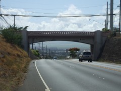 | Ka'ahumanu Avenue-Naniloa Drive Overpass | 1.9 miles | 2008 |
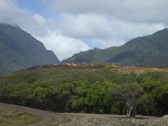 | Halekii-Pihana Heiau | 2.0 miles | 1985 |
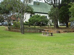 | Kaahumanu Church | 2.1 miles | 1975 |
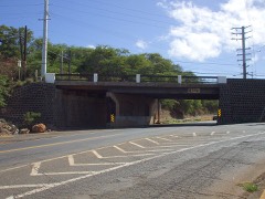 | Wai'ale Drive Bridge | 2.2 miles | 1998 |
| National Archives record | The nomination case file for reference 16000274 in Record Group 79. |
| Maui County | All 41 listed properties in this county. |