 Block
Hanalei, Hawaii
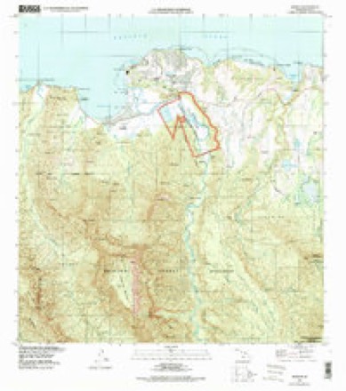
8 topographic sheets cover this place, the earliest surveyed in 1954 and the latest in 1996. It stands in the Hanalei census division. It lies in ZIP code area 96714. It stands on Waiʻoli Stream. The Survey maps it on the Hanalei quadrangle. 444 people lived here at the 2020 count.
Research this city
On record in Hanalei
Buildings and businesses the archive holds for this place. Each opens its own page, with the source record it came from.
On the National Register 5 records
 Hanalei Elementary Schoollisted 1990
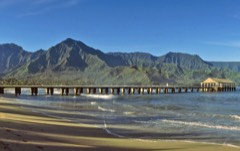 Hanalei Pierlisted 1979
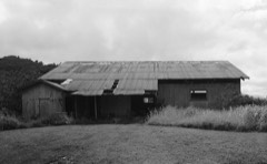 Haraguchi Rice Milllisted 1983
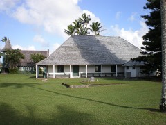 Waioli Mission Districtlisted 1973
 Albert Spencer Wilcox Beach Houselisted 1993
Population over time
2 figuresHanalei fell from 450 to 444 between 2010 and 2020. These are the recorded population figures Wikidata holds for this place, reached through the Geographic Names Information System number this page is keyed on rather than by name, so they belong to this place and not to another of the same name. Most are census counts, but not all are: an early figure may be a founding or settlement estimate, and an estimate published within five years of a census is left out. The change column is computed, and is left blank where more than 20 years separate a figure from the one before it, because a gap that long is not a change between two counts.
| Year | People | Change |
|---|---|---|
| 2010 | 450 | |
| 2020 | 444 | -6 (-1%) |
Topographic sheets covering this place
6 surveys from 8 printed sheetsMatched by testing this settlement's coordinate against the published boundary of every sheet in the United States Geological Survey's historical collection. Each opens the scanned sheet at the Survey.
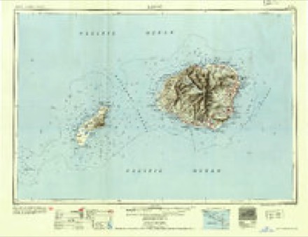
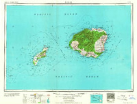
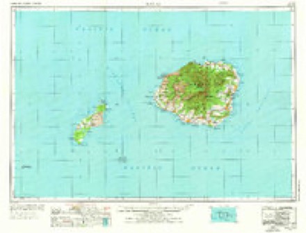
- 1954 USGS Kauai quadrangle1:250000
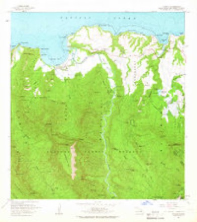
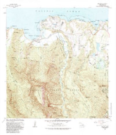
- 1963 USGS Hanalei quadrangle1:24000, 2 printings
- 1967 USGS Kauai quadrangle1:250000
- 1970 USGS Kauai quadrangle1:250000, 2 printings
- 1983 USGS Hanalei quadrangle1:24000
- 1996 USGS Hanalei quadrangle1:24000
Fires near this place
60 since 2002Regional context, not property-specific evidence. The federal wildfire occurrence database lists 60 fires within 5 miles of Hanalei between 2002 and 2017, burning about 82 acres in total. None started naturally. None was recorded as arson. Distance is straight-line from the map coordinates, so a fire counted here may appear on a neighbouring settlement's page as well.
| Reported cause | Fires |
|---|---|
| Missing data/not specified/undetermined | 60 |
The most recent of them, most recent first, with the day each was reported and the service that recorded it.
| Date | Cause | Size | Reported by | Name on the report |
|---|---|---|---|---|
| 7 September 2007 | Missing data/not specified/undetermined | under an acre | County of Kaua'i | not named |
| 3 September 2010 | Missing data/not specified/undetermined | under an acre | County of Kaua'i | not named |
| 26 September 2017 | Missing data/not specified/undetermined | 19 acres | State of Hawaii | HAENA STATE PARK FIRE |
| 23 September 2007 | Missing data/not specified/undetermined | under an acre | County of Kaua'i | not named |
| 20 September 2002 | Missing data/not specified/undetermined | under an acre | State of Hawaii | not named |
| 2 September 2006 | Missing data/not specified/undetermined | under an acre | County of Kaua'i | not named |
| 16 September 2007 | Missing data/not specified/undetermined | under an acre | County of Kaua'i | not named |
| 5 August 2010 | Missing data/not specified/undetermined | under an acre | County of Kaua'i | not named |
Settlements close enough to share some of these fires:
Mines and quarries near this place
1 within 5 milesRegional context, not property-specific evidence. The federal mineral resources record lists 1 working within 5 miles of Hanalei: 1 prospect. None of them still produces. What was taken out: Aluminum, Phosphorus-Phosphates, Iron, Silica, Titanium, Water, Free. Distance is straight-line from the map coordinates, so a quarry counted here may appear on a neighbouring settlement's page as well.
| Where | Site | Commodity | Status | Recorded |
|---|---|---|---|---|
| Northeast Kauai Deposit | Aluminum, Phosphorus-Phosphates, Iron, Silica, Titanium, Water, Free | Prospect | 1949 |
Storms near this place
60 of 100 shownRegional context, not property-specific evidence. The National Weather Service names Hanalei in 100 storm reports between 1996 and 2022: 46 heavy rain, 30 flash flood, 18 flood, 6 debris flow. The reports record 7 deaths. Each account below is quoted exactly as the forecast office filed it, from the NOAA Storm Events Database, and each date opens the federal record of that event.
| When | Event | Place named | Harm | What the report says |
|---|---|---|---|---|
| March 2006 | Flash Flood | Hanalei | 7 killed | no account filed |
| April 2018 | Flash Flood | Hanalei | $17,600,000 | In northern Kauai, Kuhio Highway was closed in Hanalei near the Hanalei Bridge due to flooding as of 1900 HST. Two homes were destroyed on Wainiha Powerhouse Road in Wainiha as of 2000 HST, and at the same time the roadway itself was washed out. At 0130 HST on the 15th, multiple people became trapped in their homes between Hanalei and Haena. Around 0400 HST, guests in the Hanalei Colony Resort in Haena had been moved to the second floor due to rising water. And at 0400 HST, water as high as 8 feet was covering Kuhio Highway in Hanalei and other areas, including submerging many vehicles. Small hail was reported by a member of the public at 0600 HST in Wailua in the eastern part of Kauai. |
| March 2021 | Debris Flow | Hanalei | $3,900,000 | Rocks and soil caused the closure of one lane of Kuhio Highway at mile marker 4.5, near Waikoko on Kauai's north shore. |
| October 2022 | Heavy Rain | Hanalei | - | Local stream gauges recorded some initial rises in response to enhanced rainfall rates, but receded quickly without much impact as rains diminished quickly over the area. |
| February 2018 | Debris Flow | Hanalei | - | A debris flow occurred on the southbound lane of Kuhio Highway in northern Kauai between Waikoko Beach and Waipa Farmers Market. |
| February 2018 | Debris Flow | Hanalei | - | A debris flow occurred near Wainiha in northern Kauai along Kuhio Highway. When county workers tried to clear the debris, a larger flow occurred which then closed both lanes of the highway. |
| February 2018 | Debris Flow | Hanalei | - | A debris flow occurred near Wainiha in northern Kauai along Kuhio Highway. When county workers tried to clear the debris, a larger flow occurred which then closed both lanes of the highway. |
| March 2018 | Debris Flow | Hanalei | - | A debris flow covered part of Kuhio Highway near Lumahai in northern Kauai. |
| April 2018 | Flash Flood | Hanalei | - | Kuhio Highway was closed near Haena Beach Park and the Maniniholo Dry Cave due to deep water flowing over the roadway. |
| April 2018 | Debris Flow | Hanalei | - | Three landslides (debris flows) closed Kuhio Highway between Wainiha and Waikoko in northern Kauai. |
| April 2018 | Flash Flood | Hanalei | - | Kuhio Highway was once again closed due to flooding near Haena Beach Park. |
| March 2012 | Flash Flood | Hanalei | - | Kuhio Highway closed near Haena Beach Park due to flooding. |
| March 2012 | Flash Flood | Hanalei | - | Debris flow blocking both lanes of Kuhio Highway. |
| January 2011 | Flash Flood | Hanalei | - | Flooding rains closed Kuhio Highway for a time near Haena at Limahuli Valley in northwest Kauai. |
| February 2008 | Flash Flood | Hanalei | - | Flooding closed the Wainiha Bridge in the northern part of Kauai. |
| November 2007 | Flash Flood | Hanalei | - | Heavy rain in the northern part of Kauai caused the Hanalei River to rise and flood the Hanalei Bridge along Kuhio Highway. Traffic was stopped for a time while the waters receded. |
| February 2007 | Heavy Rain | Hanalei | - | Heavy showers over northern and eastern parts of Kauai produced small stream and drainage ditch flooding, and ponding on roadways. No serious property damage or injuries were reported.| |
| February 2007 | Flash Flood | Hanalei | - | Heavy rain caused the Hanalei River to overflow and flood the roadway across the Hanalei Bridge. That portion of Kuhio Highway was closed until the water subsided. There were no reports of significant property damage or injuries.| |
| April 2006 | Flash Flood | Hanalei | - | The Hanalei Bridge, part of Kuhio Highway in northern Kauai, was closed for a couple of hours as the Hanalei River overflowed its banks. Heavy rain and isolated thunderstorms were impacting the local area, and generated flash flooding conditions. No serious injuries or property damage were reported, however. |
| April 2006 | Heavy Rain | Hanalei | - | Northern and eastern areas of Kauai were affected by heavy showers and isolated thunderstorms. Many locales saw ponding on roadways, and small stream and drainage ditch flooding. However, there were no reports of significant injuries or property damage. |
| November 2006 | Heavy Rain | Hanalei | - | Heavy showers and isolated thunderstorms over the eastern half of Kauai produced small stream and drainage ditch flooding, and ponding on roadways. There were no reports of significant property damage or injuries.| |
| November 2006 | Heavy Rain | Hanalei | - | Heavy showers that moved across the eastern half of Kauai caused small stream and drainage ditch flooding, and ponding of roadways. No serious injuries or property damage were reported. |
| November 2006 | Flash Flood | Hanalei | - | Heavy showers and isolated thunderstorms impacted the eastern half of Kauai. The rainfall was heavy enough to flood Kuhio Highway at the Hanalei Bridge, about 1 mile east of Hanalei town. The roadway was closed for a time because of the deep water. There were no reports of serious property damage or injuries. |
| March 2004 | Heavy Rain | Hanalei | - | Heavy showers caused ponding of roadways, and small stream and drainage ditch flooding over northern and eastern parts of the Garden Isle of Kauai. No serious injuries or property damage were reported. |
| January 1997 | Flood | Hanalei | - | 2.28 inches of rain in three hours at Kokee was representative of heavy showers over north central Kauai. Saturated soils increased runoff from the rainfall, flooding some roadways in the Hanalei area. |
| January 1997 | Flood | Hanalei | - | Heavy showers caused streams to rise over north and northeast parts of the island. The Hanalei Bridge was closed and road ponding occurred along the east side of the island to Lihue. |
| January 1997 | Flood | Hanalei | - | Keapona and Hanalei Bridges closed. Roads ponded and the Waiole Stream overflowed causing minor flooding. |
| January 2021 | Heavy Rain | Hanalei | - | no account filed |
| May 2020 | Heavy Rain | Hanalei | - | no account filed |
| January 2020 | Heavy Rain | Hanalei | - | no account filed |
| November 2020 | Heavy Rain | Hanalei | - | no account filed |
| November 2020 | Heavy Rain | Hanalei | - | no account filed |
| February 2019 | Heavy Rain | Hanalei | - | no account filed |
| August 2019 | Heavy Rain | Hanalei | - | no account filed |
| February 2018 | Heavy Rain | Hanalei | - | no account filed |
| April 2018 | Heavy Rain | Hanalei | - | no account filed |
| April 2016 | Heavy Rain | Hanalei | - | no account filed |
| August 2016 | Heavy Rain | Hanalei | - | no account filed |
| March 2015 | Heavy Rain | Hanalei | - | no account filed |
| February 2014 | Heavy Rain | Hanalei | - | no account filed |
| June 2014 | Heavy Rain | Hanalei | - | no account filed |
| November 2013 | Heavy Rain | Hanalei | - | no account filed |
| November 2013 | Heavy Rain | Hanalei | - | no account filed |
| March 2011 | Heavy Rain | Hanalei | - | no account filed |
| March 2011 | Heavy Rain | Hanalei | - | no account filed |
| December 2010 | Heavy Rain | Hanalei | - | no account filed |
| April 2009 | Heavy Rain | Hanalei | - | no account filed |
| August 2009 | Heavy Rain | Hanalei | - | no account filed |
| August 2009 | Heavy Rain | Hanalei | - | no account filed |
| March 2009 | Heavy Rain | Hanalei | - | no account filed |
| January 2006 | Heavy Rain | Hanalei | - | no account filed |
| February 2006 | Heavy Rain | Hanalei | - | no account filed |
| February 2006 | Flash Flood | Hanalei | - | no account filed |
| March 2006 | Flash Flood | Hanalei | - | no account filed |
| March 2006 | Flash Flood | Hanalei | - | no account filed |
| March 2006 | Flash Flood | Hanalei | - | no account filed |
| March 2006 | Flash Flood | Hanalei | - | no account filed |
| February 2006 | Heavy Rain | Hanalei | - | no account filed |
| February 2006 | Heavy Rain | Hanalei | - | no account filed |
| August 2006 | Flash Flood | Hanalei | - | no account filed |
Nearest settlements
The eight closest, with where each one stands in the county. Distances are straight-line, computed from the Geographic Names Information System coordinates.
| Map | Place | Distance | Sheets |
|---|---|---|---|
| Puupehu (historical) | 1.5 miles | 8 | |
| Princeville | 1.7 miles | 8 | |
| Wainiha | 2.2 miles | 7 | |
| Hanalei Homesteads | 2.2 miles | 8 | |
| Halehomaha | 2.8 miles | 7 | |
| Hāʻena | 3.4 miles | 7 | |
| Kalihi Wai | 4.0 miles | 8 | |
| Kīlauea | 5.1 miles | 9 |
Elsewhere
Matched on this settlement's Geographic Names Information System number rather than its name, so it cannot be a different place of the same name in another state.
| Wikipedia article on Hanalei | An encyclopaedic summary. Its text is share-alike, so it is linked here rather than copied. |
| Wikidata item Q2638406 | The structured record the population and elevation above come from. Public domain (CC0). |
Provenance
This settlement is recorded in the Geographic Names Information System as feature 359039. The sheet list is computed by point-in-boundary test against the United States Geological Survey's historical topographic inventory. Both are works of the United States government and carry no copyright under 17 U.S.C. 105.
Wildfire. Short, Karen C. 2022. Spatial wildfire occurrence data for the United States, 1992-2020 [FPA_FOD_20221014]. 6th Edition. Fort Collins, CO: Forest Service Research Data Archive. https://doi.org/10.2737/RDS-2013-0009.6 Collected with United States Government funding and usable without additional permissions or fees.
Mines and quarries. USGS Mineral Resources Data System (MRDS) https://mrdata.usgs.gov/mrds/ A work of the United States government, no copyright under 17 U.S.C. 105.
Storms. NOAA National Centers for Environmental Information, Storm Events Database https://www.ncei.noaa.gov/stormevents/ A work of the United States government, no copyright under 17 U.S.C. 105. Narratives are quoted verbatim from the National Weather Service report and are not edited or summarised.