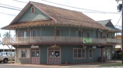
 Block
From the record
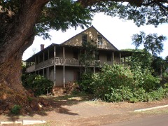
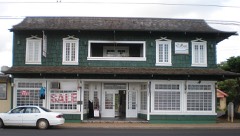
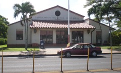
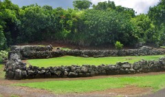
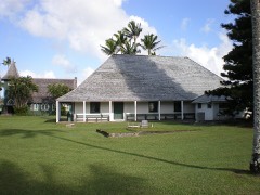
39 National Register listings published here, 4 of them National Historic Landmarks.
Sources: the National Register database, National Park Service
51 topographic sheets cover 64 settlements here, and 39 properties are on the National Register of Historic Places.
39 National Register listings published here, 4 of them National Historic Landmarks.
Sources: the National Register database, National Park Service
Every property in this county listed on the National Register of Historic Places, with the year it was listed and the federal nomination document.
Every wildfire the federal occurrence database records inside this county: 928 of them, burning about 11,552 acres. None started naturally and 1 was recorded as arson. Each settlement page carries the fires within five miles of it.
| Reported cause | Fires |
|---|---|
| Missing data/not specified/undetermined | 919 |
| Recreation and ceremony | 3 |
| Equipment and vehicle use | 2 |
| Railroad operations and maintenance | 1 |
| Debris and open burning | 1 |
| Arson/incendiarism | 1 |
| Fireworks | 1 |
The five largest, by the area the report gives. None of them was recorded as arson.
| Date | Cause | Size | Reported by | Name on the report |
|---|---|---|---|---|
| 16 August 2012 | Missing data/not specified/undetermined | 3,000 acres | County of Hawai'i | POKI'I RIDGE |
| 16 June 2019 | Missing data/not specified/undetermined | 2,150 acres | State of Hawaii | POKII RIDGE 2019 FIRE |
| 15 May 2017 | Recreation and ceremony | 750 acres | State of Hawaii | WAIMEA HEIGHTS 2017 FIRE |
| 25 June 2012 | Missing data/not specified/undetermined | 652 acres | State of Hawaii | HIKIMOE12 |
| 19 July 2003 | Missing data/not specified/undetermined | 640 acres | State of Hawaii | not named |
| 21 August 2005 | Missing data/not specified/undetermined | 500 acres | State of Hawaii | not named |
| 2 September 2001 | Missing data/not specified/undetermined | 500 acres | State of Hawaii | not named |
| 30 June 2007 | Missing data/not specified/undetermined | 300 acres | State of Hawaii | not named |
Every settlement page carries the fires within five miles of it - see the settlement index below.
The NOAA Storm Events Database holds 550 reports for this county, causing 10 deaths, 1 injury and about $97,686,000 in recorded property damage. Each settlement page carries the reports that name it.
| Kind of event | Reports |
|---|---|
| Heavy Rain | 305 |
| Flash Flood | 150 |
| Flood | 52 |
| Thunderstorm Wind | 11 |
| Debris Flow | 8 |
| Funnel Cloud | 7 |
| Tornado | 6 |
| Wildfire | 4 |
| Lightning | 4 |
| Waterspout | 2 |
| Hail | 1 |
The most serious of them, by death, then injury, then recorded damage. The accounts are quoted exactly as the forecast office filed them.
| When | Event | Place named | Harm | What the report says |
|---|---|---|---|---|
| March 2006 | Flash Flood | Hanalei | 7 killed | no account filed |
| August 2018 | Flash Flood | Princeville | 1 killed, $1,500,000 | Flooding waters on Kuhio Highway closed the roadway near the Hanalei Bridge in the northern part of Kauai. One fatality occurred when a man jumped into the swollen Waikomo Stream to try to save a dog. |
| December 2016 | Flash Flood | Wailua | 1 killed | Flash flooding at a stream near the Wailua River on Kauai swept a woman away to her death, though others in the kayak and hiking tour group managed to get to safety. |
| February 2013 | Flood | Na Pali Coast Sp | 1 killed | One of the approximately 50 hikers stranded on the Na Pali Coast on Kauai was swept into the swollen Hanakapiai Stream near Hanakapiai Beach. The body was recovered at 8:30 AM the next morning, 2/22/13. |
| November 2019 | Flash Flood | Princeville | 1 hurt | Kuhio highway was closed near the Hanalei Bridge due to water overflowing the Hanalei River. A bit later, Kuhio Highway became impassable as the Wainiha River overflowed its banks at the Twin Bridges in Wainiha. A woman was swept away by the flood waters in that area, but she was rescued by the Kauai Fire Department. |
| March 2020 | Flash Flood | Princeville | $30,600,000 | Kuhio Highway was also closed near the Hanalei Bridge in northern Kauai as the Hanalei River overflowed its banks along the roadway. Later in the morning around 04:30 HST after heavy downpours, Kuhio Highway was closed in Wailua at the Wailua River in windward Kauai as debris piled up against the bridge crossing the waterway. Some homes and businesses in the area were also affected by flooding waters. There were no reports of significant injuries. |
| March 2021 | Flash Flood | Princeville | $30,100,000 | Heavy rain caused the Hanalei River to overflow near the Hanalei Bridge, which then closed Kuhio Highway in that area. Other areas in northern Kauai were affected by downpours that caused debris flows unto roadways, near Princeville, Kilauea, and Wailoko. Other areas that had problems were near Lihue at Niumalu and Hulemalu roads, and in Kapaa where the Keapana Bridge became impassable. |
| April 2018 | Flash Flood | Hanalei | $17,600,000 | In northern Kauai, Kuhio Highway was closed in Hanalei near the Hanalei Bridge due to flooding as of 1900 HST. Two homes were destroyed on Wainiha Powerhouse Road in Wainiha as of 2000 HST, and at the same time the roadway itself was washed out. At 0130 HST on the 15th, multiple people became trapped in their homes between Hanalei and Haena. Around 0400 HST, guests in the Hanalei Colony Resort in Haena had been moved to the second floor due to rising water. And at 0400 HST, water as high as 8 feet was covering Kuhio Highway in Hanalei and other areas, including submerging many vehicles. Small hail was reported by a member of the public at 0600 HST in Wailua in the eastern part of Kauai. |
| April 2024 | Flash Flood | Wailua | $7,000,000 | Emergency managers reported flash flooding along with multiple evacuations in the Wailua area. Additionally a large crane at the Wailua River was leaning on a power line and blocking a road. Several roads were impassable due to flooding. Wailua Bridge southbound lane was closed due to flash flooding. |
| April 2024 | Flash Flood | Lawai | $6,500,000 | Multiple Roads in Koloa were impassable and closed due to flooding which was caused by the heavy rainfall. A small landslide was reported near Piko Road. Additionally, Poipu Road and Koloa Road were flooded and water entered storefront properties. There were several evacuations in the area. |
| March 2021 | Debris Flow | Hanalei | $3,900,000 | Rocks and soil caused the closure of one lane of Kuhio Highway at mile marker 4.5, near Waikoko on Kauai's north shore. |
| December 1967 | Tornado | not stated | $250,000 | no account filed |
| January 2005 | Thunderstorm Wind | Kalaheo | $100,000 | no account filed |
| March 2002 | Tornado (F0) | Anahola | $60,000 | no account filed |
| January 1996 | Thunderstorm Wind | West Kauai | $40,000 | no account filed |
| November 1995 | Thunderstorm Wind | Kauai HIZ001 | $15,000 | Thunderstorm winds tore off part of the roof of the Nawiliwili Small Boat Harbor office. Trees and powerlines were blown down over parts of south and east Kauai. |
| August 2017 | Lightning | Kalihiwai | $10,000 | Power outage in Kilauea after a transformer was struck by lightning. |
| January 1997 | Thunderstorm Wind | Kekaha | $10,000 | no account filed |
| April 2024 | Thunderstorm Wind | Lihue | $1,000 | Halehaka Road was closed due to a downed tree. |
| April 2026 | Flash Flood | Na Pali Coast Sp | - | Water was reported on the Hanalei Bridge on Kuhio Highway due to heavy rain. |
| February 2026 | Flash Flood | Princeville | - | Kauai Police shut down Kuhio Highway near the Hanalei River Bridge due to rising water and flooding. |
| July 2025 | Flash Flood | Na Pali Coast Sp | - | The Kauai Emergency Management Agency reported that a large amount of water inundated Kuhio Highway at the Hanalei Bridge. Flooding was also reported near the mouth of Wailua River. |
| April 2024 | Flash Flood | Princeville | - | Kuhio Highway was closed in both directions at the Hanalei Bridge. |
| April 2024 | Flash Flood | Kaumakani | - | Flooding was reported for 100 yards in the vicinity of Kaumakani/Pakala area. |
| April 2024 | Flash Flood | Kapaa | - | Olohena Road was closed near the solar farm due to flooding and a landslide. |
| April 2024 | Flash Flood | Lihue | - | Hulemalu Road near Alekoko Menehune Fishpond was closed due to fallen trees and boulders. |
| December 2024 | Funnel Cloud | Hanamaulu | - | An employee at the NWS Data Collection Office at Lihue Airport and an observer at the FAA tower reported a funnel cloud. |
| February 2023 | Flash Flood | Princeville | - | Kuhio Highway was closed at the Hanalei Bridge around 8:10am due to water across the road. Later that morning Hauaala Road was closed at the Keapana Bridge due to flooding in Kapaa Stream. |
| February 2023 | Flash Flood | Wailua Homesteads | - | Maalo Road was closed beginning at 2:00pm near Wailua Falls Lookout due to flash flooding. Additionally, flash flooding also forced the closure of the cement bridge near Kawaihau. |
| February 2023 | Flash Flood | Princeville | - | Kuhio Highway near the Hanalei Bridge was closed due to flooding. |
| January 2023 | Flash Flood | Princeville | - | Kuhio Highway was closed near the Hanalei Bridge. |
| January 2023 | Flash Flood | Princeville | - | Kuhio Highway was closed at the Hanalei River Bridge due to flooding. |
| March 2023 | Flash Flood | Poipu | - | Emergency management reported vehicles were stranded on Lawai and Kua Roads. |
| December 2023 | Flood | Princeville | - | A rapid rise in stream and river levels prompted the closure of Kuhio Highway at Hanalei Bridge on the Island of Kauai. |
| December 2023 | Flood | Princeville | - | Kuhio highway was closed at Hanalei bridge due to water over the road. |
| January 2022 | Flash Flood | Princeville | - | Downpours caused the Hanalei River to overflow onto Kuhio Highway near the Hanalei Bridge in the northern part of Kauai. |
| October 2022 | Heavy Rain | Hanalei | - | Local stream gauges recorded some initial rises in response to enhanced rainfall rates, but receded quickly without much impact as rains diminished quickly over the area. |
| March 2022 | Flash Flood | Princeville | - | Kuhio Highway closed near the Hanalei Bridge as the Hanalei River overflowed. |
| December 2022 | Thunderstorm Wind | Waimea | - | Emergency management reported widespread power outages due to thunderstorm wind gusts. |
| March 2021 | Flash Flood | Princeville | - | Heavy rain caused the Hanalei River to overflow onto Kuhio Highway near the Hanalei Bridge in the northern part of Kauai. |
| March 2021 | Flash Flood | Princeville | - | The overflowing Hanalei River flooded onto Kuhio Highway near the Hanalei Bridge, closing the roadway for a time. |
| January 2021 | Flash Flood | Princeville | - | Flooding caused a closure of Kuhio Highway near the Hanalei Bridge. |
| February 2021 | Flash Flood | Princeville | - | Kuhio Highway was closed near the Hanalei Bridge due to flooding from the Hanalei River. Also, a debris flow occurred near Lumahai that partially closed Kuhio Highway in the area, and Wailua Marina was inundated by flood waters. |
| February 2021 | Flash Flood | Princeville | - | Kuhio Highway was closed near the Hanalei Bridge due to flooding along the Hanalei River. |
| March 2021 | Heavy Rain | Kaunalewa | - | County officials advised homeless individuals to voluntarily evacuate the Anini Beach Park in the northern part of Kauai because of heavy precipitation in the area. |
| March 2021 | Flash Flood | Koloa | - | Multiple road closures occurred in Koloa and Kalaheo in the southern portion of Kauai because of flooding. |
| December 2021 | Flash Flood | Princeville | - | Kuhio Highway was closed near the Hanalei Bridge due to flooding across the roadway in the northern section of Kauai. |
| March 2020 | Flash Flood | Princeville | - | Kuhio Highway near the Hanalei Bridge became impassable near Hanalei due to the Hanalei River overflowing its banks. Also, part of Route 50, Kaumualii Highway, near Waimea was closed around 0735 HST on the 17th, and other roadways were closed in Waimea, because of flooding waters from heavy rainfall on Kauai. |
| March 2020 | Flash Flood | Princeville | - | Kuhio Highway was closed near the Hanalei Bridge in Hanalei because the Hanalei River overflowed its banks due to heavy rain. |
| February 2020 | Flash Flood | Princeville | - | With heavy rain falling, the Hanalei River overflowed its banks near the Hanalei Bridge along Kuhio Highway. |
| November 2020 | Flash Flood | Princeville | - | Kuhio Highway was closed near the Hanalei Bridge due to the Hanalei River overflowing its banks. |
| October 2019 | Flash Flood | Princeville | - | With heavy rain, the Hanalei River overflowed onto Kuhio Highway near the Hanalei Bridge in the northern part of Kauai. |
| August 2019 | Flash Flood | Anahola | - | Flooding prevented access to several homes in Anahola on the Garden Isle of Kauai. More problems occurred just north of Kapaa as water began overflowing Keapana Bridge. |
| September 2019 | Flash Flood | Princeville | - | Kuhio Highway was closed near the Hanalei Bridge in the northern part of Kauai due to flooding. |
| December 2019 | Flash Flood | Princeville | - | Kuhio Highway was closed near the Hanalei Bridge due to the Hanalei River overflowing its banks. |
| February 2018 | Debris Flow | Hanalei | - | A debris flow occurred on the southbound lane of Kuhio Highway in northern Kauai between Waikoko Beach and Waipa Farmers Market. |
| February 2018 | Debris Flow | Hanalei | - | A debris flow occurred near Wainiha in northern Kauai along Kuhio Highway. When county workers tried to clear the debris, a larger flow occurred which then closed both lanes of the highway. |
| February 2018 | Debris Flow | Hanalei | - | A debris flow occurred near Wainiha in northern Kauai along Kuhio Highway. When county workers tried to clear the debris, a larger flow occurred which then closed both lanes of the highway. |
| February 2018 | Flash Flood | Princeville | - | Heavy rain caused the Hanalei River to overflow and spill onto Kuhio Highway near the Hanalei Bridge over the northern part of Kauai. |
| February 2018 | Flash Flood | Princeville | - | After a period of heavy rain, the Hanalei River overflowed its banks and flooded Kuhio Highway near the Hanalei Bridge in the northern part of Kauai. |
The Survey's mineral resources record lists 14 workings inside this county. 2 still produce and 12 are closed or unrecorded. Each settlement page carries the workings within five miles of it.
| Commodity | Workings |
|---|---|
| Aluminum | 4 |
| Stone, Crushed/Broken | 2 |
| Pumice | 2 |
| Iron, Phosphorus-Phosphates, Titanium, Water, Free, Silica | 2 |
| Stone | 2 |
| Titanium, Metal, Aluminum | 1 |
| Titanium, Metal | 1 |
| Phosphorus-Phosphates, Iron, Silica, Titanium, Water, Free | 1 |
| Calcium | 1 |
| Salt | 1 |
The least common of them first, because a county's hundredth gravel pit says nothing its first ten did not.
| Where | Site | Commodity | Status | Recorded |
|---|---|---|---|---|
| Kaneha Reservoirs Deposit | Titanium, Metal | Occurrence | ||
| Kauai Bauxite Deposit | Titanium, Metal, Aluminum | Occurrence | Bauxite, Ilmenite | |
| Mahaulepu Quarry and Mill | Calcium | Producer | ||
| Northeast Kauai Deposit | Aluminum, Phosphorus-Phosphates, Iron, Silica, Titanium, Water, Free | Prospect | 1949 | |
| Unnamed Salt | Salt | Unknown | ||
| 45 Hm Quarry | Stone, Crushed/Broken | Past Producer | ||
| Bluestone Quarry and Mill | Stone | Producer | ||
| Chang Mill | Stone | Past Producer | ||
| Cinder Pit | Pumice | Past Producer | ||
| East Central Kauai Deposit | Aluminum, Iron, Phosphorus-Phosphates, Titanium, Water, Free, Silica | Prospect | 1949 | |
| Kapaia Valley Quarry | Stone, Crushed/Broken | Past Producer | ||
| Kapeku Cinder Pit | Pumice | Past Producer | ||
| Kauai Deposits | Aluminum, Iron, Phosphorus-Phosphates, Titanium, Water, Free, Silica | Prospect | 1949 | |
| Hawaii Bauxite | Aluminum | Occurrence | Bauxite, Gibbsite |
Named settlements recorded in the Geographic Names Information System, each with the topographic sheets covering it. Villages, hamlets and abandoned places alike. Each is shown with the nearest named watercourse or landform and the survey quadrangle it falls on.
Wailua-Anahola census division · 96703 · Near Puu Alanakau · Anahola quadrangle
9 sheets, 1954 to 1996
Hanalei census division · 96714 · Near Wainiha Valley · Haena quadrangle
7 sheets, 1954 to 1983
Hanalei census division · 96714 · On Waiʻoli Stream · Hanalei quadrangle
8 sheets, 1954 to 1996
Hanalei census division · 96714 · Near Kaukaʻōpua · Hanalei quadrangle
8 sheets, 1954 to 1996
Puhi-Hanamaulu census division · 96766 · Near Kalepa · Kapaa quadrangle
10 sheets, 1954 to 1996
Kaumakani-Hanapepe census division · 96716 · Near Kukamahu Gulch · Hanapepe quadrangle
10 sheets, 1954 to 1996
Kaumakani-Hanapepe census division · 96716 · On Hiloa Stream · Hanapepe quadrangle
10 sheets, 1954 to 1996
Kaumakani-Hanapepe census division · 96769 · Near Kaawanui Gulch · Hanapepe quadrangle
10 sheets, 1954 to 1996
Hanalei census division · 96754 · On Kalihi Wai River · Hanalei quadrangle
8 sheets, 1954 to 1996
Eleele-Kalaheo census division · 96741 · Near Papapaholahola · Koloa quadrangle
9 sheets, 1954 to 1983
Niihau census division · Near Kāwaʻewaʻe · Niihau South quadrangle
6 sheets, 1954 to 1989
No longer a settlement
Wailua-Anahola census division · 96746 · Near Puu Lawii · Kapaa quadrangle
10 sheets, 1954 to 1996
Puhi-Hanamaulu census division · 96766 · Near Kalepa · Kapaa quadrangle
10 sheets, 1954 to 1996
Kaumakani-Hanapepe census division · 96769 · Near Puu o Papai · Hanapepe quadrangle
10 sheets, 1954 to 1996
No longer a settlement
Kaumakani-Hanapepe census division · 96769 · On Aʻakukui Stream · Hanapepe quadrangle
10 sheets, 1954 to 1996
Kaumakani-Hanapepe census division · 96747 · Near Puu o Papai · Hanapepe quadrangle
10 sheets, 1954 to 1996
Kekaha-Waimea census division · Near Kuapaʻa Valley · Kekaha quadrangle
7 sheets, 1954 to 1983
No longer a settlement
Kapaa census division · 96746 · On Keālia Stream · Kapaa quadrangle
10 sheets, 1954 to 1996
Kekaha-Waimea census division · 96752 · Near Waiʻaka Valley · Kekaha OE S quadrangle
7 sheets, 1954 to 1983
Kaumakani-Hanapepe census division · 96769 · Near Waipao Valley · Hanapepe quadrangle
10 sheets, 1954 to 1996
Wailua-Anahola census division · 96746 · On Kapaʻa Stream · Kapaa quadrangle
10 sheets, 1954 to 1996
Niihau census division · Near Kuakamoku Rock · Niihau North OE W quadrangle
6 sheets, 1954 to 1989
Koloa-Poipu census division · 96756 · Near Puu Hi · Koloa quadrangle
9 sheets, 1954 to 1983
Koloa-Poipu census division · 96756 · On Waikomo Stream · Koloa quadrangle
9 sheets, 1954 to 1983
Wailua-Anahola census division · 96751 · On Kapaʻa Stream · Kapaa quadrangle
10 sheets, 1954 to 1996
Lihue census division · 96766 · On Nāwiliwili Stream · Lihue quadrangle
8 sheets, 1954 to 1983
Hanalei census division · 96754 · On Kaluamakua Stream · Anahola quadrangle
9 sheets, 1954 to 1996
Puhi-Hanamaulu census division · 96766 · On Puakukui Stream · Koloa quadrangle
9 sheets, 1954 to 1983
Koloa-Poipu census division · 96756 · On Pōʻeleʻele Stream · Koloa quadrangle
9 sheets, 1954 to 1983
Koloa-Poipu census division · 96741 · Near Kahuamoa · Koloa quadrangle
9 sheets, 1954 to 1983
Lihue census division · 96766 · On Nāwiliwili Stream · Lihue quadrangle
8 sheets, 1954 to 1983
Wailua-Anahola census division · 96703 · On Moloaʻa Stream · Anahola quadrangle
9 sheets, 1954 to 1996
Kekaha-Waimea census division · 96752 · Near Mana Plain · Kekaha quadrangle
7 sheets, 1954 to 1983
Puhi-Hanamaulu census division · 96766 · On Niumalu Flat · Lihue quadrangle
8 sheets, 1954 to 1983
Kaumakani-Hanapepe census division · Near Peamoa Valley · Hanapepe quadrangle
10 sheets, 1954 to 1996
No longer a settlement
Eleele-Kalaheo census division · 96705 · On Wahiawa Stream · Hanapepe quadrangle
10 sheets, 1954 to 1996
Lihue census division · 96766 · On Nāwiliwili Stream · Lihue quadrangle
8 sheets, 1954 to 1983
Wailua-Anahola census division · 96746 · Near Sleeping Giant · Kapaa quadrangle
10 sheets, 1954 to 1996
Kaumakani-Hanapepe census division · 96747 · Near Puu o Papai · Hanapepe quadrangle
10 sheets, 1954 to 1996
Puhi-Hanamaulu census division · 96766 · On Waiahi Stream · Kapaa quadrangle
9 sheets, 1954 to 1991
Wailua-Anahola census division · 96746 · On Wailua River · Kapaa quadrangle
10 sheets, 1954 to 1996
Kekaha-Waimea census division · 96752 · Near Waipao Valley · Kekaha OE S quadrangle
7 sheets, 1954 to 1983
Eleele-Kalaheo census division · 96705 · On Hanapēpē River · Hanapepe quadrangle
10 sheets, 1954 to 1996
Koloa-Poipu census division · 96756 · Near Pihakekua · Koloa quadrangle
9 sheets, 1954 to 1983
Hanalei census division · 96722 · Near Hanalei Valley · Hanalei quadrangle
8 sheets, 1954 to 1996
Lihue census division · 96766 · On Halehaka Stream · Lihue quadrangle
8 sheets, 1954 to 1983
Puhi-Hanamaulu census division · 96766 · On Halehaka Stream · Lihue quadrangle
8 sheets, 1954 to 1983
Hanalei census division · 96722 · Near Hanalei Valley · Hanalei quadrangle
8 sheets, 1954 to 1996
No longer a settlement
Niihau census division · Near Kuakamoku Rock · Niihau North OE W quadrangle
7 sheets, 1954 to 1989
Kaumakani-Hanapepe census division · 96769 · Near Mahinauli Gulch · Hanapepe quadrangle
10 sheets, 1954 to 1996
Puhi-Hanamaulu census division · 96766 · On Halehaka Stream · Lihue quadrangle
8 sheets, 1954 to 1983
Lihue census division · 96766 · On Halehaka Stream · Lihue quadrangle
8 sheets, 1954 to 1983
Kekaha-Waimea census division · 96752 · On Waieli Drain · Kekaha quadrangle
7 sheets, 1954 to 1983
Wailua-Anahola census division · 96746 · On Wailua River · Kapaa quadrangle
10 sheets, 1954 to 1996
Wailua-Anahola census division · 96746 · On Kalama Stream · Kapaa quadrangle
10 sheets, 1954 to 1996
Wailua-Anahola census division · 96746 · On ʻŌpaekaʻa Stream · Kapaa quadrangle
10 sheets, 1954 to 1996
Kekaha-Waimea census division · 96796 · On Waimea River · Kekaha OE S quadrangle
7 sheets, 1954 to 1983
Hanalei census division · 96714 · In Wainiha Valley · Haena quadrangle
7 sheets, 1954 to 1983
Wailua-Anahola census division · 96746 · On Kaehulua Stream · Kapaa quadrangle
10 sheets, 1954 to 1996
Eleele-Kalaheo census division · 96705 · On Hanapēpē River · Hanapepe quadrangle
10 sheets, 1954 to 1996
Koloa-Poipu census division · 96756 · Near Puu o Hewa · Koloa quadrangle
9 sheets, 1954 to 1983
The vanished settlements of Kauai County: the places named above that are no longer on the map.