 Block
Kahuku, Hawaii
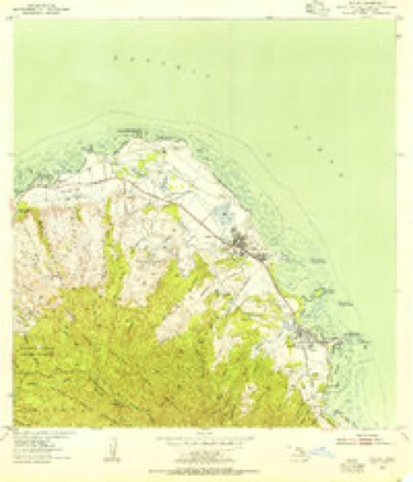
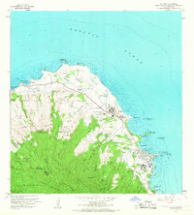
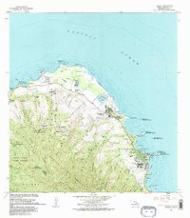
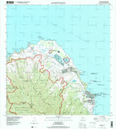
13 topographic sheets cover this place, the earliest surveyed in 1954 and the latest in 1998. It stands in the Koolauloa census division. It lies in ZIP code area 96731. It lies near Keaʻaulu Gulch. The Survey maps it on the Kahuku quadrangle. 2,852 people lived here at the 2020 count. It stands 15 feet above sea level.
Research this city
On record in Kahuku
Buildings and businesses the archive holds for this place. Each opens its own page, with the source record it came from.
On the National Register 1 record
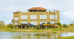 Marconi Wireless Telegraphy Stationlisted 2013
Population over time
2 figuresKahuku grew from 2,614 to 2,852 between 2010 and 2020. These are the recorded population figures Wikidata holds for this place, reached through the Geographic Names Information System number this page is keyed on rather than by name, so they belong to this place and not to another of the same name. Most are census counts, but not all are: an early figure may be a founding or settlement estimate, and an estimate published within five years of a census is left out. The change column is computed, and is left blank where more than 20 years separate a figure from the one before it, because a gap that long is not a change between two counts.
| Year | People | Change |
|---|---|---|
| 2010 | 2,614 | |
| 2020 | 2,852 | +238 (+9%) |
Topographic sheets covering this place
9 surveys from 13 printed sheetsMatched by testing this settlement's coordinate against the published boundary of every sheet in the United States Geological Survey's historical collection. Each opens the scanned sheet at the Survey.
- 1954 USGS Kahuku quadrangle1:24000
- 1954 USGS Oahu quadrangle1:250000
- 1961 USGS Oahu quadrangle1:250000
- 1965 USGS Kahuku quadrangle1:24000, 2 printings
- 1965 USGS Oahu quadrangle1:250000, 2 printings
- 1970 USGS Oahu quadrangle1:250000, 2 printings
- 1977 USGS Kahuku quadrangle1:24000
- 1983 USGS Kahuku quadrangle1:24000, 2 printings
- 1998 USGS Kahuku quadrangle1:24000
Fires near this place
129 since 1992Regional context, not property-specific evidence. The federal wildfire occurrence database lists 129 fires within 5 miles of Kahuku between 1992 and 2015, burning about 142 acres in total. None started naturally. None was recorded as arson. Distance is straight-line from the map coordinates, so a fire counted here may appear on a neighbouring settlement's page as well.
| Reported cause | Fires |
|---|---|
| Missing data/not specified/undetermined | 127 |
| Equipment and vehicle use | 2 |
The most recent of them, most recent first, with the day each was reported and the service that recorded it.
| Date | Cause | Size | Reported by | Name on the report |
|---|---|---|---|---|
| 8 September 2011 | Missing data/not specified/undetermined | under an acre | City and County of Honolulu | not named |
| 4 September 2006 | Missing data/not specified/undetermined | 1.0 acres | City and County of Honolulu | not named |
| 28 September 2009 | Missing data/not specified/undetermined | under an acre | City and County of Honolulu | not named |
| 28 September 2002 | Missing data/not specified/undetermined | 1.0 acres | City and County of Honolulu | not named |
| 28 September 2002 | Missing data/not specified/undetermined | 3.0 acres | City and County of Honolulu | not named |
| 23 September 2005 | Missing data/not specified/undetermined | under an acre | City and County of Honolulu | not named |
| 14 September 2002 | Missing data/not specified/undetermined | 2.0 acres | City and County of Honolulu | not named |
| 12 September 2008 | Missing data/not specified/undetermined | under an acre | City and County of Honolulu | not named |
Settlements close enough to share some of these fires:
Mines and quarries near this place
1 within 5 milesRegional context, not property-specific evidence. The federal mineral resources record lists 1 working within 5 miles of Kahuku: 1 producer. All of them still produce. What was taken out: Stone. Distance is straight-line from the map coordinates, so a quarry counted here may appear on a neighbouring settlement's page as well.
| Where | Site | Commodity | Status | Recorded |
|---|---|---|---|---|
| Laie Quarry | Stone | Producer |
Storms near this place
60 of 114 shownRegional context, not property-specific evidence. The National Weather Service names Kahuku in 114 storm reports between 2000 and 2026: 101 heavy rain, 9 flash flood, 2 flood, 1 waterspout. No death or injury is recorded in these reports. Each account below is quoted exactly as the forecast office filed it, from the NOAA Storm Events Database, and each date opens the federal record of that event.
| When | Event | Place named | Harm | What the report says |
|---|---|---|---|---|
| March 2026 | Flash Flood | Kahuku | $10,000,000 | Heavy rain fell over the Koolau mountain range in the middle to later half of the morning, then a thunderstorm developed and anchored itself over the mountains. This thunderstorm then produced a large amount of rain in a short time frame, quickly overwhelming Manoa Stream and sending a flood surge down towards Manoa Valley. Manoa marketplace had nearly 2 feet of water and parked cars were inundated. Homes in Manoa reported flooding and an excavation site quickly became overwhelmed with water and sent mud and debris down the road. The overflowing Manoa and Palolo Streams inundated the entire campus of Hokulani Elementary School in St. Louis Heights and students were evacuated. Large boulders and debris were observed across many roads in Manoa Valley and flooding was also observed across the upper portion of the University of Hawaii at Manoa campus. A home was also flooded in Laie. |
| February 2026 | Flash Flood | Kahuku | $10,000,000 | Heavy rain began falling over the Koolau mountain range early in the morning and became anchored through most of the day. Widespread flooding occurred over much of the Koolau Mountains and eastern areas of Oahu. The following event summary includes a list of impacts that the flooding caused. A man in Kaneohe reported forty inches of water in his backyard with twenty inches of water in his house along the Keeahala Stream. The Kokokahi Gymnasium was reportedly flooded according to the broadcast media. Flood waters reportedly inundated homes in the neighborhoods bordered by the Likelike and Kamehameha Highways downstream of the Hoomaluhia Botanical Gardens. A business was flooded on Kamehameha Highway at the confluence of Opaeula Stream and Helemano Stream. The Likelike off ramp from the H3 Kaneohe-bound was closed due to flooding, and cars were flooded up to their windows. As a result, residents had to be rescued from their vehicles. A family on Kaneohe Bay Drive reported that rapid flood waters washed away the stairs leading up to their home. According to the City and County of Honolulu, a wastewater spill at the Ahuimanu Preliminary Treatment Facility occurred due to heavy rainfall and resulting inflow and infiltration into the wastewater system. |
| November 2013 | Lightning | Kahuku | $2,000 | Lightning struck and felled a utility pole. |
| March 2012 | Flash Flood | Kahuku | - | Flooding waters were several feet deep in yards and on roads in Laie on Oahu. |
| December 2008 | Flash Flood | Kahuku | - | Otake Camp near Waialua was evacuated because of flooding, the Makaha Bridge was blocked by debris, homes were inundated in Waianae and Laie, and farm produce was damaged in the affected area. |
| April 2006 | Flash Flood | Kahuku | - | Heavy showers and isolated thunderstorms impacted a broad section of windward Oahu, producing small landslides and deep ponding on several roadways. The precipitation caused the Waikane Stream to overflow onto a stretch of Kamehameha Highway near the town of Waikane. This closed the roadway in that area for a time. Also, civil defense officials evacuated 12 families below the Kailua Reservoir as a precaution, fearing a breach in the dam. However, there were no serious injuries or property damage. |
| April 2006 | Heavy Rain | Kahuku | - | Small stream and drainage ditch flooding, along with ponding on roadways, occurred in windward sections of Oahu as heavy showers and isolated thunderstorms affected the area. No significant property damage or injuries were reported. |
| April 2006 | Heavy Rain | Kahuku | - | Heavy showers and isolated thunderstorms again pounded windward parts of Oahu; causing ponding on roadways, and small stream and drainage ditch flooding. No serious property damage or injuries were reported. |
| November 2006 | Heavy Rain | Kahuku | - | Heavy showers and thunderstorms caused ponding of roadways, and small stream and drainage ditch flooding in windward sections of Oahu. There were no reports of serious injuries or property damage. |
| March 2004 | Heavy Rain | Kahuku | - | Heavy showers produced small stream and drainage ditch flooding, and ponding of roadways in windward sections of Oahu. There were no reports of serious injuries or property damage. |
| May 2004 | Heavy Rain | Kahuku | - | Heavy showers and steady rain produced small stream and drainage ditch flooding and ponding of raodways in windward and central parts of the island of Oahu. This included communities from Kahuku to Mililani to Waimanalo. No serious property damage or injuries were reported. |
| March 2004 | Heavy Rain | Kahuku | - | Heavy showers caused small stream and drainage ditch flooding, and ponding of roadways in windward sections of Oahu. No serious injuries of property damage were reported. |
| April 2022 | Heavy Rain | Kahuku | - | no account filed |
| March 2021 | Heavy Rain | Kahuku | - | no account filed |
| February 2021 | Heavy Rain | Kahuku | - | no account filed |
| February 2021 | Heavy Rain | Kahuku | - | no account filed |
| February 2021 | Heavy Rain | Kahuku | - | no account filed |
| March 2020 | Heavy Rain | Kahuku | - | no account filed |
| April 2020 | Heavy Rain | Kahuku | - | no account filed |
| January 2020 | Heavy Rain | Kahuku | - | no account filed |
| November 2020 | Heavy Rain | Kahuku | - | no account filed |
| February 2019 | Heavy Rain | Kahuku | - | no account filed |
| September 2019 | Heavy Rain | Kahuku | - | no account filed |
| September 2019 | Heavy Rain | Kahuku | - | no account filed |
| November 2019 | Heavy Rain | Kahuku | - | no account filed |
| November 2019 | Heavy Rain | Kahuku | - | no account filed |
| November 2019 | Heavy Rain | Kahuku | - | no account filed |
| December 2018 | Heavy Rain | Kahuku | - | no account filed |
| August 2018 | Heavy Rain | Kahuku | - | no account filed |
| August 2018 | Heavy Rain | Kahuku | - | no account filed |
| November 2018 | Heavy Rain | Kahuku | - | no account filed |
| March 2017 | Heavy Rain | Kahuku | - | no account filed |
| August 2017 | Heavy Rain | Kahuku | - | no account filed |
| November 2017 | Heavy Rain | Kahuku | - | no account filed |
| November 2017 | Heavy Rain | Kahuku | - | no account filed |
| March 2016 | Heavy Rain | Kahuku | - | no account filed |
| July 2016 | Heavy Rain | Kahuku | - | no account filed |
| September 2015 | Heavy Rain | Kahuku | - | no account filed |
| September 2015 | Heavy Rain | Kahuku | - | no account filed |
| August 2015 | Heavy Rain | Kahuku | - | no account filed |
| March 2015 | Heavy Rain | Kahuku | - | no account filed |
| October 2015 | Heavy Rain | Kahuku | - | no account filed |
| October 2015 | Heavy Rain | Kahuku | - | no account filed |
| July 2015 | Heavy Rain | Kahuku | - | no account filed |
| August 2015 | Heavy Rain | Kahuku | - | no account filed |
| February 2014 | Heavy Rain | Kahuku | - | no account filed |
| February 2014 | Heavy Rain | Kahuku | - | no account filed |
| March 2014 | Heavy Rain | Kahuku | - | no account filed |
| October 2014 | Heavy Rain | Kahuku | - | no account filed |
| May 2014 | Heavy Rain | Kahuku | - | no account filed |
| May 2014 | Heavy Rain | Kahuku | - | no account filed |
| February 2013 | Heavy Rain | Kahuku | - | no account filed |
| January 2013 | Heavy Rain | Kahuku | - | no account filed |
| May 2013 | Heavy Rain | Kahuku | - | no account filed |
| May 2013 | Heavy Rain | Kahuku | - | no account filed |
| March 2013 | Heavy Rain | Kahuku | - | no account filed |
| May 2013 | Heavy Rain | Kahuku | - | no account filed |
| November 2013 | Heavy Rain | Kahuku | - | no account filed |
| October 2013 | Heavy Rain | Kahuku | - | no account filed |
| October 2013 | Heavy Rain | Kahuku | - | no account filed |
Nearest settlements
The eight closest, with where each one stands in the county. Distances are straight-line, computed from the Geographic Names Information System coordinates.
| Map | Place | Distance | Sheets |
|---|---|---|---|
| Marconi | 2.1 miles | 13 | |
| Lāʻie | 2.5 miles | 13 | |
| Kawela Bay | 3.1 miles | 13 | |
| Kawela | 3.5 miles | 13 | |
| Waialeʻe | 4.0 miles | 13 | |
| Hauʻula | 5.2 miles | 12 | |
| Sunset Beach | 5.2 miles | 13 | |
| Pūpūkea | 5.6 miles | 13 |
Elsewhere
Matched on this settlement's Geographic Names Information System number rather than its name, so it cannot be a different place of the same name in another state.
| Wikipedia article on Kahuku | An encyclopaedic summary. Its text is share-alike, so it is linked here rather than copied. |
| Wikidata item Q596007 | The structured record the population and elevation above come from. Public domain (CC0). |
Provenance
This settlement is recorded in the Geographic Names Information System as feature 359833. The sheet list is computed by point-in-boundary test against the United States Geological Survey's historical topographic inventory. Both are works of the United States government and carry no copyright under 17 U.S.C. 105.
Wildfire. Short, Karen C. 2022. Spatial wildfire occurrence data for the United States, 1992-2020 [FPA_FOD_20221014]. 6th Edition. Fort Collins, CO: Forest Service Research Data Archive. https://doi.org/10.2737/RDS-2013-0009.6 Collected with United States Government funding and usable without additional permissions or fees.
Mines and quarries. USGS Mineral Resources Data System (MRDS) https://mrdata.usgs.gov/mrds/ A work of the United States government, no copyright under 17 U.S.C. 105.
Storms. NOAA National Centers for Environmental Information, Storm Events Database https://www.ncei.noaa.gov/stormevents/ A work of the United States government, no copyright under 17 U.S.C. 105. Narratives are quoted verbatim from the National Weather Service report and are not edited or summarised.