 Block
From the record
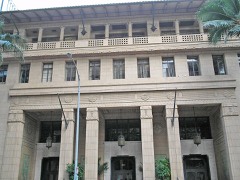
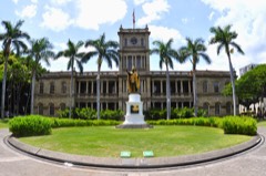
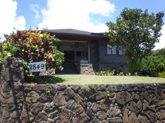
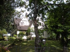
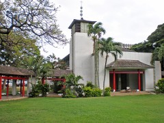
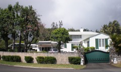
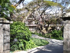
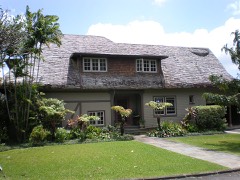
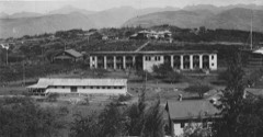
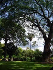
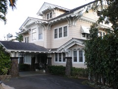
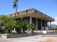
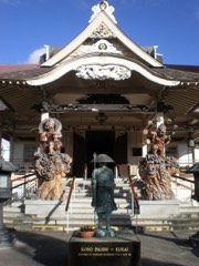
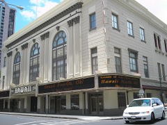
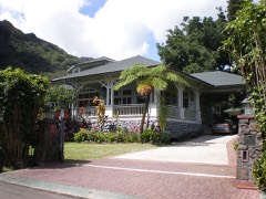
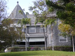
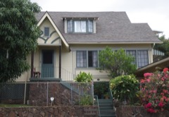
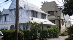
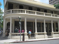
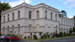
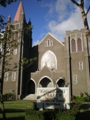
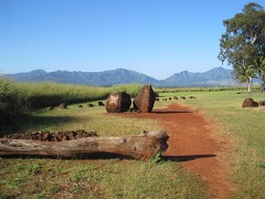
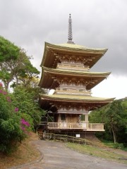
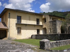
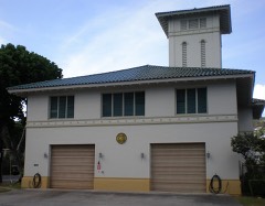
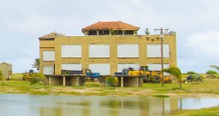
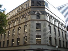
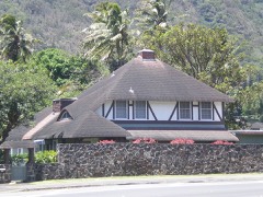
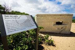
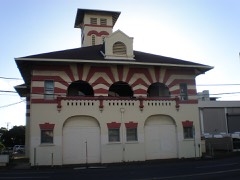
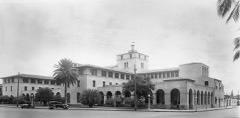
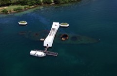
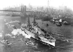
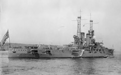
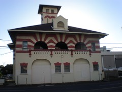
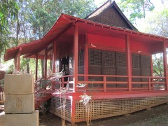
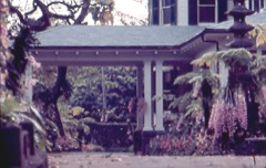
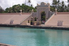
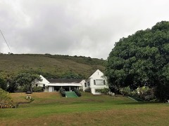
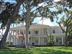
154 National Register listings published here, 16 of them National Historic Landmarks.
Sources: the National Register database, National Park Service
106 topographic sheets cover 134 settlements here, and 154 properties are on the National Register of Historic Places.
154 National Register listings published here, 16 of them National Historic Landmarks.
Sources: the National Register database, National Park Service
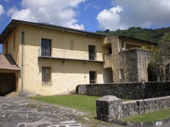
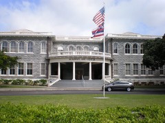
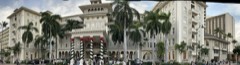
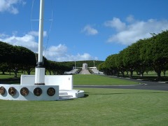
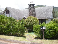
Every property in this county listed on the National Register of Historic Places, with the year it was listed and the federal nomination document.
Every wildfire the federal occurrence database records inside this county: 6,797 of them, burning about 52,404 acres. 1 started naturally and 3 were recorded as arson. Each settlement page carries the fires within five miles of it.
| Reported cause | Fires |
|---|---|
| Missing data/not specified/undetermined | 6788 |
| Arson/incendiarism | 3 |
| Railroad operations and maintenance | 2 |
| Equipment and vehicle use | 2 |
| Natural | 1 |
| Recreation and ceremony | 1 |
The five largest, by the area the report gives. None of them was recorded as arson.
| Date | Cause | Size | Reported by | Name on the report |
|---|---|---|---|---|
| 12 August 2007 | Missing data/not specified/undetermined | 7,000 acres | City and County of Honolulu | not named |
| 14 June 2005 | Missing data/not specified/undetermined | 2,820 acres | State of Hawaii | not named |
| 14 August 2005 | Missing data/not specified/undetermined | 2,800 acres | State of Hawaii | not named |
| 22 July 2003 | Missing data/not specified/undetermined | 2,100 acres | State of Hawaii | not named |
| 24 July 2002 | Missing data/not specified/undetermined | 1,700 acres | State of Hawaii | not named |
| 4 August 2018 | Missing data/not specified/undetermined | 1,700 acres | State of Hawaii | WAIANAE KAI BABY GIRL |
| 10 May 2005 | Missing data/not specified/undetermined | 1,508 acres | State of Hawaii | not named |
| 24 August 1998 | Missing data/not specified/undetermined | 1,500 acres | State of Hawaii | not named |
Every settlement page carries the fires within five miles of it - see the settlement index below.
The NOAA Storm Events Database holds 944 reports for this county, causing no deaths, 17 injuries and about $1,107,932,000 in recorded property damage. Each settlement page carries the reports that name it.
| Kind of event | Reports |
|---|---|
| Heavy Rain | 571 |
| Flash Flood | 150 |
| Flood | 78 |
| Funnel Cloud | 37 |
| Wildfire | 29 |
| Tornado | 20 |
| Thunderstorm Wind | 13 |
| Waterspout | 13 |
| Lightning | 11 |
| Debris Flow | 11 |
| Hail | 7 |
| Dust Devil | 3 |
| High Surf | 1 |
The most serious of them, by death, then injury, then recorded damage. The accounts are quoted exactly as the forecast office filed them.
| When | Event | Place named | Harm | What the report says |
|---|---|---|---|---|
| May 1999 | Flood | Makakilo City | 6 hurt | no account filed |
| October 2024 | Heavy Rain | Kaimuki | 2 hurt | Honolulu Firefighters rescued two people from Kaimuki Stream at around seven o clock a.m. |
| January 2001 | High Surf | Waimanalo | 2 hurt | no account filed |
| March 1963 | Tornado | not stated | 1 hurt, $25,000 | no account filed |
| November 2025 | Dust Devil | Aliamanu | 1 hurt | High winds from a dust devil caused tents and merchandise at a swap meet to become airborne. According to news media reports, One by one, peoples tents were starting to come off the frame, and then the frame started to lift up as well so it was very chaotic because peoples merchandise was flying everywhere, one witness said, peoples cars were getting smashed, people were getting hit in the head by poles. Emergency Medical Services reportedly treated a twenty eight year old woman for injuries after she was hit in the head by a tent that became airborne. She was reportedly taken to the hospital in serious condition. |
| December 2023 | Flood | Kaimuki | 1 hurt | Seven individuals in a homeless encampment near a bridge near Kapiolani Boulevard were rescued by Honolulu Fire Department after being swept away by rushing storm water. Emergency Medical Services was reported to have said that a woman in her twenties was treated and sent to the hospital in serious condition for severe hypothermia. |
| February 2009 | Tornado (EF0) | Barbers Pt Housing | 1 hurt | A weak tornado touched down near the Kapolei Golf Course, and damaged a golf cart and roof. One man in his 30's, an employee of the course, was injured while he was helping another person escape the strong winds. |
| December 2008 | Flash Flood | Haleiwa | 1 hurt | Flooding on Farrington Highway and on Waialua Beach Road in Waialua forced officials to close the roadways for a time. Rising water in Waianae trapped two teenage boys in a stream, but both were rescued. One boy suffered a cut on his leg and was taken to the Waianae Coast Comprehensive Health Center for treatment. The news article did not mention the exact age of the injured boy. |
| August 2000 | Wildfire | Wahiawa | 1 hurt | no account filed |
| August 1997 | Lightning | Nanakuli | 1 hurt | no account filed |
| March 2026 | Flash Flood | Kawela Bay | $1,000,000,000 | At approximately 800 pm HST, a mesoscale convective system was observed moving over the Kauai Channel towards Oahu. At around 900 pm HST, this mesoscale convective system moved over the west side of Oahu, then the Northern half of Oahu, and began to deliver large amounts of heavy rain. Due to the slow moving nature of this weather system, enormous rain amounts accumulated in a very short time frame. At approximately 1000 pm HST, stream levels rose above flood thresholds and reservoirs filled up. From 1100 pm HST to 200 AM HST, a massive flood wave surged through the North Shore. Multiple roads became impassable across Northern Oahu, Haleiwa became completely cut off, and multiple homes and many cars got swept away in flood waters. Many homes and cars that were not washed away were heavily damaged beyond use or habitation. Businesses were also flooded, and an ambulance was reportedly lost due to the rising flood waters. With the help of police officers, the crew escaped the ambulance through the side window. There were over 200 rescues by first responders and residents, these rescues included rescues from police, fire, national guard, and lifeguards. 10 people were taken to the ER with non critical hypothermia due to prolonged exposure to the flood waters. Much of the destruction and rescues were reported in Waialua and Haleiwa. However the damage spread to the northeast section of Oahu where multiple homes were inundated with flood waters. Over 171 million dollars in damages were reported across Oahu's public schools from the Department of Education and officials put the total costs of the storm island wide above 1 billion dollars . |
| October 2004 | Flash Flood | Kailua | $80,000,000 | no account filed |
| March 2026 | Flash Flood | Kahuku | $10,000,000 | Heavy rain fell over the Koolau mountain range in the middle to later half of the morning, then a thunderstorm developed and anchored itself over the mountains. This thunderstorm then produced a large amount of rain in a short time frame, quickly overwhelming Manoa Stream and sending a flood surge down towards Manoa Valley. Manoa marketplace had nearly 2 feet of water and parked cars were inundated. Homes in Manoa reported flooding and an excavation site quickly became overwhelmed with water and sent mud and debris down the road. The overflowing Manoa and Palolo Streams inundated the entire campus of Hokulani Elementary School in St. Louis Heights and students were evacuated. Large boulders and debris were observed across many roads in Manoa Valley and flooding was also observed across the upper portion of the University of Hawaii at Manoa campus. A home was also flooded in Laie. |
| February 2026 | Flash Flood | Kahuku | $10,000,000 | Heavy rain began falling over the Koolau mountain range early in the morning and became anchored through most of the day. Widespread flooding occurred over much of the Koolau Mountains and eastern areas of Oahu. The following event summary includes a list of impacts that the flooding caused. A man in Kaneohe reported forty inches of water in his backyard with twenty inches of water in his house along the Keeahala Stream. The Kokokahi Gymnasium was reportedly flooded according to the broadcast media. Flood waters reportedly inundated homes in the neighborhoods bordered by the Likelike and Kamehameha Highways downstream of the Hoomaluhia Botanical Gardens. A business was flooded on Kamehameha Highway at the confluence of Opaeula Stream and Helemano Stream. The Likelike off ramp from the H3 Kaneohe-bound was closed due to flooding, and cars were flooded up to their windows. As a result, residents had to be rescued from their vehicles. A family on Kaneohe Bay Drive reported that rapid flood waters washed away the stairs leading up to their home. According to the City and County of Honolulu, a wastewater spill at the Ahuimanu Preliminary Treatment Facility occurred due to heavy rainfall and resulting inflow and infiltration into the wastewater system. |
| March 2021 | Flash Flood | Kaneohe | $2,700,000 | Four feet of water from heavy rain flooded William Henry Road in Kaneohe in windward Oahu. A blocked drain caused the backup of water, inundating some homes in the area. Major flooding problems continued over windward portions of Oahu and the North Shore, especially around Haleiwa and Waialua. The Opaeula Stream overflowed at Haleiwa Road and caused flooding of homes in the area. Also in windward Oahu, flooding was reported along Okana Road and a partial road closure occurred on Kamehameha Highway between Wailehua Road and Waikane Store. |
| April 2018 | Flash Flood | Aina Haina | $2,200,000 | Traffic stalled in all lanes of Kalanianaole Highway in East Oahu near Niu Valley due to 10-12 inches of standing water on the roadway, and the water was still rising. Moments later, the roadway was closed from Aina Haina to Makapuu due to flooding. |
| January 1996 | Flash Flood | Windward Oahu | $800,000 | no account filed |
| February 1982 | Tornado (F2) | not stated | $250,000 | no account filed |
| February 1982 | Tornado (F2) | not stated | $250,000 | no account filed |
| March 1982 | Tornado (F2) | not stated | $250,000 | no account filed |
| January 1971 | Tornado | not stated | $250,000 | no account filed |
| July 2000 | Wildfire | Maili | $230,000 | no account filed |
| April 2026 | Flash Flood | Kawela Bay | $200,000 | Heavy rainfall led to multiple flooding impacts across the northern half of Oahu. Police reported to emergency management that Ke Nui Road just west of Ehukai Beach Park |was impassable due to flooding. Wilikina Dr was closed at Kaukonahua Rd due to flooding. Large boulders on Kamehameha Highway was closed the road in both directions. |
| March 2026 | Flash Flood | Waipio | $100,000 | Heavy rain moved over southern Oahu in Honolulu and east Honolulu from the south. Flooding was reported on Queen Street and Kapiolani Boulevard. Landslides were reported on Diamond Head Road, the Punchbowl ramp onto the H1 west bound, and the Pali Highway ramp onto the H1 east bound. Flooding occurred on the H1 Pali offramp, and on Kalanianaole Highway. Significant erosion and undermining of Kalanianaole Highway caused total closure of the highway in both directions near Sealife Park. Nine homeless people and dog were rescued in the Manoa-Palolo Stream near Kaimuki High School due to rapidly rising stream levels. Pearl Highlands shopping center also had flooding. |
| January 2025 | Flash Flood | Kalihi | $100,000 | Two westbound left lanes were closed on Nimitz Highway after River Street due to flooding, with a stalled vehicle also reported in one of the closed lanes. |
| May 2024 | Flash Flood | Kaneohe | $100,000 | According to the Star Advertiser, the H-3 off-ramp onto Kamehameha Highway (Kaneohe) was closed after a dozen vehicles were reportedly stalled on flooded roadway. |
| May 2002 | Flash Flood | Waialua | $60,000 | no account filed |
| March 2026 | Flash Flood | Waikane | $50,000 | Due to the persistent heavy rain that fell over Oahu, widespread flooding over the east side of Oahu was observed on March 12 through March 13. Kapaa Quary Rd was closed on March 12. The next day a landslide was reported at Kapaa Quarry Rd and Kalanianaole Highway. Additionally on March 13, flooding was reported on Humupaa Pl. Emergency management reported a landslide on Auloa Rd 400 yards from Pali Hwy. Flooding was also observed on Kamehameha Highway, and near Hihimanu St and Waikupanaha Street. |
| March 2026 | Lightning | Makakilo City | $50,000 | A lightning strike destroyed a transmission pole in the Campbell Industrial area at about 2 am. |
| March 2025 | Flood | Kahaluu | $50,000 | Three vehicles were stranded in knee deep water near Waikane Valley Rd. Additionally, Kamehameha Hwy was closed in both directions near Waikane Valley Bridge. |
| May 2011 | Lightning | Kailua | $50,000 | Around 60,000 customers in east Oahu lost electrical power after lightning struck two major transmission lines that serve the Pukele and Koolau substations. |
| March 2026 | Flash Flood | Waialua | $40,000 | Persistent heavy rain fell across the island of Oahu. Water flooded a residence in Waialua and over a foot of water was reported on Farrington Highway. Flooding was also reported at Waialua High and Intermediate School, and Komo St and Waialua Beach Rd, Waialua. |
| June 1971 | Tornado | not stated | $25,000 | no account filed |
| February 1963 | Tornado | not stated | $25,000 | no account filed |
| January 1957 | Tornado | not stated | $25,000 | no account filed |
| March 2026 | Flash Flood | Schofield Barracks | $20,000 | There were flood waters inundating a residence in Wahiawa. |
| March 2021 | Lightning | Moilili | $20,000 | Lightning strikes on Oahu led to power outages from Honolulu to Hauula. Power was restored after several hours for most locales as lines were repaired. |
| June 2011 | Lightning | Hauula | $20,000 | A lightning strike downed power lines along Naniloa Loop in Laie in windward Oahu. |
| April 2018 | Thunderstorm Wind | Waialae | $10,000 | Maunaloa Avenue in Kaimuki in East Oahu was closed between 8th and 9th Streets because of downed power lines. |
| March 2012 | Lightning | Waikiki | $10,000 | Lightning was reported to have struck the roof of the Ilikai Hotel, causing a structure fire. |
| March 1996 | Thunderstorm Wind | Ewa Beach | $10,000 | no account filed |
| February 1989 | Tornado (F0) | not stated | $2,500 | no account filed |
| September 1983 | Tornado (F0) | not stated | $2,500 | no account filed |
| November 2013 | Lightning | Kahuku | $2,000 | Lightning struck and felled a utility pole. |
| January 1996 | Thunderstorm Wind | Pearl Harbor | $2,000 | no account filed |
| March 1996 | Thunderstorm Wind | Honolulu | $2,000 | no account filed |
| February 2023 | Flood | Pearl City | $1,000 | Officials reported that the Pearl City Peninsula Compound main gate and Victor Wharf Access Road were closed due to flooding. |
| March 2026 | Flash Flood | Makaha Valley | - | Heavy rain over the west side of Oahu led to widespread flooding and road closures across Waianae and Nanakuli. These roads included Puhawai Rd between Lualualei Homestead Road and Halona Roads. Also Halona Road and Hakimo Road had flooding. |
| February 2026 | Flash Flood | Fort Shafter | - | A Moanalua Gardens employee reported the Moanalua stream overflowed its banks and flooded the Moanalua Gardens parking lot and field with debris. |
| January 2025 | Flood | Kailua | - | Kapaa Quarry Rd was closed due to flooding. |
| December 2025 | Flood | Waimalu | - | Multiple roads reportedly had several feet of water, due to poor drainage. These roads included Richards Street, H-1 westbound under Radford Drive, and Nimitz Highway near the Likelike Highway. Additionally, there was a water rescue in Kalihi. |
| December 2025 | Flood | Waikane | - | According to Emergency Management and the Fire Department, there was a water evacuation in Kaneohe and Ahuimanu. Additionally, there was several feet of ponded flooding on Kapaa Quarry Road near Mokapu Road. |
| January 2024 | Flash Flood | Makaha Valley | - | Flash flooding was observed at Makaha Valley Towers. A video of flash flooding was seen |through social media. The flow of the flash flooding was moving down Kili Drive. |
| January 2024 | Flash Flood | Kahala | - | Two people and one dog were reportedly swept into a storm drain and were later rescued. |
| January 2024 | Flood | Kalihi | - | Ahua Street was shut down from Kilihau Street to Awaawaloa Street due to flooding. |
| May 2024 | Flood | Kailua | - | Kapaa Quarry Rd was closed from Mokapu Saddle Rd to Mokapu Quarry Rd due to flooding. |
| May 2024 | Flash Flood | Mililani Town | - | Minor flooding was reported at the intersection of Kamehamaha Hwy and Lanakuhana |Ave. |
| May 2024 | Flood | Ala Moana Beach Park | - | Kamakee St and Queen St behind Whole Foods were closed due to flooding. |
| May 2024 | Flash Flood | Waikiki | - | Kalakaua Ave was closed between Seaside and Dukes Lane due to flooding. |
| May 2024 | Flood | Whitmore Village | - | Kamehameha Highway was closed in both directions at Waikane Valley Road due to flooding. Also the town-bound portion of Kalanianaole Highway was closed near Kapaa Quarry Road due to a landslide. |
The Survey's mineral resources record lists 12 workings inside this county. 8 still produce and 4 are closed or unrecorded. Each settlement page carries the workings within five miles of it.
| Commodity | Workings |
|---|---|
| Calcium | 5 |
| Stone | 4 |
| Limestone, General | 2 |
| Clay | 2 |
| Sand and Gravel, Construction | 1 |
The least common of them first, because a county's hundredth gravel pit says nothing its first ten did not.
| Where | Site | Commodity | Status | Recorded |
|---|---|---|---|---|
| Waialua Sand Pits | Sand and Gravel, Construction | Past Producer | ||
| Cyprus Hawaiian Cement Corp. | Limestone, General, Clay | Producer | ||
| Waianae Cement Plant | Limestone, General, Clay | Producer | ||
| Halawa Quarry and Mill | Stone | Producer | ||
| Kapah Quarry and Mill | Stone | Producer | ||
| Laie Quarry | Stone | Producer | ||
| Makakilo Quarry and Mill | Stone | Producer | ||
| Barbers Point Limestone Pit | Calcium | Past Producer | ||
| Barbers Point Mill | Calcium | Producer | ||
| Ewa Pit | Calcium | Past Producer | ||
| Waianea Quarry | Calcium | Producer | ||
| Waimanalo Quarry and Mill | Calcium | Past Producer |
Named settlements recorded in the Geographic Names Information System, each with the topographic sheets covering it. Villages, hamlets and abandoned places alike. Each is shown with the nearest named watercourse or landform and the survey quadrangle it falls on.
Ewa census division · 96707 · Near Palikea Ridge · Schofield Barracks quadrangle
12 sheets, 1953 to 1998
Honolulu census division · 96817 · On Waolani Stream · Honolulu quadrangle
13 sheets, 1953 to 1998
Ewa census division · 96797 · Near Pānakauahi Gulch · Waipahu quadrangle
11 sheets, 1954 to 1998
Honolulu census division · 96817 · On Moʻole Stream · Honolulu quadrangle
13 sheets, 1953 to 1998
Ewa census division · 96706 · On Honouliuli Stream · Ewa quadrangle
14 sheets, 1953 to 1998
Ewa census division · 96706 · On Honouliuli Stream · Ewa quadrangle
14 sheets, 1953 to 1998
Ewa census division · 96818 · On South Hālawa Stream · Pearl Harbor quadrangle
15 sheets, 1953 to 1999
Wahiawa census division · 96786 · On North Kaukonahua Stream · Haleiwa quadrangle
12 sheets, 1953 to 1999
No longer a settlement
Waialua census division · 96712 · On Anahulu River · Haleiwa quadrangle
12 sheets, 1953 to 1999
Honolulu census division · 96819 · Near Puʻukapu · Honolulu quadrangle
13 sheets, 1953 to 1998
Koolauloa census division · 96717 · On Maakua Stream · Hauula quadrangle
12 sheets, 1953 to 1992
Honolulu census division · 96825 · Near Kohelepelepe · Koko Head quadrangle
12 sheets, 1952 to 1999
Koolaupoko census division · 96744 · On Heʻeia Stream · Kaneohe quadrangle
13 sheets, 1954 to 1998
Ewa census division · 96707 · Near Makaīwa Gulch · Ewa quadrangle
14 sheets, 1953 to 1998
Honolulu census division · 96813 · On Pauoa Stream · Honolulu quadrangle
13 sheets, 1953 to 1998
Ewa census division · 96706 · On Honouliuli Stream · Ewa quadrangle
14 sheets, 1953 to 1998
Ewa census division · 96701 · On North Hālawa Stream · Waipahu quadrangle
11 sheets, 1954 to 1998
Ewa census division · 96701 · On North Hālawa Stream · Waipahu quadrangle
11 sheets, 1954 to 1998
Ewa census division · 96701 · On North Hālawa Stream · Waipahu quadrangle
11 sheets, 1954 to 1998
Honolulu census division · 96817 · On Kapālama Stream · Honolulu quadrangle
13 sheets, 1953 to 1998
Koolaupoko census division · 96744 · On Kahaluʻu Stream · Kaneohe quadrangle
13 sheets, 1954 to 1998
Koolauloa census division · 96717 · On Kahana Stream · Kahana quadrangle
13 sheets, 1954 to 1992
Koolauloa census division · 96731 · Near Keaʻaulu Gulch · Kahuku quadrangle
13 sheets, 1954 to 1998
Koolaupoko census division · 96734 · On Maunawili Stream · Mokapu Point quadrangle
14 sheets, 1952 to 1998
Honolulu census division · 96826 · On Makiki Stream · Honolulu quadrangle
13 sheets, 1953 to 1998
Ewa census division · 96701 · On Waimalu Stream · Waipahu quadrangle
11 sheets, 1954 to 1998
Honolulu census division · 96819 · On Kalihi Stream · Honolulu quadrangle
13 sheets, 1953 to 1998
Honolulu census division · 96819 · On Kapālama Stream · Honolulu quadrangle
13 sheets, 1953 to 1998
Honolulu census division · 96817 · On Kamanaiki Stream · Honolulu quadrangle
13 sheets, 1953 to 1998
Honolulu census division · 96817 · On Kapālama Stream · Honolulu quadrangle
13 sheets, 1953 to 1998
Waialua census division · 96791 · On North Poamoho Stream · Haleiwa quadrangle
12 sheets, 1953 to 1999
Waialua census division · 96712 · Near Wānanapaoa Island · Waimea quadrangle
13 sheets, 1952 to 1998
Honolulu census division · 96815 · Near Kaimukī · Honolulu quadrangle
13 sheets, 1953 to 1998
Wahiawa census division · 96786 · On North Kaukonahua Stream · Haleiwa quadrangle
12 sheets, 1953 to 1999
No longer a settlement
Waialua census division · 96712 · Near Lauhulu · Haleiwa quadrangle
12 sheets, 1953 to 1999
Koolauloa census division · 96731 · On Kawela Stream · Kahuku quadrangle
13 sheets, 1954 to 1998
Koolauloa census division · 96731 · Near ʻŌʻio Gulch · Kahuku quadrangle
13 sheets, 1954 to 1998
Honolulu census division · 96817 · On Kapālama Stream · Honolulu quadrangle
13 sheets, 1953 to 1998
Honolulu census division · 96816 · By Kuilei Cliffs · Honolulu quadrangle
13 sheets, 1953 to 1998
Koolauloa census division · 96730 · Near Crouching Lion · Kahana quadrangle
13 sheets, 1954 to 1992
Koolaupoko census division · 96744 · On Kawa Stream · Mokapu Point quadrangle
14 sheets, 1952 to 1998
Koolaupoko census division · 96734 · Near Kaʻiwa Ridge · Mokapu Point quadrangle
14 sheets, 1952 to 1998
Koolaupoko census division · 96744 · On Kawa Stream · Kaneohe quadrangle
13 sheets, 1954 to 1998
Honolulu census division · 96821 · In Kuliʻouʻou Valley · Koko Head quadrangle
12 sheets, 1952 to 1999
Ewa census division · 96759 · Near Maunauna · Schofield Barracks quadrangle
12 sheets, 1953 to 1998
Honolulu census division · 96816 · On Waiʻalae Stream · Honolulu quadrangle
13 sheets, 1953 to 1998
Koolaupoko census division · 96744 · On Kamoʻoaliʻi Stream · Kaneohe quadrangle
13 sheets, 1954 to 1998
Koolaupoko census division · 96734 · Near Puʻuhalo · Mokapu Point quadrangle
14 sheets, 1952 to 1998
Ewa census division · 96706 · On Honouliuli Stream · Ewa quadrangle
14 sheets, 1953 to 1998
Koolauloa census division · 96762 · Near Kukuihoʻolua · Kahuku quadrangle
13 sheets, 1954 to 1998
Koolaupoko census division · 96744 · On Kawa Stream · Mokapu Point quadrangle
14 sheets, 1952 to 1998
Ewa census division · 96707 · Near Puʻupālailai · Ewa quadrangle
14 sheets, 1953 to 1998
Honolulu census division · 96822 · On Maunalaha Stream · Honolulu quadrangle
13 sheets, 1953 to 1998
Koolauloa census division · 96731 · Near Hoʻolapa Gulch · Kahuku quadrangle
13 sheets, 1954 to 1998
Honolulu census division · 96816 · On Waiʻōmaʻo Stream · Honolulu quadrangle
13 sheets, 1953 to 1998
Koolaupoko census division · 96734 · In Maunawili Valley · Koko Head quadrangle
12 sheets, 1952 to 1999
Honolulu census division · 96817 · On Pauoa Stream · Honolulu quadrangle
13 sheets, 1953 to 1998
Waianae census division · 96792 · Near Puʻukaʻīlio · Schofield Barracks quadrangle
12 sheets, 1953 to 1998
No longer a settlement
Waianae census division · 96792 · Near Puʻuʻohuluuka · Schofield Barracks quadrangle
12 sheets, 1953 to 1998
No longer a settlement
Ewa census division · 96789 · On Waikakalaua Stream · Waipahu quadrangle
11 sheets, 1954 to 1998
Honolulu census division · 96819 · Near Red Hill · Honolulu quadrangle
13 sheets, 1953 to 1998
Waialua census division · 96791 · On Makaleha Stream · Kaena quadrangle
10 sheets, 1954 to 1998
Waialua census division · 96791 · On Polipoli Stream · Kaena quadrangle
10 sheets, 1954 to 1998
Honolulu census division · 96819 · Near Onini Island (historical) · Pearl Harbor quadrangle
15 sheets, 1953 to 1999
No longer a settlement
Waianae census division · 96792 · In Mākaha Valley · Waianae quadrangle
13 sheets, 1954 to 1998
Waianae census division · 96792 · Near Puʻukamaileʻunu · Waianae quadrangle
13 sheets, 1954 to 1998
Koolaupoko census division · 96744 · Near Puʻupāpaʻa · Mokapu Point quadrangle
14 sheets, 1952 to 1998
Waianae census division · 96792 · On Māʻiliʻili Stream · Waianae quadrangle
13 sheets, 1954 to 1998
Honolulu census division · 96826 · On Mānoa Stream · Honolulu quadrangle
13 sheets, 1953 to 1998
Waialua census division · 96791 · Near Puʻupueo · Kaena quadrangle
10 sheets, 1954 to 1998
No longer a settlement
Honolulu census division · 96821 · Near Pia Valley · Koko Head quadrangle
12 sheets, 1952 to 1999
Waianae census division · 96792 · On Ulehawa Stream · Waianae quadrangle
13 sheets, 1954 to 1998
Honolulu census division · 96813 · Near Nuʻuanu Valley · Honolulu quadrangle
13 sheets, 1953 to 1998
Ewa census division · 96782 · On Mānana Stream · Waipahu quadrangle
11 sheets, 1954 to 1998
Honolulu census division · 96816 · On Waiʻōmaʻo Stream · Honolulu quadrangle
13 sheets, 1953 to 1998
Ewa census division · 96782 · Near Punanani Gulch · Waipahu quadrangle
11 sheets, 1954 to 1998
Honolulu census division · 96825 · Near Kuamoʻokāne · Koko Head quadrangle
12 sheets, 1952 to 1999
Honolulu census division · 96817 · On Kapālama Stream · Honolulu quadrangle
13 sheets, 1953 to 1998
Honolulu census division · 96826 · On Makiki Stream · Honolulu quadrangle
13 sheets, 1953 to 1998
Koolauloa census division · 96717 · On Maipuna Stream · Kahana quadrangle
13 sheets, 1954 to 1992
Ewa census division · 96818 · Near Ford Island · Pearl Harbor quadrangle
15 sheets, 1953 to 1999
Honolulu census division · 96817 · On Niniko Stream · Honolulu quadrangle
13 sheets, 1953 to 1998
Ewa census division · 96707 · Near Maunakapu · Schofield Barracks quadrangle
12 sheets, 1953 to 1998
Koolaupoko census division · 96734 · On Kahanaiki Stream · Mokapu Point quadrangle
14 sheets, 1952 to 1998
Koolauloa census division · 96712 · On Pākūlena Stream · Waimea quadrangle
13 sheets, 1952 to 1998
Koolaupoko census division · 96744 · On Kamoʻoaliʻi Stream · Kaneohe quadrangle
13 sheets, 1954 to 1998
Waialua census division · 96791 · On Poamoho Stream · Haleiwa quadrangle
12 sheets, 1953 to 1999
Honolulu census division · 96816 · On Pūkele Stream · Honolulu quadrangle
13 sheets, 1953 to 1998
Koolauloa census division · 96712 · Near Paumalū Gulch · Waimea quadrangle
13 sheets, 1952 to 1998
Ewa census division · 96706 · Near Makalapa Gulch · Ewa quadrangle
14 sheets, 1953 to 1998
Waialua census division · 96791 · On North Poamoho Stream · Haleiwa quadrangle
12 sheets, 1953 to 1999
Ewa census division · 96706 · Near Makalapa Gulch · Ewa quadrangle
14 sheets, 1953 to 1998
Ewa census division · 96797 · On Kīpapa Stream · Schofield Barracks quadrangle
12 sheets, 1953 to 1998
Wahiawa census division · 96786 · On North Kaukonahua Stream · Hauula quadrangle
12 sheets, 1953 to 1992
Koolauloa census division · 96712 · In Waialeʻe Gulch · Kahuku quadrangle
13 sheets, 1954 to 1998
Waialua census division · 96791 · On Kaukonahua Stream · Haleiwa quadrangle
12 sheets, 1953 to 1999
Ewa census division · 96782 · Near Punanani Gulch · Waipahu quadrangle
11 sheets, 1954 to 1998
Koolaupoko census division · 96744 · Near Puʻupueo · Kaneohe quadrangle
13 sheets, 1954 to 1998
Honolulu census division · 96815 · On Mānoa Stream · Honolulu quadrangle
13 sheets, 1953 to 1998
Honolulu census division · 96821 · In Wailupe Gulch · Koko Head quadrangle
12 sheets, 1952 to 1999
Ewa census division · 96701 · Near Punanani Gulch · Waipahu quadrangle
11 sheets, 1954 to 1998
Ewa census division · 96707 · Near Awanui Gulch · Ewa quadrangle
14 sheets, 1953 to 1998
Koolauloa census division · 96712 · Near Kalahopele Gulch · Waimea quadrangle
13 sheets, 1952 to 1998
Koolaupoko census division · 96795 · On Puha Stream · Koko Head quadrangle
12 sheets, 1952 to 1999
Koolaupoko census division · 96795 · On Puha Stream · Koko Head quadrangle
12 sheets, 1952 to 1999
Ewa census division · 96797 · On Waipahu Stream (historical) · Waipahu quadrangle
11 sheets, 1954 to 1998
Ewa census division · 96789 · On Waieli Stream (historical) · Waipahu quadrangle
11 sheets, 1954 to 1998
Koolaupoko census division · 96744 · On Waianu Stream · Kaneohe quadrangle
13 sheets, 1954 to 1998
Honolulu census division · 96816 · Near Waiʻalaenui Gulch · Honolulu quadrangle
13 sheets, 1953 to 1998
Waianae census division · 96792 · On Kaupuni Stream · Waianae quadrangle
13 sheets, 1954 to 1998
Ewa census division · 96818 · Pearl Harbor quadrangle
15 sheets, 1953 to 1999
No longer a settlement
Ewa census division · 96706 · On Honouliuli Stream · Pearl Harbor quadrangle
15 sheets, 1953 to 1999
Wahiawa census division · 96786 · On North Kaukonahua Stream · Schofield Barracks quadrangle
12 sheets, 1953 to 1998
Honolulu census division · 96816 · Near Pālolo Valley · Honolulu quadrangle
13 sheets, 1953 to 1998
Honolulu census division · 96822 · Near Kalaepōhaku Ridge · Honolulu quadrangle
13 sheets, 1953 to 1998
Honolulu census division · 96818 · On South Hālawa Stream · Pearl Harbor quadrangle
15 sheets, 1953 to 1999
Ewa census division · 96701 · On North Hālawa Stream · Waipahu quadrangle
11 sheets, 1954 to 1998
Ewa census division · 96706 · On Honouliuli Stream · Ewa quadrangle
14 sheets, 1953 to 1998
Ewa census division · 96782 · Near Pānakauahi Gulch · Waipahu quadrangle
11 sheets, 1954 to 1998
Koolaupoko census division · 96744 · On ʻĀhuimanu Stream · Kaneohe quadrangle
13 sheets, 1954 to 1998
Honolulu census division · 96821 · Near Wailupe Gulch · Koko Head quadrangle
12 sheets, 1952 to 1999
Honolulu census division · 96817 · On Niniko Stream · Honolulu quadrangle
13 sheets, 1953 to 1998
The vanished settlements of Honolulu County: the places named above that are no longer on the map.