
BlockBefore
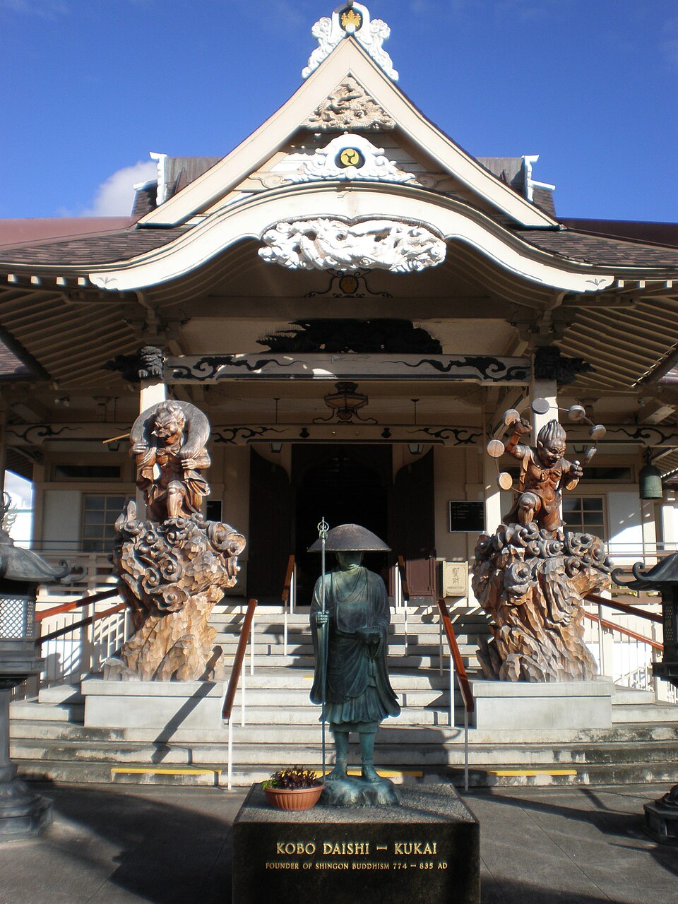
Photograph of Hawaii Shingon Mission
Photograph by Joel Bradshaw, Public domain. Via Wikimedia Commons.

Hawaii Shingon Mission

Listed on the National Register of Historic Places in 2002.

From the record

One of 154 National Register listings published here for Honolulu County · listed in 2002 · category: Building.

Sources: the case file at the National Archives · the National Register database, National Park Service · the Wikipedia article

The listing

  • What is counted as historic. The nomination lists 1 building, 1 object as contributing to the listing.
  • Address. 915 Sheridan St., Honolulu
  • When was it listed? April 2002
  • Category. building
  • National Register reference number. 02000386 - the number the National Park Service assigned this property when it was listed, and the key its nomination file is catalogued under at the National Archives.

Storms near this property

26 since 1996

Regional context, not property-specific evidence. The National Weather Service names Honolulu, the town this property stands in, in 26 storm reports between 1996 and 2023: 7 flood, 7 flash flood, 4 heavy rain, 2 funnel cloud. No death or injury is recorded in these reports. Each account below is quoted exactly as the forecast office filed it, from the NOAA Storm Events Database, and each date opens the federal record of that event.

WhenEvent Place namedHarm What the report says
March 1996Thunderstorm WindHonolulu$2,000no account filed
April 2023FloodHonolulu-Oahu emergency management reported the School Street onramp to H1 Freeway was|closed due to water over the roadway.
June 2019Flash FloodHonolulu-Heavy runoff from showers and thunderstorms caused deep ponding on the H-1 freeway near the Liliha Street overpass. Deep ponding of precipitation also occurred along Nimitz Highway near Fort and River streets, on Ahua Street in the Mapunapuna area, and H-1 freeway westbound near the Pali Highway off-ramp.
September 2018Flash FloodHonolulu-Kalihi Stream overflowed onto Dillingham Boulevard in Honolulu on Oahu, closing the roadway.
July 2016Flash FloodHonolulu-H-1 Westbound at Liliha Street on Oahu closed due to flooding waters and stalled vehicles. Precipitation was associated with Tropical Storm Darby.
September 2015Flash FloodHonolulu-One foot of water flooded the intersection of Liliha, Dillingham, and North King Street in Honolulu on the island of Oahu. More flash flooding was reported at the intersection of Dillingham and Alakawa, and Liliha Street was closed in both directions from King to Vineyard Boulevard because of excessive ponding on the roadway. In the Iwilei section of Honolulu, Dole Cannery and surrounding offices had to be evacuated due to flooding on the first floor, including rooms with electrical equipment.
December 2011Flash FloodHonolulu-Heavy rain caused a debris flow at the westbound H-1 Freeway off ramp to School Street. This closed the roadway for a time while highway crews cleared the debris.
December 1996FloodHonolulu-Scattered areas of minor street flooding reported across Oahu.
November 2011Heavy RainHonolulu-no account filed
November 2007Heavy RainHonolulu-no account filed
January 2005Heavy RainHonolulu-no account filed
June 2005Funnel CloudHonolulu-no account filed
February 2004Flash FloodHonolulu-no account filed
October 2002WildfireHonolulu-no account filed
September 2002WildfireHonolulu-no account filed
June 2001Flash FloodHonolulu-no account filed
October 2001FloodHonolulu-no account filed
January 1999FloodHonolulu-no account filed
December 1998WaterspoutHonolulu-no account filed
January 1998FloodHonolulu-no account filed
August 1997FloodHonolulu-no account filed
April 1997WaterspoutHonolulu-no account filed
March 1997FloodHonolulu-no account filed
March 1996Funnel CloudHonolulu-no account filed
March 1996Thunderstorm WindHonolulu-no account filed

Every storm recorded in Honolulu County

Map coverage status

No historic map-sheet match is published for this property yet. That does not mean no map exists. This record needs a coordinate-quality review before it can be joined to a sheet boundary. Browse the county's mapped places while that work is pending.

Sources for this property

National Archives recordThe nomination case file for reference 02000386 in Record Group 79.
Wikipedia articleCommunity-written account of this property, licensed CC BY-SA.
Honolulu CountyAll 154 listed properties in this county.

Provenance

  • Listing record. National Park Service National Register of Historic Places, listed-properties dataset, current to 2026-05-22.
  • Map join. Address geocoded through the United States Census geocoder, then tested against the published boundary of every sheet in the USGS Historical Topographic Map Collection.
  • How this page is made. Listing fields come from federal records; map-sheet coverage is a labelled coordinate-to-boundary calculation, not a source-field claim.
  • Storms. NOAA National Centers for Environmental Information, Storm Events Database https://www.ncei.noaa.gov/stormevents/ A work of the United States government, no copyright under 17 U.S.C. 105. Narratives are quoted verbatim from the National Weather Service report and are not edited or summarised.