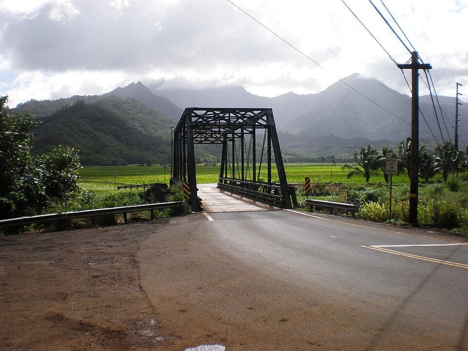
| August 2018 | Flash Flood | Princeville | 1 killed, $1,500,000 | Flooding waters on Kuhio Highway closed the roadway near the Hanalei Bridge in the northern part of Kauai. One fatality occurred when a man jumped into the swollen Waikomo Stream to try to save a dog. |
| November 2019 | Flash Flood | Princeville | 1 hurt | Kuhio highway was closed near the Hanalei Bridge due to water overflowing the Hanalei River. A bit later, Kuhio Highway became impassable as the Wainiha River overflowed its banks at the Twin Bridges in Wainiha. A woman was swept away by the flood waters in that area, but she was rescued by the Kauai Fire Department. |
| March 2020 | Flash Flood | Princeville | $30,600,000 | Kuhio Highway was also closed near the Hanalei Bridge in northern Kauai as the Hanalei River overflowed its banks along the roadway. Later in the morning around 04:30 HST after heavy downpours, Kuhio Highway was closed in Wailua at the Wailua River in windward Kauai as debris piled up against the bridge crossing the waterway. Some homes and businesses in the area were also affected by flooding waters. There were no reports of significant injuries. |
| March 2021 | Flash Flood | Princeville | $30,100,000 | Heavy rain caused the Hanalei River to overflow near the Hanalei Bridge, which then closed Kuhio Highway in that area. Other areas in northern Kauai were affected by downpours that caused debris flows unto roadways, near Princeville, Kilauea, and Wailoko. Other areas that had problems were near Lihue at Niumalu and Hulemalu roads, and in Kapaa where the Keapana Bridge became impassable. |
| February 2026 | Flash Flood | Princeville | - | Kauai Police shut down Kuhio Highway near the Hanalei River Bridge due to rising water and flooding. |
| April 2024 | Flash Flood | Princeville | - | Kuhio Highway was closed in both directions at the Hanalei Bridge. |
| February 2023 | Flash Flood | Princeville | - | Kuhio Highway was closed at the Hanalei Bridge around 8:10am due to water across the road. Later that morning Hauaala Road was closed at the Keapana Bridge due to flooding in Kapaa Stream. |
| February 2023 | Flash Flood | Princeville | - | Kuhio Highway near the Hanalei Bridge was closed due to flooding. |
| January 2023 | Flash Flood | Princeville | - | Kuhio Highway was closed near the Hanalei Bridge. |
| January 2023 | Flash Flood | Princeville | - | Kuhio Highway was closed at the Hanalei River Bridge due to flooding. |
| December 2023 | Flood | Princeville | - | A rapid rise in stream and river levels prompted the closure of Kuhio Highway at Hanalei Bridge on the Island of Kauai. |
| December 2023 | Flood | Princeville | - | Kuhio highway was closed at Hanalei bridge due to water over the road. |
| January 2022 | Flash Flood | Princeville | - | Downpours caused the Hanalei River to overflow onto Kuhio Highway near the Hanalei Bridge in the northern part of Kauai. |
| March 2022 | Flash Flood | Princeville | - | Kuhio Highway closed near the Hanalei Bridge as the Hanalei River overflowed. |
| March 2021 | Flash Flood | Princeville | - | Heavy rain caused the Hanalei River to overflow onto Kuhio Highway near the Hanalei Bridge in the northern part of Kauai. |
| March 2021 | Flash Flood | Princeville | - | The overflowing Hanalei River flooded onto Kuhio Highway near the Hanalei Bridge, closing the roadway for a time. |
| January 2021 | Flash Flood | Princeville | - | Flooding caused a closure of Kuhio Highway near the Hanalei Bridge. |
| February 2021 | Flash Flood | Princeville | - | Kuhio Highway was closed near the Hanalei Bridge due to flooding from the Hanalei River. Also, a debris flow occurred near Lumahai that partially closed Kuhio Highway in the area, and Wailua Marina was inundated by flood waters. |
| February 2021 | Flash Flood | Princeville | - | Kuhio Highway was closed near the Hanalei Bridge due to flooding along the Hanalei River. |
| December 2021 | Flash Flood | Princeville | - | Kuhio Highway was closed near the Hanalei Bridge due to flooding across the roadway in the northern section of Kauai. |
| March 2020 | Flash Flood | Princeville | - | Kuhio Highway near the Hanalei Bridge became impassable near Hanalei due to the Hanalei River overflowing its banks. Also, part of Route 50, Kaumualii Highway, near Waimea was closed around 0735 HST on the 17th, and other roadways were closed in Waimea, because of flooding waters from heavy rainfall on Kauai. |
| March 2020 | Flash Flood | Princeville | - | Kuhio Highway was closed near the Hanalei Bridge in Hanalei because the Hanalei River overflowed its banks due to heavy rain. |
| February 2020 | Flash Flood | Princeville | - | With heavy rain falling, the Hanalei River overflowed its banks near the Hanalei Bridge along Kuhio Highway. |
| November 2020 | Flash Flood | Princeville | - | Kuhio Highway was closed near the Hanalei Bridge due to the Hanalei River overflowing its banks. |
| October 2019 | Flash Flood | Princeville | - | With heavy rain, the Hanalei River overflowed onto Kuhio Highway near the Hanalei Bridge in the northern part of Kauai. |
| September 2019 | Flash Flood | Princeville | - | Kuhio Highway was closed near the Hanalei Bridge in the northern part of Kauai due to flooding. |
| December 2019 | Flash Flood | Princeville | - | Kuhio Highway was closed near the Hanalei Bridge due to the Hanalei River overflowing its banks. |
| February 2018 | Flash Flood | Princeville | - | Heavy rain caused the Hanalei River to overflow and spill onto Kuhio Highway near the Hanalei Bridge over the northern part of Kauai. |
| February 2018 | Flash Flood | Princeville | - | After a period of heavy rain, the Hanalei River overflowed its banks and flooded Kuhio Highway near the Hanalei Bridge in the northern part of Kauai. |
| March 2018 | Flash Flood | Princeville | - | Kuhio Highway was closed near the Hanalei Bridge due to the Hanalei River overflowing its banks. |
| March 2018 | Flash Flood | Princeville | - | Kuhio Highway was closed near the Hanalei Bridge after the Hanalei River overflowed its banks. |
| December 2018 | Flash Flood | Princeville | - | Heavy rain caused the Hanalei River to overflow its banks and flood Kuhio Highway near the Hanalei Bridge in the northern part of Kauai. |
| August 2018 | Flash Flood | Princeville | - | Kuhio Highway was closed near the Hanalei Bridge because of flooding over the roadway in the northern part of Kauai. |
| November 2018 | Flash Flood | Princeville | - | Kuhio Highway was closed near the Hanalei Bridge due to flooding in northern Kauai. |
| March 2017 | Flash Flood | Princeville | - | Flooding waters closed Kuhio Highway near the Hanalei Bridge for a time. |
| August 2017 | Flash Flood | Princeville | - | Kuhio Highway near the Hanalei Bridge was closed because of flooding waters on the roadway. |
| November 2017 | Flash Flood | Princeville | - | Kuhio Highway was closed near the Hanalei bridge in the northern part of Kauai as the Hanalei River overflowed its banks because of heavy rain. |
| November 2017 | Flash Flood | Princeville | - | Kauai Emergency Management Agency reported that Kuhio Highway near the Hanalei bridge was closed due to flooding waters from the Hanalei River. |
| October 2017 | Flash Flood | Princeville | - | Kuhio Highway was closed near the Hanalei Bridge due to flooding. |
| March 2016 | Flash Flood | Princeville | - | Kuhio Highway closed near the Hanalei Bridge due to water over the roadway from an overflowing Hanalei River. |
| December 2016 | Flash Flood | Princeville | - | Kuhio Highway was closed near the Hanalei Bridge on Kauai due to flooding from the Hanalei River. |
| December 2016 | Flash Flood | Princeville | - | Kuhio Highway near the Hanalei Bridge on Kauai was closed due to flooding from the Hanalei River. |
| July 2015 | Flash Flood | Princeville | - | Kauai Civil Defense reported water crossing Kuhio Highway near the Hanalei Bridge. |
| September 2015 | Flash Flood | Princeville | - | Kauai civil defense reported Kuhio Highway was closed near the Hanalei Bridge due to flooding. |
| December 2014 | Flash Flood | Princeville | - | Kuhio Highway was closed at the Hanalei Bridge due to high water. |
| March 2013 | Flash Flood | Princeville | - | Kauai law enforcement and emergency manager reported the closing of the highway at the Hanalei Bridge due to high water reaching the road. |
| December 2013 | Flash Flood | Princeville | - | Kuhio Highway was closed at the Hanalei Bridge due to flash flooding. |
| November 2013 | Flash Flood | Princeville | - | Heavy rain caused the Hanalei River to overflow its banks along Kuhio Highway near the Hanalei Bridge in north Kauai. |
| January 2012 | Flash Flood | Princeville | - | Kuhio Highway was closed at the Hanalei Bridge because of flooding in the area from the Hanalei River. |
| February 2012 | Flash Flood | Princeville | - | Kuhio Highway closed at the Hanalei Bridge due to flooding. |
| March 2012 | Flash Flood | Princeville | - | Hanalei River Bridge reported closed around 1025PM. |
| March 2012 | Flash Flood | Princeville | - | Kuhio Highway closed in the vicinity of the Hanalei Bridge. |
| March 2012 | Flash Flood | Princeville | - | Kuhio Highway closed in the vicinity of the Hanalei Bridge. |
| March 2012 | Flash Flood | Princeville | - | Flooding waters closed Kuhio Highway at the Hanalei Bridge. |
| May 2011 | Flash Flood | Princeville | - | Kuhio Highway was closed for a time at the Hanalei Bridge because of rising water that threatened to overflow the roadway. |
| November 2011 | Flash Flood | Princeville | - | Hanalei Bridge was closed along Kuhio Highway because of water from the Hanalei River overflowing the roadway. Kauai police reopened the bridge at 2:10 AM on the 6th. |
| November 2011 | Flash Flood | Princeville | - | Hanalei Bridge was closed along Kuhio Highway because of water from the Hanalei River overflowing the roadway. |
| April 2010 | Flash Flood | Princeville | - | Kuhio Highway was closed by the Kauai Police at the Hanalei Bridge because of flooding along the Hanalei River. |
| December 2010 | Flash Flood | Princeville | - | Heavy rains caused the Hanalei River to rise over its banks along Kuhio Highway at the Hanalei Bridge. |
| December 2010 | Flash Flood | Princeville | - | Flooding rains caused the Hanalei River to flow over its banks along Kuhio Highway at the Hanalei Bridge. |
 Block