 Block
From the record
One of 107 National Register listings published here for Hawaii County · listed in 1974 · category: Building · built in 1912.
Sources: the case file at the National Archives · the National Register database, National Park Service
Built in 1912. Listed on the National Register of Historic Places in 1974.
One of 107 National Register listings published here for Hawaii County · listed in 1974 · category: Building · built in 1912.
Sources: the case file at the National Archives · the National Register database, National Park Service
Regional context, not property-specific evidence. The federal wildfire occurrence database lists 65 fires within 5 miles of Whitney Seismograph Vault No. 29 between 1992 and 2020, burning about 1,020 acres in total. 2 started naturally. 2 were recorded as arson. Distance is straight-line from the map coordinates, so a fire counted here may appear on a neighbouring settlement's page as well.
| Reported cause | Fires |
|---|---|
| Recreation and ceremony | 41 |
| Missing data/not specified/undetermined | 8 |
| Equipment and vehicle use | 5 |
| Smoking | 3 |
| Debris and open burning | 2 |
| Arson/incendiarism | 2 |
| Natural | 2 |
| Fireworks | 1 |
| Power generation/transmission/distribution | 1 |
The most recent of them, most recent first, with the day each was reported and the service that recorded it.
| Date | Cause | Size | Reported by | Name on the report |
|---|---|---|---|---|
| 3 September 1996 | Recreation and ceremony | under an acre | Hawaii Volcanoes National Park | MENESES |
| 23 September 2001 | Recreation and ceremony | under an acre | Hawaii Volcanoes National Park | STUMP |
| 9 August 1999 | Recreation and ceremony | under an acre | Hawaii Volcanoes National Park | MAWAE |
| 31 August 2017 | Equipment and vehicle use | 2.8 acres | Hawaii Volcanoes National Park | GRAVEL PIT |
| 28 August 1998 | Missing data/not specified/undetermined | under an acre | Hawaii Volcanoes National Park | SOLAR |
| 2 August 1992 | Recreation and ceremony | under an acre | Hawaii Volcanoes National Park | BABOO2E |
| 17 August 2008 | Missing data/not specified/undetermined | under an acre | County of Hawai'i | not named |
| 1 August 2020 | Missing data/not specified/undetermined | 1.8 acres | Hawaii Volcanoes National Park | NAMAKANI PAIO |
Regional context, not property-specific evidence. The National Weather Service names Hilo, the town this property stands in, in 68 storm reports between 1996 and 2026: 28 heavy rain, 16 flood, 14 flash flood, 3 waterspout. The reports record 1 death. Each account below is quoted exactly as the forecast office filed it, from the NOAA Storm Events Database, and each date opens the federal record of that event.
| When | Event | Place named | Harm | What the report says |
|---|---|---|---|---|
| September 2015 | Flash Flood | Hilo | 1 killed | Fire/rescue crews responded to a 5:50 p.m. alarm Monday (Sept 14) to Wailuku River Boiling Pots State Park for a missing swimmer.|A witness said he was swimming in the upper pond at Boiling Pots with a 62-year-old woman when both began to be pulled downstream by the fast-moving current. Both attempted to swim towards the river bank but the woman didnt make it out. |
| March 2026 | Flash Flood | Hilo | $2,000,000 | Heavy rain developed over the eastern and southeastern areas of the Big Island, leading to flooding impacts. Flooding was reported along Bayfront Highway and on Highway 11 south of Hilo. Flooding was also reported in Keeau Industrial Park. A residence in Pahala reportedly experienced flooding. |
| October 2001 | Flash Flood | Hilo | $30,000 | no account filed |
| October 2017 | Lightning | Hilo | $15,000 | no account filed |
| December 2013 | Thunderstorm Wind | Hilo | $5,000 | Fire officials reported a gust of wind damaged a roof on a home on Hoopuni Street in Hilo. |
| May 2024 | Flash Flood | Hilo | - | Waianuenue and Kamehameha Avenues were closed in both directions due to flooding. |
| November 2017 | Flash Flood | Hilo | - | Deep flooding occurred along Bayfront Highway in the Hilo area of the Big Island after an overflow of Alenaio Stream. |
| December 2017 | Flash Flood | Hilo | - | Portions of Kamehameha Avenue and Bayfront Highway in Hilo were closed due to flooding. Some downtown businesses also became flooded with the heavy downpours. |
| December 2013 | Flash Flood | Hilo | - | Kukila Street in Hilo was closed due to flooding. |
| December 2013 | Hail | Hilo | - | A member of the pubic reported 3/4 inch hail in Waiakea Uka. |
| December 2013 | Flash Flood | Hilo | - | Palai Stream overflowed at Kanoelehua Avenue in Hilo. |
| December 2013 | Flash Flood | Hilo | - | Flooding reported at Ainako Avenue near Kaumana Drive in Hilo. |
| March 2004 | Flash Flood | Hilo | - | Heavy showers caused overflowing streams in and around Hilo town on the Big Island of Hawaii. Highway 19--Hawaii Belt Road--was closed for a time near Wainaku because of flooding waters. However, no serious injuries or property damage were reported. |
| March 2004 | Heavy Rain | Hilo | - | Heavy showers produced ponding of roadways, and small stream and drainage ditch flooding in windward sections of the Hilo, Puna, and Kau districts on the Big Island of Hawaii. There were no reports of serious property damage or injuries. |
| July 1997 | Flood | Hilo | - | Rainfall rates of 1 to 2 inches per hour occurred across the Hamakua, Hilo, Puna, and Kau Districts with widespread minor street flooding and stream flooding north of Hilo where some streams were blocked by debris. |
| July 1997 | Flash Flood | Hilo | - | Several houses in the Hilo and Puna Districts had flooded basements or ground floors. About a dozen cars were flooded out near Pauahi Street and Kamehameha Avenue in Hilo. In Puna, North Kulani Road, Hawaiian Acres and Fern Acres subdivisions were flooded. The Hawaiian Belt Road through the Kau District was flooded out in several locations between Naalehu and Pahala. |
| March 2022 | Heavy Rain | Hilo | - | no account filed |
| March 2021 | Heavy Rain | Hilo | - | no account filed |
| December 2021 | Heavy Rain | Hilo | - | no account filed |
| August 2019 | Heavy Rain | Hilo | - | no account filed |
| October 2019 | Heavy Rain | Hilo | - | no account filed |
| February 2018 | Heavy Rain | Hilo | - | no account filed |
| October 2018 | Heavy Rain | Hilo | - | no account filed |
| August 2016 | Heavy Rain | Hilo | - | no account filed |
| August 2016 | Heavy Rain | Hilo | - | no account filed |
| August 2014 | Heavy Rain | Hilo | - | no account filed |
| March 2014 | Heavy Rain | Hilo | - | no account filed |
| November 2011 | Heavy Rain | Hilo | - | no account filed |
| November 2011 | Heavy Rain | Hilo | - | no account filed |
| December 2010 | Heavy Rain | Hilo | - | no account filed |
| March 2009 | Heavy Rain | Hilo | - | no account filed |
| December 2008 | Flash Flood | Hilo | - | no account filed |
| July 2007 | Heavy Rain | Hilo | - | no account filed |
| August 2006 | Heavy Rain | Hilo | - | no account filed |
| October 2006 | Heavy Rain | Hilo | - | no account filed |
| January 2005 | Heavy Rain | Hilo | - | no account filed |
| February 2005 | Heavy Rain | Hilo | - | no account filed |
| February 2005 | Heavy Rain | Hilo | - | no account filed |
| September 2005 | Flash Flood | Hilo | - | no account filed |
| November 2005 | Heavy Rain | Hilo | - | no account filed |
| August 2004 | Heavy Rain | Hilo | - | no account filed |
| October 2004 | Heavy Rain | Hilo | - | no account filed |
| January 2004 | Hail | Hilo | - | no account filed |
| January 2002 | Heavy Rain | Hilo | - | no account filed |
| March 2002 | Heavy Rain | Hilo | - | no account filed |
| May 2002 | Heavy Rain | Hilo | - | no account filed |
| February 2001 | Flood | Hilo | - | no account filed |
| May 2001 | Waterspout | Hilo | - | no account filed |
| November 2001 | Flood | Hilo | - | no account filed |
| October 2001 | Flood | Hilo | - | no account filed |
| November 2001 | Flood | Hilo | - | no account filed |
| April 2000 | Waterspout | Hilo | - | no account filed |
| August 2000 | Wildfire | Hilo | - | no account filed |
| January 1999 | Flash Flood | Hilo | - | no account filed |
| January 1999 | Flood | Hilo | - | no account filed |
| January 1999 | Thunderstorm Wind | Hilo | - | no account filed |
| January 1999 | Flood | Hilo | - | no account filed |
| April 1999 | Flood | Hilo | - | no account filed |
| January 1999 | Flood | Hilo | - | no account filed |
| April 1999 | Flood | Hilo | - | no account filed |
No historic map-sheet match is published for this property yet. That does not mean no map exists. This record needs a coordinate-quality review before it can be joined to a sheet boundary. Browse the county's mapped places while that work is pending.
Other National Register properties close enough to walk or drive between, ordered by distance from this one. Both positions come from the same geocoding pass that matched these properties to their map sheets.
| Photograph | Property | Distance | Listed |
|---|---|---|---|
 | Old Volcano House No. 42 | under 500 feet | 1974 |
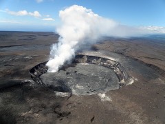 | Kilauea Crater | 1.5 miles | 1974 |
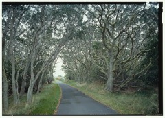 | Mauna Loa Road | 1.9 miles | 2015 |
| Mauna Loa Road | 2.9 miles | 2015 |
| Mauna Loa Road | 3.3 miles | 2015 |
| Hilina Pali Road | 3.8 miles | 2015 |
| National Archives record | The nomination case file for reference 74000292 in Record Group 79. |
| Hawaii County | All 107 listed properties in this county. |