 Block
From the record
107 National Register listings published here, 5 of them National Historic Landmarks.
Sources: the county history on the Internet Archive · the National Register database, National Park Service
295 topographic sheets cover 202 settlements here, and 107 properties are on the National Register of Historic Places.
107 National Register listings published here, 5 of them National Historic Landmarks.
Sources: the county history on the Internet Archive · the National Register database, National Park Service
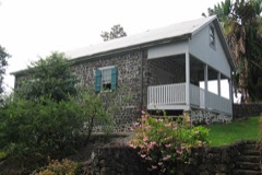
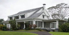
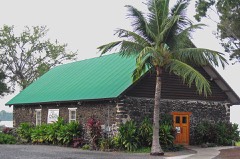
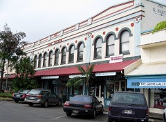
Every property in this county listed on the National Register of Historic Places, with the year it was listed and the federal nomination document.
Every wildfire the federal occurrence database records inside this county: 1,223 of them, burning about 169,175 acres. 43 started naturally and 7 were recorded as arson. Each settlement page carries the fires within five miles of it.
| Reported cause | Fires |
|---|---|
| Missing data/not specified/undetermined | 1076 |
| Recreation and ceremony | 65 |
| Natural | 43 |
| Debris and open burning | 12 |
| Equipment and vehicle use | 11 |
| Arson/incendiarism | 7 |
| Smoking | 6 |
| Fireworks | 2 |
| Power generation/transmission/distribution | 1 |
The five largest, by the area the report gives. None of them was recorded as arson.
| Date | Cause | Size | Reported by | Name on the report |
|---|---|---|---|---|
| 1 August 2005 | Missing data/not specified/undetermined | 25,000 acres | State of Hawaii | not named |
| 1 August 2018 | Missing data/not specified/undetermined | 18,000 acres | State of Hawaii | HIGHWAY 190 FIRE |
| 4 August 1999 | Missing data/not specified/undetermined | 10,000 acres | State of Hawaii | not named |
| 1 July 2007 | Missing data/not specified/undetermined | 9,138 acres | State of Hawaii | not named |
| 28 April 1998 | Missing data/not specified/undetermined | 6,500 acres | State of Hawaii | not named |
| 7 October 1999 | Missing data/not specified/undetermined | 5,000 acres | State of Hawaii | not named |
| 12 May 2003 | Natural | 4,930 acres | Hawaii Volcanoes National Park | LUHI FIRE |
| 17 February 1992 | Missing data/not specified/undetermined | 4,700 acres | Hawaii Volcanoes National Park | NAPAU |
Every settlement page carries the fires within five miles of it - see the settlement index below.
The NOAA Storm Events Database holds 962 reports for this county, causing 6 deaths, 8 injuries and about $97,756,060 in recorded property damage. Each settlement page carries the reports that name it.
| Kind of event | Reports |
|---|---|
| Heavy Rain | 653 |
| Flash Flood | 137 |
| Flood | 89 |
| Wildfire | 25 |
| Hail | 11 |
| Tornado | 10 |
| Funnel Cloud | 10 |
| Lightning | 10 |
| Waterspout | 7 |
| Thunderstorm Wind | 6 |
| Debris Flow | 4 |
The most serious of them, by death, then injury, then recorded damage. The accounts are quoted exactly as the forecast office filed them.
| When | Event | Place named | Harm | What the report says |
|---|---|---|---|---|
| July 2011 | Flash Flood | Papaikou | 1 killed, 1 hurt | A brief heavy shower over the eastern parts of the Big Island of Hawaii caused the Kawainui Stream to rise abruptly. Two individuals prawning in the stream bed were caught in the rapidly moving water. One man died as he was swept away, while a woman was injured as she held on to a large rock as the water rushed around her. |
| February 2018 | Flash Flood | Honokaa | 1 killed | Flooding rain damaged a store in the Hamakua District on the Big Island of Hawaii, in the town of Honokaa. Also, a man died in leeward Big Island in the later evening on the 18th. His was staying in a shack-like structure on a coffee farm in Holualoa when, apparently, strong and gusty winds from a thunderstorm blew the structure about 150 feet from its foundation; and he was killed. |
| February 2018 | Thunderstorm Wind | Holualoa | 1 killed | A shack-like structure was blown 150 feet off its foundation by the thunderstorm winds. Time of event estimated based on radar. |
| January 2017 | Flash Flood | Honokaa | 1 killed | A woman attempted to cross fast-moving water that was knee-deep in a private driveway off Kahana Drive in Ahumoa near Honokaa on the Big Island of Hawaii. She was swept away and was found dead the next morning, Jan. 22. |
| September 2015 | Flash Flood | Hilo | 1 killed | Fire/rescue crews responded to a 5:50 p.m. alarm Monday (Sept 14) to Wailuku River Boiling Pots State Park for a missing swimmer.|A witness said he was swimming in the upper pond at Boiling Pots with a 62-year-old woman when both began to be pulled downstream by the fast-moving current. Both attempted to swim towards the river bank but the woman didnt make it out. |
| December 2012 | Flash Flood | Papaaloa | 1 killed | Brief heavy rainfall along the windward slopes of the Big Island above Papaaloa caused rapid rises in local streams. Broadcast media reported that a tourist from California was swept to his death in the Pahale Stream while attempting to cross. It appears the individual may have been lost while seeking a local cabin where he had reservations for the night. |
| January 1971 | Tornado | not stated | 4 hurt, $2,500,000 | no account filed |
| November 2018 | Flash Flood | Kamuela | 2 hurt | Civil Defense on the Big Island of Hawaii reported 13 hikers needed rescue after being stranded by flash flooding at Anna's Pond near Waimea. Also, at 1711 HST, police reported flooding on Kohala Mountain Road. |
| November 1997 | Lightning | Milolii | 1 hurt | no account filed |
| November 2000 | Flash Flood | Laupahoehoe | $70,000,000 | no account filed |
| August 2018 | Flash Flood | Kukuihaele | $7,100,000 | Flash flooding continued for about two full days for much of the east half of the Big Island of Hawaii. From near Hawi in the north to the Kawa Flats area in the south, almost continuous heavy rain and thunderstorms associated with Hurricane Lane affected the isle. Flooding waters closed Bayfront Highway in Hilo, Highway 19 in multiple areas was closed due to debris flows and deep water on the roadway, flash flooding was ongoing in Waipio Valley for much of the time, Akoni Pule Highway became impassable near Hawi, Kaalaiki Road northeast of Naalehu was closed because of deep ponding, water rescues and evacuations were undetaken in the Hilo area at Kaiulani Street with water levels running at 5 feet, a resident in Keaau had to evacuate the home because of flooding on N. Wilder Road, a portion of Saddle Road upslope from Hilo was closed because of a debris flow and large rocks on the roadway, route 130 was closed from Keaau High School to Hawaiian Paradise Park due to flooding, and both lanes of Highway 11 in the Kawa Flats area were closed because of deep water over the roadway. |
| March 2026 | Flash Flood | Mahukona | $5,000,000 | Heavy rain developed over the Kona slopes during the evening of March 14. At approximately 1000 pm HST, significant flooding was reported on Alii Drive with a large amount of water on roadways. A Kealakekua resident reported flood waters coming down a hill and flooding his property, destroying the flooring and forcing his family to evacuate. His neighbors were reportedly hit harder; his neighbor's farm's water supply was taken offline and the flood waters broke up the asphalt on his driveway and opened many cracks. The County reportedly responded to 25 to 30 calls to save peoples lives when heavy rain bands hit Kau and South Kona. Between the Kau and South Kona Districts, 18 to 20 people were rescued. Other residents reported massive potholes, broken up asphalt, and boulders along with flooding impacting homes. Fifteen dead goats were reportedly found washed up or floating in Kawaihae harbor. |
| August 2024 | Flood | Papaaloa | $5,000,000 | As quoted in the Star-Advertiser, the Hawaii County Civil Defense Administrator reported the county had received thirty eight damage claims from Kohala to Kau and that, out of the thirty eight damage reports, eighteen had been verified. Nine of these damage reports were major, meaning they may be uninhabitable. One of these properties included a home used as a bed and breakfast experienced extensive flooding with massive mud, boulder, and debris buildup in the home. |
| August 2024 | Flash Flood | Mountain View | $3,000,000 | Heavy rain from the outer bands of Hurricane Hone caused flooding which closed several roads over the southeast portion of the Big Island. In the Kau District, Highway 11 was closed at Kawa Flats. Wood Valley Road and Cane Haul Road were closed near Pahala. In the Puna District, North Kulani Road was closed. Many of the roads were damaged. |
| March 2026 | Flash Flood | Hilo | $2,000,000 | Heavy rain developed over the eastern and southeastern areas of the Big Island, leading to flooding impacts. Flooding was reported along Bayfront Highway and on Highway 11 south of Hilo. Flooding was also reported in Keeau Industrial Park. A residence in Pahala reportedly experienced flooding. |
| September 2024 | Flash Flood | Kailua Kona | $1,000,000 | Hualalai Rd was closed near Lako St due to flooding. Twenty two properties reported flood damage. |
| September 1996 | Flash Flood | Waikoloa, S Kohala | $1,000,000 | no account filed |
| March 2004 | Flash Flood | Kamuela | $550,000 | Heavy rain and showers closed and damaged several roads in northern parts of the Big Island of Hawaii. The rain also forced Waikoloa Stream over its banks, and the flood waters in turn damaged water mains that supplied Kamuela with drinking water. Damages to the roadways alone were more than half a million dollars. There were no reports of serious injuries, however. |
| April 2026 | Flash Flood | Mountain View | $200,000 | Heavy rain developed over the southeastern slopes of the Big Island and led to flooding impacts. Water was reportedly flowing into a house in the Puna district near Hawaiian Paradise Park. Water also accumulated on Highway 11 near mile marker 60. Hao Springs Road closed due to flooding. |
| March 2026 | Flash Flood | Glenwood | $100,000 | Heavy rain led to road closures between Naalehu and Pahala due to a culvert overflowing. Highway 11 was also closed at Kawa Flats due to flooding. Then on March 14, water over Highway 11 cut off the towns on Naalehu and Pahala. The Department of Transportation reported Hawaii Belt Road (Route 11) at mile marker 57.5 at the Hilea Stream Bridge was closed due to flooding in the area. |
| November 2024 | Flash Flood | Akaka Falls St Park | $100,000 | Multiple Roads within Hilo and Mountainview were closed or partially closed due to flooding. Additionally, there was a vehicle submerged underwater on South Kopua Road in Punas Eden Roc neighborhood near Mountain View. The roads closed included Pohaku Dr, Enos Road, Mauna Loa Road, N Kulani Rd, Kahikopele St, Pohaku St between 39th Ave and 40th Av, Kamehameha Ave, Pauahi St, E Kawailani Rd. |
| March 1996 | Flash Flood | Hilo,Puna,Kau,Hamaku | $100,000 | no account filed |
| February 2026 | Heavy Rain | Kukuihaele | $40,000 | Hawaii County Civil Defense reported landslides along Waipio Valley Access Rd. The road was shut down as a result. |
| October 2001 | Flash Flood | Hilo | $30,000 | no account filed |
| October 2017 | Lightning | Hilo | $15,000 | no account filed |
| September 2015 | Lightning | Hawaiian Paradise Pk | $10,000 | no account filed |
| December 2013 | Thunderstorm Wind | Hilo | $5,000 | Fire officials reported a gust of wind damaged a roof on a home on Hoopuni Street in Hilo. |
| April 1986 | Tornado (F0) | not stated | $2,500 | no account filed |
| February 2023 | Lightning | Upolu Airport | $1,000 | Broadcast media relayed a report that a lightning strike in the Ewa Beach area split a tree. No other damage was reported from this event. |
| February 2023 | Lightning | Waikii | $1,000 | Broadcast media initially reported that lightning strikes sparked two brush fires near the Keamuku Maneuver Area in the Pohakuloa Training Area. Based on hot-spot satellite imagery taken from FIRMS (Fire Information for Resource Management System), the fires were extinguished Feb 20th. |
| December 2016 | Lightning | Akaka Falls St Park | $1,000 | A pilot for Hawaiian Airlines reported a lightning strike on his aircraft inbound to Hilo on the Big Island of Hawaii. |
| March 1980 | Tornado (F1) | not stated | $250 | no account filed |
| November 1978 | Tornado | not stated | $250 | no account filed |
| March 1955 | Tornado | not stated | $30 | no account filed |
| March 1955 | Tornado | not stated | $30 | no account filed |
| February 2026 | Flash Flood | Laupahoehoe | - | Law Enforcement reported landslides in Laupahoehoe Gulch, Kawaili Gulch, and Maulua Gulch. |
| January 2026 | Flood | Volcano | - | Mamalohoa Hwy was closed between mile markers 57 and 61 due to water on the road. |
| March 2024 | Flood | Kailua Kona | - | Kuakini Highway was closed between Onioni St and Queen Kaahumanu Hwy due to flooding. |
| January 2024 | Flood | Naalehu | - | Kaalaiki Rd was closed between Naalehu and Pahala due to water on the road at low water crossings. |
| January 2024 | Flood | Pahala | - | Wood Valley Road was closed at the low water crossing at Waiakaloa Gulch due to excess water. |
| May 2024 | Flash Flood | Hilo | - | Waianuenue and Kamehameha Avenues were closed in both directions due to flooding. |
| May 2024 | Flash Flood | Kawaihae | - | All lanes were closed at the Kawaihae Road and Queen Kaahumanu Hwy intersection due to flooding at the bridges on both sides of the intersection. |
| February 2023 | Flash Flood | Pahala | - | A single vehicle attempted to cross a flooded roadway near Wood Valley Road. The vehicle was carried downstream with operator inside. When emergency personnel arrived, the operator had already self-extricated from the vehicle. |
| February 2023 | Flash Flood | Keaau | - | Multiple roads were closed as a result of the repeated rounds of heavy rainfall, including Highway 11 at Kawa Flats, Wood Valley Road, Pohaku Drive, East Kawailani Street, and Kaalaiki Road. Railroad Ave. was also closed in both directions from East Lanikaula St. to Kukil St. Additionally, Piake St. and Llima St. were affected by water flooding the bridge at Paauau Gulch near Pahala. |
| February 2023 | Heavy Rain | Hakalau | - | Highway 19 near mile marker 13 was closed in both directions due to a landslide. |
| November 2023 | Debris Flow | Hakalau | - | The Hawaii Police Department reported a landslide closing the Hawaii Belt Rd (Highway 19) between Mile Marker Twelve and Honomu Rd. |
| November 2023 | Debris Flow | Paauilo | - | A landslide was reported near Mile Marker 28 in Kawaili Gulch along Hawaii Belt rd. (Highway 19). |
| April 2023 | Flood | Pahala | - | Emergency management reported flooding on Highway 11 near Kawa Flats between mile marker 50.5 and mile marker 60. The road was closed due to water over the road between Pahala and Naalehu. |
| April 2023 | Flood | Upolu Airport | - | Piilani Highway was closed between mile markers 29 and 31 due to unpassable flooding waters. |
| May 2023 | Flood | Puako | - | Flood waters were reported on Highway 19 between mile marker 70 and 71. Both lanes were closed due to the flooding. |
| November 2023 | Flood | Pahala | - | Persistent heavy rainfall lead to water accumulating on the roads which prompted the road closure of Wood Valley Road. |
| July 2023 | Flood | Pahala | - | Heavy rainfall due to Tropical Storm Calvin lead to a road closure on Kaalaiki Rd, also known as Pahala Transfer Station Road, due to the buildup of flood waters on the road. |
| July 2023 | Flood | Pahala | - | Wood Valley Rd. was closed due to flooding on the road. The flood waters were the result of heavy rainfall from Tropical Storm Calvin. |
| July 2023 | Flood | Ookala | - | Old Mamalahoa Highway was closed due to a landslide due to flooding, which was caused by heavy rainfall from Tropical Storm Calvin. |
| January 2022 | Flash Flood | Saddle Road Junction | - | Highway 190 on the Big Island was closed between the Saddle Road junction and Waimea due to flooding waters that overflowed from Kamakoa Gulch. This was an impact from the Mana Road burn scar, the result of an earlier fire that devastated the local area. |
| September 2022 | Flash Flood | Kailua Kona | - | After a downpour, Kuakini Highway in leeward Big Island between Hualalai Road and Highway 11 was closed due to deep standing water. |
| December 2022 | Flash Flood | Kailua Kona | - | Emergency management reported the upper portion of Palani Rd. was flooded. |
| December 2022 | Flash Flood | Waikoloa Village | - | Waikoloa Village was flooded along Waikoloa Road near the Paniolo Avenue intersection. Also, Highway 190 was closed near mile marker 5-6 due to debris on the road. |
| December 2022 | Flash Flood | Kamuela | - | Kawaihae Road near the Kohala Mountain Road junction was flooded. |
| December 2022 | Flash Flood | Mahukona | - | Highway 270 was closed between mile markers 10 and 11 due to debris on the road resulting from heavy rainfall. |
The Survey's mineral resources record lists 15 workings inside this county. 4 still produce and 11 are closed or unrecorded. Each settlement page carries the workings within five miles of it.
| Commodity | Workings |
|---|---|
| Stone, Crushed/Broken | 11 |
| Stone | 2 |
| Calcium | 1 |
| Sand and Gravel, Construction | 1 |
The least common of them first, because a county's hundredth gravel pit says nothing its first ten did not.
| Where | Site | Commodity | Status | Recorded |
|---|---|---|---|---|
| Pacific Quarry and Mill | Sand and Gravel, Construction | Past Producer | ||
| Yamada Kawaihae Coral Mill | Calcium | Past Producer | ||
| Honokahau Pit | Stone | Past Producer | ||
| Unnamed Quarry | Stone | Past Producer | ||
| Boase Number 1 Quarry and Mill | Stone, Crushed/Broken | Past Producer | ||
| Hcpc Quarries and Mill | Stone, Crushed/Broken | Past Producer | ||
| Hilo Quarry and Mill | Stone, Crushed/Broken | Producer | ||
| Honokahau Quarry and Mill | Stone, Crushed/Broken | Producer | ||
| Iilewa Pit | Stone, Crushed/Broken | Past Producer | ||
| Kawaihae Coral Mill | Stone, Crushed/Broken | Past Producer | ||
| Keaau Mill and Quarry | Stone, Crushed/Broken | Producer | ||
| Keauaou Quarry | Stone, Crushed/Broken | Past Producer | ||
| Parker Ranch Quarry and Mill | Stone, Crushed/Broken | Past Producer | ||
| Puu Waawaa Pit and Mine | Stone, Crushed/Broken | Past Producer | ||
| Yamada Hilo Quarry and Mill | Stone, Crushed/Broken | Producer |
The part of each published history that is about one town: 1 chapter, each reproduced complete.
| Town | Chapter | From | Length |
|---|---|---|---|
| Hilo | Godfrey's Handbook of Hawaii: Guide to Hilo and the Volcano | Godfrey's Handbook of Hawaii: Guide to Hilo and the Volcano (1899) | 11,577 words |
Named settlements recorded in the Geographic Names Information System, each with the topographic sheets covering it. Villages, hamlets and abandoned places alike. Each is shown with the nearest named watercourse or landform and the survey quadrangle it falls on.
Honokaa-Kukuihaele census division · 96727 · On Nanaue Stream · Kukuihaele quadrangle
11 sheets, 1916 to 1995
South Kona census division · 96750 · By Palikapuokeōua · Honaunau quadrangle
12 sheets, 1954 to 1996
Kau census division · 96772 · Near Puʻuwaʻawaʻa · Kahuku Ranch quadrangle
14 sheets, 1924 to 1995
Keaau-Mountain View census division · 96771 · Mountain View quadrangle
13 sheets, 1917 to 1994
Keaau-Mountain View census division · 96771 · Mountain View quadrangle
13 sheets, 1917 to 1994
Keaau-Mountain View census division · 96785 · Volcano quadrangle
14 sheets, 1922 to 1997
Keaau-Mountain View census division · 96760 · Mountain View quadrangle
13 sheets, 1917 to 1994
No longer a settlement
Honokaa-Kukuihaele census division · 96727 · Near Niʻeniʻe Gulch · Honokaa quadrangle
14 sheets, 1915 to 1995
Papaikou-Wailea census division · 96710 · On Hakalau Stream · Papaaloa quadrangle
13 sheets, 1915 to 1992
North Kohala census division · 96755 · Near East Branch Hālawa Gulch · Hawi quadrangle
14 sheets, 1913 to 1995
Keaau-Mountain View census division · 96760 · Mountain View quadrangle
13 sheets, 1917 to 1994
Pahoa-Kalapana census division · 96778 · Pahoa North quadrangle
14 sheets, 1924 to 1995
Kau census division · 96737 · Near Puu o Kamaoa · Pohue Bay quadrangle
14 sheets, 1928 to 1995
Kau census division · 96737 · Near Honopū · Pohue Bay quadrangle
14 sheets, 1928 to 1995
Kau census division · 96737 · Pohue Bay quadrangle
14 sheets, 1928 to 1995
Keaau-Mountain View census division · 96749 · Pahoa North quadrangle
14 sheets, 1924 to 1995
Pahoa-Kalapana census division · 96778 · Near Sand Hill · Pahoa North quadrangle
14 sheets, 1924 to 1995
North Kohala census division · 96755 · Near Kehoni · Hawi quadrangle
14 sheets, 1913 to 1995
North Kona census division · 96725 · Near Puʻuloa · Kealakekua quadrangle
15 sheets, 1928 to 1996
North Hilo census division · 96710 · On Pulili Stream (historical) · Papaaloa quadrangle
13 sheets, 1915 to 1992
No longer a settlement
Honokaa-Kukuihaele census division · 96727 · On Ouhi Stream · Honokaa quadrangle
14 sheets, 1915 to 1995
Pahoa-Kalapana census division · 96778 · Near Sand Hill · Pahoa North quadrangle
14 sheets, 1924 to 1995
No longer a settlement
North Kohala census division · 96755 · Near Waikaulapala Gulch · Hawi quadrangle
14 sheets, 1913 to 1995
Papaikou-Wailea census division · 96728 · On Honomū Stream · Papaikou quadrangle
11 sheets, 1915 to 1994
South Kona census division · 96704 · By Palianihi · Honaunau quadrangle
12 sheets, 1954 to 1996
South Kona census division · 96704 · Near Mokuokahaʻilani Rock · Milolii quadrangle
12 sheets, 1928 to 1996
North Kona census division · 96740 · Near ʻAkahipuʻu · Kiholo quadrangle
14 sheets, 1928 to 1996
North Kohala census division · 96755 · Near East Branch Hālawa Gulch · Hawi quadrangle
14 sheets, 1913 to 1995
North Kohala census division · 96719 · Near Kumakua Gulch · Hawi quadrangle
14 sheets, 1913 to 1995
Keaau-Mountain View census division · 96749 · Near Kalele · Keaau Ranch quadrangle
13 sheets, 1924 to 1994
North Kona census division · 96725 · On Waiʻaha Stream · Kealakekua quadrangle
15 sheets, 1928 to 1996
South Kona census division · 96704 · By Pali Alahaka · Honaunau quadrangle
12 sheets, 1954 to 1996
Pahoa-Kalapana census division · 96778 · Kalapana OE E quadrangle
16 sheets, 1924 to 1994
No longer a settlement
Pahoa-Kalapana census division · 96778 · Pahoa South quadrangle
14 sheets, 1924 to 1994
Pahoa-Kalapana census division · 96778 · Near Kaliʻu · Pahoa South quadrangle
14 sheets, 1924 to 1994
Pahoa-Kalapana census division · 96778 · Pahoa South quadrangle
14 sheets, 1924 to 1994
South Kohala census division · 96738 · Near Pōhakulua · Anaehoomalu quadrangle
12 sheets, 1928 to 1997
North Kohala census division · 96755 · Near Waikaulapala Gulch · Hawi quadrangle
14 sheets, 1913 to 1995
Pahoa-Kalapana census division · 96778 · Near Puʻukea · Kapoho OE N quadrangle
13 sheets, 1924 to 1995
Honokaa-Kukuihaele census division · 96727 · Near Malanahae Gulch · Kukuihaele quadrangle
11 sheets, 1916 to 1995
South Kona census division · 96704 · Near Ohepuupuu · Milolii quadrangle
12 sheets, 1928 to 1996
No longer a settlement
Pahoa-Kalapana census division · 96778 · Near Puu Kepaka · Pahoa South quadrangle
14 sheets, 1924 to 1994
South Kohala census division · 96743 · Near Makeāhua Gulch · Kawaihae quadrangle
14 sheets, 1913 to 1995
South Kohala census division · 96743 · On Kohākōhau Stream · Kamuela quadrangle
15 sheets, 1916 to 1995
No longer a settlement
Papaikou-Wailea census division · 96783 · On Kawainui Stream · Papaikou quadrangle
11 sheets, 1915 to 1994
Honokaa-Kukuihaele census division · 96727 · Near Kuilei Gulch · Honokaa quadrangle
14 sheets, 1915 to 1995
Hilo census division · 96720 · On Kaluiiki Branch · Piihonua quadrangle
15 sheets, 1917 to 1997
Honokaa-Kukuihaele census division · 96727 · On Nanaue Stream · Kukuihaele quadrangle
11 sheets, 1916 to 1995
South Kona census division · 96750 · Near Kalaemamo · Honaunau quadrangle
12 sheets, 1954 to 1996
Kau census division · Makaopuhi Crater quadrangle
17 sheets, 1922 to 1995
No longer a settlement
North Kona census division · 96725 · Near Puu o Kalaukani · Puulehua quadrangle
14 sheets, 1928 to 1993
North Hilo census division · 96774 · Near Puʻulahohinu · Keanakolu quadrangle
10 sheets, 1954 to 1993
South Kona census division · 96704 · Kaunene quadrangle
12 sheets, 1954 to 1993
No longer a settlement
North Kona census division · 96740 · Near Puʻuloa · Kealakekua quadrangle
15 sheets, 1928 to 1996
Hilo census division · 96720 · Near Mahikea Island · Hilo quadrangle
15 sheets, 1917 to 1995
Keaau-Mountain View census division · 96749 · Mountain View quadrangle
13 sheets, 1917 to 1994
South Kona census division · 96704 · Near Puʻukalapa · Honaunau quadrangle
12 sheets, 1954 to 1996
South Kona census division · 96704 · Near Kaʻōpapa · Honaunau quadrangle
12 sheets, 1954 to 1996
South Kohala census division · Near Puʻuʻiwaʻiwa · Keamuku quadrangle
10 sheets, 1954 to 1993
No longer a settlement
Pahoa-Kalapana census division · 96778 · Near Kūkiʻi · Kapoho OE N quadrangle
13 sheets, 1924 to 1995
No longer a settlement
Keaau-Mountain View census division · 96771 · Mountain View quadrangle
13 sheets, 1917 to 1994
North Hilo census division · 96774 · Near Alaialoa Gulch · Kukaiau quadrangle
14 sheets, 1915 to 1993
Honokaa-Kukuihaele census division · 96727 · On Waiulili Stream · Kukuihaele quadrangle
11 sheets, 1916 to 1995
Keaau-Mountain View census division · 96749 · Mountain View quadrangle
13 sheets, 1917 to 1994
South Kona census division · 96726 · Near Puʻukalapa · Honaunau quadrangle
12 sheets, 1954 to 1996
Kau census division · 96772 · By Kaulu Pali · Naalehu quadrangle
14 sheets, 1924 to 1995
No longer a settlement
South Kohala census division · 96743 · On Lanimaumau Stream · Kamuela quadrangle
15 sheets, 1916 to 1995
Paauhau-Paauilo census division · 96776 · Near Kawaili Gulch · Kukaiau quadrangle
14 sheets, 1915 to 1993
North Kona census division · 96740 · Near Poopoomino · Kiholo quadrangle
14 sheets, 1928 to 1996
Kau census division · Near Puu Manawalea · Kalapana quadrangle
15 sheets, 1922 to 1994
No longer a settlement
South Kohala census division · 96743 · Puu Hinai quadrangle
13 sheets, 1928 to 1997
No longer a settlement
North Hilo census division · 96764 · On Hōkūmāhoe Stream (historical) · Papaaloa quadrangle
13 sheets, 1915 to 1992
Keaau-Mountain View census division · 96771 · Puumakaala quadrangle
13 sheets, 1917 to 1994
No longer a settlement
Pahoa-Kalapana census division · 96778 · Near Ahuʻailāʻau · Pahoa South quadrangle
14 sheets, 1924 to 1994
Honokaa-Kukuihaele census division · 96727 · Near Puʻuhuluhulu Gulch · Makahalau quadrangle
11 sheets, 1954 to 1993
North Kona census division · 96740 · Near Kuili · Makalawena quadrangle
11 sheets, 1954 to 1996
Hilo census division · 96720 · Near Coconut Island · Hilo quadrangle
15 sheets, 1917 to 1995
North Kohala census division · 96755 · Near Niuliʻi Gulch · Hawi quadrangle
14 sheets, 1913 to 1995
North Kona census division · 96740 · Keahole Point quadrangle
11 sheets, 1954 to 1996
No longer a settlement
Kau census division · 96772 · Manuka Bay quadrangle
12 sheets, 1928 to 1995
No longer a settlement
Keaau-Mountain View census division · 96785 · Volcano quadrangle
14 sheets, 1922 to 1997
North Hilo census division · 96774 · Near Alaialoa Gulch · Kukaiau quadrangle
14 sheets, 1915 to 1993
South Kona census division · 96704 · Near Mokuokahaʻilani Rock · Milolii quadrangle
12 sheets, 1928 to 1996
Kau census division · 96777 · Near Puu Kolea · Pahala quadrangle
14 sheets, 1923 to 1995
No longer a settlement
Keaau-Mountain View census division · 96771 · Mountain View quadrangle
13 sheets, 1917 to 1994
Honokaa-Kukuihaele census division · 96727 · Near Puʻukekuakāhea · Makahalau quadrangle
11 sheets, 1954 to 1993
Kau census division · 96772 · Near Waiaʻele Gulch · Naalehu quadrangle
14 sheets, 1924 to 1995
No longer a settlement
North Hilo census division · 96774 · Near Kaohaoha Gulch · Kukaiau quadrangle
14 sheets, 1915 to 1993
North Kohala census division · 96755 · In Niuliʻi Gulch · Honokane quadrangle
15 sheets, 1916 to 1993
South Kona census division · 96704 · Near Ohepuupuu · Manuka Bay quadrangle
12 sheets, 1928 to 1995
No longer a settlement
Pahoa-Kalapana census division · 96778 · Pahoa North quadrangle
14 sheets, 1924 to 1995
South Kona census division · 96704 · Near Kaʻōpapa · Honaunau quadrangle
12 sheets, 1954 to 1996
Kau census division · 96772 · Near Alapaʻi Gulch · Naalehu quadrangle
14 sheets, 1924 to 1995
North Hilo census division · 96773 · On Puʻuohua Stream (historical) · Papaaloa quadrangle
13 sheets, 1915 to 1992
North Hilo census division · 96773 · On Puʻuohua Stream (historical) · Papaaloa quadrangle
13 sheets, 1915 to 1992
Keaau-Mountain View census division · 96760 · Mountain View quadrangle
13 sheets, 1917 to 1994
No longer a settlement
South Kona census division · 96704 · Near Mokunaia · Milolii quadrangle
12 sheets, 1928 to 1996
No longer a settlement
South Kona census division · 96704 · Near Kuhulu Rock · Kauluoa Point quadrangle
11 sheets, 1954 to 1996
No longer a settlement
Papaikou-Wailea census division · 96783 · On Alakahi Stream · Papaikou quadrangle
11 sheets, 1915 to 1994
No longer a settlement
South Kona census division · 96750 · Kealakekua quadrangle
15 sheets, 1928 to 1996
No longer a settlement
Keaau-Mountain View census division · 96749 · Mountain View quadrangle
13 sheets, 1917 to 1994
Honokaa-Kukuihaele census division · 96727 · Near Pūnohu · Makahalau quadrangle
11 sheets, 1954 to 1993
No longer a settlement
Honokaa-Kukuihaele census division · 96727 · Near Puʻuhuluhulu Gulch · Makahalau quadrangle
11 sheets, 1954 to 1993
Papaikou-Wailea census division · 96720 · On Honoliʻi Stream · Papaikou quadrangle
11 sheets, 1915 to 1994
South Kona census division · 96704 · Puulehua quadrangle
14 sheets, 1928 to 1993
No longer a settlement
Paauhau-Paauilo census division · 96776 · Near Opihilala Gulch · Kukaiau quadrangle
14 sheets, 1915 to 1993
Papaikou-Wailea census division · 96783 · Near Kānoa · Papaikou quadrangle
11 sheets, 1915 to 1994
Papaikou-Wailea census division · 96783 · On Makoewai Stream (historical) · Papaikou quadrangle
11 sheets, 1915 to 1994
Hilo census division · 96720 · On Kapehu Stream · Piihonua quadrangle
15 sheets, 1917 to 1997
South Kohala census division · 96743 · Near Kamakoa Gulch · Puu Hinai quadrangle
13 sheets, 1928 to 1997
Hilo census division · 96720 · Near Magnetic Hill · Puaakala quadrangle
10 sheets, 1954 to 1993
Keaau-Mountain View census division · 96771 · Mountain View quadrangle
13 sheets, 1917 to 1994
No longer a settlement
Kau census division · 96777 · Near Nīnole Gulch · Punaluu quadrangle
15 sheets, 1924 to 1995
Kau census division · Near Puʻukinikini · Punaluu quadrangle
15 sheets, 1924 to 1995
South Kohala census division · 96743 · Near Haleʻaha Gulch · Kamuela quadrangle
15 sheets, 1916 to 1995
North Kona census division · 96740 · Near Puʻuʻio · Puuanahulu quadrangle
13 sheets, 1928 to 1996
Kau census division · 96777 · Near Kauhuhuʻula Gulch · Pahala quadrangle
14 sheets, 1923 to 1995
North Hilo census division · 96780 · On Kaiwilahilahi Stream · Papaaloa quadrangle
13 sheets, 1915 to 1992
Keaau-Mountain View census division · 96749 · Keaau Ranch quadrangle
13 sheets, 1924 to 1994
No longer a settlement
Papaikou-Wailea census division · 96781 · On Kaapoko Stream · Papaikou quadrangle
11 sheets, 1915 to 1994
South Kona census division · 96704 · Papa quadrangle
12 sheets, 1928 to 1995
No longer a settlement
Paauhau-Paauilo census division · 96727 · Near Kahawailiʻiliʻi Gulch · Honokaa quadrangle
14 sheets, 1915 to 1995
Pahoa-Kalapana census division · 96778 · Near Pohakupala · Kapoho quadrangle
15 sheets, 1924 to 1995
Pahoa-Kalapana census division · 96778 · Kalapana quadrangle
15 sheets, 1922 to 1994
No longer a settlement
Keaau-Mountain View census division · 96785 · Volcano quadrangle
14 sheets, 1922 to 1997
South Kohala census division · 96743 · Near Nohonaohaeiki · Nohonaohae quadrangle
10 sheets, 1954 to 1997
Keaau-Mountain View census division · 96778 · Pahoa North quadrangle
14 sheets, 1924 to 1995
Pahoa-Kalapana census division · 96778 · Near Puʻukūkae · Kapoho quadrangle
15 sheets, 1924 to 1995
Keaau-Mountain View census division · 96785 · Near Puʻupuaʻi · Volcano quadrangle
14 sheets, 1922 to 1997
Pahoa-Kalapana census division · 96778 · Near Sand Hill · Pahoa North quadrangle
14 sheets, 1924 to 1995
No longer a settlement
Kau census division · 96772 · By Waikapuna Pali · Naalehu quadrangle
14 sheets, 1924 to 1995
South Kohala census division · 96743 · Near Puʻukahekili · Keamuku quadrangle
10 sheets, 1954 to 1993
South Kohala census division · 96738 · Near Pōhakulua · Anaehoomalu quadrangle
12 sheets, 1928 to 1997
South Kohala census division · 96738 · Near ʻAuwaiakeakua · Puu Hinai quadrangle
13 sheets, 1928 to 1997
South Kohala census division · 96743 · Near Puʻukoholā · Kawaihae quadrangle
14 sheets, 1913 to 1995
Papaikou-Wailea census division · 96710 · On Kaʻahakini Stream · Papaikou OE N quadrangle
11 sheets, 1915 to 1994
South Kohala census division · 96743 · On Lanimaumau Stream · Kamuela quadrangle
15 sheets, 1916 to 1995
Hilo census division · 96720 · On Pohakunanaka Stream (historical) · Hilo quadrangle
15 sheets, 1917 to 1995
Honokaa-Kukuihaele census division · 96743 · On Hiʻilawe Stream · Kukuihaele quadrangle
11 sheets, 1916 to 1995
Keaau-Mountain View census division · 96749 · Mountain View quadrangle
13 sheets, 1917 to 1994
South Kohala census division · 96743 · Near Haleʻaha Gulch · Kamuela quadrangle
15 sheets, 1916 to 1995
South Kohala census division · 96738 · Near Pōhakulua · Anaehoomalu quadrangle
12 sheets, 1928 to 1997
North Hilo census division · 96773 · On Welokā Stream · Papaaloa quadrangle
13 sheets, 1915 to 1992
North Kona census division · 96740 · Kealakekua quadrangle
15 sheets, 1928 to 1996
South Kohala census division · 96738 · Near Pōhakulua · Anaehoomalu quadrangle
12 sheets, 1928 to 1997
Pahoa-Kalapana census division · 96778 · Near Kaakepa · Pahoa South quadrangle
14 sheets, 1924 to 1994
Keaau-Mountain View census division · 96778 · Pahoa North quadrangle
14 sheets, 1924 to 1995
Hilo census division · 96720 · On Kaluiiki Branch · Piihonua quadrangle
15 sheets, 1917 to 1997
Kau census division · Makaopuhi Crater quadrangle
17 sheets, 1922 to 1995
No longer a settlement
Kau census division · Kilauea Crater quadrangle
20 sheets, 1921 to 1995
No longer a settlement
Kau census division · By Kaʻōiki Pali · Kilauea Crater quadrangle
20 sheets, 1921 to 1995
No longer a settlement
North Hilo census division · 96774 · Near Kaʻula Gulch · Kukaiau quadrangle
14 sheets, 1915 to 1993
The vanished settlements of Hawaii County: the places named above that are no longer on the map.