 Block
From the record
10 National Register listings published here.
Sources: the National Register database, National Park Service
20 topographic sheets cover 18 settlements here, and 10 properties are on the National Register of Historic Places.
10 National Register listings published here.
Sources: the National Register database, National Park Service
Every property in this county listed on the National Register of Historic Places, with the year it was listed and the federal nomination document.
| Photograph | Property | Type | Listed | Reference |
|---|---|---|---|---|
 | Adair County Courthouse | building | 1981 | 81000224 |
| Adair County Democrat-Adair County Free Press Building | building | 2011 | 10001203 | |
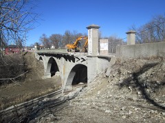 | Adair Viaduct | structure | 1998 | 98000775 |
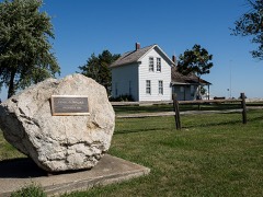 | Catalpa | building | 1974 | 74000776 |
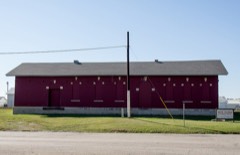 | Chicago,Rock Island and Pacific Railroad: Stuart Passenger Station | building | 1980 | 80001428 |
| Greenfield Public Square Historic District | district | 2014 | 14000623 | |
 | Hotel Greenfield | building | 2011 | 11000812 |
| Loucks Grove Church | building | 1995 | 95001314 | |
| Tastee-Freez Drive In and Dairy Store | building | 2025 | 100011921 | |
 | Warren Opera House Block and Hetherington Block | building | 1979 | 79000880 |
Every wildfire the federal occurrence database records inside this county: 55 of them, burning about 779 acres. None started naturally and none was recorded as arson. Each settlement page carries the fires within five miles of it.
| Reported cause | Fires |
|---|---|
| Missing data/not specified/undetermined | 34 |
| Debris and open burning | 18 |
| Equipment and vehicle use | 1 |
| Smoking | 1 |
| Misuse of fire by a minor | 1 |
The five largest, by the area the report gives. None of them was recorded as arson.
| Date | Cause | Size | Reported by | Name on the report |
|---|---|---|---|---|
| 12 April 2011 | Missing data/not specified/undetermined | 300 acres | Iowa Department of Natural Resources | 150TH AND MARION ST. CASEY, IA, IA |
| 3 April 2011 | Missing data/not specified/undetermined | 80 acres | Iowa Department of Natural Resources | 150TH AND LEWIS SE OF CASEY, IA |
| 3 May 2020 | Debris and open burning | 40 acres | Iowa Department of Natural Resources | not named |
| 12 April 2014 | Debris and open burning | 40 acres | Iowa Department of Natural Resources | not named |
| 22 February 2006 | Missing data/not specified/undetermined | 30 acres | Iowa Department of Natural Resources | not named |
| 16 March 2011 | Missing data/not specified/undetermined | 25 acres | Iowa Department of Natural Resources | I-80 MM96 TO MM93, LINCOLN TWP, IA |
| 19 March 2011 | Missing data/not specified/undetermined | 20 acres | Iowa Department of Natural Resources | 1852 STUART RD, HARRISON TWP, IA |
| 7 April 2018 | Equipment and vehicle use | 20 acres | Iowa Department of Natural Resources | not named |
Every settlement page carries the fires within five miles of it - see the settlement index below.
The NOAA Storm Events Database holds 431 reports for this county, causing 6 deaths, 42 injuries and about $51,285,000 in recorded property damage. Each settlement page carries the reports that name it.
| Kind of event | Reports |
|---|---|
| Hail | 175 |
| Thunderstorm Wind | 158 |
| Tornado | 33 |
| Heavy Rain | 31 |
| Flash Flood | 19 |
| Flood | 8 |
| Funnel Cloud | 4 |
| Lightning | 3 |
The most serious of them, by death, then injury, then recorded damage. The accounts are quoted exactly as the forecast office filed them.
| When | Event | Place named | Harm | What the report says |
|---|---|---|---|---|
| May 2024 | Tornado (EF4) | Fisk | 4 killed, 35 hurt, $30,000,000 | This large and violent tornado entered into south central Adair County from Adams County. The tornado remained a multi-vortex circulation as it moved into the county producing high end damage for much of its remaining path. The tornado encountered several houses in the vicinity of Fontanelle Road and 320th Street. Many of the structures received at least EF2 damage with one house north of the intersection receiving up to EF4 damage with a sufficiently anchored structure destroyed and slumped into a debris field nearby. Additional EF4 damage was noted at a farmstead on Jordan Avenue south of 280th Street with the house destroyed and trees chewed down to only the largest trucks and portions of the bark removed. The path then passed through another wind mill area with additional turbines collapsing west of Kent Avenue. The tornado then passed over Nodaway Park Ponds and entered the southwest side of Greenfield along SW 3rd Street. Several structures over the next several blocks had up to EF4 damage from SW 3rd Street over the SE 3rd Street and South of Linn Street and north of Oak and Noble Streets. Most of these saw complete destruction of the house with much of the debris scattered in the area but not completely swept away. The tornado weakened slightly for the later half of the destructive path through Greenfield. EF3 damage was widespread from SE Kent Street and SE 4th Street to the Intersection of E Iowa Street and NE 8th Street. The tornado exited the east side of Greenfield near the Adair County Fairgrounds. The tornado continued east northeast and gradually weakened impacting a few more houses before dissipating just south of the intersection of 220th Street and Quebec Avenue. This tornado produced at least 35 injuries in addition to 4 deaths within Greenfield. All of the deaths occurred in homes. Of note, according to media reports, a Doppler on Wheels (DOW) intercept research team measured a wind speed of just over 300 mph approximately 150 feet above ground level with this tornado. |
| June 1953 | Tornado (F5) | not stated | 1 killed, 2 hurt, $250,000 | no account filed |
| May 2019 | Tornado (EF2) | Adair | 1 killed, 1 hurt, $500,000 | Tornado developed south southeast of Adair and moved quickly north. Initial damage was mainly to trees, grain bins and outbuildings. Three houses were encountered by the tornado with the first two receiving EF0 damage. The third house had the roof removed with several of the outside walls collapsing, but the inside walls remaining intact. Two individuals were sleeping inside when the tornado arrived with one injury and one fatality occurring. This structure sustained EF2 damage with the tornado passing over Interstate 80 and remaining in rural cropland for the remainder of its path in Adair County. The tornado then crossed into Guthrie County before dissipating. |
| April 1999 | Tornado (F4) | Bridgewater | 2 hurt, $1,000,000 | no account filed |
| May 1959 | Tornado (F4) | not stated | 1 hurt, $2,500,000 | no account filed |
| March 2006 | Thunderstorm Wind | Fontanelle | 1 hurt, $20,000 | no account filed |
| June 2014 | Hail | Adair | $10,000,000 | Emergency manager reported around 190 homes in Adair were damaged by large hail driven by strong to severe wind. Numerous trees were damaged. Crops shredded by the wind driven hail. Cars on I-80 had broken windows. |
| May 2024 | Tornado (EF2) | Greenfield | $750,000 | Emergency management recorded a path of damage from just east of Greenfield to just shy of the Adair/Madison County line north of 140th Street. The initial portion of this tornado was observed via the Doppler on Wheels (DOW) and was extended farther southwest accordingly. This tornado impacted farmsteads with damage to outbuildings and tree groves. Toward the end of the path, a large industrial wind mill was blown over southeast of the intersection of 150th street and Walnut Avenue. EF2 damage was then done with complete destruction of an outbuilding along York Avenue along with shredding of trees. The tornado then quickly weakened and dissipated as it approached the county line. |
| April 1994 | Tornado (F3) | Bridgewater to 4 N Gr | $500,000 | Mostly F1 and F2 Damage. |
| April 1994 | Hail | Adair | $500,000 | no account filed |
| May 2007 | Flash Flood | Bridgewater | $250,000 | no account filed |
| May 2007 | Flood | Bridgewater | $250,000 | no account filed |
| July 1988 | Tornado (F1) | not stated | $250,000 | no account filed |
| June 2014 | Tornado (EF1) | Rosserdale | $200,000 | Tornado with intermittent southeastward track produced the worst damage near the end of its life. |
| July 2000 | Flash Flood | Northwest Portion | $200,000 | no account filed |
| June 2018 | Thunderstorm Wind | Greenfield | $150,000 | Trained spotter reported a machine shed destroyed, a grain bin severely damaged, and multiple trees down. |
| June 2010 | Thunderstorm Wind | Greenfield Arpt | $150,000 | Semi was blown off the road on Highway 25 north of Greenfield. |
| June 2018 | Thunderstorm Wind | Greenfield | $100,000 | Emergency manager reported that within the towns of Greenfield and Fontanelle 8 to 10 inch diameter trees, branches, and fences down. A greenhouse was blown over at the Shopko in Greenfield. Time estimated from radar. |
| June 2018 | Thunderstorm Wind | Greenfield | $100,000 | Emergency manager reported significant wind damage in Adair County near Greenfield. Multiple trees reported down and home damage about 3 miles south of Greenfield, and a radio tower on the hospital down. |
| April 2012 | Thunderstorm Wind | Greenfield | $100,000 | Damage to several trees, along with roof damage to a building. |
| May 1998 | Thunderstorm Wind | Fontanelle | $100,000 | no account filed |
| March 2020 | Tornado (EF1) | Fisk | $95,000 | Tornado moved into Adair county from Adams county. The tornado remained in rural southern Adair county as it moved to the northeast. It did encounter one farmstead and produced EF1 damage to an outbuilding along with additional tree damage. The rest of the track was in rural cropland before dissipating several miles south of Fontanelle. |
| May 2007 | Thunderstorm Wind | Bridgewater | $75,000 | no account filed |
| May 2004 | Flash Flood | Adair | $75,000 | no account filed |
| May 1996 | Flash Flood | Greenfield | $75,000 | no account filed |
| August 2019 | Thunderstorm Wind | Adair | $60,000 | Law enforcement and Iowa DOT reported 3 semis blown over near the westbound rest stop near MM 80 on Interstate 80. Three additional semis were blown over in the eastbound traffic lanes in the same area. Time estimated from radar. |
| May 2019 | Flood | Canby | $50,000 | Water was reported over 120th St just east of Highway 25 near the Freedom Rock, which was overflow from the Middle River. Several gravel roads were flooded in and around the Middle River across Adair County. |
| May 2019 | Flash Flood | Canby | $50,000 | Emergency manager reported gravel roads in the area under water, and creeks and streams rising fast. |
| June 2014 | Flash Flood | Bridgewater | $50,000 | Several roads were reported covered by water and had to be closed until water receded in southern Adair County. |
| March 2009 | Thunderstorm Wind | Adair | $50,000 | A roof was blown off a restaurant and a canopy of a gas station was destroyed. |
| July 2009 | Flash Flood | Fisk | $50,000 | Debris on roads and several gravel roads were washed out. |
| October 2007 | Flood | Rosserdale | $50,000 | Water was reported over Highway 25 just south of Interstate 80, possibly from the Middle river. The report was received from the Adair County Sheriff. |
| May 2004 | Tornado (F1) | Greenfield | $50,000 | Tornado touched down southwest of the town of Stuart and tracked northeast through mostly open countryside. The tornado did lift occasionally. |
| June 2007 | Flash Flood | Greenfield | $50,000 | no account filed |
| May 2004 | Flash Flood | Countywide | $50,000 | no account filed |
| May 1998 | Thunderstorm Wind | Greenfield | $50,000 | no account filed |
| June 1998 | Flood | Greenfield | $50,000 | no account filed |
| April 1994 | Hail | Bridgewater | $50,000 | no account filed |
| April 1994 | Thunderstorm Wind | Adair | $50,000 | no account filed |
| April 1994 | Hail | not stated | $50,000 | no account filed |
| April 1994 | Hail | Bridgewater | $50,000 | no account filed |
| August 1993 | Thunderstorm Wind | Adair | $50,000 | no account filed |
| March 2019 | Heavy Rain | Greenfield | $40,000 | A heated horse barn near the town of Greenfield experienced a partial roof collapse due to the snow and rainfall absorbed into the snow putting too much weight on the that part of the roof. Minor injuries to a couple of horses were reported. |
| May 2017 | Thunderstorm Wind | Adair | $40,000 | A semi roll-over occurred on I-80 east of Adair due to strong winds. |
| May 2017 | Thunderstorm Wind | Howe | $40,000 | Emergency manager reported numerous instances across Guthrie County to the Adair County line of wind damage. This included 2 modular offices blown off I-80 2 miles east of Stuart. |
| August 2011 | Thunderstorm Wind | Orient | $40,000 | Metal sheds were dented from high winds. Part of the roof was peeled off with many tree limbs down. |
| September 2006 | Thunderstorm Wind | Fontanelle | $40,000 | no account filed |
| September 2002 | Hail | Greenfield | $40,000 | no account filed |
| August 2007 | Thunderstorm Wind | Adair | $35,000 | no account filed |
| August 2011 | Thunderstorm Wind | Orient | $30,000 | Roof torn off of a hog house and a large tree was down on a trailer at the intersection of 310th St and Henry A Wallace Road. |
| May 2007 | Thunderstorm Wind | Adair | $30,000 | no account filed |
| October 2001 | Hail | Orient | $30,000 | no account filed |
| July 1999 | Hail | Greenfield | $30,000 | no account filed |
| July 1998 | Flood | Greenfield | $30,000 | no account filed |
| April 1995 | Thunderstorm Wind | Greenfield | $30,000 | no account filed |
| November 2015 | Thunderstorm Wind | Bridgewater | $25,000 | Storm chaser reported a barn lost its roof 1 mile north of Bridgewater along Iowa Highway 92. |
| June 2014 | Hail | Adair | $25,000 | Golf ball hail on I-80 at mile post 77 with cars and windows damaged. |
| May 2013 | Thunderstorm Wind | Bridgewater | $25,000 | Numerous 6 inch tree limbs down with hail damage to a house. Siding and roof damage. Hail size unknown but dents in aluminum were quarter to half dollar size. |
| March 2011 | Hail | Greenfield | $25,000 | Vehicle damage reported along with some roof damage. |
| June 2010 | Thunderstorm Wind | Fontanelle | $25,000 | Numerous large trees ranging from 10 to 12 inches in diameter were downed. |
The Survey's mineral resources record lists 6 workings inside this county. 3 still produce and 3 are closed or unrecorded. Each settlement page carries the workings within five miles of it.
| Commodity | Workings |
|---|---|
| Stone, Crushed/Broken | 4 |
| Phosphorus-Phosphates | 1 |
| Sand and Gravel, Construction | 1 |
The least common of them first, because a county's hundredth gravel pit says nothing its first ten did not.
| Where | Site | Commodity | Status | Recorded |
|---|---|---|---|---|
| Fort Madison Phosphoric Acid Plant | Phosphorus-Phosphates | Past Producer | ||
| Unknown | Sand and Gravel, Construction | Past Producer | ||
| Albright Quarry | Stone, Crushed/Broken | Past Producer | ||
| Howe Quarry | Stone, Crushed/Broken | Producer | ||
| Jefferson Quarry | Stone, Crushed/Broken | Producer | ||
| Menlo Quarry | Stone, Crushed/Broken | Producer |
Named settlements recorded in the Geographic Names Information System, each with the topographic sheets covering it. Villages, hamlets and abandoned places alike. Each is shown with the nearest named watercourse or landform and the survey quadrangle it falls on.
Grand River township · 50858 · On Ninemile Creek · Arbor Hill quadrangle
10 sheets, 1954 to 1993
Grove township · 50849 · Greenfield quadrangle
10 sheets, 1954 to 1993
No longer a settlement
Grove township · 50250 · On South Turkey Creek · Rosserdale quadrangle
10 sheets, 1954 to 1993
The vanished settlements of Adair County: the places named above that are no longer on the map.