 Block
Fisk, Iowa
9 topographic sheets cover this place, the earliest surveyed in 1954 and the latest in 1993. It stands in Richland Township. It lies in ZIP code area 50858. The Survey maps it on the Nevinville quadrangle. It stands 1,309 feet above sea level.
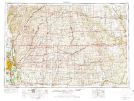
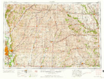
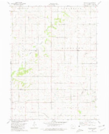
Topographic sheets covering this place
6 surveys from 9 printed sheetsMatched by testing this settlement's coordinate against the published boundary of every sheet in the United States Geological Survey's historical collection. Each opens the scanned sheet at the Survey.
- 1954 USGS Omaha quadrangle1:250000, 3 printings
- 1957 USGS Omaha quadrangle1:250000
- 1958 USGS Omaha quadrangle1:250000, 2 printings
- 1980 USGS Nevinville quadrangle1:24000
- 1985 USGS Creston quadrangle1:100000
- 1993 USGS Creston quadrangle1:100000
Storms near this place
12 since 2007Regional context, not property-specific evidence. The National Weather Service names Fisk in 12 storm reports between 2007 and 2024: 5 hail, 3 thunderstorm wind, 3 tornado, 1 flash flood. The reports record 4 deaths and 35 injuries. Each account below is quoted exactly as the forecast office filed it, from the NOAA Storm Events Database, and each date opens the federal record of that event.
| When | Event | Place named | Harm | What the report says |
|---|---|---|---|---|
| May 2024 | Tornado (EF4) | Fisk | 4 killed, 35 hurt, $30,000,000 | This large and violent tornado entered into south central Adair County from Adams County. The tornado remained a multi-vortex circulation as it moved into the county producing high end damage for much of its remaining path. The tornado encountered several houses in the vicinity of Fontanelle Road and 320th Street. Many of the structures received at least EF2 damage with one house north of the intersection receiving up to EF4 damage with a sufficiently anchored structure destroyed and slumped into a debris field nearby. Additional EF4 damage was noted at a farmstead on Jordan Avenue south of 280th Street with the house destroyed and trees chewed down to only the largest trucks and portions of the bark removed. The path then passed through another wind mill area with additional turbines collapsing west of Kent Avenue. The tornado then passed over Nodaway Park Ponds and entered the southwest side of Greenfield along SW 3rd Street. Several structures over the next several blocks had up to EF4 damage from SW 3rd Street over the SE 3rd Street and South of Linn Street and north of Oak and Noble Streets. Most of these saw complete destruction of the house with much of the debris scattered in the area but not completely swept away. The tornado weakened slightly for the later half of the destructive path through Greenfield. EF3 damage was widespread from SE Kent Street and SE 4th Street to the Intersection of E Iowa Street and NE 8th Street. The tornado exited the east side of Greenfield near the Adair County Fairgrounds. The tornado continued east northeast and gradually weakened impacting a few more houses before dissipating just south of the intersection of 220th Street and Quebec Avenue. This tornado produced at least 35 injuries in addition to 4 deaths within Greenfield. All of the deaths occurred in homes. Of note, according to media reports, a Doppler on Wheels (DOW) intercept research team measured a wind speed of just over 300 mph approximately 150 feet above ground level with this tornado. |
| March 2020 | Tornado (EF1) | Fisk | $95,000 | Tornado moved into Adair county from Adams county. The tornado remained in rural southern Adair county as it moved to the northeast. It did encounter one farmstead and produced EF1 damage to an outbuilding along with additional tree damage. The rest of the track was in rural cropland before dissipating several miles south of Fontanelle. |
| July 2009 | Flash Flood | Fisk | $50,000 | Debris on roads and several gravel roads were washed out. |
| June 2011 | Thunderstorm Wind | Fisk | $5,000 | Three to four inch diameter tree branches blown down. Pea size hail as well. |
| June 2007 | Hail | Fisk | $2,000 | no account filed |
| March 2022 | Hail | Fisk | - | Hail report of 1 inch via spotter network west of Orient. |
| June 2022 | Hail | Fisk | - | Wind driven hail event that features hail up to half dollar sized and winds over 60 mph that lasted for 15 to 20 minutes. Just emerged corn and beans were pulverized, pine trees stripped of needles, and hardwood trees defoliated. Worst hail this spotter has seen in 50 years at this location. |
| June 2022 | Thunderstorm Wind | Fisk | - | Pine trees uprooted and split. Damage to an outbuilding including some broken windows. |
| June 2022 | Thunderstorm Wind | Fisk | - | Roof blown off a machine shed. Time estimated via radar. |
| June 2022 | Hail | Fisk | - | Nickel to quarter sized hail reported. |
| July 2021 | Hail | Fisk | - | Mostly quarter sized hail with a few stones up to golf ball sized. Ground was white with hail. No wind. |
| August 2015 | Tornado (EF0) | Fisk | - | This very visible tornado meandered across Adair and Adams counties for over half an hour, traveling only 8.5 miles in that time. The worst damage occurred near the small hamlet of Williamson where multiple buildings were damaged. The tornado initially traveled to the SW-SE, but executed a cyclonic loop two miles south of Williamson and then traveled to the N-NE for the remainder of its life. This is segment is for Adair county, the tornado then continued into Adams county. |
Nearest settlements
The eight closest, with where each one stands in the county. Distances are straight-line, computed from the Geographic Names Information System coordinates.
| Map | Place | Distance | Sheets |
|---|---|---|---|
| Gilead | 3.6 miles | 9 | |
| Orient | 6.0 miles | 9 | |
| Fontanelle | 6.4 miles | 9 | |
| Greenfield | 8.0 miles | 10 | |
| Bridgewater | 8.1 miles | 9 | |
| Lemont (historical) | 9.6 miles | 10 | |
| Prussia | 12.0 miles | 9 | |
| Zion | 12.1 miles | 9 |
Elsewhere
Matched on this settlement's Geographic Names Information System number rather than its name, so it cannot be a different place of the same name in another state.
| Wikipedia article on Fisk | An encyclopaedic summary. Its text is share-alike, so it is linked here rather than copied. |
| Wikidata item Q18150784 | The structured record the population and elevation above come from. Public domain (CC0). |
Provenance
This settlement is recorded in the Geographic Names Information System as feature 464542. The sheet list is computed by point-in-boundary test against the United States Geological Survey's historical topographic inventory. Both are works of the United States government and carry no copyright under 17 U.S.C. 105.
Storms. NOAA National Centers for Environmental Information, Storm Events Database https://www.ncei.noaa.gov/stormevents/ A work of the United States government, no copyright under 17 U.S.C. 105. Narratives are quoted verbatim from the National Weather Service report and are not edited or summarised.