 Block
From the record
13 National Register listings published here.
Sources: the National Register database, National Park Service
32 topographic sheets cover 32 settlements here, and 13 properties are on the National Register of Historic Places.
13 National Register listings published here.
Sources: the National Register database, National Park Service
Every property in this county listed on the National Register of Historic Places, with the year it was listed and the federal nomination document.
| Photograph | Property | Type | Listed | Reference |
|---|---|---|---|---|
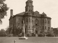 | Appanoose County Courthouse | building | 1981 | 81000225 |
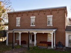 | Appanoose County Sheriff's House and Jail | building | 1997 | 97001292 |
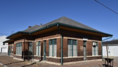 | C B & Q Passenger Depot | building | 2003 | 03000833 |
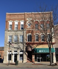 | Courthouse Square Historic District | district | 1997 | 97001291 |
 | Drake Public Library | building | 1997 | 97001290 |
| Franklin Regular Baptist Church | building | 2008 | 08000087 | |
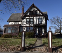 | Porter Hall | building | 1980 | 80001429 |
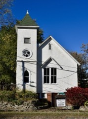 | Second Baptist Church | building | 1999 | 99001223 |
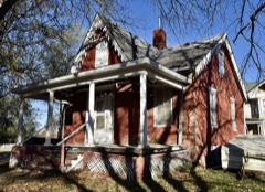 | Stratton House | building | 1975 | 75000677 |
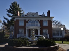 | Sturdivant-Sawyer House | building | 1984 | 84001202 |
 | U.S. Post Office | building | 1978 | 78001204 |
| Vermilion Estate | building | 1978 | 78001205 | |
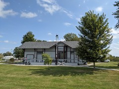 | Wabash Combination Depot-Moravia | building | 1996 | 96001158 |
Every wildfire the federal occurrence database records inside this county: 53 of them, burning about 1,289 acres. None started naturally and 2 were recorded as arson. Each settlement page carries the fires within five miles of it.
| Reported cause | Fires |
|---|---|
| Missing data/not specified/undetermined | 28 |
| Debris and open burning | 17 |
| Recreation and ceremony | 2 |
| Arson/incendiarism | 2 |
| Smoking | 2 |
| Equipment and vehicle use | 2 |
The five largest, by the area the report gives. One of them was set deliberately.
| Date | Cause | Size | Reported by | Name on the report |
|---|---|---|---|---|
| 14 March 2009 | Missing data/not specified/undetermined | 200 acres | Iowa Department of Natural Resources | not named |
| 22 March 2014 | Arson/incendiarism | 120 acres | Iowa Department of Natural Resources | not named |
| 30 March 2015 | Debris and open burning | 120 acres | Iowa Department of Natural Resources | not named |
| 21 March 2009 | Missing data/not specified/undetermined | 100 acres | Iowa Department of Natural Resources | not named |
| 19 January 2015 | Missing data/not specified/undetermined | 100 acres | Iowa Department of Natural Resources | not named |
| 30 March 2015 | Missing data/not specified/undetermined | 82 acres | Iowa Department of Natural Resources | not named |
| 6 March 2020 | Debris and open burning | 63 acres | Iowa Department of Natural Resources | not named |
| 18 February 2017 | Debris and open burning | 60 acres | Iowa Department of Natural Resources | not named |
Every settlement page carries the fires within five miles of it - see the settlement index below.
The NOAA Storm Events Database holds 412 reports for this county, causing no deaths, 12 injuries and about $14,204,250 in recorded property damage. Each settlement page carries the reports that name it.
| Kind of event | Reports |
|---|---|
| Hail | 114 |
| Thunderstorm Wind | 113 |
| Heavy Rain | 96 |
| Flash Flood | 38 |
| Tornado | 24 |
| Flood | 19 |
| Lightning | 5 |
| Funnel Cloud | 3 |
The most serious of them, by death, then injury, then recorded damage. The accounts are quoted exactly as the forecast office filed them.
| When | Event | Place named | Harm | What the report says |
|---|---|---|---|---|
| June 1980 | Tornado (F2) | not stated | 5 hurt, $2,500,000 | no account filed |
| June 1980 | Tornado (F1) | not stated | 3 hurt, $2,500,000 | no account filed |
| September 2001 | Thunderstorm Wind | Centerville | 1 hurt, $100,000 | no account filed |
| August 2007 | Lightning | Centerville | 1 hurt, $5,000 | no account filed |
| April 2014 | Thunderstorm Wind | Udell | 1 hurt | A woman was injured by flying debris. |
| May 1989 | Thunderstorm Wind | not stated | 1 hurt | no account filed |
| March 2017 | Tornado (EF2) | Centerville Arpt | $750,000 | NWS storm survey confirmed a tornado touchdown on the south side of Centerville just after 830 pm. The tornado produced significant damage to a manufacturing facility with a partial collapse of walls and roof structures. The tornado tracked very quickly northeast damaging an outbuilding and taking a large section of a roof off a residence along Highway 2. Damage was also found to several outbuildings at a farmstead south of Udell with a camper being tipped on its side. The worst damage occurred near Centerville where damage was consistent with winds of 115 to 125 mph - or EF2 damage. Damage to the east was not quite as intense generally EF0 or EF1 damage. It should be noted that the tornado may not have been continuous along the the entire 10 mile path...as the damage appeared to be more intermittent. |
| June 2011 | Flash Flood | Cincinnati | $500,000 | Several roads and bridges washed out in various locations across the southeast part of the county. |
| August 2007 | Flash Flood | Rathbun | $500,000 | Several homes were evacuated due to high water in Centerville and Mystic. Water was flowing over county road T14 north of Mystic. Highway 2 just east of the Chariton River was reduced to one lane and the second lane was nearly under water. |
| August 2007 | Flash Flood | Streepy | $500,000 | Water rescues occurred southwest of Mystic. Numerous county roads were under water throughout the county. |
| May 2019 | Flood | Griffinsville | $250,000 | Emergency manager reported multiple secondary roads remained under water or closed and a few culverts damaged or destroyed in Appanoose County from the heavy rainfall and subsequent overland and river flooding. |
| June 2015 | Flood | Lacona | $250,000 | The Chariton River at Moulton crested at 36.19 feet at 7:45 Am CST on 25 June. |
| July 2010 | Flash Flood | Numa | $250,000 | Closures included 135th St south of Highway J46 with a pickup truck stalled out. Water flowing over the road at Highway 2 east of Centerville, and the intersection of Highway T14 and Main Street. Flooding on roads west of Centerville near the Chariton River. |
| August 2007 | Flash Flood | Thirty | $250,000 | Homes in the area were threatened by flash flooding. |
| April 2007 | Flood | Centerville | $250,000 | no account filed |
| July 1992 | Tornado (F2) | not stated | $250,000 | no account filed |
| May 1988 | Tornado (F2) | not stated | $250,000 | no account filed |
| June 1964 | Tornado (F2) | not stated | $250,000 | no account filed |
| September 1961 | Tornado (F2) | not stated | $250,000 | no account filed |
| November 2015 | Tornado (EF2) | Griffinsville | $200,000 | Storm survey team indicated start of the tornado occurred southwest of Rathbun reservoir in northwest Appanoose county. Tornado was strongest of the day producing damage to several farmsteads along its path. This tornado crossed into Monroe county. |
| July 2010 | Flash Flood | Darbyville | $200,000 | Water was reported over the road on J5T between Rathbun Lake and Walnut City. |
| June 2000 | Flash Flood | Countywide | $200,000 | no account filed |
| September 2019 | Flood | Griffinsville | $150,000 | Flooding was reported to be ongoing in Centerville as well as on several gravel roads around the county. One gravel road was washed out as well. One bridge abutment was damaged, causing the bridge to be closed. |
| April 2014 | Thunderstorm Wind | Sharon | $150,000 | Several outbuildings damaged or destroyed. Carports were overturned with 12 to 15 inch diameter trees snapped off. Power lines were downed with cattle trapped in a pole barn. |
| June 2015 | Flood | Griffinsville | $100,000 | Many primary and secondary roads were flooded. Some roads were washed out. |
| July 2015 | Flash Flood | Iconium | $100,000 | Law Enforcement reported Highway 2 occasionally impacted by flooding. Numerous county gravel roads also flooded. Water was also reported out of the banks of some local creeks and streams. Multiple reports of water over roads near Mystic and Centerville. |
| July 2015 | Thunderstorm Wind | Griffinsville | $100,000 | Winds of 65 to 70 mph were estimated across much of the county along with several reports of large tree limb damage. |
| June 2011 | Flash Flood | Dean | $100,000 | Bridge damage on 610th Street from the creek. |
| June 2010 | Flash Flood | Mystic | $100,000 | Water running over numerous streets in town. Estimated 6-8 inches depth in several areas including west Main Street, Low Road, Spring Street, and Lodwick Street. |
| June 2010 | Flash Flood | Mystic | $100,000 | South 2nd, 3rd, 4th, 6th, West Main, Powell, Spring, Willow, and Low Road were all under water and closed. Total rainfall since 0600 CST was 2.6 inches. |
| August 2007 | Flash Flood | Udell | $100,000 | Old Highway 5 just west of Moravia was reported under four feet of water. |
| May 2004 | Thunderstorm Wind | Numa | $100,000 | no account filed |
| May 2003 | Hail | Centerville | $100,000 | no account filed |
| September 2001 | Thunderstorm Wind | Numa | $100,000 | no account filed |
| April 2008 | Tornado (EF1) | Jerome | $75,000 | Law enforcement reported the tornado on the ground west of Numa, moving northeast. |
| April 2008 | Tornado (EF1) | Griffinsville | $75,000 | Law enforcement reported a tornado near Monrovia moving northeast with damage to a garage and house. |
| April 2003 | Lightning | Moulton | $75,000 | no account filed |
| April 1999 | Thunderstorm Wind | Moravia | $75,000 | no account filed |
| May 1996 | Tornado (F1) | Moravia | $70,000 | no account filed |
| December 2021 | Thunderstorm Wind | Centerville | $50,000 | Public reported a large tree partially uprooted and on a home. Metal building flipped. Time estimated from radar. |
| July 2015 | Thunderstorm Wind | Centerville | $50,000 | Appanoose County Sheriff reported power lines and trees down in the town of Centerville. Time was estimated via radar. |
| April 2014 | Thunderstorm Wind | Cincinnati | $50,000 | Roofs were blown off farm outbuildings and several windows blown out of cars. |
| October 2013 | Lightning | Moravia | $50,000 | Lightning struck the main lodge of the Honey Creek Resort at Rathbun Lake causing structural and electrical damage. |
| June 2011 | Hail | Centerville | $50,000 | Quarter to golf ball size hail. |
| June 2010 | Thunderstorm Wind | Garfield | $50,000 | Power poles snapped and shingles torn off of a roof. Trees were also topped by strong straight line winds. |
| June 2010 | Flash Flood | Garfield | $50,000 | Several roads were flooded near Mystic due to flash flooding. Roads included 472nd Street, 163rd Street, and 160th Street. |
| September 2010 | Flash Flood | Cincinnati | $50,000 | Significant gravel road washout south of Centerville. |
| July 2010 | Thunderstorm Wind | Moravia | $50,000 | A barn was destroyed by high winds. |
| June 2008 | Flash Flood | Clarkdale | $50,000 | Water from a creek flooded 493rd street. Also 176th ave four miles northeast of Centerville was flooded. |
| June 2011 | Hail | Cincinnati | $50,000 | no account filed |
| September 2001 | Thunderstorm Wind | Udell | $50,000 | no account filed |
| May 1998 | Flood | Monrovia | $50,000 | no account filed |
| June 1994 | Hail | Unionville | $50,000 | no account filed |
| June 1994 | Thunderstorm Wind | Moulton | $50,000 | no account filed |
| March 2017 | Tornado (EF1) | Cincinnati | $40,000 | Tornado developed just east of Cincinnati and moved rapidly to the northeast. The tornado damaged many trees along its path as well as a few different outbuildings with top wind speeds of 90mph - of EF1 damage. |
| July 2010 | Lightning | Moulton | $40,000 | no account filed |
| June 2000 | Thunderstorm Wind | Plano | $40,000 | no account filed |
| April 1997 | Thunderstorm Wind | Moulton | $40,000 | no account filed |
| June 2019 | Thunderstorm Wind | Monrovia | $30,000 | Emergency manager and Appanoose County Dispatch wind damage in Moravia. They reported roof damage to buildings, siding damage to buildings, and multiple trees with limbs 10 to 12 inches in diameter down. Winds went through the center of town and the tree damage was widespread. |
| May 2019 | Flash Flood | Exline | $25,000 | Law enforcement reported water over the road near Highway 5 and T30 blocking poeple from leaving their residences. |
The Survey's mineral resources record lists 33 workings inside this county. 8 still produce and 25 are closed or unrecorded. Each settlement page carries the workings within five miles of it.
| Commodity | Workings |
|---|---|
| Stone, Crushed/Broken | 19 |
| Clay | 6 |
| Zinc | 4 |
| Sand and Gravel, Construction | 3 |
| Gypsum-Anhydrite | 1 |
The least common of them first, because a county's hundredth gravel pit says nothing its first ten did not.
| Where | Site | Commodity | Status | Recorded |
|---|---|---|---|---|
| Centerville Gypsum Co. Mine | Gypsum-Anhydrite | Past Producer | ||
| Cincinatti Sand Pit | Sand and Gravel, Construction | Producer | ||
| Ewing Pit | Sand and Gravel, Construction | Past Producer | ||
| Unknown | Sand and Gravel, Construction | Past Producer | ||
| Drill Hole | Zinc | Past Producer | Sphalerite | |
| Drill Hole | Zinc | Past Producer | Sphalerite | |
| Drill Hole | Zinc | Past Producer | Sphalerite | |
| Drill Hole | Zinc | Past Producer | Sphalerite | |
| Carter-Waters Corp. Plant | Clay | Producer | ||
| Centerville Clay Products Co. | Clay | Past Producer | ||
| Centerville Quarry | Clay | Producer | ||
| Unknown | Clay | Past Producer | ||
| Unknown | Clay | Past Producer | ||
| Unknown | Clay | Past Producer | ||
| Centerville No. 2 Quarry | Stone, Crushed/Broken | Past Producer | ||
| Centerville Quarry | Stone, Crushed/Broken | Past Producer | ||
| Clarkdale Quarry | Stone, Crushed/Broken | Past Producer | ||
| Confidence Quarry | Stone, Crushed/Broken | Past Producer | ||
| County Quarry | Stone, Crushed/Broken | Past Producer | ||
| Farnsworth-Mott Quarry | Stone, Crushed/Broken | Past Producer | ||
| Kincade Quarry | Stone, Crushed/Broken | Past Producer | ||
| L and W No. 5 Quarry | Stone, Crushed/Broken | Producer | ||
| Mc Clurg Quarry | Stone, Crushed/Broken | Producer | ||
| Mott Quarries Shop | Stone, Crushed/Broken | Producer | ||
| Plano Quarry | Stone, Crushed/Broken | Past Producer | ||
| Quarry No. 3 | Stone, Crushed/Broken | Producer | ||
| Swan Quarry | Stone, Crushed/Broken | Producer | ||
| Tait Quarry | Stone, Crushed/Broken | Past Producer | ||
| Unknown | Stone, Crushed/Broken | Past Producer | ||
| Unknown | Stone, Crushed/Broken | Past Producer | ||
| Unknown | Stone, Crushed/Broken | Past Producer | ||
| Unknown | Stone, Crushed/Broken | Past Producer | ||
| Van Antwerp Quarry | Stone, Crushed/Broken | Past Producer |
Named settlements recorded in the Geographic Names Information System, each with the topographic sheets covering it. Villages, hamlets and abandoned places alike. Each is shown with the nearest named watercourse or landform and the survey quadrangle it falls on.
Bellair township · 52544 · Centerville West quadrangle
11 sheets, 1939 to 1981
No longer a settlement
Centerville city · 52544 · On Manson Branch · Centerville East quadrangle
11 sheets, 1939 to 1981
Pleasant township · 52549 · On North Creek · Centerville West quadrangle
11 sheets, 1939 to 1981
Pleasant township · 52549 · On South Creek · Mendota quadrangle
11 sheets, 1939 to 1981
No longer a settlement
The vanished settlements of Appanoose County: the places named above that are no longer on the map.