 Block
Rathbun, Iowa
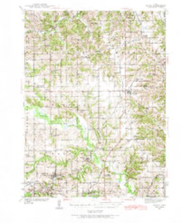
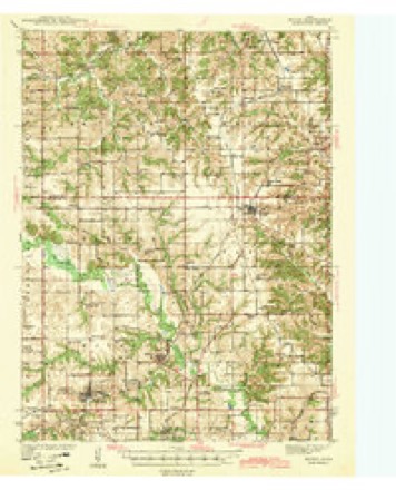
9 topographic sheets cover this place, the earliest surveyed in 1939 and the latest in 1981. It stands in Walnut Township. It lies in ZIP code area 52544. It stands on Little Walnut Creek. The Survey maps it on the Mystic quadrangle. 43 people lived here at the 2020 count. It stands 938 feet above sea level.
Population over time
2 figuresRathbun fell from 89 to 43 between 2010 and 2020. These are the recorded population figures Wikidata holds for this place, reached through the Geographic Names Information System number this page is keyed on rather than by name, so they belong to this place and not to another of the same name. Most are census counts, but not all are: an early figure may be a founding or settlement estimate, and an estimate published within five years of a census is left out. The change column is computed, and is left blank where more than 20 years separate a figure from the one before it, because a gap that long is not a change between two counts.
| Year | People | Change |
|---|---|---|
| 2010 | 89 | |
| 2020 | 43 | -46 (-52%) |
Topographic sheets covering this place
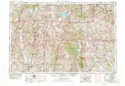
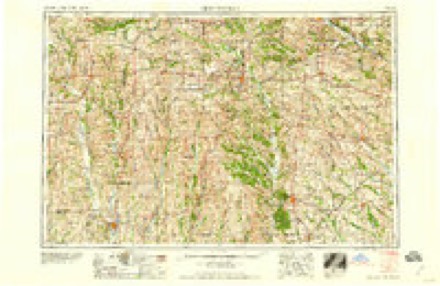
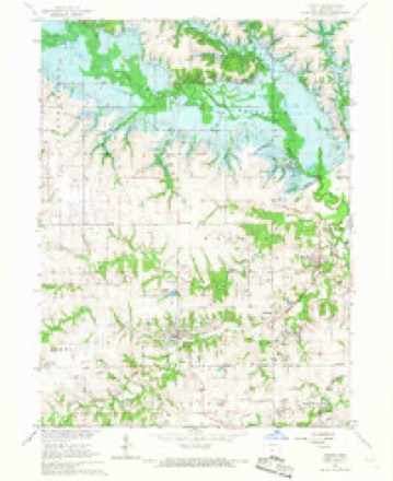
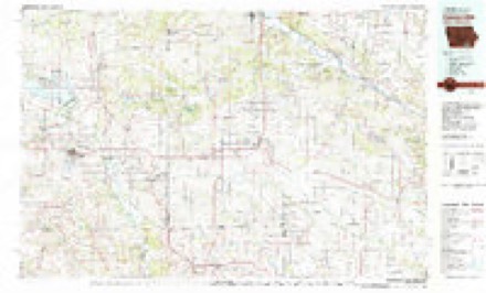
7 surveys from 9 printed sheetsMatched by testing this settlement's coordinate against the published boundary of every sheet in the United States Geological Survey's historical collection. Each opens the scanned sheet at the Survey.
- 1939 USGS Mystic quadrangle1:62500
- 1942 USGS Mystic quadrangle1:62500
- 1954 USGS Centerville quadrangle1:250000, 3 printings
- 1957 USGS Centerville quadrangle1:250000
- 1958 USGS Centerville quadrangle1:250000
- 1966 USGS Mystic quadrangle1:24000
- 1981 USGS Centerville quadrangle1:100000
Fires near this place
5 since 2015Regional context, not property-specific evidence. The federal wildfire occurrence database lists 5 fires within 5 miles of Rathbun in 2015, burning about 142 acres in total. None started naturally. None was recorded as arson. Distance is straight-line from the map coordinates, so a fire counted here may appear on a neighbouring settlement's page as well.
| Reported cause | Fires |
|---|---|
| Debris and open burning | 5 |
The most recent of them, most recent first, with the day each was reported and the service that recorded it.
| Date | Cause | Size | Reported by | Name on the report |
|---|---|---|---|---|
| 5 July 2015 | Debris and open burning | under an acre | Iowa Department of Natural Resources | not named |
| 4 April 2015 | Debris and open burning | 1.0 acres | Iowa Department of Natural Resources | not named |
| 30 March 2015 | Debris and open burning | 120 acres | Iowa Department of Natural Resources | not named |
| 14 March 2015 | Debris and open burning | 20 acres | Iowa Department of Natural Resources | not named |
| 18 January 2015 | Debris and open burning | 1.0 acres | Iowa Department of Natural Resources | not named |
Settlements close enough to share some of these fires:
Mines and quarries near this place
10 of 11 shownRegional context, not property-specific evidence. The federal mineral resources record lists 11 workings within 5 miles of Rathbun: 8 past producers, 3 producers. 3 still produce. What was taken out: Stone, Crushed/Broken, Clay. Distance is straight-line from the map coordinates, so a quarry counted here may appear on a neighbouring settlement's page as well.
| Where | Site | Commodity | Status | Recorded |
|---|---|---|---|---|
| Carter-Waters Corp. Plant | Clay | Producer | ||
| Centerville Quarry | Clay | Producer | ||
| Unknown | Clay | Past Producer | ||
| Unknown | Clay | Past Producer | ||
| Centerville No. 2 Quarry | Stone, Crushed/Broken | Past Producer | ||
| Centerville Quarry | Stone, Crushed/Broken | Past Producer | ||
| Clarkdale Quarry | Stone, Crushed/Broken | Past Producer | ||
| Kincade Quarry | Stone, Crushed/Broken | Past Producer | ||
| Swan Quarry | Stone, Crushed/Broken | Producer | ||
| Tait Quarry | Stone, Crushed/Broken | Past Producer |
Storms near this place
11 since 1995Regional context, not property-specific evidence. The National Weather Service names Rathbun in 11 storm reports between 1995 and 2024: 3 hail, 3 heavy rain, 2 thunderstorm wind, 1 tornado. No death or injury is recorded in these reports. Each account below is quoted exactly as the forecast office filed it, from the NOAA Storm Events Database, and each date opens the federal record of that event.
| When | Event | Place named | Harm | What the report says |
|---|---|---|---|---|
| August 2007 | Flash Flood | Rathbun | $500,000 | Several homes were evacuated due to high water in Centerville and Mystic. Water was flowing over county road T14 north of Mystic. Highway 2 just east of the Chariton River was reduced to one lane and the second lane was nearly under water. |
| July 2010 | Thunderstorm Wind | Rathbun | $5,000 | Very heavy rain and tree damage reported. |
| June 2019 | Thunderstorm Wind | Rathbun | $2,000 | US Army Corps of Engineers reported large branches down in the campgrounds near Rathbun Lake. |
| July 1995 | Hail | Rathbun | $2,000 | no account filed |
| May 1995 | Tornado (F0) | Rathbun | $1,000 | A powerful storm system developed over the southern Rockies and moved northeast into the central United States during the Memorial Day weekend. The storm brought with it a significant cold pool with 500 mb temperatures falling to around -15° C during the late afternoon hours of the 27th. The surface low pressure area moved across north-central Kansas into northeast Nebraska. Aloft, the dry slot punched into western Iowa. This set the stage for a major tornado outbreak as the jet stream dynamics were also very strong. During the afternoon, temperatures warmed into the 70s F. with dew point temperatures in the middle to upper 60s F. This combination produced a CAPE by the late afternoon hours in the 2500 J-kg-1. The lifted indices were in the -7° to -9° C range with helicity values approaching 600 m2-s-2. Strong thunderstorms fired over eastern Nebraska along the surface dry line. The storms quickly became tornadic as the moved into Iowa. There were several major tornadoes in Iowa. One tornado of F4 strength moved from near Carroll to near Fonda. This tornado caused extensive damage. Many farmsteads were damaged along its path, some of which were totally wiped out. The tornado was between one-fourth and one-half mile wide during part of its path. Reports also indicate that the tornado took on a multiple vortex structure as it passed north of Mt. Carmel. Another tornado of lesser strength moved from near Glidden towards Lanesboro. There was some house damage with this tornado. It was about 200 meters wide. Carroll County was also clipped by another F4 strength tornado. This tornado moved from near Coon Rapids to near Churdan. It was at least 200 meters wide during much of its path. At one point between Bayard and Scranton it was three-fourths of a mile wide. The tornado picked up a car and tossed it more than one-fourth mile out into a field. Debris from houses could be found one-half mile from their origin. In addition, one girls homework papers were found some 55 miles away in the town of Gilmore City. A receipt was also found in Gilmore City from the Bates residence, 75 miles to the south. There was one injury from this tornado. This tornado alone caused $2 million in damage. Another tornado, and the one with the longest track, touched down near Creston and tracked north to near Perry. This tornado had an interesting feature. Aside from the fact that it was one-half mile wide at times, the tornado took on a double vortex structure around 2050 CST and continued this way for some time. The double structure lasted at least 20 minutes and was captured on film as it crossed Interstate 80 between the 94 and 95 mile marker at 2058 CST. Aerial photography revealed a definite split in the tornado track over Adair County. The Iowa State Patrol closed off a four mile section of the Interstate to allow the half mile wide tornado to pass. The track of this, as well as several other of the stronger tornadoes, was clearly visible from the air as striations in the soil of many fields. Many farmsteads were also damaged or completely leveled by this tornado. It resulted in at least one injury as a woman fled to her basement as the tornado approached. The tornado hit her house, completely destroying it. As the house collapsed she was struck with a fuel oil tank. The tank broke her hip. She was taken to a hospital in Greenfield, treated and released the next day. The other two members of the family reported struggling to remain in the basement as the suction of the tornado nearly pulled them out. There were also other minor injuries reported around the Greenfield area. Another woman was injured in Stuart as she was thrown by the tornado while attempting to flee. There was also one injury in Carroll County. As the tornado moved through, there was one farmstead that lost five of the six buildings on it. Two cars were destroyed almost beyond recognition. A strong tornado set down in Decatur County near Lamoni. This tornado moved into south-central Clarke County before dissipation. Damage from it was relatively minor as it traversed open country as it paralleled Interstate 35 for some time. The other tornadoes in the state were fairly small and did not cause catastrophic damage. Some preliminary damage estimates from the harder hit counties include: $2 million in Greene County, $1.2 million in Carroll County, $1,146,000 in Union County, $828,000 in Adair County, $642,000 in Sac County, and $160,000 in Guthrie County. Six counties were declared disaster areas. They were Greene, Adair, Carroll, Guthrie, Sac, and Union. A quick run down of damages indicated a total of 52 homes were damaged, 13 of which were destroyed with 16 receiving heavy damage, and 10 businesses damaged or destroyed in the six named counties. A total of 41 farmsteads reported damage caused by the tornadoes. Several of the farm buildings were completely wiped off the map. A break down by county showed seven homes and three businesses damaged in Sac County, 18 homes and two businesses damaged or destroyed in Carroll County, eight homes and two business damaged or destroyed in Greene County, two homes and two businesses damaged or destroyed in Guthrie County, seven homes and one business damaged or destroyed in Adair County, and ten homes damaged or destroyed in Union County. Home and business damage alone in these counties amounted to between $4 and $5 million. Iowa was very fortunate the tornadoes did not move directly into any large population areas. In spite of the significant advance warning provided for these tornadoes, there would almost certainly have been significant loss of life has a major population area taken a direct hit. The closest call was when the tornado headed for a state park in southern Iowa. There was enough advance warning that officials evacuated the park before the tornado hit. The park was hit and this could have been a disaster since it was a holiday weekend and all. There was a significant loss of livestock along the tornadoes paths. Numerous accounts were received of either dead or seriously injured livestock. At the time of this writing there was on official tally of livestock loss. As amazing as it may seem, there was not a great deal of severe weather associated with the storms. One news report indicated that the title papers from a persons car in Creston was found in tact over 50 miles away in the town of Adel. The freezing level was relatively low, 10,500 msl, yet there were only scattered reports of large hail. Golf ball-size hail pelted the southeast side of Leon as well as the Greenfield area. Hail of an inch diameter was also reported in the Ellsworth area. Most of the hail was pea- to marble-size, and even at that, there were few reports. Winds also were not a major problem. There were some reports, such as the 60 mph wind gust at Churdan in Greene County. The most significant wind occurred near Cromwell in Union County. Eighty to 90 mph winds caused structural damage to several buildings there. The storms produced some locally heavy rainfall in the state. The scattered nature of the storms helped to reduce the amount of flash flooding. Guthrie County did have some problems with the water as two and one-half inches of rain fell in Guthrie Center in two hours. Flooding was reported in the Lake Panora area as well. Storm total rainfall approached two inches in parts of the county. The flooding was relatively minor and generally just ditches overtopping roads in spots. |
| April 2024 | Hail | Rathbun | - | Delayed report with picture of hail north of Centerville. |
| July 2015 | Heavy Rain | Rathbun | - | Social media report of storm total of 5.50 inches of rain between Centerville and Moravia. |
| July 2010 | Heavy Rain | Rathbun | - | Rainfall since last night was 6.89 inches. Rainfall resulted in flash flooding south of Rathbun Lake. See Appanoose County flash flood event in this report. |
| August 2007 | Heavy Rain | Rathbun | - | Extreme rainfall was reported with 12.34 inches of rain, most of the rain fell in the past 12 hours. |
| June 2013 | Funnel Cloud | Rathbun | - | no account filed |
| April 2008 | Hail | Rathbun | - | no account filed |
Nearest settlements
The eight closest, with where each one stands in the county. Distances are straight-line, computed from the Geographic Names Information System coordinates.
| Map | Place | Distance | Sheets |
|---|---|---|---|
| Darbyville | 1.3 miles | 9 | |
| Clarkdale | 1.4 miles | 9 | |
| Forbush | 2.3 miles | 9 | |
| Walnut City | 3.1 miles | 9 | |
| Mystic | 3.3 miles | 9 | |
| Maine | 4.1 miles | 9 | |
| Hiattsville | 4.5 miles | 9 | |
| Brazil | 4.6 miles | 9 |
Elsewhere
Matched on this settlement's Geographic Names Information System number rather than its name, so it cannot be a different place of the same name in another state.
| Wikipedia article on Rathbun | An encyclopaedic summary. Its text is share-alike, so it is linked here rather than copied. |
| Wikidata item Q1925982 | The structured record the population and elevation above come from. Public domain (CC0). |
Provenance
This settlement is recorded in the Geographic Names Information System as feature 460531. The sheet list is computed by point-in-boundary test against the United States Geological Survey's historical topographic inventory. Both are works of the United States government and carry no copyright under 17 U.S.C. 105.
Wildfire. Short, Karen C. 2022. Spatial wildfire occurrence data for the United States, 1992-2020 [FPA_FOD_20221014]. 6th Edition. Fort Collins, CO: Forest Service Research Data Archive. https://doi.org/10.2737/RDS-2013-0009.6 Collected with United States Government funding and usable without additional permissions or fees.
Mines and quarries. USGS Mineral Resources Data System (MRDS) https://mrdata.usgs.gov/mrds/ A work of the United States government, no copyright under 17 U.S.C. 105.
Storms. NOAA National Centers for Environmental Information, Storm Events Database https://www.ncei.noaa.gov/stormevents/ A work of the United States government, no copyright under 17 U.S.C. 105. Narratives are quoted verbatim from the National Weather Service report and are not edited or summarised.