Block
From the record
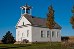
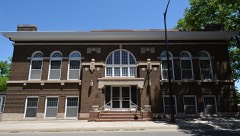
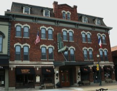
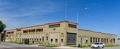
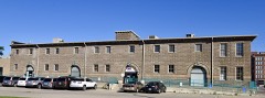
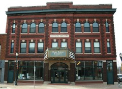
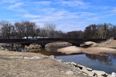
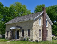
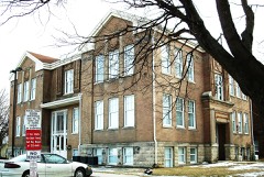
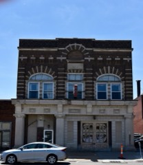
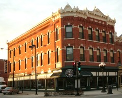
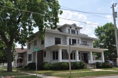
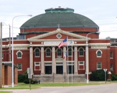
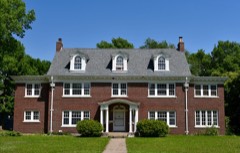
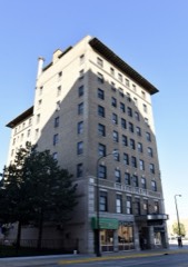
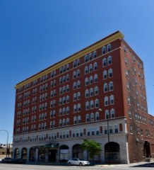
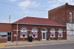
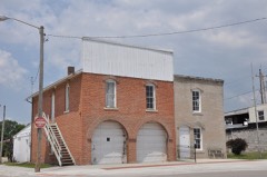
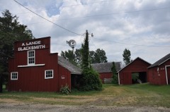
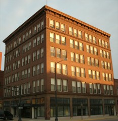
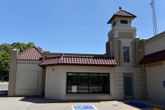
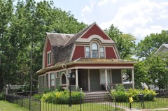
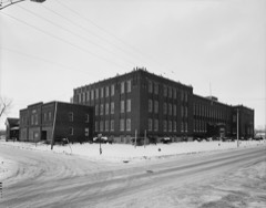
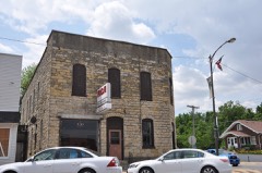
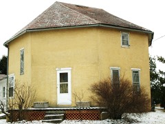
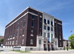
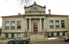
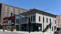
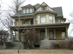
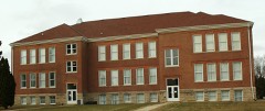
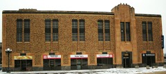
51 National Register listings published here.
Sources: the National Register database, National Park Service
32 topographic sheets cover 37 settlements here, and 51 properties are on the National Register of Historic Places.
51 National Register listings published here.
Sources: the National Register database, National Park Service
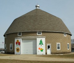
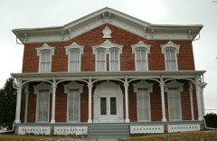
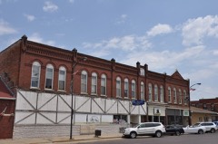
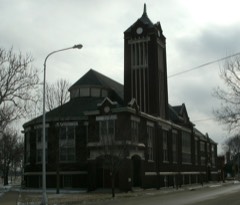
Every property in this county listed on the National Register of Historic Places, with the year it was listed and the federal nomination document.
Every wildfire the federal occurrence database records inside this county: 50 of them, burning about 213 acres. None started naturally and 6 were recorded as arson. Each settlement page carries the fires within five miles of it.
| Reported cause | Fires |
|---|---|
| Missing data/not specified/undetermined | 24 |
| Recreation and ceremony | 8 |
| Debris and open burning | 7 |
| Arson/incendiarism | 6 |
| Equipment and vehicle use | 3 |
| Railroad operations and maintenance | 1 |
| Smoking | 1 |
The five largest, by the area the report gives. None of them was recorded as arson.
| Date | Cause | Size | Reported by | Name on the report |
|---|---|---|---|---|
| 8 November 2009 | Missing data/not specified/undetermined | 75 acres | Iowa Department of Natural Resources | not named |
| 14 April 2008 | Missing data/not specified/undetermined | 20 acres | Iowa Department of Natural Resources | not named |
| 10 April 2004 | Missing data/not specified/undetermined | 20 acres | Iowa State Fire Marshal's Office | not named |
| 26 March 2006 | Missing data/not specified/undetermined | 18 acres | Iowa Department of Natural Resources | not named |
| 27 October 2007 | Missing data/not specified/undetermined | 10 acres | Iowa Department of Natural Resources | not named |
| 12 October 2001 | Equipment and vehicle use | 10 acres | Iowa State Fire Marshal's Office | not named |
| 30 March 2020 | Railroad operations and maintenance | 6.0 acres | Iowa Department of Natural Resources | not named |
| 2 April 2011 | Missing data/not specified/undetermined | 6.0 acres | Iowa Department of Natural Resources | 1690 HWY 218 AND 27, IA |
Every settlement page carries the fires within five miles of it - see the settlement index below.
The NOAA Storm Events Database holds 861 reports for this county, causing 2 deaths, 82 injuries and about $84,181,250 in recorded property damage. Each settlement page carries the reports that name it.
| Kind of event | Reports |
|---|---|
| Thunderstorm Wind | 271 |
| Hail | 253 |
| Flood | 136 |
| Heavy Rain | 92 |
| Flash Flood | 44 |
| Tornado | 39 |
| Lightning | 14 |
| Funnel Cloud | 12 |
The most serious of them, by death, then injury, then recorded damage. The accounts are quoted exactly as the forecast office filed them.
| When | Event | Place named | Harm | What the report says |
|---|---|---|---|---|
| May 2000 | Tornado (F3) | Cedar Falls | 1 killed, 25 hurt, $1,750,000 | Multi-vortex, regerative tornado |
| April 1960 | Tornado (F3) | not stated | 1 killed, 5 hurt, $250,000 | no account filed |
| May 1964 | Tornado (F2) | not stated | 27 hurt, $25,000,000 | no account filed |
| May 2008 | Tornado (EF2) | Benson | 20 hurt, $25,000,000 | Tornado moved in from Butler County and became very broad as it headed toward Fairbank. Tornado lifted on the Buchanan County border. |
| June 1976 | Tornado (F2) | not stated | 2 hurt, $25,000 | no account filed |
| May 1989 | Thunderstorm Wind | not stated | 2 hurt | no account filed |
| May 2008 | Lightning | Waterloo | 1 hurt | Lighting struck and injured one outside of the Waterloo Post Office. |
| August 1965 | Tornado (F4) | not stated | $2,500,000 | no account filed |
| June 2008 | Flood | Benson | $2,000,000 | no account filed |
| May 1999 | Flash Flood | Dunkerton | $1,200,000 | no account filed |
| March 2019 | Flood | Finchford | $1,000,000 | Public reported water over the road at Miller Creek Road between Laporte City and Washburn. Additionally downstream near Vinton there was an ice jam on the Cedar River. This was causing water to backup in Waterloo and Cedar Falls and causing some flooding. Another ice jam in the Cottage Row area of Cedar Falls was causing flooding and impacting homes. Many roads across the Waterloo and Cedar Falls area had been closed. |
| April 2010 | Hail | Cedar Falls | $1,000,000 | The ground was covered by 1 to 3.5 inch diameter hail. |
| July 2006 | Hail | Waterloo | $1,000,000 | no account filed |
| June 2002 | Lightning | Waterloo | $1,000,000 | no account filed |
| July 1999 | Flash Flood | Waterloo | $1,000,000 | no account filed |
| July 2009 | Thunderstorm Wind | Cedar Falls | $750,000 | Six inch diameter tree branches were down and a radio station tower collapsed. |
| July 2010 | Flash Flood | Evansdale | $500,000 | Intersection of Shaulis Road near Highway 218 had water up to the car doors. |
| July 2009 | Thunderstorm Wind | (Alo)Waterloo Muni A | $500,000 | A strong thunderstorms bowed out and damaged a garage in Cedar Falls. Other damage around the city was extensive. |
| June 2013 | Flood | Benson | $500,000 | no account filed |
| June 2013 | Flood | Benson | $500,000 | no account filed |
| May 2013 | Flood | Benson | $500,000 | no account filed |
| May 2013 | Flood | Benson | $500,000 | no account filed |
| June 2008 | Flood | Finchford | $500,000 | no account filed |
| June 2008 | Flood | Benson | $500,000 | no account filed |
| May 2000 | Tornado (F2) | Dunkerton | $350,000 | Farm and several outbuildings destroyed |
| May 2000 | Tornado (F2) | Dunkerton | $300,000 | Two houses destroyed |
| July 2007 | Hail | Cedar Falls | $300,000 | no account filed |
| June 1997 | Thunderstorm Wind | La Porte City | $300,000 | no account filed |
| July 2018 | Flood | Finchford | $250,000 | Water was reported over many roads in the county. |
| September 2018 | Flood | Evansdale | $250,000 | Black Hawk Creek at Hudson crested at 16.82 feet on 5 September 2018 at 1345 UTC. |
| June 2015 | Flood | (Alo)Waterloo Muni A | $250,000 | The Cedar River at Cedar Falls crested at 89.67 feet at 9:00 AM CST on 26 June. |
| May 2013 | Flash Flood | Evansdale | $250,000 | Flash flooding at Black Hawk and Ansborough Ave. Southbound U.S. 218 at Washington and Mullan Ave flooded. |
| July 2009 | Thunderstorm Wind | (Alo)Waterloo Muni A | $250,000 | Air traffic controller reports trees, estimated 3-4 feet in diameter, uprooted at the airport. Limbs, estimated 8-10 inches in diameter were blown down. Some hangar doors were bent in and a helicopter was blown into a fence. |
| July 2009 | Thunderstorm Wind | (Alo)Waterloo Muni A | $250,000 | Widespread damage from Cedar Falls to the Waterloo Airport. |
| April 2008 | Flood | Voorhies | $250,000 | The Black Hawk County Sheriff reported the city of Hudson was inundated with water from Black Hawk Creek. Sandbagging was underway, but failed to hold back the water. A local emergency was declared. |
| June 2013 | Flood | Benson | $250,000 | no account filed |
| June 2013 | Flood | Benson | $250,000 | no account filed |
| May 2013 | Flood | Benson | $250,000 | no account filed |
| May 2013 | Flood | Benson | $250,000 | no account filed |
| July 2001 | Flash Flood | Waterloo | $250,000 | no account filed |
| July 2000 | Flash Flood | Countywide | $250,000 | no account filed |
| May 1990 | Tornado (F1) | not stated | $250,000 | no account filed |
| May 1988 | Tornado (F1) | not stated | $250,000 | no account filed |
| June 1973 | Tornado (F1) | not stated | $250,000 | no account filed |
| May 2018 | Flood | (Alo)Waterloo Muni A | $200,000 | The Cedar River at Cedar Falls crested at 92.19 feet on 6 May 2018 at 14:30 UTC. |
| May 2018 | Flood | (Alo)Waterloo Muni A | $200,000 | The Cedar River at Waterloo crested at 13.68 feet on 6 May 2018 at 21:45 UTC. |
| May 2013 | Flash Flood | Castle Hill | $200,000 | University Ave near Town House Tenderloins flooded. At least one care was submerged. |
| May 2013 | Flood | Hudson | $200,000 | Flooding of areas streams and creeks resulted in flooding in Hudson and Dunkerton with volunteer evacuations underway. Some roads remain flooded. |
| July 2010 | Flash Flood | Dewar | $200,000 | Portions of the railroad bed undermined near the town of Dewar. |
| April 2008 | Flood | Benson | $200,000 | no account filed |
| July 2007 | Hail | Cedar Falls | $200,000 | no account filed |
| June 2008 | Flash Flood | Waterloo | $150,000 | Two to 3 feet of water standing in Waterloo near the Sycamore area. Water was also over portions of Black Hawk Road. |
| April 2008 | Flood | Benson | $150,000 | no account filed |
| June 1999 | Flash Flood | La Porte City | $150,000 | no account filed |
| May 1999 | Flash Flood | Waterloo | $150,000 | no account filed |
| June 1997 | Thunderstorm Wind | Hudson | $150,000 | no account filed |
| April 2001 | Tornado (F1) | La Porte City | $125,000 | Tornado with intermittent track over open country. |
| May 2019 | Flood | (Alo)Waterloo Muni A | $100,000 | The Cedar River at Cedar Falls crested at 90.3 feet on 31 May 2019 at 22:45 UTC. |
| April 2018 | Flood | (Alo)Waterloo Muni A | $100,000 | The Cedar River at Cedar Falls crested at 90.39 feet on 17 April 2018 at 9:15 UTC. |
| April 2018 | Flood | (Alo)Waterloo Muni A | $100,000 | The Cedar River at Cedar Falls crested at 89.23 feet on 25 April 2018 at 19:00 UTC. |
The Survey's mineral resources record lists 61 workings inside this county. 14 still produce and 47 are closed or unrecorded. Each settlement page carries the workings within five miles of it.
| Commodity | Workings |
|---|---|
| Sand and Gravel, Construction | 40 |
| Stone, Crushed/Broken | 17 |
| Clay | 2 |
| Iron, Fluorine-Fluorite, Barium-Barite, Copper | 1 |
| Fluorine-Fluorite, Zinc, Lead, Barium-Barite, Iron | 1 |
The least common of them first, because a county's hundredth gravel pit says nothing its first ten did not.
| Where | Site | Commodity | Status | Recorded |
|---|---|---|---|---|
| Pint's Quarry | Fluorine-Fluorite, Zinc, Lead, Barium-Barite, Iron | Past Producer | Barite, Fluorite, Galena, Pyrite, Sphalerite | |
| Waterloo South Quarry | Iron, Fluorine-Fluorite, Barium-Barite, Copper | Past Producer | Barite, Fluorite, Pyrite | |
| Stead Bros. and Guenther Clay Pit | Clay | Past Producer | ||
| Waterloo and Cedar Falls Brick Co. | Clay | Past Producer | ||
| Burton Avenue Quarry | Stone, Crushed/Broken | Past Producer | ||
| Fehl Quarry | Stone, Crushed/Broken | Past Producer | ||
| Fox Quarry | Stone, Crushed/Broken | Producer | ||
| Franta Quarry | Stone, Crushed/Broken | Producer | ||
| Glory Quarry | Stone, Crushed/Broken | Past Producer | ||
| Morgan Quarry | Stone, Crushed/Broken | Producer | ||
| Mullen Quarry | Stone, Crushed/Broken | Past Producer | ||
| Newton Quarry | Stone, Crushed/Broken | Past Producer | ||
| Newton Quarry | Stone, Crushed/Broken | Past Producer | ||
| Newton Quarry | Stone, Crushed/Broken | Past Producer | ||
| Pints Quarry | Stone, Crushed/Broken | Past Producer | ||
| Raymond Mine | Stone, Crushed/Broken | Producer | ||
| Raymond Quarry | Stone, Crushed/Broken | Producer | ||
| Unknown | Stone, Crushed/Broken | Past Producer | ||
| Waterloo South | Stone, Crushed/Broken | Producer | ||
| Waterloo South Quarry | Stone, Crushed/Broken | Producer | ||
| Yokom Quarry | Stone, Crushed/Broken | Producer | ||
| Assink Sand & Gravel Pit | Sand and Gravel, Construction | Producer | ||
| Bagenstos Sand & Gravel Pit & Plant | Sand and Gravel, Construction | Producer | ||
| Dobbs Pit | Sand and Gravel, Construction | Past Producer | ||
| Hawkeye Sand & Gravel | Sand and Gravel, Construction | Producer | ||
| Livingston Pit | Sand and Gravel, Construction | Past Producer | ||
| Mohler Pit | Sand and Gravel, Construction | Past Producer | ||
| Tom Zeien Sand and Gravel | Sand and Gravel, Construction | Producer | ||
| Unknown | Sand and Gravel, Construction | Past Producer | ||
| Unknown | Sand and Gravel, Construction | Past Producer | ||
| Unknown | Sand and Gravel, Construction | Past Producer | ||
| Unknown | Sand and Gravel, Construction | Past Producer | ||
| Unknown | Sand and Gravel, Construction | Past Producer | ||
| Unknown | Sand and Gravel, Construction | Past Producer | ||
| Unknown | Sand and Gravel, Construction | Past Producer | ||
| Unknown | Sand and Gravel, Construction | Past Producer | ||
| Unknown | Sand and Gravel, Construction | Past Producer | ||
| Unknown | Sand and Gravel, Construction | Past Producer | ||
| Unknown | Sand and Gravel, Construction | Past Producer | ||
| Unknown | Sand and Gravel, Construction | Past Producer | ||
| Unknown | Sand and Gravel, Construction | Past Producer | ||
| Unknown | Sand and Gravel, Construction | Past Producer | ||
| Unknown | Sand and Gravel, Construction | Past Producer | ||
| Unknown | Sand and Gravel, Construction | Past Producer | ||
| Unknown | Sand and Gravel, Construction | Past Producer | ||
| Unknown | Sand and Gravel, Construction | Past Producer | ||
| Unknown | Sand and Gravel, Construction | Past Producer | ||
| Unknown | Sand and Gravel, Construction | Past Producer | ||
| Unknown | Sand and Gravel, Construction | Past Producer | ||
| Unknown | Sand and Gravel, Construction | Past Producer | ||
| Unknown | Sand and Gravel, Construction | Past Producer | ||
| Unknown | Sand and Gravel, Construction | Past Producer | ||
| Unknown | Sand and Gravel, Construction | Past Producer | ||
| Unknown | Sand and Gravel, Construction | Past Producer | ||
| Unknown | Sand and Gravel, Construction | Unknown | ||
| Unknown | Sand and Gravel, Construction | Past Producer | ||
| Unknown | Sand and Gravel, Construction | Past Producer | ||
| Unknown | Sand and Gravel, Construction | Past Producer | ||
| Unknown | Sand and Gravel, Construction | Past Producer | ||
| Waterloo Pit and Plant | Sand and Gravel, Construction | Producer | ||
| Waterloo Sand Plant | Sand and Gravel, Construction | Producer |
Named settlements recorded in the Geographic Names Information System, each with the topographic sheets covering it. Villages, hamlets and abandoned places alike. Each is shown with the nearest named watercourse or landform and the survey quadrangle it falls on.
East Waterloo township · 50703 · Waterloo North quadrangle
10 sheets, 1954 to 1984
No longer a settlement
Mount Vernon township · 50613 · Cedar Falls quadrangle
12 sheets, 1954 to 1984
No longer a settlement
Barclay township · 50703 · Dunkerton quadrangle
9 sheets, 1954 to 1984
No longer a settlement
Waterloo city · 50701 · Near Blackwood Island · Cedar Falls quadrangle
12 sheets, 1954 to 1984
Cedar Falls city · 50613 · On Snag Creek · Cedar Falls quadrangle
12 sheets, 1954 to 1984
Waterloo city · 50701 · On Prescotts Creek · Hudson quadrangle
10 sheets, 1954 to 1984
East Waterloo township · 50703 · Waterloo North quadrangle
10 sheets, 1954 to 1984
No longer a settlement
Bennington township · 50703 · Waterloo North quadrangle
10 sheets, 1954 to 1984
No longer a settlement
East Waterloo township · 50707 · On Elk Run · Waterloo South quadrangle
11 sheets, 1954 to 1984
Poyner township · 50634 · On Indian Creek · Gilbertville quadrangle
9 sheets, 1954 to 1984
Mount Vernon township · 50703 · Waterloo North quadrangle
10 sheets, 1954 to 1984
No longer a settlement
Cedar Falls city · 50613 · On Dry Run · Cedar Falls quadrangle
12 sheets, 1954 to 1984
Cedar Falls city · 50613 · Near Deadmans Island · Cedar Falls quadrangle
12 sheets, 1954 to 1984
Cedar Falls city · 50613 · On Snag Creek · Cedar Falls quadrangle
12 sheets, 1954 to 1984
Waterloo city · 50701 · On Virden Creek · Waterloo South quadrangle
11 sheets, 1954 to 1984
The vanished settlements of Black Hawk County: the places named above that are no longer on the map.