 Block
From the record
One of 51 National Register listings published here for Black Hawk County · listed in 2023 · category: Building.
Sources: the National Register database, National Park Service
Listed on the National Register of Historic Places in 2023.
One of 51 National Register listings published here for Black Hawk County · listed in 2023 · category: Building.
Sources: the National Register database, National Park Service
Regional context, not property-specific evidence. The federal wildfire occurrence database lists 6 fires within 5 miles of Friedl Bakery Building between 2002 and 2011, burning about 11 acres in total. None started naturally. 1 was recorded as arson. Distance is straight-line from the map coordinates, so a fire counted here may appear on a neighbouring settlement's page as well.
| Reported cause | Fires |
|---|---|
| Missing data/not specified/undetermined | 4 |
| Arson/incendiarism | 1 |
| Recreation and ceremony | 1 |
The most recent of them, most recent first, with the day each was reported and the service that recorded it.
| Date | Cause | Size | Reported by | Name on the report |
|---|---|---|---|---|
| 9 September 2002 | Arson/incendiarism | under an acre | Iowa State Fire Marshal's Office | not named |
| 6 July 2009 | Missing data/not specified/undetermined | 1.0 acres | Iowa Department of Natural Resources | not named |
| 25 May 2009 | Missing data/not specified/undetermined | under an acre | Iowa Department of Natural Resources | not named |
| 2 April 2011 | Missing data/not specified/undetermined | 6.0 acres | Iowa Department of Natural Resources | 1690 HWY 218 AND 27, IA |
| 27 March 2002 | Recreation and ceremony | 2.0 acres | Iowa State Fire Marshal's Office | not named |
| 26 February 2006 | Missing data/not specified/undetermined | 1.0 acres | Iowa Department of Natural Resources | not named |
Regional context, not property-specific evidence. The federal mineral resources record lists 11 workings within 5 miles of Friedl Bakery Building: 8 past producers, 2 producers, 1 unknown. 2 still produce. What was taken out: Sand and Gravel, Construction, Stone, Crushed/Broken, Clay. Distance is straight-line from the map coordinates, so a quarry counted here may appear on a neighbouring settlement's page as well.
| Where | Site | Commodity | Status | Recorded |
|---|---|---|---|---|
| Burton Avenue Quarry | Stone, Crushed/Broken | Past Producer | ||
| Stead Bros. and Guenther Clay Pit | Clay | Past Producer | ||
| Unknown | Sand and Gravel, Construction | Past Producer | ||
| Unknown | Sand and Gravel, Construction | Past Producer | ||
| Unknown | Sand and Gravel, Construction | Past Producer | ||
| Unknown | Sand and Gravel, Construction | Past Producer | ||
| Unknown | Sand and Gravel, Construction | Past Producer | ||
| Unknown | Sand and Gravel, Construction | Unknown | ||
| Unknown | Sand and Gravel, Construction | Past Producer | ||
| Waterloo Pit and Plant | Sand and Gravel, Construction | Producer |
Regional context, not property-specific evidence. The National Weather Service names Waterloo, the town this property stands in, in 168 storm reports between 1993 and 2025: 66 hail, 50 thunderstorm wind, 23 heavy rain, 14 flash flood. The reports record 1 injury. Each account below is quoted exactly as the forecast office filed it, from the NOAA Storm Events Database, and each date opens the federal record of that event.
| When | Event | Place named | Harm | What the report says |
|---|---|---|---|---|
| May 2008 | Lightning | Waterloo | 1 hurt | Lighting struck and injured one outside of the Waterloo Post Office. |
| July 2006 | Hail | Waterloo | $1,000,000 | no account filed |
| June 2002 | Lightning | Waterloo | $1,000,000 | no account filed |
| July 1999 | Flash Flood | Waterloo | $1,000,000 | no account filed |
| July 2001 | Flash Flood | Waterloo | $250,000 | no account filed |
| June 2008 | Flash Flood | Waterloo | $150,000 | Two to 3 feet of water standing in Waterloo near the Sycamore area. Water was also over portions of Black Hawk Road. |
| May 1999 | Flash Flood | Waterloo | $150,000 | no account filed |
| July 2010 | Heavy Rain | Waterloo | $100,000 | Rainfall of 3.8 to 4 inches since 0430 CST. Several houses have water in the basement. |
| June 1997 | Thunderstorm Wind | Waterloo | $100,000 | no account filed |
| May 2013 | Flash Flood | Waterloo | $75,000 | A car stalled in flash flood waters near the Grout Museum. |
| May 2004 | Flash Flood | Waterloo | $75,000 | no account filed |
| June 1998 | Flood | Waterloo | $75,000 | no account filed |
| July 2025 | Thunderstorm Wind | Waterloo | $50,000 | Several reports across Waterloo of trees on utility lines and transformers. Power is out in various locations around Waterloo. Time estimated by radar and ASOS recorded gust. |
| March 2024 | Lightning | Waterloo | $50,000 | Delayed report of house fire in vicinity due to lightning. Time of lightning strike estimated from radar. |
| June 2010 | Thunderstorm Wind | Waterloo | $50,000 | Large trees down, power lines down, some damage to home on Gloria Drive. |
| July 2010 | Flash Flood | Waterloo | $50,000 | Law enforcement reported the road impassible at the intersection of Franklin and Elm Street due to water. |
| April 2009 | Flash Flood | Waterloo | $50,000 | Reports of 18 to 24 inches of flowing water through the intersection. |
| March 2007 | Flood | Waterloo | $50,000 | no account filed |
| July 2006 | Hail | Waterloo | $50,000 | no account filed |
| July 2001 | Thunderstorm Wind | Waterloo | $50,000 | no account filed |
| September 2001 | Thunderstorm Wind | Waterloo | $50,000 | no account filed |
| May 2000 | Flash Flood | Waterloo | $50,000 | no account filed |
| June 1998 | Thunderstorm Wind | Waterloo | $50,000 | no account filed |
| June 1998 | Flood | Waterloo | $50,000 | no account filed |
| April 1997 | Thunderstorm Wind | Waterloo | $50,000 | no account filed |
| June 2025 | Thunderstorm Wind | Waterloo | $40,000 | Damage to homes due to downed tree limbs. |
| June 2008 | Thunderstorm Wind | Waterloo | $30,000 | Trees and power lines were down across the Waterloo and Cedar Falls area including the University of Northern Iowa. One tree fell on a house. |
| April 2013 | Hail | Waterloo | $25,000 | Quarter size hall covering the ground two the three inches deep at the intersection of Conger St and Highway 63. |
| June 2010 | Thunderstorm Wind | Waterloo | $25,000 | Tree fell on a house. |
| June 2010 | Thunderstorm Wind | Waterloo | $25,000 | Numerous trees blown down. |
| June 2008 | Thunderstorm Wind | Waterloo | $25,000 | Large trees were down in the southern end of Waterloo. Power lines taken down as well. Another tree was downed in Evansdale. |
| April 2013 | Hail | Waterloo | $25,000 | no account filed |
| April 2010 | Hail | Waterloo | $25,000 | no account filed |
| July 2006 | Hail | Waterloo | $25,000 | no account filed |
| May 2003 | Hail | Waterloo | $25,000 | no account filed |
| May 2002 | Hail | Waterloo | $25,000 | no account filed |
| June 2018 | Flash Flood | Waterloo | $20,000 | KWWL reported flash flooding along 4th St in downtown Waterloo. |
| June 2008 | Flash Flood | Waterloo | $20,000 | Sixth Street and Lafayette in Waterloo under water one half block in either direction. |
| July 2008 | Thunderstorm Wind | Waterloo | $20,000 | Several large trees and numerous large branches were down along Highway 63 in the southern section of Waterloo. |
| August 2002 | Thunderstorm Wind | Waterloo | $20,000 | no account filed |
| June 2001 | Thunderstorm Wind | Waterloo | $20,000 | no account filed |
| May 2000 | Hail | Waterloo | $20,000 | no account filed |
| July 2008 | Lightning | Waterloo | $15,000 | KWWL reported that lightning struck a home in Waterloo around 1500 CST. Fire crews were called to the scene. |
| April 2010 | Hail | Waterloo | $15,000 | no account filed |
| August 2016 | Thunderstorm Wind | Waterloo | $10,000 | Media reported a large tree down on some power lines. Delayed report. |
| May 2013 | Thunderstorm Wind | Waterloo | $10,000 | Trees were reported down from high wind. |
| April 2009 | Flash Flood | Waterloo | $10,000 | Flooding has popped up manhole covers on Upton Ave near Ansborough Ave. |
| June 2008 | Thunderstorm Wind | Waterloo | $10,000 | no account filed |
| June 2007 | Thunderstorm Wind | Waterloo | $10,000 | no account filed |
| July 2007 | Thunderstorm Wind | Waterloo | $10,000 | no account filed |
| March 2006 | Hail | Waterloo | $10,000 | no account filed |
| April 2006 | Hail | Waterloo | $10,000 | no account filed |
| March 2005 | Thunderstorm Wind | Waterloo | $10,000 | no account filed |
| May 2004 | Hail | Waterloo | $10,000 | no account filed |
| August 2004 | Thunderstorm Wind | Waterloo | $10,000 | no account filed |
| May 2003 | Hail | Waterloo | $10,000 | no account filed |
| September 2001 | Thunderstorm Wind | Waterloo | $10,000 | no account filed |
| May 2000 | Flood | Waterloo | $10,000 | no account filed |
| June 2000 | Lightning | Waterloo | $10,000 | no account filed |
| August 1998 | Flood | Waterloo | $10,000 | no account filed |
No historic map-sheet match is published for this property yet. That does not mean no map exists. This record needs a coordinate-quality review before it can be joined to a sheet boundary. Browse the county's mapped places while that work is pending.
Other National Register properties close enough to walk or drive between, ordered by distance from this one. Both positions come from the same geocoding pass that matched these properties to their map sheets.
| Photograph | Property | Distance | Listed |
|---|---|---|---|
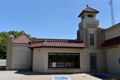 | Master Service Station | under 500 feet | 2011 |
 | Campbell Baking Company | 0.2 miles | 2016 |
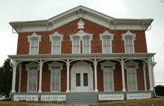 | Snowden House | 0.2 miles | 1977 |
| Rensselaer Russell House | 0.2 miles | 1973 | |
 | YMCA Building | 0.3 miles | 1983 |
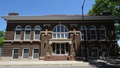 | Black Hawk County Soldiers Memorial Hall | 0.3 miles | 1988 |
| National Archives record | The nomination case file for reference 100009670 in Record Group 79. |
| Black Hawk County | All 51 listed properties in this county. |