Block
From the record
20 National Register listings published here.
Sources: the National Register database, National Park Service
30 topographic sheets cover 19 settlements here, and 20 properties are on the National Register of Historic Places.
20 National Register listings published here.
Sources: the National Register database, National Park Service
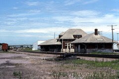
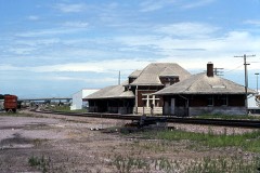
Every property in this county listed on the National Register of Historic Places, with the year it was listed and the federal nomination document.
Every wildfire the federal occurrence database records inside this county: 67 of them, burning about 728 acres. None started naturally and none was recorded as arson. Each settlement page carries the fires within five miles of it.
| Reported cause | Fires |
|---|---|
| Missing data/not specified/undetermined | 46 |
| Debris and open burning | 11 |
| Equipment and vehicle use | 5 |
| Smoking | 3 |
| Railroad operations and maintenance | 1 |
| Misuse of fire by a minor | 1 |
The five largest, by the area the report gives. None of them was recorded as arson.
| Date | Cause | Size | Reported by | Name on the report |
|---|---|---|---|---|
| 6 October 2011 | Missing data/not specified/undetermined | 80 acres | Iowa Department of Natural Resources | 22373 150TH ST. CARROLL, IA, IA |
| 26 October 2011 | Missing data/not specified/undetermined | 50 acres | Iowa Department of Natural Resources | 5008 290TH , IA |
| 15 April 2008 | Missing data/not specified/undetermined | 50 acres | Iowa Department of Natural Resources | not named |
| 6 April 2011 | Missing data/not specified/undetermined | 46 acres | Iowa Department of Natural Resources | 5423 290TH ST., IA |
| 4 October 2011 | Missing data/not specified/undetermined | 40 acres | Iowa Department of Natural Resources | 140TH ST AND NOBLE AVE NORTH OF CARROLL, IA, IA |
| 28 April 2013 | Debris and open burning | 35 acres | Iowa Department of Natural Resources | not named |
| 5 September 2012 | Equipment and vehicle use | 30 acres | Iowa Department of Natural Resources | not named |
| 15 April 2006 | Missing data/not specified/undetermined | 30 acres | Iowa Department of Natural Resources | not named |
Every settlement page carries the fires within five miles of it - see the settlement index below.
The NOAA Storm Events Database holds 461 reports for this county, causing no deaths, 89 injuries and about $11,055,100 in recorded property damage. Each settlement page carries the reports that name it.
| Kind of event | Reports |
|---|---|
| Thunderstorm Wind | 201 |
| Hail | 143 |
| Heavy Rain | 42 |
| Tornado | 34 |
| Flash Flood | 16 |
| Flood | 11 |
| Lightning | 7 |
| Funnel Cloud | 7 |
The most serious of them, by death, then injury, then recorded damage. The accounts are quoted exactly as the forecast office filed them.
| When | Event | Place named | Harm | What the report says |
|---|---|---|---|---|
| May 2003 | Hail | Breda | 88 hurt, $2,000 | no account filed |
| May 2008 | Lightning | Carroll | 1 hurt | no account filed |
| May 1995 | Tornado (F4) | Carroll to | $3,000,000 | Multiple vortex at times. |
| July 2002 | Thunderstorm Wind | Carroll | $1,500,000 | no account filed |
| August 1993 | Tornado (F1) | Breda | $500,000 | no account filed |
| May 1996 | Lightning | Lidderdale | $300,000 | no account filed |
| July 1996 | Flash Flood | Carroll | $300,000 | no account filed |
| May 1995 | Tornado (F2) | Dedham to | $300,000 | no account filed |
| April 2007 | Flood | Carroll | $250,000 | no account filed |
| May 2007 | Flood | Lanesboro | $250,000 | no account filed |
| June 1998 | Thunderstorm Wind | Carroll | $250,000 | no account filed |
| June 1996 | Flash Flood | Carroll | $250,000 | no account filed |
| May 1960 | Tornado (F2) | not stated | $250,000 | no account filed |
| May 2008 | Tornado (EF1) | Templeton | $200,000 | A tornado damaged 3 farmsteads in southern Carroll County as it moved east from near Templeton toward Dedham. A machine shed was completely destroyed and numerous outbuildings sustained damage. Widespread tree damage was also reported. |
| July 2008 | Tornado (EF1) | Templeton | $150,000 | Tornado touched down near the intersection of Highway 141 and Hawthorne. A farmstead was hit along the path, flattening the barn and damaging the homestead. Power lines were also downed by the tornado. |
| September 2015 | Flash Flood | Coon Rapids | $100,000 | Emergency Manager reported water over Highway 141 near Coon Rapids, and that it is not a place that normally flash floods. |
| June 2011 | Tornado (EF1) | Halbur | $100,000 | An EF1 tornado was on the ground for a brief time with a path length of 2.5 miles due east. Width was up to 100 yards with peak wind estimated at around 95 mph. A roof was blown off a hog confinement building and Morton building with other damage in between. |
| August 2010 | Flash Flood | Carroll | $100,000 | Three to four feet of standing water on city streets. |
| December 2021 | Tornado (EF1) | Wiley | $80,000 | Damage was obtained via social media. The track was also observed near the Carroll Airport from high resolution satellite imagery. There was damage to a home and outbuildings with up to EF1 damage. |
| March 2025 | Thunderstorm Wind | Maple River | $75,000 | Half mile of power poles snapped off 3 miles west and 1 mile north of Carroll near the town of Maple River. |
| June 2013 | Flash Flood | Coon Rapids | $75,000 | Water over Highway 141 west of Coon Rapids. |
| July 2012 | Thunderstorm Wind | Arcadia | $75,000 | A few three foot diameter trees were downed. A 30 foot long camper attached to a truck was blown over. Several crops damaged. |
| May 2004 | Flash Flood | Countywide | $75,000 | no account filed |
| May 1998 | Thunderstorm Wind | Breda | $75,000 | no account filed |
| May 1998 | Thunderstorm Wind | Glidden | $60,000 | no account filed |
| May 2024 | Thunderstorm Wind | Carroll | $50,000 | Sheriff dispatch relayed wind and hail in Carroll, including trees and powerlines down. |
| July 2016 | Thunderstorm Wind | Carroll | $50,000 | Sheriff reported half of the city of Carroll without power and numerous crews out clearing up to a foot diameter trees from roads in town along with power lines. |
| June 2015 | Thunderstorm Wind | Mt Carmel | $50,000 | Power poles down north of Carroll along Highway 71 at 120th street. |
| September 2015 | Flash Flood | Carroll | $50,000 | Heavy rainfall of 2 inches in about 45 minutes. Street flooding in Carroll was reported with water up to the doors of cars. |
| September 2015 | Flash Flood | Glidden | $50,000 | Public reported roadside ditches full and local roads in Glidden with 6 to 10 inches of standing water. |
| September 2015 | Flash Flood | Glidden | $50,000 | Public reported water running over Highway 30 in multiple locations about a half mile west of Glidden. |
| June 2013 | Flash Flood | Coon Rapids | $50,000 | Water was over A Avenue along the Guthrie/Carroll County line. |
| July 2012 | Thunderstorm Wind | Carroll | $50,000 | Widespread damage throughout the town of Carroll. Numerous branches, power lines, and street signs down. |
| August 2010 | Flash Flood | Glidden | $50,000 | One and a half feet of slowly flowing water on streets in Glidden. |
| August 2007 | Thunderstorm Wind | Coon Rapids | $50,000 | Strong winds blew a barn over. |
| May 2015 | Thunderstorm Wind | Carroll Neu Arpt | $50,000 | no account filed |
| May 2004 | Thunderstorm Wind | Breda | $50,000 | no account filed |
| July 2002 | Thunderstorm Wind | Glidden | $50,000 | no account filed |
| April 1998 | Flood | Carroll | $50,000 | no account filed |
| July 1998 | Flood | Carroll | $50,000 | no account filed |
| August 1996 | Lightning | Carroll | $50,000 | no account filed |
| August 1993 | Thunderstorm Wind | Carroll | $50,000 | no account filed |
| August 1993 | Thunderstorm Wind | Mt. Carmel | $50,000 | no account filed |
| August 1993 | Thunderstorm Wind | Carroll | $50,000 | no account filed |
| April 2001 | Thunderstorm Wind | Carroll | $35,000 | no account filed |
| May 1998 | Thunderstorm Wind | Manning | $35,000 | no account filed |
| April 2001 | Thunderstorm Wind | Templeton | $30,000 | no account filed |
| June 1998 | Thunderstorm Wind | Glidden | $30,000 | no account filed |
| June 1996 | Flood | Carroll | $30,000 | no account filed |
| May 2015 | Tornado (EF0) | Mt Carmel | $25,000 | Debris on the ground. Tornado continued into Calhoun County. |
| August 2014 | Thunderstorm Wind | Manning | $25,000 | Numerous trees were blown down. |
| July 2012 | Thunderstorm Wind | Carroll | $25,000 | Power lines down in Carroll. Large branches down, causing damage to a house porch. |
| May 2008 | Flash Flood | Mt Carmel | $25,000 | Water was over Highway 71 north of Carroll. |
| June 2008 | Flash Flood | Lidderdale | $25,000 | Street flooding was reported in town. |
| June 2008 | Flood | Carroll | $25,000 | Highway was closed and flooded at 3rd street. |
| July 2008 | Thunderstorm Wind | Glidden | $25,000 | From a KCCI schoolnet site. |
| July 2008 | Thunderstorm Wind | Glidden | $25,000 | Measured wind by KCCI schoolnet site. |
| August 2007 | Thunderstorm Wind | Templeton | $25,000 | A 50 year old large tree was blown down along with several other limbs covering the roads in the town of Templeton. |
| June 2008 | Thunderstorm Wind | Halbur | $25,000 | no account filed |
| May 2005 | Hail | Manning | $25,000 | no account filed |
The Survey's mineral resources record lists 28 workings inside this county. 3 still produce and 25 are closed or unrecorded. Each settlement page carries the workings within five miles of it.
| Commodity | Workings |
|---|---|
| Sand and Gravel, Construction | 28 |
The least common of them first, because a county's hundredth gravel pit says nothing its first ten did not.
| Where | Site | Commodity | Status | Recorded |
|---|---|---|---|---|
| Carroll Pit Dredge and Plant | Sand and Gravel, Construction | Producer | ||
| Handlos Pit | Sand and Gravel, Construction | Producer | ||
| Johnson Pit | Sand and Gravel, Construction | Past Producer | ||
| Lanesboro Pits 1 and 2 | Sand and Gravel, Construction | Past Producer | ||
| Lanesboro Pits 3 and 4 | Sand and Gravel, Construction | Past Producer | ||
| Matt Lappe | Sand and Gravel, Construction | Past Producer | ||
| Mcclue Pit | Sand and Gravel, Construction | Producer | ||
| Pound Pit | Sand and Gravel, Construction | Past Producer | ||
| Ralston-Beiter | Sand and Gravel, Construction | Past Producer | ||
| Schumacher Pit | Sand and Gravel, Construction | Past Producer | ||
| Unknown | Sand and Gravel, Construction | Past Producer | ||
| Unknown | Sand and Gravel, Construction | Past Producer | ||
| Unknown | Sand and Gravel, Construction | Past Producer | ||
| Unknown | Sand and Gravel, Construction | Past Producer | ||
| Unknown | Sand and Gravel, Construction | Past Producer | ||
| Unknown | Sand and Gravel, Construction | Past Producer | ||
| Unknown | Sand and Gravel, Construction | Unknown | ||
| Unknown | Sand and Gravel, Construction | Past Producer | ||
| Unknown | Sand and Gravel, Construction | Past Producer | ||
| Unknown | Sand and Gravel, Construction | Past Producer | ||
| Unknown | Sand and Gravel, Construction | Past Producer | ||
| Unknown | Sand and Gravel, Construction | Past Producer | ||
| Unknown | Sand and Gravel, Construction | Past Producer | ||
| Unknown | Sand and Gravel, Construction | Unknown | ||
| Viola Hart | Sand and Gravel, Construction | Past Producer | ||
| Walters Pit | Sand and Gravel, Construction | Past Producer | ||
| Williams Pit | Sand and Gravel, Construction | Past Producer | ||
| Wright Pit | Sand and Gravel, Construction | Past Producer |
Named settlements recorded in the Geographic Names Information System, each with the topographic sheets covering it. Villages, hamlets and abandoned places alike. Each is shown with the nearest named watercourse or landform and the survey quadrangle it falls on.
Jasper township · 51443 · On Purgatory Creek · Glidden quadrangle
8 sheets, 1954 to 1993
No longer a settlement
The vanished settlements of Carroll County: the places named above that are no longer on the map.