Block
From the record
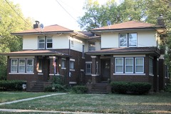
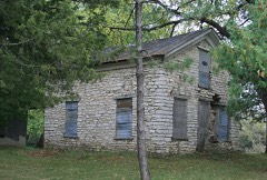
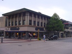
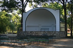
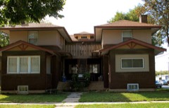
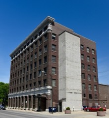
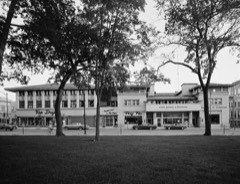
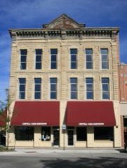
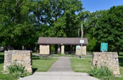
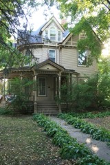
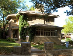
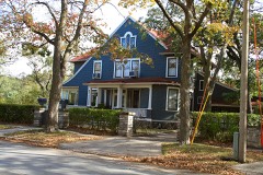
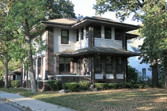
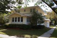
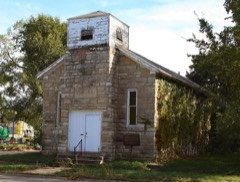
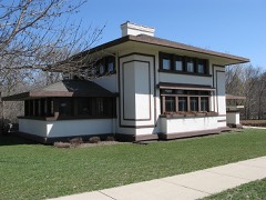
48 National Register listings published here, 1 of them a National Historic Landmark.
Sources: the National Register database, National Park Service
28 topographic sheets cover 26 settlements here, and 48 properties are on the National Register of Historic Places.
48 National Register listings published here, 1 of them a National Historic Landmark.
Sources: the National Register database, National Park Service
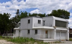
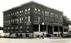
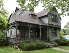
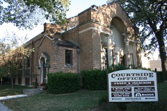
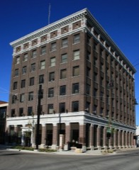
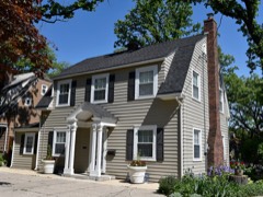
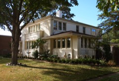
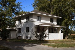
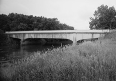
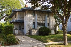
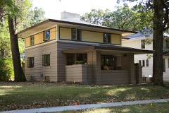
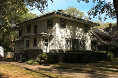
Every property in this county listed on the National Register of Historic Places, with the year it was listed and the federal nomination document.
Every wildfire the federal occurrence database records inside this county: 33 of them, burning about 98 acres. 1 started naturally and none was recorded as arson. Each settlement page carries the fires within five miles of it.
| Reported cause | Fires |
|---|---|
| Missing data/not specified/undetermined | 22 |
| Railroad operations and maintenance | 4 |
| Debris and open burning | 4 |
| Recreation and ceremony | 1 |
| Smoking | 1 |
| Natural | 1 |
The five largest, by the area the report gives. None of them was recorded as arson.
| Date | Cause | Size | Reported by | Name on the report |
|---|---|---|---|---|
| 12 December 2020 | Missing data/not specified/undetermined | 30 acres | Iowa Wetland Management District | UNION HILLS WF |
| 19 April 2020 | Debris and open burning | 15 acres | Iowa Department of Natural Resources | not named |
| 15 April 2009 | Missing data/not specified/undetermined | 8.0 acres | Iowa Department of Natural Resources | not named |
| 28 March 2011 | Missing data/not specified/undetermined | 6.0 acres | Iowa Department of Natural Resources | 2211 F-52 TRAIL WILIAMSBURG, IA 52361, IA |
| 21 March 2011 | Missing data/not specified/undetermined | 5.0 acres | Iowa Department of Natural Resources | 2967 MALLARD AVE, IA |
| 11 April 2009 | Missing data/not specified/undetermined | 5.0 acres | Iowa Department of Natural Resources | not named |
| 6 June 2012 | Railroad operations and maintenance | 5.0 acres | Iowa Department of Natural Resources | not named |
| 15 April 2009 | Missing data/not specified/undetermined | 5.0 acres | Iowa Department of Natural Resources | not named |
Every settlement page carries the fires within five miles of it - see the settlement index below.
The NOAA Storm Events Database holds 605 reports for this county, causing 1 death, 14 injuries and about $14,407,200 in recorded property damage. Each settlement page carries the reports that name it.
| Kind of event | Reports |
|---|---|
| Thunderstorm Wind | 223 |
| Hail | 184 |
| Heavy Rain | 76 |
| Tornado | 39 |
| Flash Flood | 32 |
| Flood | 27 |
| Funnel Cloud | 14 |
| Lightning | 10 |
The most serious of them, by death, then injury, then recorded damage. The accounts are quoted exactly as the forecast office filed them.
| When | Event | Place named | Harm | What the report says |
|---|---|---|---|---|
| July 1991 | Thunderstorm Wind | not stated | 1 killed | no account filed |
| June 1997 | Thunderstorm Wind | Clear Lake | 4 hurt, $40,000 | no account filed |
| June 1984 | Tornado (F1) | not stated | 2 hurt, $250,000 | no account filed |
| August 2007 | Thunderstorm Wind | Swaledale | 2 hurt, $50,000 | Two semis were blown over between mile markers 185 and 186 on interstate 35. |
| February 1977 | Tornado (F1) | not stated | 1 hurt, $250,000 | no account filed |
| August 2018 | Thunderstorm Wind | Thornton | 1 hurt, $30,000 | Law enforcement reported a semi-truck blown over by winds on Interstate 35. One individual was transported to the hospital. Time estimated from radar. |
| August 1996 | Thunderstorm Wind | Mason City | 1 hurt, $25,000 | no account filed |
| August 1996 | Thunderstorm Wind | Mason City | 1 hurt, $25,000 | no account filed |
| June 1995 | Thunderstorm Wind | Mason City Airport | 1 hurt, $25,000 | no account filed |
| July 2003 | Thunderstorm Wind | Clear Lake | 1 hurt, $5,000 | no account filed |
| June 1984 | Tornado (F1) | not stated | $2,500,000 | no account filed |
| June 2008 | Flood | Portland | $1,000,000 | no account filed |
| July 1999 | Flash Flood | Mason City | $1,000,000 | no account filed |
| August 2014 | Flash Flood | Mason City | $500,000 | The roof of a Walmart collapsed form water weight. Water was deep enough to reach the roof on cars with several submerged along Highways 65 and 122. Several roads were impassable in the city until around 0820 CST. |
| June 2008 | Flash Flood | Mason City | $500,000 | The levee failed along North Hampshire Avenue in Mason City. A subdivision near the river is flooding. |
| June 1994 | Thunderstorm Wind | Mason City Arpt | $500,000 | no account filed |
| August 2007 | Flash Flood | Winnebago Hgts | $250,000 | Heavy rains caused flooding with 1 to 2 feet of water in the streets. Evacuations were necessary in East Park. |
| June 1998 | Thunderstorm Wind | Clear Lake | $250,000 | no account filed |
| March 1988 | Tornado (F1) | not stated | $250,000 | no account filed |
| April 1967 | Tornado (F3) | not stated | $250,000 | no account filed |
| May 1953 | Tornado (F4) | not stated | $250,000 | no account filed |
| March 2019 | Flood | Clear Lake Lake | $200,000 | Emergency manager reported flooding occurring in Mason City due to the sewers and storm drains backing up. This is near the area of the Mason City Fire Department. Willow Creek has also been rising in the last hour. |
| June 2008 | Flash Flood | Mason City | $200,000 | Numerous streets were flooded in Mason City, with water up to the door or higher in places. |
| June 2008 | Flash Flood | Freeman | $200,000 | Water was over the road at the corner of B15 and Partridge Ave. Debris was on the road as well. |
| May 2024 | Thunderstorm Wind | Mason City | $150,000 | Emergency manager reported trees on multiple homes and power lines down. |
| May 2004 | Flash Flood | Countywide | $150,000 | no account filed |
| June 1998 | Flood | Mason City | $150,000 | no account filed |
| April 2022 | Tornado (EF1) | Clear Lake Jct | $125,000 | This QLCS tornado developed to the southwest of the intersection of 43rd Street SW and South Federal Avenue. The tornado crossed Federal Avenue and produced EF1 damage to several commercial buildings on the east side of the road. The tornado continued northeast and damaged another commercial building along 245th Street near the Union Pacific railroad. Additional damage occurred to trees along S Kentucky Avenue and eventually near 4th Street SE near Yorktown Pike. The tornado lifted before encountering Buena Vista University - Mason City Campus. |
| July 2011 | Thunderstorm Wind | Clear Lake | $125,000 | A boat was blown from the dock into a house at the 700 block of South Shore Drive. |
| June 1998 | Tornado (F2) | Swaledale | $125,000 | no account filed |
| July 1998 | Thunderstorm Wind | Meservey | $105,000 | no account filed |
| December 2021 | Tornado (EF2) | Meservey | $100,000 | This tornado moved into Cerro Gordo County from Franklin County. The tornado produced damage to several farmsteads, mainly to the outbuildings with a couple of outbuildings destroyed northeast of Meservey. The tornado eventually dissipated several miles west of Swaledale. |
| May 2018 | Thunderstorm Wind | Clear Lake Lake | $100,000 | Law enforcement reported 6 inch diameter tree limbs and multiple power lines down throughout the town of Clear Lake. Several boats on Clear Lake were either capsized or lost power. Time was estimated by radar. |
| June 2018 | Flood | Clear Lake Lake | $100,000 | Cerro Gordo County Sheriff's Department reported several roads covered by water across the county. |
| June 2018 | Flash Flood | Winnebago Hgts | $100,000 | Trained spotter reported several roads in town reportedly under 1 to 2 feet of water. |
| September 2018 | Flood | Freeman | $100,000 | The Winnebago River at Mason City crested at 12.17 feet on 21 September 2018 at 0545 UTC. |
| May 2017 | Lightning | Clear Lake | $100,000 | A family reported seeing a red and orange fireball before realizing their neighbor's home was on fire. A tall tree behind the home appeared to have been struck on fire as well. |
| September 2016 | Flash Flood | Rockwell | $100,000 | DOT reported county roads flooded near Rockwell. Delayed report. |
| June 2015 | Thunderstorm Wind | Plymouth | $100,000 | Emergency Manager reported numerous trees uprooted throughout town along with tree damage throughout the county. Grain bins blown down as well. |
| June 2013 | Flash Flood | Mason City | $100,000 | Multiple fields under water across northeast Cerro Gordo County. Many gravel roads have water over them. Three campgrounds were evacuated: Camp at the Woods, Wilkinson County Park and Shell Rock Preserve due to water impacting the entrances/exits. |
| May 2004 | Flash Flood | Countywide | $100,000 | no account filed |
| June 2002 | Hail | Mason City | $100,000 | no account filed |
| June 2002 | Hail | Mason City | $100,000 | no account filed |
| July 2000 | Flash Flood | Countywide | $100,000 | no account filed |
| June 1998 | Flash Flood | Mason City | $100,000 | no account filed |
| August 2007 | Flash Flood | Clear Lake | $75,000 | Water was reported to be door high on North Shore Drive in the 2700 block. |
| June 2002 | Hail | Mason City | $75,000 | Accompanied by 40 to 50 MPH winds. |
| June 1995 | Tornado (F1) | Mason City Airport | $75,000 | no account filed |
| July 2025 | Thunderstorm Wind | Ventura | $50,000 | Large grain bins destroyed in Ventura. Delayed report, time estimated from radar. Relayed via social media. |
| December 2021 | Thunderstorm Wind | Swaledale | $50,000 | Public reported heavy damage to machine sheds and out buildings. |
| May 2018 | Hail | Mason City | $50,000 | Trained spotter reported hail for 5 minutes with up to quarter sized hail being driven by high winds and heavy rain. |
| May 2018 | Thunderstorm Wind | Clear Lake | $50,000 | Trained spotter reported several tree branches, power lines, and a few tree trunks down through the town of Clear Lake. |
| June 2018 | Flood | Freeman | $50,000 | The Winnebago River at Mason City crested at 11.34 feet on 10 June 2018 at 06:30 UTC. |
| June 2018 | Flood | Clear Lake Lake | $50,000 | Law enforcement reported flooding of various streets in and around Mason City, with creeks at bankfull or flooding areas in and around the city as well. |
| June 2016 | Flash Flood | Winnebago Hgts | $50,000 | KIMT reported road washout and sink hole on B20 near Poplar and Raven Rd. Delayed report. |
| July 2016 | Flash Flood | Mason City | $50,000 | Law Enforcement reported 1st street blocked off with water 3 to 4 feet deep and a submerged vehicle. Various locations across Mason City with 4 to 6 inches deep. Time and location estimated. |
| September 2016 | Flash Flood | Rockwell | $50,000 | Law enforcement reported barricades put up due to street flooding along Highway 65 near Rockwell. |
| June 2014 | Tornado (EF1) | (Mcw)Mason City Muni | $50,000 | Tornado is evident in high resolution satellite imagery early in track when crossing open agricultural fields. Most property damage occurred toward the end of the track. |
| June 2010 | Thunderstorm Wind | Mason City | $50,000 | Trees were blown down in several areas of the city. |
| June 2008 | Flash Flood | Mason City | $50,000 | Flooding was reported at Autumn Creek Apartments. Evacuations were taking place at Rock Falls Camp Woods. Twelfth |Street was closed by the water plant. |
The Survey's mineral resources record lists 76 workings inside this county. 27 still produce and 49 are closed or unrecorded. Each settlement page carries the workings within five miles of it.
| Commodity | Workings |
|---|---|
| Sand and Gravel, Construction | 46 |
| Stone, Crushed/Broken | 22 |
| Clay | 8 |
| Sand and Gravel, Construction, Stone, Crushed/Broken | 2 |
The least common of them first, because a county's hundredth gravel pit says nothing its first ten did not.
| Where | Site | Commodity | Status | Recorded |
|---|---|---|---|---|
| Sheriff Pit | Sand and Gravel, Construction, Stone, Crushed/Broken | Producer | ||
| Unknown | Sand and Gravel, Construction, Stone, Crushed/Broken | Past Producer | ||
| Faught Pit | Clay | Producer | ||
| Kirk Pit | Clay | Producer | ||
| Lehigh Quarry | Stone, Crushed/Broken, Clay | Producer | ||
| Mason City Brick and Tile | Clay | Past Producer | ||
| Northwestern States Qry Cemt Plnt | Stone, Crushed/Broken, Clay | Producer | ||
| Oswald Clay Pit | Clay | Producer | ||
| Unknown | Clay | Past Producer | ||
| Willowbrook Shale Pit | Clay | Producer | ||
| Andrews Quarry | Stone, Crushed/Broken | Past Producer | ||
| Bernhardt | Stone, Crushed/Broken | Producer | ||
| Cement Lands Park | Stone, Crushed/Broken | Past Producer | ||
| Ideal Quarry | Stone, Crushed/Broken | Past Producer | ||
| Lehigh Portland Cement Plant | Stone, Crushed/Broken | Producer | ||
| Mason City Quarry | Stone, Crushed/Broken | Producer | ||
| Mason City Quarry & Mill | Stone, Crushed/Broken | Producer | ||
| Mason City Shop | Stone, Crushed/Broken | Producer | ||
| Portland Quarry | Stone, Crushed/Broken | Past Producer | ||
| Portland West Quarry | Stone, Crushed/Broken | Producer | ||
| Quimby Quarry and Mill | Stone, Crushed/Broken | Producer | ||
| Rock Falls Quarry | Stone, Crushed/Broken | Past Producer | ||
| Stricker Quarry | Stone, Crushed/Broken | Past Producer | ||
| Swaledale Quarry and Pit | Stone, Crushed/Broken | Past Producer | ||
| Ubben Quarry | Stone, Crushed/Broken | Producer | ||
| Unknown | Stone, Crushed/Broken | Past Producer | ||
| Unknown | Stone, Crushed/Broken | Past Producer | ||
| Unknown | Stone, Crushed/Broken | Past Producer | ||
| Unknown | Stone, Crushed/Broken | Past Producer | ||
| Weaver Readymix Inc | Stone, Crushed/Broken | Producer | ||
| Airport Pit | Sand and Gravel, Construction | Producer | ||
| Andrews Pit | Sand and Gravel, Construction | Producer | ||
| Cerro Gordo County Pits | Sand and Gravel, Construction | Unknown | ||
| Clear Lake Sand & Gravel Pit | Sand and Gravel, Construction | Producer | ||
| Duesenberg Pit | Sand and Gravel, Construction | Producer | ||
| Ingebretson Park | Sand and Gravel, Construction | Past Producer | ||
| Jorgensen Pit | Sand and Gravel, Construction | Past Producer | ||
| Kimbley Quarry | Sand and Gravel, Construction | Producer | ||
| Kuhn Pit | Sand and Gravel, Construction | Producer | ||
| Lehigh Pit | Sand and Gravel, Construction | Past Producer | ||
| Mason City Sand Pit & Plant | Sand and Gravel, Construction | Producer | ||
| Nelson-Forbes Pit | Sand and Gravel, Construction | Past Producer | ||
| Rockwell Pit | Sand and Gravel, Construction | Past Producer | ||
| Sugar Beet Pit | Sand and Gravel, Construction | Past Producer | ||
| Unknown | Sand and Gravel, Construction | Past Producer | ||
| Unknown | Sand and Gravel, Construction | Producer | ||
| Unknown | Sand and Gravel, Construction | Past Producer | ||
| Unknown | Sand and Gravel, Construction | Past Producer | ||
| Unknown | Sand and Gravel, Construction | Past Producer | ||
| Unknown | Sand and Gravel, Construction | Past Producer | ||
| Unknown | Sand and Gravel, Construction | Past Producer | ||
| Unknown | Sand and Gravel, Construction | Past Producer | ||
| Unknown | Sand and Gravel, Construction | Past Producer | ||
| Unknown | Sand and Gravel, Construction | Past Producer | ||
| Unknown | Sand and Gravel, Construction | Past Producer | ||
| Unknown | Sand and Gravel, Construction | Past Producer | ||
| Unknown | Sand and Gravel, Construction | Past Producer | ||
| Unknown | Sand and Gravel, Construction | Unknown | ||
| Unknown | Sand and Gravel, Construction | Past Producer | ||
| Unknown | Sand and Gravel, Construction | Past Producer | ||
| Unknown | Sand and Gravel, Construction | Past Producer | ||
| Unknown | Sand and Gravel, Construction | Producer | ||
| Unknown | Sand and Gravel, Construction | Past Producer | ||
| Unknown | Sand and Gravel, Construction | Past Producer | ||
| Unknown | Sand and Gravel, Construction | Past Producer | ||
| Unknown | Sand and Gravel, Construction | Past Producer | ||
| Unknown | Sand and Gravel, Construction | Past Producer | ||
| Unknown | Sand and Gravel, Construction | Past Producer | ||
| Unknown | Sand and Gravel, Construction | Past Producer | ||
| Unknown | Sand and Gravel, Construction | Producer | ||
| Unknown | Sand and Gravel, Construction | Past Producer | ||
| Unknown | Sand and Gravel, Construction | Past Producer | ||
| Unknown | Sand and Gravel, Construction | Past Producer | ||
| Unknown | Sand and Gravel, Construction | Past Producer | ||
| Unknown | Sand and Gravel, Construction | Past Producer | ||
| Wash Plant | Sand and Gravel, Construction | Producer |
Named settlements recorded in the Geographic Names Information System, each with the topographic sheets covering it. Villages, hamlets and abandoned places alike. Each is shown with the nearest named watercourse or landform and the survey quadrangle it falls on.
Lime Creek township · 50401 · On Spring Creek · Mason City quadrangle
9 sheets, 1954 to 1985
Falls township · 50401 · On Beaver Creek · Mason City quadrangle
9 sheets, 1954 to 1985
Portland township · 50401 · On Mason Creek · Nora Springs quadrangle
8 sheets, 1954 to 1985
Mason City city · 50401 · On Crane Creek · Clear Lake East quadrangle
7 sheets, 1954 to 1985
Falls township · 50467 · On Rock Falls Creek · Nora Springs quadrangle
8 sheets, 1954 to 1985