 Block
From the record
One of 48 National Register listings published here for Cerro Gordo County · listed in 1972 · category: Building.
Sources: the case file at the National Archives · the National Register database, National Park Service
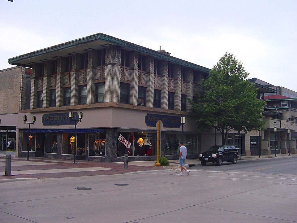
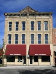
Listed on the National Register of Historic Places in 1972.
One of 48 National Register listings published here for Cerro Gordo County · listed in 1972 · category: Building.
Sources: the case file at the National Archives · the National Register database, National Park Service
Regional context, not property-specific evidence. The federal wildfire occurrence database lists 3 fires within 5 miles of City National Bank Building between 2007 and 2011, burning about 8 acres in total. None started naturally. None was recorded as arson. Distance is straight-line from the map coordinates, so a fire counted here may appear on a neighbouring settlement's page as well.
| Reported cause | Fires |
|---|---|
| Missing data/not specified/undetermined | 3 |
The most recent of them, most recent first, with the day each was reported and the service that recorded it.
| Date | Cause | Size | Reported by | Name on the report |
|---|---|---|---|---|
| 20 April 2007 | Missing data/not specified/undetermined | under an acre | Iowa Department of Natural Resources | not named |
| 1 April 2010 | Missing data/not specified/undetermined | 1.0 acres | Iowa Department of Natural Resources | 14259 300TH ST., MASON CITY, IOWA |
| 28 March 2011 | Missing data/not specified/undetermined | 6.0 acres | Iowa Department of Natural Resources | 2211 F-52 TRAIL WILIAMSBURG, IA 52361, IA |
Regional context, not property-specific evidence. The federal mineral resources record lists 34 workings within 5 miles of City National Bank Building: 17 producers, 16 past producers, 1 unknown. 17 still produce. What was taken out: Stone, Crushed/Broken, Sand and Gravel, Construction, Clay, Sand and Gravel, Construction, Stone, Crushed/Broken. Distance is straight-line from the map coordinates, so a quarry counted here may appear on a neighbouring settlement's page as well.
| Where | Site | Commodity | Status | Recorded |
|---|---|---|---|---|
| Unknown | Sand and Gravel, Construction, Stone, Crushed/Broken | Past Producer | ||
| Faught Pit | Clay | Producer | ||
| Kirk Pit | Clay | Producer | ||
| Lehigh Quarry | Stone, Crushed/Broken, Clay | Producer | ||
| Mason City Brick and Tile | Clay | Past Producer | ||
| Northwestern States Qry Cemt Plnt | Stone, Crushed/Broken, Clay | Producer | ||
| Oswald Clay Pit | Clay | Producer | ||
| Unknown | Clay | Past Producer | ||
| Willowbrook Shale Pit | Clay | Producer | ||
| Cerro Gordo County Pits | Sand and Gravel, Construction | Unknown |
Regional context, not property-specific evidence. The National Weather Service names Mason City, the town this property stands in, in 160 storm reports between 1994 and 2025: 54 thunderstorm wind, 52 hail, 23 heavy rain, 11 flash flood. The reports record 2 injuries. Each account below is quoted exactly as the forecast office filed it, from the NOAA Storm Events Database, and each date opens the federal record of that event.
| When | Event | Place named | Harm | What the report says |
|---|---|---|---|---|
| August 1996 | Thunderstorm Wind | Mason City | 1 hurt, $25,000 | no account filed |
| August 1996 | Thunderstorm Wind | Mason City | 1 hurt, $25,000 | no account filed |
| July 1999 | Flash Flood | Mason City | $1,000,000 | no account filed |
| August 2014 | Flash Flood | Mason City | $500,000 | The roof of a Walmart collapsed form water weight. Water was deep enough to reach the roof on cars with several submerged along Highways 65 and 122. Several roads were impassable in the city until around 0820 CST. |
| June 2008 | Flash Flood | Mason City | $500,000 | The levee failed along North Hampshire Avenue in Mason City. A subdivision near the river is flooding. |
| June 2008 | Flash Flood | Mason City | $200,000 | Numerous streets were flooded in Mason City, with water up to the door or higher in places. |
| May 2024 | Thunderstorm Wind | Mason City | $150,000 | Emergency manager reported trees on multiple homes and power lines down. |
| June 1998 | Flood | Mason City | $150,000 | no account filed |
| June 2013 | Flash Flood | Mason City | $100,000 | Multiple fields under water across northeast Cerro Gordo County. Many gravel roads have water over them. Three campgrounds were evacuated: Camp at the Woods, Wilkinson County Park and Shell Rock Preserve due to water impacting the entrances/exits. |
| June 2002 | Hail | Mason City | $100,000 | no account filed |
| June 2002 | Hail | Mason City | $100,000 | no account filed |
| June 1998 | Flash Flood | Mason City | $100,000 | no account filed |
| June 2002 | Hail | Mason City | $75,000 | Accompanied by 40 to 50 MPH winds. |
| May 2018 | Hail | Mason City | $50,000 | Trained spotter reported hail for 5 minutes with up to quarter sized hail being driven by high winds and heavy rain. |
| July 2016 | Flash Flood | Mason City | $50,000 | Law Enforcement reported 1st street blocked off with water 3 to 4 feet deep and a submerged vehicle. Various locations across Mason City with 4 to 6 inches deep. Time and location estimated. |
| June 2010 | Thunderstorm Wind | Mason City | $50,000 | Trees were blown down in several areas of the city. |
| June 2008 | Flash Flood | Mason City | $50,000 | Flooding was reported at Autumn Creek Apartments. Evacuations were taking place at Rock Falls Camp Woods. Twelfth |Street was closed by the water plant. |
| March 2010 | Flash Flood | Mason City | $50,000 | no account filed |
| March 2007 | Flood | Mason City | $50,000 | no account filed |
| July 2004 | Flash Flood | Mason City | $50,000 | no account filed |
| June 1998 | Flood | Mason City | $50,000 | no account filed |
| June 1998 | Flood | Mason City | $50,000 | no account filed |
| June 1999 | Thunderstorm Wind | Mason City | $45,000 | no account filed |
| August 2007 | Thunderstorm Wind | Mason City | $40,000 | Damage to numerous signs and other buildings around the intersection of hwy 122 and Monroe Ave. Damage done to the roof and exterior of a business at the intersection of hwy 122 and South Monroe. |
| May 1998 | Thunderstorm Wind | Mason City | $40,000 | no account filed |
| August 1996 | Thunderstorm Wind | Mason City | $40,000 | no account filed |
| August 1995 | Thunderstorm Wind | Mason City | $30,000 | no account filed |
| September 2016 | Flash Flood | Mason City | $25,000 | Cerro Gordo County dispatch noted that East Park had been fully closed due to flooding. |
| September 2012 | Thunderstorm Wind | Mason City | $25,000 | Large trees toppled power lines along State Street in downtown Mason City. |
| August 2006 | Thunderstorm Wind | Mason City | $25,000 | no account filed |
| July 2003 | Hail | Mason City | $25,000 | no account filed |
| June 1998 | Thunderstorm Wind | Mason City | $25,000 | no account filed |
| May 1998 | Thunderstorm Wind | Mason City | $25,000 | no account filed |
| July 2025 | Thunderstorm Wind | Mason City | $20,000 | Trees and Branches down in Mason City. Report of at least one tree on a vehicle. Several power poles on fire. |
| May 2017 | Thunderstorm Wind | Mason City | $15,000 | Emergency manager reported multiple tree limbs down throughout the town of Mason City. Some have fallen on power lines or are blocking roads. A few power poles snapped as well. Power out in multiple locations. Time estimated by radar. |
| October 2013 | Hail | Mason City | $15,000 | Sheriff's department reported hail up to ping pong ball size. |
| October 2013 | Hail | Mason City | $15,000 | no account filed |
| June 2002 | Hail | Mason City | $15,000 | no account filed |
| October 1998 | Thunderstorm Wind | Mason City | $15,000 | no account filed |
| June 1997 | Lightning | Mason City | $15,000 | no account filed |
| May 2018 | Thunderstorm Wind | Mason City | $10,000 | Trained spotter reported widespread tree damage including branches up to 2 to 3 inches in diameter down. |
| May 2018 | Thunderstorm Wind | Mason City | $10,000 | Trained spotter reported numerous 3 to 4 inch diameter tree branches down throughout Mason City along with a few larger trees down as well. Hail sized was unknown at the time. Time was estimated from radar. |
| August 2018 | Thunderstorm Wind | Mason City | $10,000 | Local 911 call center reported a power line down on a tree and an associated fire along Birch Dr. Time estimated from radar. |
| July 2017 | Thunderstorm Wind | Mason City | $10,000 | Emergency manager reported multiple locations with trees down in Mason City. This is a delayed report and time estimated from radar. |
| September 2012 | Thunderstorm Wind | Mason City | $10,000 | Several 6 inch diameter limbs were down. |
| June 2010 | Thunderstorm Wind | Mason City | $10,000 | Five inch diameter branch down on 9th St. Several branches down around the city. |
| July 2010 | Thunderstorm Wind | Mason City | $10,000 | Trees were down on the zero block of 10th Street NW. |
| May 2008 | Hail | Mason City | $10,000 | Dime to golf ball size hail nearly covered the ground. |
| April 2007 | Flood | Mason City | $10,000 | no account filed |
| July 2007 | Thunderstorm Wind | Mason City | $10,000 | no account filed |
| March 2006 | Thunderstorm Wind | Mason City | $10,000 | no account filed |
| March 2006 | Thunderstorm Wind | Mason City | $10,000 | no account filed |
| June 2002 | Hail | Mason City | $10,000 | no account filed |
| July 1998 | Thunderstorm Wind | Mason City | $10,000 | no account filed |
| May 2011 | Hail | Mason City | $5,000 | Pea to quarter size hail was reported in the town of Mason City. |
| July 2010 | Thunderstorm Wind | Mason City | $5,000 | Tree down on the 1000 block of 9th Street NE. Sixty MPH wind gust estimated by storm spotter. |
| July 2011 | Hail | Mason City | $5,000 | no account filed |
| May 2008 | Thunderstorm Wind | Mason City | $5,000 | no account filed |
| May 2008 | Thunderstorm Wind | Mason City | $5,000 | no account filed |
| July 2007 | Thunderstorm Wind | Mason City | $5,000 | no account filed |
No historic map-sheet match is published for this property yet. That does not mean no map exists. This record needs a coordinate-quality review before it can be joined to a sheet boundary. Browse the county's mapped places while that work is pending.
Other National Register properties close enough to walk or drive between, ordered by distance from this one. Both positions come from the same geocoding pass that matched these properties to their map sheets.
| Photograph | Property | Distance | Listed |
|---|---|---|---|
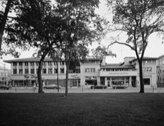 | Park Inn Hotel | under 500 feet | 1972 |
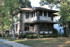 | Chris Rye House | under 500 feet | 1980 |
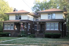 | A. J. Andrus Duplex | under 500 feet | 1980 |
 | Parker's Opera House | 0.1 miles | 1998 |
 | MBA (Modern Brotherhood of America) Building | 0.1 miles | 2002 |
| Wagner-Mozart Music Hall | 0.1 miles | 1978 |
| National Archives record | The nomination case file for reference 72000469 in Record Group 79. |
| Cerro Gordo County | All 48 listed properties in this county. |