Block
From the record
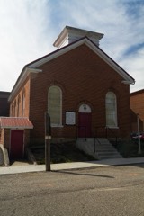
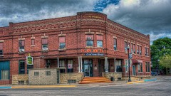
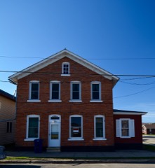
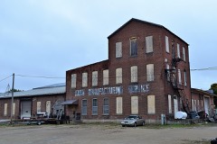
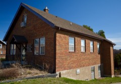
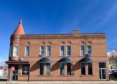
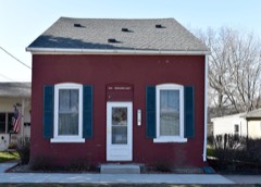
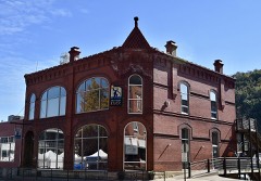
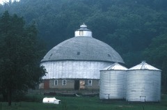
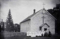
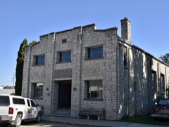
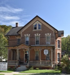
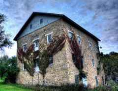
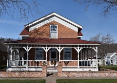
54 National Register listings published here.
Sources: the National Register database, National Park Service
72 topographic sheets cover 46 settlements here, and 54 properties are on the National Register of Historic Places.
54 National Register listings published here.
Sources: the National Register database, National Park Service
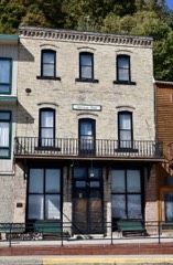
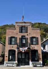
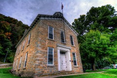
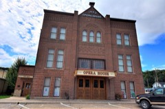
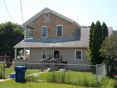
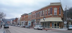
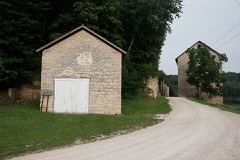
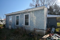
Every property in this county listed on the National Register of Historic Places, with the year it was listed and the federal nomination document.
Every wildfire the federal occurrence database records inside this county: 47 of them, burning about 552 acres. None started naturally and 1 was recorded as arson. Each settlement page carries the fires within five miles of it.
| Reported cause | Fires |
|---|---|
| Missing data/not specified/undetermined | 28 |
| Debris and open burning | 17 |
| Arson/incendiarism | 1 |
| Equipment and vehicle use | 1 |
The five largest, by the area the report gives. None of them was recorded as arson.
| Date | Cause | Size | Reported by | Name on the report |
|---|---|---|---|---|
| 28 April 2018 | Missing data/not specified/undetermined | 165 acres | Port Louisa National Wildlife Refuge | TURKEY RIVER |
| 21 April 2019 | Debris and open burning | 60 acres | Iowa Department of Natural Resources | not named |
| 27 March 2011 | Missing data/not specified/undetermined | 40 acres | Iowa Department of Natural Resources | 37383 ACORN RD., STRAWBERRY POINT, IA 52076, IA |
| 15 April 2016 | Debris and open burning | 40 acres | Iowa Department of Natural Resources | LUANA FIRE DEPT. |
| 17 April 2007 | Missing data/not specified/undetermined | 36 acres | Iowa Department of Natural Resources | not named |
| 14 April 2006 | Missing data/not specified/undetermined | 23 acres | Driftless National Wildlife Refuge | HOWARD CREEK |
| 11 April 2014 | Debris and open burning | 20 acres | Iowa Department of Natural Resources | not named |
| 1 April 2018 | Debris and open burning | 15 acres | Iowa Department of Natural Resources | not named |
Every settlement page carries the fires within five miles of it - see the settlement index below.
The NOAA Storm Events Database holds 536 reports for this county, causing 2 deaths, 28 injuries and about $49,227,750 in recorded property damage. Each settlement page carries the reports that name it.
| Kind of event | Reports |
|---|---|
| Thunderstorm Wind | 165 |
| Flood | 143 |
| Hail | 142 |
| Flash Flood | 36 |
| Heavy Rain | 23 |
| Tornado | 17 |
| Funnel Cloud | 9 |
| Lightning | 1 |
The most serious of them, by death, then injury, then recorded damage. The accounts are quoted exactly as the forecast office filed them.
| When | Event | Place named | Harm | What the report says |
|---|---|---|---|---|
| May 1985 | Tornado (F3) | not stated | 2 killed, 25 hurt, $25,000,000 | no account filed |
| July 2017 | Tornado (EF1) | Giard | 2 hurt, $840,000 | An EF-1 tornado touched down about 5 miles west of McGregor and then moved through McGregor before dissipating just east of town over the Mississippi River. The most damage occurred in McGregor with two buildings downtown completely destroyed while numerous others were damaged. Two people sustained minor injuries due to flying glass. Hundreds of trees across town were snapped off. West of McGregor, the tornado damaged a storage shed, ripped back part of a metal roof from an outbuilding and damaged numerous trees. One person was killed in an accident cleaning up debris when a tractor rolled over pinning the person underneath it. |
| June 1989 | Tornado (F0) | not stated | 1 hurt, $25,000 | no account filed |
| June 2008 | Flood | Strawberry Pt | $4,700,000 | Most secondary roads were either damaged or under water. Rainfall totals of 3 to 7 inches were reported during the weekend of June 7-8. About 4000 acres of farm land were impacted. Combined with flooding along the Turkey River, a total of 20 homes were destroyed, 9 with major damage, 15 with minor damage, and recovery costs easily into the millions. |
| June 2008 | Flood | Elkader | $3,500,000 | The Turkey River at Elkader established a new record crest at about 6 a.m. CDT on June 10 of 30.9 feet. The previous record crest was 27.3 feet on June 15, 1991. Flood stage is 12.0 feet. The river rose again above flood stage from June 12 through June 14th cresting at 16.63 feet. |
| March 2019 | Flood | Marquette | $2,030,000 | Flooding occurred across parts of Clayton County from the combination of rainfall and melting snow. An ice jam on the Turkey River caused flooding to occur near Millville with water going over U.S. Highway 52 and a restaurant sustained major damage. Near the mouth of the Turkey River, the ice jam took out a railroad bridge. Flooding along the Turkey River also occurred in the Osterdock. |
| June 2008 | Flood | Garber | $2,000,000 | The Turkey River at Garber had a major flood and crested at 29.1 feet around 11:30 a.m. CDT on June 10. The all-time record crest of 32.8 feet occurred on May 23, 2004. Flood stage is 17.0 feet. |
| May 1999 | Flash Flood | Countywide | $1,500,000 | no account filed |
| July 2007 | Flash Flood | Mc Gregor | $1,300,000 | Mud slides caused trees to fall down off Mississippi River bluffs onto roads and cars were floating in the town of McGregor. Numerous locations across northeast Clayton County, Iowa had wash outs, high water, and damage. |
| July 2017 | Flash Flood | Clayton | $950,000 | After heavy rains of 4 to 8 inches, flash flooding occurred across the southern half of Clayton County. Flooding along Roberts and Dry Mill Creeks washed out County Road C1X east of Elkader. Numerous other roads were closed across the county due to inundation, rock slides and mud slides with the hardest hit part of the county between Garber and Guttenberg. Near Guttenberg, the residents of three homes had to be rescued from flood waters on Miners Creek. The flooding heavily damaged a bridge over Miners Creek, took out a 30 foot retaining wall, damaged the inventory of two business and undercut railroad tracks. |
| June 2013 | Flash Flood | St Olaf | $650,000 | Locally heavy rain produced flash flooding in numerous low lying areas across the county with many secondary roads under water. A campground outside of McGregor suffered extensive damage with a bridge and part of a road washed out, a bathroom facility destroyed and numerous picnic tables washed away. Some permanent camp foundations were also washed away and four campers had to be evacuated. |
| May 1994 | Thunderstorm Wind | Garnavillo | $500,000 | no account filed |
| April 2008 | Flood | Elkader | $380,000 | Runoff from heavy rainfall caused significant rises on the Turkey River and caused moderate to major flooding. At Elkader, the Turkey River crested at 18.84 feet on April 25. Flood stage is 12 feet. Damage was estimated at $100,000 including damage to the dike on the town's southwest side and erosion on the riverbank on the northwest side of the community. At Garber, the river crested at 27.98 feet on April 25, which was below the record setting crest of 32.8 feet on May 23, 2004. Flood stage at Garber is 17 feet. |
| June 2002 | Flash Flood | South Portion | $350,000 | no account filed |
| April 2008 | Flash Flood | Strawberry Pt | $290,000 | The emergency manager indicated a park was flooded near Elkader, along with some homes on the south side of Elkader. There were also numerous road closures across the county, with mudslides reported near Millville. Also near Millville, some freight train cars fell into the Turkey River due to a bridge collapse. St.Olaf had about $35,000 in damages, mostly due to erosion. At least two bridges were washed out in the county. |
| June 1990 | Tornado (F2) | not stated | $250,000 | no account filed |
| May 1989 | Tornado (F0) | not stated | $250,000 | no account filed |
| August 1965 | Tornado (F2) | not stated | $250,000 | no account filed |
| May 1953 | Tornado (F3) | not stated | $250,000 | no account filed |
| April 2026 | Hail | Monona | $225,000 | The public reported tennis ball sized hail near Monona. |
| July 2016 | Flash Flood | Clayton | $200,000 | Locally heavy rain pushed a branch of the Sny Magill Creek out of its banks. The flooding caused the Paradise Valley Campground to be evacuated. The campground was extensively damaged, with picnic tables destroyed, gazebos washed away, a small building moved several feet, roads damaged and there was two feet of standing water in the office building. |
| June 2015 | Thunderstorm Wind | Elkport | $200,000 | An Amish grocery store near Garber was destroyed when the roof was blown off and some of the walls subsequently collapsed. |
| June 2015 | Thunderstorm Wind | Guttenburg | $200,000 | A large area of wind damage occurred between Guttenberg and Millvile along U.S. Highway 52. A barn roof was blown off and several other barns were blown down near Millville. Numerous trees were blown down causing U.S. Highway 52 to be closed and a parked semi and trailer were overturned by the winds. |
| May 2017 | Thunderstorm Wind | Garber | $175,000 | Three barns and a machine shed were destroyed northeast of Garber. Several trees were also uprooted, a garage collapsed and some roof panels were taken off a farm building. |
| July 2009 | Hail | Edgewood | $150,000 | Wind gusts were measured at 40 mph in town. Hail broke windows in town and caused considerable damage to crops. Rainfall totaled 0.47 inches. |
| May 2004 | Flash Flood | Countywide | $125,000 | no account filed |
| July 2017 | Heavy Rain | Millville | $120,000 | East of Millville, 8.25 inches of rain fell. |
| July 2009 | Hail | Edgewood | $120,000 | Strong winds were also reported. |
| July 2009 | Hail | Volga | $111,000 | no account filed |
| May 2017 | Thunderstorm Wind | Monona Muni Arpt | $110,000 | A machine shed was destroyed and a house damaged east of Monona. |
| May 1999 | Thunderstorm Wind | Elkader | $100,000 | no account filed |
| July 2017 | Heavy Rain | Guttenberg Arpt | $87,000 | Near Guttenberg, 5.65 inches of rain fell. |
| July 2010 | Flood | Strawberry Pt | $80,000 | Several gravel roads have been washed out across the southern part of Clayton County. Also, in the vicinity of Garber, water was flooding some corn fields and County Road C7X had water over it. Some homes also sustained damage with some basement walls collapsing. A three day rainfall total of 12.23 inches was measured at 6 a.m. CST July 24th in Strawberry Point and 6.69 inches at Lock and Dam 10 in Guttenberg. |
| April 2008 | Flood | Strawberry Pt | $80,000 | no account filed |
| May 2004 | Flash Flood | Countywide | $65,000 | no account filed |
| August 2016 | Flood | Elkader | $63,000 | Runoff from heavy rain pushed the Turkey River out of its banks in Elkader. The river crested over ten feet above the flood stage at 22.57 feet. The flood waters damaged some trails, sidewalks and the riverbank. |
| June 2024 | Thunderstorm Wind | Guttenburg | $60,000 | Trees and power lines were reported down. |
| July 2017 | Flash Flood | Graham | $59,000 | Runoff from heavy rains caused Mill Creek and the Little Turkey River to go out of their banks. Fifteen to twenty homes along these two streams had to be evacuated. More than a dozen roads across the southeast part of Clayton County were washed out. |
| July 2022 | Flash Flood | Monona | $50,000 | Runoff from heavy rains caused some flash flooding to occur across northeast Clayton County. Flood waters from Bloody Run Creek took out a bridge in the Bloody Run County Park west of Marquette. |
| May 2017 | Thunderstorm Wind | Guttenburg | $50,000 | Roofs were blown off a few buildings in Guttenberg and power lines were down. |
| July 2017 | Thunderstorm Wind | Marquette | $50,000 | Hundreds of trees were blown down in Pikes Peak State Park and Effigy Mounds National Monument near Marquette. Some of the trees fell on vehicles in the two parks. |
| June 2015 | Thunderstorm Wind | Garber | $50,000 | Farm buildings were damaged or blown over along a path from Garber to about 2 miles southeast of Garber. |
| June 2015 | Thunderstorm Wind | Strawberry Pt | $50,000 | Numerous trees were blown down and barns damaged along a path from near Strawberry Point to North Buena Vista. Some cattle were killed from the damage that occurred to the barns. |
| April 2008 | Flood | Mc Gregor | $50,000 | Due to runoff from heavy rainfall, the Mississippi River at McGregor crested at 17.02 feet on April 27. Flood stage is 16 feet. Some basement flooding of homes was reported, as well as flooding of McGregor's Riverfront Park. The Mississippi River at Guttenberg crested at 16.21 feet on April 27 causing minor flooding. Flood stage at Guttenberg is 15 feet. |
| July 1998 | Thunderstorm Wind | Garnavillo | $50,000 | no account filed |
| August 1997 | Hail | Elkader | $50,000 | no account filed |
| May 1994 | Thunderstorm Wind | Luana | $50,000 | no account filed |
| May 1994 | Thunderstorm Wind | McGregor | $50,000 | no account filed |
| May 1994 | Thunderstorm Wind | Elkader | $50,000 | no account filed |
| August 2016 | Flood | Garber | $45,000 | Runoff from heavy rain pushed the Turkey River out of its banks in Garber. The river crested over six feet above the flood stage at 23.6 feet. Flooding along the Turkey River throughout the county damaged some roads. |
| June 2013 | Flash Flood | Mc Gregor | $44,000 | Heavy rain produced some street flooding in McGregor. Along with damaging streets, the flooding caused several storm sewer pipes to collapse. |
| March 2007 | Tornado (EF1) | Edgewood | $40,000 | A tornado, that originally started in Delaware County, Iowa, moved into Clayton County east of Edgewood, and continued northward toward Garber before lifting. This tornado hit a farm and destroyed a machine shed and snapped off trees. Debris was blown into a nearby field, which included boards being stabbed into the ground. |
| July 2016 | Flash Flood | National | $35,000 | Locally heavy rain pushed the North Cedar Creek out of its banks causing damage to Ivory Road. |
| July 2000 | Thunderstorm Wind | Monona | $35,000 | no account filed |
| June 1998 | Thunderstorm Wind | Elkader | $35,000 | no account filed |
| May 2019 | Flood | Mc Gregor | $34,000 | Flooding along the Mississippi River at McGregor that began in March, temporarily ended in late May. |
| September 2019 | Tornado (EF0) | Gunder | $30,000 | A tornado touched down northwest of Farmersburg and moved northeast before dissipating southwest of Monona. Damage from the tornado was limited to some trees, a few outbuildings, and crops. One home did have some tree branches impaled through a wall. |
| September 2019 | Flash Flood | Marquette | $30,000 | Runoff from heavy rain turned the streets of Marquette and McGregor into mini-rivers leaving behind mud covered streets and sidewalks. Water also got into the basements of some downtown businesses. Bloody Run county park was closed because of flooding along Bloody Run Creek. |
| May 2017 | Thunderstorm Wind | Luana | $30,000 | Near Luana, the winds lifted up a barn and dropped it several feet away. Some cattle were trapped inside the destroyed barn. |
| June 2015 | Thunderstorm Wind | Osterdock | $30,000 | Trees were blown down and one home sustained severe roof damage in Osterdock. |
The Survey's mineral resources record lists 121 workings inside this county. 18 still produce and 103 are closed or unrecorded. Each settlement page carries the workings within five miles of it.
| Commodity | Workings |
|---|---|
| Stone, Crushed/Broken | 77 |
| Sand and Gravel, Construction | 16 |
| Lead | 15 |
| Phosphorus-Phosphates | 9 |
| Zinc | 4 |
| Phosphorus-Phosphates, Fluorine-Fluorite, Zinc | 1 |
| Sand and Gravel, Industrial/Frac Sand | 1 |
| Silica | 1 |
| Flagstone | 1 |
The least common of them first, because a county's hundredth gravel pit says nothing its first ten did not.
| Where | Site | Commodity | Status | Recorded |
|---|---|---|---|---|
| Pattison Sand Co. | Sand and Gravel, Industrial/Frac Sand, Silica | Producer | Sand | |
| Unknown | Flagstone | Past Producer | ||
| Volga Occurrence | Phosphorus-Phosphates, Fluorine-Fluorite, Zinc | Past Producer | Fluorite, Sphalerite | |
| Buena Vista Mines | Lead, Zinc | Past Producer | ||
| Elkader Mine | Zinc | Past Producer | Smithsonite | |
| Holmes Mine | Lead, Zinc | Unknown | Galena | |
| Kann Mine | Lead, Zinc | Unknown | Galena | |
| Outcrop | Phosphorus-Phosphates | Past Producer | ||
| Quarry | Phosphorus-Phosphates | Past Producer | ||
| Quarry | Phosphorus-Phosphates | Past Producer | ||
| Quarry | Phosphorus-Phosphates | Past Producer | ||
| Roadcut | Phosphorus-Phosphates | Past Producer | ||
| Roadcut | Phosphorus-Phosphates | Past Producer | ||
| Roadcut | Phosphorus-Phosphates | Past Producer | ||
| Roadcut | Phosphorus-Phosphates | Past Producer | ||
| Roadcut | Phosphorus-Phosphates | Past Producer | ||
| Burtletts Diggings | Lead | Past Producer | ||
| Guttenberg Mines | Lead | Past Producer | ||
| Indian Lead Mines | Lead | Occurrence | Galena | |
| Kann Mine | Lead | Past Producer | Galena | |
| Lunders Diggings | Lead | Past Producer | ||
| Occurrence | Lead | Past Producer | Galena | |
| Old Indian Mines | Lead | Past Producer | ||
| Panther Hollow Mines | Lead | Past Producer | ||
| Quarry | Lead | Past Producer | Galena | |
| Sny Magill Mines | Lead | Past Producer | Galena | |
| Spellman Farm | Lead | Occurrence | Galena | |
| Unknown | Lead | Past Producer | ||
| Bente Quarry | Sand and Gravel, Construction | Producer | ||
| Cheeseman Pit | Sand and Gravel, Construction | Past Producer | ||
| Essman Island Pit | Sand and Gravel, Construction | Past Producer | ||
| Fairgrounds Pit | Sand and Gravel, Construction | Past Producer | ||
| Joy Springs Pit | Sand and Gravel, Construction | Past Producer | ||
| Mederville Pit | Sand and Gravel, Construction | Past Producer | ||
| Thurn Sand Pit | Sand and Gravel, Construction | Producer | ||
| Unknown | Sand and Gravel, Construction | Past Producer | ||
| Unknown | Sand and Gravel, Construction | Past Producer | ||
| Unknown | Sand and Gravel, Construction | Past Producer | ||
| Unknown | Sand and Gravel, Construction | Past Producer | ||
| Unknown | Sand and Gravel, Construction | Past Producer | ||
| Unknown | Sand and Gravel, Construction | Past Producer | ||
| Unknown | Sand and Gravel, Construction | Past Producer | ||
| Unknown | Sand and Gravel, Construction | Past Producer | ||
| Wacker Pit | Sand and Gravel, Construction | Past Producer | ||
| Anderegg Quarry | Stone, Crushed/Broken | Unknown | ||
| Anderson Quarry | Stone, Crushed/Broken | Past Producer | ||
| Bente/Elkader Quarry | Stone, Crushed/Broken | Producer | ||
| Blume Quarry | Stone, Crushed/Broken | Producer | ||
| Boege Quarry | Stone, Crushed/Broken | Past Producer | ||
| Brown Quarry | Stone, Crushed/Broken | Past Producer | ||
| Burrack Quarry | Stone, Crushed/Broken | Producer | ||
| Doerring Quarry | Stone, Crushed/Broken | Producer | ||
| Eberhardt Quarry | Stone, Crushed/Broken | Past Producer | ||
| Eldon Kruse Quarry | Stone, Crushed/Broken | Producer | ||
| Farmer Brothers | Stone, Crushed/Broken | Past Producer | ||
| Fassbinder Quarry | Stone, Crushed/Broken | Producer | ||
| Giard Land Claim | Stone, Crushed/Broken | Past Producer | ||
| Giard Quarry | Stone, Crushed/Broken | Past Producer | ||
| Gisleson Quarry | Stone, Crushed/Broken | Producer | ||
| Harold Hartman Quarry | Stone, Crushed/Broken | Producer | ||
| Johnson Quarry | Stone, Crushed/Broken | Producer | ||
| Johnson Quarry | Stone, Crushed/Broken | Past Producer | ||
| Joy Springs Quarry | Stone, Crushed/Broken | Past Producer | ||
| Kickbush Quarry | Stone, Crushed/Broken | Past Producer | ||
| Langsgaard Quarry | Stone, Crushed/Broken | Unknown | ||
| Larson Quarry | Stone, Crushed/Broken | Producer | ||
| Marquette Quarry | Stone, Crushed/Broken | Unknown | ||
| Mcgregor Quarry | Stone, Crushed/Broken | Producer | ||
| Meisgier Quarry | Stone, Crushed/Broken | Past Producer | ||
| Mielke Quarry | Stone, Crushed/Broken | Producer | ||
| Morarend Quarry | Stone, Crushed/Broken | Past Producer | ||
| Mueller Quarry | Stone, Crushed/Broken | Past Producer | ||
| Olson Quarry | Stone, Crushed/Broken | Past Producer | ||
| Osborne Quarry | Stone, Crushed/Broken | Past Producer | ||
| Osterdock Quarry | Stone, Crushed/Broken | Past Producer | ||
| Peterson Quarry | Stone, Crushed/Broken | Past Producer | ||
| Pust and Thurn | Stone, Crushed/Broken | Past Producer | ||
| Saint Olaf Quarry | Stone, Crushed/Broken | Producer | ||
| Schmidt Quarry | Stone, Crushed/Broken | Past Producer | ||
| Shrader/Twin Rocks | Stone, Crushed/Broken | Unknown | ||
| Smith Quarry | Stone, Crushed/Broken | Unknown | ||
| Sny Magill Quarry | Stone, Crushed/Broken | Producer | ||
| Spook Cave | Stone, Crushed/Broken | Unknown | ||
| Unknown | Stone, Crushed/Broken | Past Producer | ||
| Unknown | Stone, Crushed/Broken | Unknown | ||
| Unknown | Stone, Crushed/Broken | Unknown | ||
| Unknown | Stone, Crushed/Broken | Past Producer | ||
| Unknown | Stone, Crushed/Broken | Past Producer | ||
| Unknown | Stone, Crushed/Broken | Past Producer | ||
| Unknown | Stone, Crushed/Broken | Past Producer | ||
| Unknown | Stone, Crushed/Broken | Past Producer | ||
| Unknown | Stone, Crushed/Broken | Unknown | ||
| Unknown | Stone, Crushed/Broken | Unknown | ||
| Unknown | Stone, Crushed/Broken | Past Producer | ||
| Unknown | Stone, Crushed/Broken | Unknown | ||
| Unknown | Stone, Crushed/Broken | Past Producer | ||
| Unknown | Stone, Crushed/Broken | Unknown | ||
| Unknown | Stone, Crushed/Broken | Past Producer | ||
| Unknown | Stone, Crushed/Broken | Past Producer | ||
| Unknown | Stone, Crushed/Broken | Past Producer | ||
| Unknown | Stone, Crushed/Broken | Unknown | ||
| Unknown | Stone, Crushed/Broken | Unknown | ||
| Unknown | Stone, Crushed/Broken | Past Producer | ||
| Unknown | Stone, Crushed/Broken | Unknown | ||
| Unknown | Stone, Crushed/Broken | Past Producer | ||
| Unknown | Stone, Crushed/Broken | Unknown | ||
| Unknown | Stone, Crushed/Broken | Past Producer | ||
| Unknown | Stone, Crushed/Broken | Unknown | ||
| Unknown | Stone, Crushed/Broken | Unknown | ||
| Unknown | Stone, Crushed/Broken | Unknown | ||
| Unknown | Stone, Crushed/Broken | Past Producer | ||
| Unknown | Stone, Crushed/Broken | Past Producer | ||
| Unknown | Stone, Crushed/Broken | Past Producer | ||
| Unknown | Stone, Crushed/Broken | Past Producer | ||
| Unknown | Stone, Crushed/Broken | Unknown | ||
| Unknown | Stone, Crushed/Broken | Past Producer | ||
| Unknown | Stone, Crushed/Broken | Past Producer | ||
| Watson Quarry | Stone, Crushed/Broken | Producer | ||
| Wellman Quarry | Stone, Crushed/Broken | Past Producer | ||
| Winger Quarry | Stone, Crushed/Broken | Past Producer | ||
| Zurcher Quarry | Stone, Crushed/Broken | Past Producer |
Named settlements recorded in the Geographic Names Information System, each with the topographic sheets covering it. Villages, hamlets and abandoned places alike. Each is shown with the nearest named watercourse or landform and the survey quadrangle it falls on.
Farmersburg township · 52047 · Near Dry Hollow · Farmersburg quadrangle
12 sheets, 1902 to 1984
Giard township · 52157 · Giard quadrangle
13 sheets, 1903 to 1985
No longer a settlement
Jefferson township · 52052 · Near Willow Island · Guttenberg quadrangle
13 sheets, 1902 to 1984
Cox Creek township · 52043 · On Honey Creek · Littleport quadrangle
12 sheets, 1902 to 1984
Mendon township · 52158 · On Bloody Run · Prairie du Chien quadrangle
20 sheets, 1903 to 1985
Mendon township · 52157 · By Point Ann · Prairie du Chien quadrangle
20 sheets, 1903 to 1985
Mendon township · 52157 · On Bloody Run · Prairie du Chien quadrangle
20 sheets, 1903 to 1985
Millville township · 52035 · Near Cherry Valley · Turkey River quadrangle
14 sheets, 1902 to 1984
Buena Vista township · 52066 · Near Panther Hollow · Cassville quadrangle
16 sheets, 1900 to 1984
Jefferson township · 52052 · On Price Branch · Colesburg quadrangle
13 sheets, 1902 to 1984
Wagner township · 52072 · On Howard Creek · Saint Olaf quadrangle
12 sheets, 1902 to 1984
Sperry township · 52076 · On Ensign Creek · Strawberry Point quadrangle
12 sheets, 1901 to 1984
Millville township · 52052 · Near Adams Mill Hollow · Turkey River quadrangle
14 sheets, 1902 to 1984
Mallory township · 52048 · Near Rock Hollow · Colesburg quadrangle
13 sheets, 1902 to 1984
Mendon township · 52157 · On Bloody Run · Prairie du Chien quadrangle
20 sheets, 1903 to 1985
The vanished settlements of Clayton County: the places named above that are no longer on the map.