Block
From the record
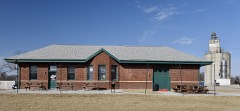
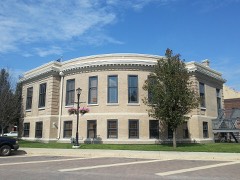
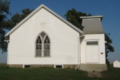
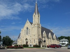
19 National Register listings published here.
Sources: the National Register database, National Park Service
52 topographic sheets cover 31 settlements here, and 19 properties are on the National Register of Historic Places.
19 National Register listings published here.
Sources: the National Register database, National Park Service
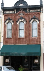
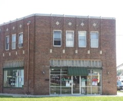
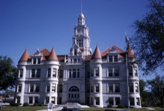
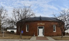
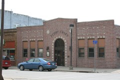
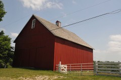
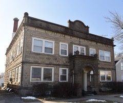
Every property in this county listed on the National Register of Historic Places, with the year it was listed and the federal nomination document.
Every wildfire the federal occurrence database records inside this county: 31 of them, burning about 344 acres. None started naturally and none was recorded as arson. Each settlement page carries the fires within five miles of it.
| Reported cause | Fires |
|---|---|
| Missing data/not specified/undetermined | 20 |
| Debris and open burning | 6 |
| Equipment and vehicle use | 4 |
| Misuse of fire by a minor | 1 |
The five largest, by the area the report gives. None of them was recorded as arson.
| Date | Cause | Size | Reported by | Name on the report |
|---|---|---|---|---|
| 18 January 2006 | Missing data/not specified/undetermined | 80 acres | Iowa Department of Natural Resources | not named |
| 10 April 2009 | Missing data/not specified/undetermined | 60 acres | Iowa Department of Natural Resources | not named |
| 25 March 2008 | Missing data/not specified/undetermined | 40 acres | Iowa Department of Natural Resources | not named |
| 20 March 2014 | Debris and open burning | 25 acres | Iowa Department of Natural Resources | not named |
| 9 October 2020 | Equipment and vehicle use | 25 acres | Iowa Department of Natural Resources | not named |
| 6 October 2020 | Equipment and vehicle use | 20 acres | Iowa Department of Natural Resources | not named |
| 4 November 2010 | Missing data/not specified/undetermined | 20 acres | Iowa Department of Natural Resources | 141ST & WILLIS AVE, PERRY, IOWA |
| 3 April 2010 | Missing data/not specified/undetermined | 18 acres | Iowa Department of Natural Resources | 31376 210TH STREET, DALLAS CENTER, IA 50063, IOW |
Every settlement page carries the fires within five miles of it - see the settlement index below.
The NOAA Storm Events Database holds 965 reports for this county, causing no deaths, 9 injuries and about $24,305,530 in recorded property damage. Each settlement page carries the reports that name it.
| Kind of event | Reports |
|---|---|
| Thunderstorm Wind | 350 |
| Hail | 249 |
| Heavy Rain | 141 |
| Flood | 83 |
| Tornado | 58 |
| Flash Flood | 53 |
| Funnel Cloud | 19 |
| Lightning | 12 |
The most serious of them, by death, then injury, then recorded damage. The accounts are quoted exactly as the forecast office filed them.
| When | Event | Place named | Harm | What the report says |
|---|---|---|---|---|
| October 2018 | Lightning | Hadden Hill | 3 hurt | Reported by an off duty NWS employee. Three individuals were struck by lightning walking to their cars in the parking lot. Minor injuries reported. |
| June 1990 | Thunderstorm Wind | not stated | 3 hurt | no account filed |
| June 1998 | Tornado (F2) | Granger | 2 hurt, $500,000 | no account filed |
| May 2007 | Thunderstorm Wind | Dawson | 1 hurt, $25,000 | no account filed |
| June 1998 | Thunderstorm Wind | Granger | $5,000,000 | no account filed |
| November 2005 | Tornado (F2) | Minburn | $2,500,000 | Tornado touched down in Dallas County and moved into Boone County. |
| August 2010 | Lightning | Adel | $1,000,000 | no account filed |
| June 2008 | Flood | Panther | $500,000 | Water was over the road at 210th St and J Ave. |
| June 2008 | Flood | Panther | $500,000 | Water was over the road at 210th St and J Ave. |
| April 2007 | Flood | Redfield | $500,000 | no account filed |
| April 1994 | Thunderstorm Wind | Booneville | $500,000 | no account filed |
| June 2015 | Flood | Dawson | $385,000 | Many primary and secondary roads were flooded. Some roads were washed out and one bridge was damaged and will need to be replaced. Damage was also done to several parks and trails across the county. |
| June 2015 | Flood | Van Meter | $250,000 | The Raccoon River at Van Meter crested at 17.68 feet at 11:00 PM CST on 15 June. |
| June 2015 | Flood | Van Meter | $250,000 | The South Raccoon River at Redfield crested at 22.65 feet at 3:45 PM CST on 25 June. |
| August 2015 | Flood | Adel | $250,000 | The North Raccoon River at Perry crested at 16.35 feet on 1 September 2015 at 8:30 AM CDT. Another entry for this event is in the September 2015 report. |
| June 2010 | Flood | Hadden Hill | $250,000 | no account filed |
| April 2007 | Flood | Perry | $250,000 | no account filed |
| May 2004 | Flash Flood | Countywide | $250,000 | no account filed |
| June 1998 | Tornado (F1) | De Soto | $250,000 | no account filed |
| June 1979 | Tornado (F1) | not stated | $250,000 | no account filed |
| June 1976 | Tornado (F3) | not stated | $250,000 | no account filed |
| June 1964 | Tornado (F2) | not stated | $250,000 | no account filed |
| June 2015 | Flood | Van Meter | $200,000 | The Raccoon River at Van Meter crested at 23.09 feet at 9:30 PM CST on 26 June. |
| June 2014 | Flash Flood | Waukee | $200,000 | Suger Creek was out of its banks and flooding Ashworth road. The road was closed. |
| May 2013 | Flood | Adel | $200,000 | Highway 169 will be closing due to flooding north of Adel. |
| May 2013 | Flood | Dawson | $200,000 | no account filed |
| June 2010 | Flood | Dawson | $200,000 | no account filed |
| June 2008 | Flood | Van Meter | $200,000 | no account filed |
| March 2010 | Flood | Dawson | $150,000 | no account filed |
| May 2002 | Flash Flood | Countywide | $150,000 | no account filed |
| June 1998 | Flash Flood | Dallas Center | $150,000 | no account filed |
| August 2002 | Thunderstorm Wind | Dallas Center | $125,000 | no account filed |
| March 2019 | Flood | Booneville | $100,000 | Emergency management and river gauges reported 8 to 10 foot rises on the Middle Raccoon and South Raccoon Rivers due to ice jams. Several county roads were impacts with road closures. Flooding was also reported along Highway 44 between Panora and Dallas Center from heavy rain and snowmelt. Portions of Walnut Creek were also just above bankfull from the rain and snowmelt. |
| May 2019 | Flood | Van Meter | $100,000 | The Raccoon River at Van Meter crested at 17.71 feet on 29 May 2019 at 01:45 UTC. |
| May 2019 | Flood | Adel | $100,000 | The North Raccoon River at Perry crested twice at 16.2 feet on 27 May 2019 at 13:45 UTC and at 15.22 feet on 30 May 2019 at 13:45 UTC. |
| June 2018 | Flood | Adel | $100,000 | The Raccoon River at Perry crested at 18.04 feet on 23 June 2018 at 14:15 UTC. |
| September 2018 | Flood | Adel | $100,000 | The North Raccoon River at Perry crested at 15.50 feet on 8 September at 1645 UTC. |
| August 2016 | Thunderstorm Wind | Adel | $100,000 | Emergency manager reported numerous trees and power lines down throughout Dallas County. Cities affected include Adel, Dallas Center, Redfield, and Dexter. Tree limb also reported on the EM's roof. Time estimated from when storm hit Adel. |
| June 2015 | Flood | Adel | $100,000 | The North Raccoon River at Perry crested at 15.10 feet at 12:30 PM CST on 13 June. |
| June 2015 | Flood | Adel | $100,000 | The North Raccoon River at Perry crested at 19.40 feet at 4:00 PM CST on 26 June. |
| May 2014 | Tornado (EF0) | Minburn | $100,000 | EF0 Tornado north of Dallas Center stayed in rural area and produced minor damage. |
| July 2010 | Thunderstorm Wind | Hadden Hill | $100,000 | Large trees down in Waukee and Woodward. Power out across half of Waukee. |
| May 2008 | Tornado (EF1) | Kennedy | $100,000 | Power lines and trees were damaged as well as farm outbuildings being damaged or destroyed. |
| July 2008 | Thunderstorm Wind | Dallas Center | $100,000 | Highway 44 in Dallas Center was blocked due to tree limbs down across the road. Several homes were damaged by falling limbs. |
| July 2008 | Thunderstorm Wind | Dawson | $100,000 | Numerous trees were uprooted with only one road remaining open in town. Three homes had trees down on them. A few LP tanks were leaking due to tree damage and a grain elevator sustained damage in town. |
| August 2010 | Flood | Bouton | $100,000 | no account filed |
| June 2007 | Flash Flood | Woodward | $100,000 | no account filed |
| May 2004 | Flash Flood | Countywide | $100,000 | no account filed |
| July 2000 | Thunderstorm Wind | De Soto | $100,000 | no account filed |
| July 1998 | Flash Flood | Dallas Center | $100,000 | no account filed |
| June 1998 | Thunderstorm Wind | Perry | $100,000 | no account filed |
| June 1998 | Flood | Dallas Center | $100,000 | no account filed |
| May 2013 | Thunderstorm Wind | Shuler Mine | $75,000 | A roof was damaged with structural damage to a building was reported. |
| May 2013 | Thunderstorm Wind | Shuler Mine | $75,000 | A house lost about three-quarters of its roof on County Highway R22 south of Highway 44. |
| September 2013 | Thunderstorm Wind | Adel | $75,000 | Two 9 inch tree limbs down. Virtually every street has some tree damage. |
| June 2009 | Thunderstorm Wind | Dallas Center Arpt | $75,000 | Straight line winds blew down two hangars at a private air strip. |
| July 2008 | Thunderstorm Wind | Dawson | $75,000 | Trained spotters reported winds estimated at 100 MPH with numerous trees uprooted in Dawson. |
| July 2010 | Flood | Dawson | $75,000 | no account filed |
| August 2007 | Thunderstorm Wind | Van Meter | $75,000 | no account filed |
| June 2001 | Flash Flood | North Portion | $75,000 | no account filed |
The Survey's mineral resources record lists 54 workings inside this county. 9 still produce and 45 are closed or unrecorded. Each settlement page carries the workings within five miles of it.
| Commodity | Workings |
|---|---|
| Sand and Gravel, Construction | 37 |
| Clay | 10 |
| Stone, Crushed/Broken | 6 |
| Flagstone | 1 |
The least common of them first, because a county's hundredth gravel pit says nothing its first ten did not.
| Where | Site | Commodity | Status | Recorded |
|---|---|---|---|---|
| Unknown | Flagstone | Past Producer | ||
| Bear Creek Quarry | Stone, Crushed/Broken | Past Producer | ||
| Bear Creek Quarry | Stone, Crushed/Broken | Past Producer | ||
| I-80 Quarry | Stone, Crushed/Broken | Past Producer | ||
| Schuler Coal Co. No. 1 | Stone, Crushed/Broken | Past Producer | ||
| Talbot Quarry | Stone, Crushed/Broken | Past Producer | ||
| Unknown | Stone, Crushed/Broken | Past Producer | ||
| Clay Pit No. 6 | Clay | Producer | ||
| D. A. Mcbride Brickyard | Clay | Past Producer | ||
| De Soto Brick and Tile Works | Clay | Past Producer | ||
| Goodwin Brick and Tile Company | Clay | Past Producer | ||
| Redfield Pit | Clay | Producer | ||
| Redfield Plant | Clay | Producer | ||
| Unknown | Clay | Past Producer | ||
| Unknown | Clay | Past Producer | ||
| Unknown | Clay | Past Producer | ||
| Unknown | Clay | Past Producer | ||
| Adel Pit | Sand and Gravel, Construction | Producer | ||
| Adel Plant | Sand and Gravel, Construction | Producer | ||
| Booneville Gravel Co | Sand and Gravel, Construction | Producer | ||
| Boyer Pit | Sand and Gravel, Construction | Past Producer | ||
| Commerce Pit | Sand and Gravel, Construction | Past Producer | ||
| Croft Pit | Sand and Gravel, Construction | Past Producer | ||
| Dallas County Pits | Sand and Gravel, Construction | Producer | ||
| Davis Pit | Sand and Gravel, Construction | Past Producer | ||
| Diddy Pit | Sand and Gravel, Construction | Unknown | ||
| Dudley Pit | Sand and Gravel, Construction | Producer | ||
| Feller Pit | Sand and Gravel, Construction | Past Producer | ||
| Harold Moore | Sand and Gravel, Construction | Past Producer | ||
| Hodges Pit | Sand and Gravel, Construction | Past Producer | ||
| Messerschmidt Pit | Sand and Gravel, Construction | Past Producer | ||
| Nissley Pit | Sand and Gravel, Construction | Past Producer | ||
| Perry Sand and Gravel Pit | Sand and Gravel, Construction | Producer | ||
| Ross Pit | Sand and Gravel, Construction | Past Producer | ||
| S N Wilson | Sand and Gravel, Construction | Past Producer | ||
| Unknown | Sand and Gravel, Construction | Past Producer | ||
| Unknown | Sand and Gravel, Construction | Past Producer | ||
| Unknown | Sand and Gravel, Construction | Past Producer | ||
| Unknown | Sand and Gravel, Construction | Past Producer | ||
| Unknown | Sand and Gravel, Construction | Past Producer | ||
| Unknown | Sand and Gravel, Construction | Past Producer | ||
| Unknown | Sand and Gravel, Construction | Past Producer | ||
| Unknown | Sand and Gravel, Construction | Past Producer | ||
| Unknown | Sand and Gravel, Construction | Past Producer | ||
| Unknown | Sand and Gravel, Construction | Past Producer | ||
| Unknown | Sand and Gravel, Construction | Past Producer | ||
| Unknown | Sand and Gravel, Construction | Past Producer | ||
| Unknown | Sand and Gravel, Construction | Past Producer | ||
| Unknown | Sand and Gravel, Construction | Past Producer | ||
| Unknown | Sand and Gravel, Construction | Past Producer | ||
| Unknown | Sand and Gravel, Construction | Past Producer | ||
| Unknown | Sand and Gravel, Construction | Past Producer | ||
| Unknown | Sand and Gravel, Construction | Past Producer | ||
| Wm Spatz | Sand and Gravel, Construction | Past Producer |
Named settlements recorded in the Geographic Names Information System, each with the topographic sheets covering it. Villages, hamlets and abandoned places alike. Each is shown with the nearest named watercourse or landform and the survey quadrangle it falls on.
Grant township · 50109 · On Royer Creek · Granger quadrangle
13 sheets, 1911 to 1984
Union township · 50233 · On Middle Raccoon River · Redfield quadrangle
14 sheets, 1949 to 1993
Van Meter township · 50261 · On South Raccoon River · Waukee quadrangle
11 sheets, 1908 to 1984
Union township · 50233 · On Middle Raccoon River · Redfield quadrangle
14 sheets, 1949 to 1993
The vanished settlements of Dallas County: the places named above that are no longer on the map.