Block
From the record
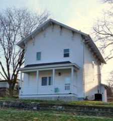
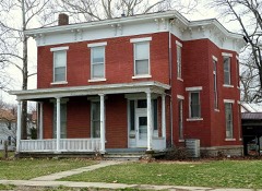
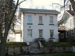
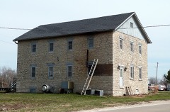
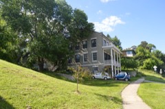
35 National Register listings published here.
Sources: the National Register database, National Park Service
47 topographic sheets cover 26 settlements here, and 35 properties are on the National Register of Historic Places.
35 National Register listings published here.
Sources: the National Register database, National Park Service
Every property in this county listed on the National Register of Historic Places, with the year it was listed and the federal nomination document.
Every wildfire the federal occurrence database records inside this county: 17 of them, burning about 372 acres. None started naturally and none was recorded as arson. Each settlement page carries the fires within five miles of it.
| Reported cause | Fires |
|---|---|
| Debris and open burning | 10 |
| Missing data/not specified/undetermined | 6 |
| Equipment and vehicle use | 1 |
The five largest, by the area the report gives. None of them was recorded as arson.
| Date | Cause | Size | Reported by | Name on the report |
|---|---|---|---|---|
| 24 April 2018 | Debris and open burning | 180 acres | Iowa Department of Natural Resources | not named |
| 3 March 2018 | Debris and open burning | 70 acres | Iowa Department of Natural Resources | not named |
| 5 March 2020 | Debris and open burning | 50 acres | Iowa Department of Natural Resources | not named |
| 2 April 2013 | Debris and open burning | 35 acres | Iowa Department of Natural Resources | not named |
| 22 March 2018 | Debris and open burning | 12 acres | Iowa Department of Natural Resources | not named |
| 4 March 2018 | Debris and open burning | 10 acres | Iowa Department of Natural Resources | not named |
| 25 April 2014 | Debris and open burning | 4.0 acres | Iowa Department of Natural Resources | not named |
| 3 May 2014 | Debris and open burning | 2.0 acres | Iowa Department of Natural Resources | not named |
Every settlement page carries the fires within five miles of it - see the settlement index below.
The NOAA Storm Events Database holds 492 reports for this county, causing no deaths, 31 injuries and about $30,765,000 in recorded property damage. Each settlement page carries the reports that name it.
| Kind of event | Reports |
|---|---|
| Thunderstorm Wind | 238 |
| Hail | 122 |
| Flood | 51 |
| Flash Flood | 33 |
| Tornado | 24 |
| Lightning | 9 |
| Funnel Cloud | 9 |
| Heavy Rain | 6 |
The most serious of them, by death, then injury, then recorded damage. The accounts are quoted exactly as the forecast office filed them.
| When | Event | Place named | Harm | What the report says |
|---|---|---|---|---|
| June 1983 | Tornado (F1) | not stated | 27 hurt, $2,500,000 | no account filed |
| August 1965 | Tornado (F3) | not stated | 1 hurt, $250,000 | no account filed |
| June 2010 | Lightning | Burlington | 1 hurt, $25,000 | Lightning struck a light pole near the main stage of Burlington Steamboat Days, blowing a chunk of concrete from the base of the pole and damaging sound equipment. A nearby man was injured by the lightning and another witness was treated for hyperventilation. |
| June 2010 | Lightning | Lenox Park | 1 hurt | Lightning struck a man in Burlington, IA around 1200 am June 18. The victim sustained minor injuries. This report was confirmed by hospital personnel. |
| April 2001 | Lightning | West Burlington | 1 hurt | One person suffered minor injuries after being struck by lightning in a department store parking lot. |
| May 2003 | Hail | Burlington | $10,000,000 | no account filed |
| May 2010 | Flash Flood | Pleasantgrove | $3,950,000 | Heavy rains resulted in the flash flooding of parts of Des Moines County during the early morning hours of May 12. The Burlington area and locations north were some of the hardest hit areas. The flood waters were 10 to 12 inches deep south of Agency Road. In addition, the intersection of Highway 61 and Roosevelt Avenue was flooded with some vehicles stalled out in the flood waters. Several homes and businesses had water in basements with some flooded with over 7 feet of water. Parts of Tama Road and Plank Road were washed out. In other areas, landslides spilled onto some streets. Several businesses along Jefferson Street also sustained flood damage and loss of property. |
| June 2008 | Flood | Huron | $3,800,000 | The record crest on the Mississippi River at Burlington occurred on June 17, 2008 at 25.73 feet. Flood stage is 15 feet. |
| May 2003 | Hail | Burlington | $2,000,000 | Covered the ground |
| May 2003 | Hail | Middletown | $1,000,000 | no account filed |
| May 2003 | Hail | West Burlington | $1,000,000 | no account filed |
| September 2008 | Flood | St Paul | $500,000 | The Skunk River near Augusta, IA experienced major flooding from the evening of September 13 to the late afternoon of September 15. It crested near 21.4 feet during the evening of September 14. The major flood stage level is 20.0 feet. |
| April 1995 | Hail | West Burlington | $350,000 | no account filed |
| June 2015 | Tornado (EF1) | Middletown | $300,000 | An EF1 tornado touched down briefly on the northwest side of the Iowa Army Ammunition Plant and tracked southeast for about 3 miles. Trees, roofs, outbuildings, power poles, and vehicles were damaged along the path. The maximum wind was estimated at 95 mph. |
| May 2011 | Tornado (EF1) | Augusta | $250,000 | The tornado damage included snapped trees, broken large tree limbs, two broken power poles, a destroyed shed, and two over-turned railroad box cars. |
| June 2010 | Flood | Lenox Park | $250,000 | Heavy rains during the third week of June resulted in the Mississippi River at Burlington going above the moderate flood stage level of 16.5 feet on June 22 around 230 pm. It crested around 16.95 feet around 1 pm June 26. It fell below the moderate flood stage level around 4 am June 28. |
| May 2010 | Flood | Danville Wilson Arpt | $250,000 | Heavy rains during the second week of May resulted in the Skunk River at Augusta going above the moderate flood stage level of 17 feet on May 13 around 2 am. It crested around 19.4 feet around 1 pm May 13. It fell below the moderate flood stage level around 9 pm May 15. |
| June 2010 | Flood | Danville Wilson Arpt | $250,000 | Heavy rains during the second and third weeks of June resulted in the Skunk River at Augusta going above the moderate flood stage level of 17 feet on June 14 around 2 pm. It crested above the major flood stage around 21.6 feet around 1 am June 22. It fell below the moderate flood stage level around 1 am June 27. |
| July 2010 | Flash Flood | Beaverdale | $250,000 | Heavy rains resulted in flash flooding of Burlington, IA and West Burlington, IA during the evening of July 19 and morning of July 20. Major street flooding was observed in Burlington, IA. The flood waters were 6 inches deep on south bound lanes of Gear Avenue in West Burlington. Ten inches of water covered Mason and Garfield Streets in Burlington. The 2500 block of Flint Hills Drive was flooded with 1 foot of water. The flood waters forced the closure of Roosevelt Road near Fun City. |
| April 2011 | Flood | Spring Grove | $250,000 | no account filed |
| August 2010 | Flood | Danville Wilson Arpt | $250,000 | no account filed |
| August 2009 | Flood | Danville Wilson Arpt | $250,000 | no account filed |
| May 1988 | Tornado (F1) | not stated | $250,000 | no account filed |
| July 1980 | Tornado (F1) | not stated | $250,000 | no account filed |
| May 1974 | Tornado (F2) | not stated | $250,000 | no account filed |
| May 1966 | Tornado (F2) | not stated | $250,000 | no account filed |
| April 1963 | Tornado (F1) | not stated | $250,000 | no account filed |
| May 2009 | Flood | Danville Wilson Arpt | $150,000 | Heavy rains from May 12th to May 16th resulted in the Skunk River at Augusta going above the moderate flood stage level of 17 feet around 12 am on May 16. It crested around 17.5 feet around 9 am on May 16. It fell back below the moderate flood stage level around 11 am on May 17. |
| June 2009 | Thunderstorm Wind | Burlington | $150,000 | Wind gusts estimated to be 70 mph blew down a four foot diameter tree across Dumbell Lake Rd about 3 miles north of Burlington, IA around 340 am June 18. Several dozen additional large tree limbs were also blown down in the same area. In addition, a 100 foot tall tree fell onto a mobile home on Dumbell Lake Road. A garage on Tama Road was also damaged by a fallen tree limb. |
| July 2010 | Flood | Northfield | $125,000 | no account filed |
| September 2016 | Flood | Lenox Park | $100,000 | Heavy rainfall of 4 to over 10 inches over significant areas from 21 to 23 September in extreme North Central and Northeast Iowa moved downstream causing the Mississippi River to rise above major flood stage levels. ||Burlington rose above its major flood stage level of 18.0 feet on September 30th, 2016 at approximately 7 PM CST. It crested around 18.93 feet on October 3rd, 2016.|It fell below major flood stage on October 6th around 1 pm CST.||Major flooding continued into October. |
| August 2010 | Lightning | Burlington | $100,000 | Lightning struck a tower on the north side on top of the Burlington Police Department building around 645 pm CDT August 10. The strike affected the communications center's dispatching capabilities, phone systems, radio-assisted dispatch, computer systems, and some computers. The Burlington Police Department also contributed to this report. |
| May 2003 | Thunderstorm Wind | Burlington | $100,000 | no account filed |
| August 1995 | Thunderstorm Wind | Burlington | $75,000 | A very unstable air mass was over Iowa in advance of an approaching warm front. CAPE values were around 4000 J-kg-1 with lifted indices already -7° C. at sunrise. Surface dew point readings were in the middle 70s. Thunderstorms fired and produced heavy rain and hail. One cell dropped golf ball-size hail on the town of Pleasantville. The area of thunderstorm continued to spread and develop east into eastern Iowa. They dumped heavy rains and generally small hail as the moved southeast. A couple of the cells did become severe over the east central and southeast counties of the state. Golf ball-size hail fell in Johnson County at Hills. Another storm produced high winds as it passed through the Burlington area. Numerous trees were downed and windows were blown out of a few buildings. Three to four inches of rain fell in under two hours over both counties. Flooding was reported, but for the most part it was restricted to urban areas. Lightning struck a tree on a farm south of Dubuque. Several head of cattle were standing beneath the tree, 14 head were killed. Several others were downed, but were able to be revived. |
| August 1995 | Thunderstorm Wind | Burlington | $75,000 | no account filed |
| July 2003 | Thunderstorm Wind | Burlington | $70,000 | Also by media |
| June 2005 | Thunderstorm Wind | Countywide | $60,000 | The southern part of the bow echo or perhaps a new bow echo moved across Des Moines County from Henry County. A large number of trees were downed along with power poles with some trees as big as 2 to 4 feet in diameter with the main damage in West Burlington and Burlington. Radar data does indicate the stronger winds were along and north of the apex of the main bow in Louisa County. Tornado like damage was reported in Beaverdale with a funnel cloud reported 1S of Beaverdale. The following times have been established based on radar data (all CST); Pleasant Grove 1129-1139, Mediapolis 1136-1146, Danville 1138-1148, Beaverdale 1143-1153, West Burlington 1148-1158, Burlington 1155-1205. |
| May 2011 | Tornado (EF1) | Dodgeville | $50,000 | The tornado damage included some snapped trees and the destruction of a small barn and outbuilding. |
| August 2009 | Thunderstorm Wind | Middletown | $50,000 | Wind gusts estimated to be 70 mph damaged a farmstead near Middletown, IA around 150 pm August 19. A truck top lofted by the winds partially punctured a wall. Also, the residence sustained roof damage and some of the crops were flattened. This report was relayed by the Burlington Hawkeye. |
| July 2003 | Thunderstorm Wind | Burlington | $50,000 | Trees down |
| September 2000 | Hail | Burlington | $50,000 | Baseball sized hail damaged several homes on 42nd Street. The large hail punched holes in windows and siding and dented several vehicles. Mobile homes nearby also suffered damage from the hail. |
| April 1993 | Thunderstorm Wind | Danville | $50,000 | no account filed |
| April 1993 | Thunderstorm Wind | Danville | $50,000 | no account filed |
| May 1996 | Lightning | Burlington | $30,000 | no account filed |
| August 1995 | Thunderstorm Wind | Middletown | $30,000 | no account filed |
| June 2012 | Thunderstorm Wind | West Burlington | $25,000 | Wind gusts estimated to be 70 mph blew half of a tree onto a house just west of the Burlington Regional Airport around 610 pm CDT June 16. |
| June 2009 | Thunderstorm Wind | Sperry | $25,000 | Wind gusts estimated to be 70 mph blew down some 1 to 2 foot diameter trees and some power poles in Sperry, IA around 515 pm June 19. |
| June 2009 | Thunderstorm Wind | Lenox Park | $25,000 | Wind gusts estimated to be 70 mph blew down some power lines onto Highway 61 about 3 miles north of Burlington, IA around 656 pm June 23. The highway was closed for a time. |
| December 1982 | Tornado (F1) | not stated | $25,000 | no account filed |
| July 1980 | Tornado (F1) | not stated | $25,000 | no account filed |
| May 1977 | Tornado (F2) | not stated | $25,000 | no account filed |
| May 1974 | Tornado (F1) | not stated | $25,000 | no account filed |
| June 1973 | Tornado (F0) | not stated | $25,000 | no account filed |
| April 1954 | Tornado (F2) | not stated | $25,000 | no account filed |
| March 2006 | Hail | Burlington | $20,000 | Nickel to golfball sized hail; also reported by NWS personnel. |
| September 2000 | Thunderstorm Wind | Burlington | $20,000 | Strong winds knocked down several large trees and tore off part of a roof of a residence on 42nd Street. |
| September 2005 | Thunderstorm Wind | Burlington | $15,000 | Numerous trees and branches down. KBUR radio measured a peak gust at their station of 41 knots (47 mph). There is also a report of a measured gust of 52 knots (60 mph) on Adams street in Burlington. |
| June 1995 | Thunderstorm Wind | Burlington | $15,000 | The same upper level low pressure area mentioned above continued to influence the weather over Iowa again on the 2nd. Temperatures at 500 mb remained around the -15° C range. Thunderstorms formed by mid day. A small tornado touched down briefly northeast of Ottumwa. It lifted a pop-up camper off of its jacks, but there was no other significant damage. During the later afternoon hours, thunderstorms spread south and east. The weather features were rather slow moving and as a result heavy rainfall occurred in Louisa and Des Moines Counties. In one hours time, 4.65 inches of rainfall was recorded in Columbus Junction. Parts of Des Moines County received five inches of rainfall in a short period of time. The heavy rainfall produced flash flooding. Two children were injured indirectly in Des Moines County as their mother lost control of the car while driving into the flood waters. The children, two and three years of age, were not fastened in their car seats. One was thrown in the car, the other was thrown through the window and into the ditch. Both were taken to a local hospital and treated for minor injuries. A citation was written charging the mother with failure to restrain her children. Flooding was also widespread in the urban areas. Burlington was quite hard hit. High winds from one of the storms tore part of the roof off of a house in Burlington. Also, in Burlington, lightning struck an electrical service box at a sewer station causing about $2000 in damage. |
| May 2013 | Lightning | Lenox Park | $10,000 | A garage was struck by lightning at 2640 South Main Street in Burlington resulting in a structure fire. |
| April 2009 | Flood | Burlington Arpt | $10,000 | Heavy rains resulted in two separate landslides in Burlington, IA on the morning of April 30. One resident on Sweeney Avenue lost a 20 foot by 10 foot section of his backyard while another resident on the 300 block of South 5th Street sustained damage to a 20 foot section of a retaining wall. |
The Survey's mineral resources record lists 24 workings inside this county. 6 still produce and 18 are closed or unrecorded. Each settlement page carries the workings within five miles of it.
| Commodity | Workings |
|---|---|
| Stone, Crushed/Broken | 13 |
| Gypsum-Anhydrite | 2 |
| Sand and Gravel, Construction | 2 |
| Stone, Crushed/Broken, Limestone, Dimension | 2 |
| Limestone, Dimension | 2 |
| Flagstone | 1 |
| Clay | 1 |
| Limestone, Dimension, Stone, Crushed/Broken | 1 |
The least common of them first, because a county's hundredth gravel pit says nothing its first ten did not.
| Where | Site | Commodity | Status | Recorded |
|---|---|---|---|---|
| Burlington Quarries | Limestone, Dimension, Stone, Crushed/Broken | Past Producer | ||
| Granite Brick Co. Pit | Clay | Past Producer | ||
| Renner Quarry | Flagstone | Past Producer | ||
| Kemper Quarry | Stone, Crushed/Broken, Limestone, Dimension | Past Producer | ||
| Miller-Ervin Quarries | Stone, Crushed/Broken, Limestone, Dimension | Past Producer | ||
| Sperry Mine and Mill | Gypsum-Anhydrite | Producer | ||
| Spring Sand Pit | Sand and Gravel, Construction | Producer | ||
| Unknown | Limestone, Dimension | Past Producer | ||
| Unknown | Sand and Gravel, Construction | Past Producer | ||
| Unknown | Limestone, Dimension | Past Producer | ||
| Us Gypsum Mine & Plant | Gypsum-Anhydrite | Producer | ||
| Beach Quarry | Stone, Crushed/Broken | Past Producer | ||
| Bietsch Quarry | Stone, Crushed/Broken | Past Producer | ||
| Concrete Mt | Stone, Crushed/Broken | Past Producer | ||
| County Quarry | Stone, Crushed/Broken | Past Producer | ||
| County Quarry | Stone, Crushed/Broken | Past Producer | ||
| Heinold Quarry | Stone, Crushed/Broken | Producer | ||
| Mc Kenzie Quarry | Stone, Crushed/Broken | Past Producer | ||
| Mediapolis Quarry | Stone, Crushed/Broken | Producer | ||
| Nelson Quarry | Stone, Crushed/Broken | Producer | ||
| Prospect Hill Quarry | Stone, Crushed/Broken | Past Producer | ||
| Sullivan Slough Quarry | Stone, Crushed/Broken | Past Producer | ||
| Unknown | Stone, Crushed/Broken | Past Producer | ||
| Ward Quarry | Stone, Crushed/Broken | Past Producer |
Named settlements recorded in the Geographic Names Information System, each with the topographic sheets covering it. Villages, hamlets and abandoned places alike. Each is shown with the nearest named watercourse or landform and the survey quadrangle it falls on.
Flint River township · 52655 · On Little Flint Creek · West Burlington quadrangle
17 sheets, 1934 to 1990
Burlington city · 52601 · On O'Connell Slough · Burlington quadrangle
18 sheets, 1934 to 1990
Concordia township · 52601 · On Spring Creek · Dallas City quadrangle
17 sheets, 1932 to 1990
Union township · 52601 · On Brush Creek · Dallas City quadrangle
17 sheets, 1932 to 1990