Block
From the record
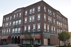
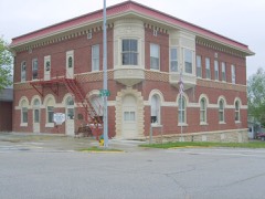
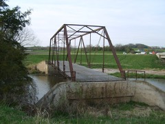
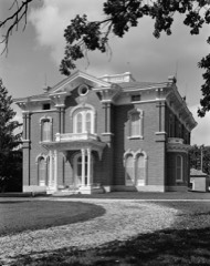
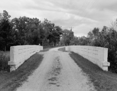
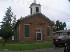
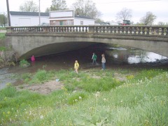
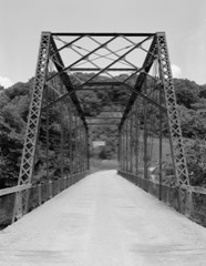
29 National Register listings published here.
Sources: the National Register database, National Park Service
50 topographic sheets cover 27 settlements here, and 29 properties are on the National Register of Historic Places.
29 National Register listings published here.
Sources: the National Register database, National Park Service
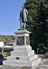
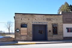
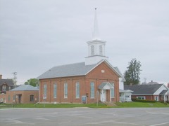
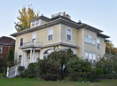
Every property in this county listed on the National Register of Historic Places, with the year it was listed and the federal nomination document.
Every wildfire the federal occurrence database records inside this county: 114 of them, burning about 953 acres. 1 started naturally and none was recorded as arson. Each settlement page carries the fires within five miles of it.
| Reported cause | Fires |
|---|---|
| Missing data/not specified/undetermined | 65 |
| Debris and open burning | 41 |
| Equipment and vehicle use | 6 |
| Smoking | 1 |
| Natural | 1 |
The five largest, by the area the report gives. None of them was recorded as arson.
| Date | Cause | Size | Reported by | Name on the report |
|---|---|---|---|---|
| 9 April 2009 | Missing data/not specified/undetermined | 140 acres | Iowa Department of Natural Resources | not named |
| 19 October 2015 | Equipment and vehicle use | 120 acres | Iowa Department of Natural Resources | not named |
| 28 November 2008 | Missing data/not specified/undetermined | 50 acres | Iowa Department of Natural Resources | not named |
| 6 April 2015 | Debris and open burning | 50 acres | Iowa Department of Natural Resources | not named |
| 31 March 2019 | Debris and open burning | 50 acres | Iowa Department of Natural Resources | not named |
| 15 April 2009 | Missing data/not specified/undetermined | 45 acres | Iowa Department of Natural Resources | not named |
| 13 April 2011 | Missing data/not specified/undetermined | 30 acres | Iowa Department of Natural Resources | WEST ON 90TH ST., OFF OF W AVE., SW OF WESTGATE, I |
| 2 November 2014 | Equipment and vehicle use | 30 acres | Iowa Department of Natural Resources | not named |
Every settlement page carries the fires within five miles of it - see the settlement index below.
The NOAA Storm Events Database holds 444 reports for this county, causing 6 deaths, 171 injuries and about $57,434,030 in recorded property damage. Each settlement page carries the reports that name it.
| Kind of event | Reports |
|---|---|
| Thunderstorm Wind | 174 |
| Hail | 141 |
| Flood | 41 |
| Tornado | 30 |
| Flash Flood | 28 |
| Heavy Rain | 19 |
| Funnel Cloud | 9 |
| Lightning | 2 |
The most serious of them, by death, then injury, then recorded damage. The accounts are quoted exactly as the forecast office filed them.
| When | Event | Place named | Harm | What the report says |
|---|---|---|---|---|
| May 1968 | Tornado (F5) | not stated | 5 killed, 156 hurt, $25,000,000 | no account filed |
| June 1971 | Tornado (F3) | not stated | 1 killed, $250,000 | no account filed |
| August 2011 | Thunderstorm Wind | Wadena | 6 hurt, $2,500 | Numerous trees were blown down or uprooted in Wadena. Some of the trees went down on power lines. A two inch diameter flag pole was bent over and some cornfields were flattened. The high winds caused a school bus to slip off the road south of West Union with some of the students on board receiving a few bumps and bruises. |
| July 1971 | Tornado (F4) | not stated | 4 hurt, $2,500,000 | no account filed |
| June 2015 | Tornado (EF1) | Maynard | 2 hurt, $100,000 | The tornado started about 4 miles southeast of Maynard and ended approximately 5 miles southeast of Maynard. The tornado destroyed a farmhouse by moving it off its foundation and it then fell into the basement. Two people inside the house sustained non-life threatening injuries. The tornado also damaged crops, trees and farm buildings. |
| August 2021 | Thunderstorm Wind | Oelwein | 1 hurt, $50,000 | An estimated 60 mph wind gust in Oelwein snapped or uprooted numerous trees. One person sustained injuries when they became trapped under the branches of a fallen tree. A building partially collapsed briefly trapping one person. |
| April 2001 | Tornado (F1) | West Union | 1 hurt, $40,000 | no account filed |
| August 1996 | Thunderstorm Wind | Elgin | 1 hurt, $30,000 | no account filed |
| June 2008 | Flood | Clermont Vly Arpt | $3,600,000 | The Turkey River through northern and northeast Fayette County experienced a record flood. At Eldorado, the river crested at a record level of 22.11 feet about 9 a.m. CDT on June 9. The previous record crest was 19.6 feet in May 2004. Flood stage is 12.0 feet. Flood stage levels were also exceeded at Clermont.||Damage in Eldorado was surprisingly minimal with flood waters only impacting a few homes directly near the river on the north side of the village. Further southeast though several bridges and roads were damaged or destroyed as debris would pile up along bridge supports and running water flowed over highways. A large bridge north of West Union, called the Huntzinger Bridge, on County Road W42 was broke apart in two sections. County Road B40, known as the river road was also closed and heavily damaged.||In Clermont, the Turkey River heavily damaged the Skip-A-Way Campground on the southwest edge of town. River levels quickly rose out of their banks and swept across many of the camp sites heavily damaging at least 50 of them. Water also flowed into a holding pond and busted a new opening back to the Turkey River leading to even more infrastructure damage. Luckily no one was killed or injured.||In Elgin, local officials decided to breach the road on the north side of the river, allowing flood waters to spill into a nearby rural home to protect the downtown area. |
| June 2015 | Thunderstorm Wind | Maynard | $3,100,000 | A path of wind damage occurred across southern Fayette County. Numerous trees and power lines were downed, several roofs were blown off farm buildings, metal corn bins were caved in and pieces of siding and roofing were strewn throughout farm fields. One home was destroyed, 17 farms received major damage and 10 cows were killed. |
| June 2008 | Flood | Oelwein Muni Arpt | $3,100,000 | Numerous secondary roads were flooded. Over 5 inches of rain was reported for the weekend of June 7-8. |
| March 1988 | Tornado (F2) | not stated | $2,500,000 | no account filed |
| May 1964 | Tornado (F2) | not stated | $2,500,000 | no account filed |
| July 2009 | Hail | Clermont Vly Arpt | $2,000,000 | Windows were broken in a house. Hail size was estimated. |
| May 1999 | Flash Flood | Countywide | $2,000,000 | no account filed |
| July 2009 | Hail | Eldorado | $1,100,000 | no account filed |
| July 2017 | Flood | Waucoma | $1,080,000 | After the initial flash flooding, the flood waters lingered across much of Fayette County into Sunday, July 23rd. On Saturday morning, numerous roads were reported to be impassable in Fairbank because of the flood waters. Sandbagging was occurring around several businesses. State Highway 3 was closed between Oelwein and Oran. In the town of Fayette, around 80 percent of the homes had water in their basements and a park in town was closed because of the flooding. |
| July 2017 | Flash Flood | Waucoma | $1,000,000 | After heavy rains dropped 4 to 8 inches of rain, flash flooding occurred across the southern sections of Fayette County. East of Wadena, the bridge over the Volga River on Acorn Road failed. Otter Creek went out if its banks in Oelwein. |
| June 2014 | Thunderstorm Wind | Westgate | $940,000 | Barns were blown down near Westgate with tin strewn across a road. Another barn was blown down with cattle trapped inside the debris, two of which died. Part of a roof was blown off a building used for milking, exposing an office, with the rain soaking office supplies and computers. On the same farm, part of free stall barn was ripped off and a shed was destroyed. Numerous trees and power lines were blown down in town and a church roof sustained damage from the high winds. Some of the trees were 2 to 4 feet in diameter and were either uprooted or snapped off about 20 feet above the ground. Two grain bins were blown over and landed on a building and a truck. |
| June 2013 | Flash Flood | Oelwein | $704,000 | Several roads were closed northwest of Oelwein as locally heavy rain produced some flash flooding. Almost two inches of rain fell in about an hour. |
| July 2010 | Flash Flood | Oelwein Muni Arpt | $580,000 | Law enforcement reported numerous streets and county roads closed due to flooding in and around the city of Oelwein. Law enforcement reported many homes with basements flooded and some structural damage. Public and cooperative observers estimated rainfall amounts between 630 a.m. and 1100 a.m. CST of 3.20 inches to 5.80 inches around the city of Oelwein. The flooding caused an estimated $400,000 worth of damage to the city of Oelwein.||Around the high school, the volume of water overwhelmed the storm sewer. The parking lot had water between 3-4 feet high for about 45 minutes until the drains caught up. This pool of water ran against the school building, causing water to run in under doors, etc. which led to $18, 760 worth of damage to carpet in two school buildings. |
| August 2016 | Flood | Eldorado | $410,000 | Runoff from heavy rain pushed the Turkey River out of its banks near Eldorado. The river crested at almost nine feet above the flood stage at 21.92 feet. This established a new crest of record. Flooding downstream along the Turkey River damaged some roads and bridges along with county parks. |
| July 2021 | Tornado (EF0) | Oelwein Muni Arpt | $275,000 | An EF0 tornado developed southwest of Oelwein and moved northeast into the city before dissipating. The tornado damaged the ticket booth, fencing and ripped metal siding off of stands at the high school football field. The tornado also blew out the sides of a greenhouse, tipped over the FFA's chicken coop and lifted but did not remove the roof on the main portion of the high school. At a restaurant, an air handler unit was ripped off and windows broken. Some crop and tree damage was noted southwest of the city as well. |
| June 1990 | Tornado (F1) | not stated | $250,000 | no account filed |
| July 1971 | Tornado (F2) | not stated | $250,000 | no account filed |
| September 2016 | Flash Flood | Hawkeye | $200,000 | Flood waters from Crane Creek covered U.S. Highway 18 northeast of Hawkeye and the streets were flooded in Hawkeye. Numerous roads between West Union and Sumner had water over them. |
| August 2016 | Flood | Clermont | $200,000 | Runoff from heavy rain pushed the Turkey River out of its banks in Clermont. The river crested over six feet above the flood stage at 22.32 feet. The flood waters damaged the waste water treatment facility. |
| May 2024 | Thunderstorm Wind | West Union | $175,000 | Emergency management reported numerous trees and power lines down in Elgin. A tree had also fallen onto a home. |
| May 2011 | Tornado (EF1) | Westgate | $175,000 | This was the first of two tornadoes to hit Fayette County. This tornado tracked east-northeast across the western part of the county. The tornado snapped off or uprooted numerous trees and damaged several homes, barns and grain bins. |
| March 2020 | Tornado (EF1) | Oelwein Muni Arpt | $165,000 | An EF1 tornado moved through the west and northwest side of Oelwein during the late afternoon of March 28th. The tornado produced extensive tree damage at Red Gate Park, blew in the wall of an apartment building and damaged the siding and roof of a second apartment building. The building that sustained the wall damage was condemned. One person was injured at the apartment complex when they stepped on broken glass. At least two vehicles parked outside the apartment complex were heavily damaged. |
| September 2016 | Flash Flood | Oelwein Muni Arpt | $125,000 | Heavy rain caused Otter Creek to go out of its banks in Oelwein flooding several city parks. A road was washed out on the northeast side of the city and street flooding occurred in other parts of the city. |
| July 2009 | Thunderstorm Wind | Westgate | $125,000 | A two mile long path of destruction occurred from approximately 150th Street and S and U Avenues. Numerous barns, bins and outbuildings were demolished. One farm north of Sumner was hit particularly hard. The residence sustained damage and its attached garage was ripped away, with two vehicles in the garage a total loss. Also, a mobile home was severely damaged. Approximately 600 acres of corn and soybeans were shredded by the hail and wind, with crop damage totals nearly a half of a million dollars. |
| May 2004 | Flash Flood | Countywide | $125,000 | no account filed |
| April 2008 | Flash Flood | Oran | $120,000 | Eleven roads were closed due to the effects of high water, including washouts and erosion. Even three days after the heavy rain had fallen, there were a few roads still closed. Damage estimates totaled $120,000. |
| July 2007 | Thunderstorm Wind | Oelwein | $100,000 | Numerous trees and power lines were blown down in Oelwein. The hardest hit area was on the northern side of town. Corn was also flattened in fields just northwest of town. |
| March 2020 | Tornado (EF0) | Maynard | $75,000 | An EF0 tornado touched down touched down southeast of Maynard and move north-northeast before dissipating between Maynard and Fayette. Several farm buildings were damaged along the path of the tornado. |
| May 2013 | Flash Flood | Arlington | $75,000 | Heavy rains caused several small streams that feed the Maquoketa River to go out of their banks south of Arlington. At least three roads were closed due to washouts or water over the road. |
| July 2010 | Flood | Fairbank | $75,000 | Several gravel roads are washed out across the southern part of Fayette County. Several homes sustained damages as well, mainly to basements with a few basement walls pushed in by the water. A three day rainfall total of 12.18 inches was measured at 6 a.m. CST July 24th about three quarters of a mile northwest of Oelwein. |
| May 2004 | Flash Flood | Countywide | $75,000 | no account filed |
| May 2011 | Thunderstorm Wind | West Union | $65,000 | A fifth wheel camper was picked up and turned upside down by straight line winds from a severe thunderstorm. The winds also partially removed the metal roof off a large machine shed. Golf ball sized hail also fell that broke the siding on a house. |
| June 2014 | Thunderstorm Wind | Brainard | $60,000 | A cattle barn was blown down north of Wadena with approximately 150 head of cattle trapped in the debris. |
| April 2008 | Flood | Westgate | $60,000 | No homes or businesses had major damage due to flood waters, although there were widespread reports of basement flooding in homes. Due to the excessive rainfall, the Turkey River at Eldorado rose 8 feet in 9 hours on the morning of April 25. The Turkey River crested at 18.07 feet at Eldorado, which was only 1.5 feet below the record level of 19.6 feet. |
| June 1998 | Thunderstorm Wind | Oelwein | $55,000 | no account filed |
| July 2020 | Thunderstorm Wind | Westgate | $50,000 | Several farm out buildings were damaged or blown down and some corn was flattened northeast of Westgate. |
| August 2016 | Flood | Waucoma | $50,000 | Runoff from heavy rain pushed the Little Turkey River out of its banks in Waucoma. The flood waters damaged the town's wastewater treatment facility. |
| June 2010 | Thunderstorm Wind | Stanley | $50,000 | Severe thunderstorms winds created a path of damage between I and E Avenues just south of 20th Street. Several trees, power lines and buildings were damaged. A NWS storm survey determined the damage was created by straight-line winds of estimated speeds between 70 and 90 mph. |
| May 2000 | Flash Flood | Countywide | $50,000 | no account filed |
| July 1999 | Flash Flood | West Portion | $50,000 | no account filed |
| June 1994 | Thunderstorm Wind | Hawkeye | $50,000 | no account filed |
| June 1994 | Thunderstorm Wind | Hawkeye | $50,000 | no account filed |
| August 1994 | Hail | Fayette | $50,000 | no account filed |
| August 1994 | Hail | Randalia | $50,000 | no account filed |
| August 1994 | Hail | .5 S Randalia | $50,000 | no account filed |
| May 2016 | Thunderstorm Wind | Maynard | $40,000 | Roofs were damaged or blown off barns and some hog confinements in the Arlington area. One barn was blown over by the high winds. |
| June 1997 | Thunderstorm Wind | Oelwein | $40,000 | no account filed |
| July 2017 | Thunderstorm Wind | Clermont | $35,000 | Trees were blown down in Clermont. At least one tree landed on a house and another destroyed a garage. Numerous trees and power lines were blown down in a campground on the southwest edge of town. |
| September 2005 | Hail | Elgin | $35,000 | no account filed |
| May 1999 | Hail | West Union | $35,000 | no account filed |
| June 2010 | Thunderstorm Wind | Arlington | $32,000 | Severe thunderstorm winds caused the roofs of two hog confinement buildings to cave in on a farm on County Road W45 (G Avenue). Media reports indicate several hogs had to later be destroyed due to the extent of their injuries suffered when the building collapsed. Several other farm buildings in the area were also damaged or blown down. |
| June 2008 | Thunderstorm Wind | Oelwein Muni Arpt | $32,000 | Power lines were blown down, some farm buildings were damaged, and trees were blown down just west of Oelwein from an apparent downburst. |
The Survey's mineral resources record lists 67 workings inside this county. 19 still produce and 48 are closed or unrecorded. Each settlement page carries the workings within five miles of it.
| Commodity | Workings |
|---|---|
| Stone, Crushed/Broken | 38 |
| Sand and Gravel, Construction | 27 |
| Barium-Barite | 1 |
| Flagstone | 1 |
The least common of them first, because a county's hundredth gravel pit says nothing its first ten did not.
| Where | Site | Commodity | Status | Recorded |
|---|---|---|---|---|
| Jacobsen Quarry | Flagstone | Producer | ||
| Turner Creek Occurrence | Barium-Barite | Past Producer | Barite | |
| Alpha Pit | Sand and Gravel, Construction | Past Producer | ||
| Bassett Pit | Sand and Gravel, Construction | Past Producer | ||
| Clermont Pit & Plant | Sand and Gravel, Construction | Producer | ||
| Crider Sand and Gravel | Sand and Gravel, Construction | Producer | ||
| Durscher Pit | Sand and Gravel, Construction | Unknown | ||
| Fayette Sand and Gravel Co | Sand and Gravel, Construction | Producer | ||
| Miller Pit | Sand and Gravel, Construction | Past Producer | ||
| Olsen Pit | Sand and Gravel, Construction | Past Producer | ||
| Reisner Pit | Sand and Gravel, Construction | Past Producer | ||
| Strawberry Point Pit | Sand and Gravel, Construction | Past Producer | ||
| Unknown | Sand and Gravel, Construction | Past Producer | ||
| Unknown | Sand and Gravel, Construction | Unknown | ||
| Unknown | Sand and Gravel, Construction | Past Producer | ||
| Unknown | Sand and Gravel, Construction | Past Producer | ||
| Unknown | Sand and Gravel, Construction | Past Producer | ||
| Unknown | Sand and Gravel, Construction | Unknown | ||
| Unknown | Sand and Gravel, Construction | Past Producer | ||
| Unknown | Sand and Gravel, Construction | Past Producer | ||
| Unknown | Sand and Gravel, Construction | Past Producer | ||
| Unknown | Sand and Gravel, Construction | Past Producer | ||
| Unknown | Sand and Gravel, Construction | Past Producer | ||
| Unknown | Sand and Gravel, Construction | Unknown | ||
| Unknown | Sand and Gravel, Construction | Past Producer | ||
| Unknown | Sand and Gravel, Construction | Past Producer | ||
| Vogts Pit | Sand and Gravel, Construction | Producer | ||
| Wadena Pit | Sand and Gravel, Construction | Past Producer | ||
| Zupke Dredge & Plant | Sand and Gravel, Construction | Producer | ||
| Ashby Quarry | Stone, Crushed/Broken | Past Producer | ||
| Brockway Quarry | Stone, Crushed/Broken | Past Producer | ||
| Carmichael Quarry | Stone, Crushed/Broken | Past Producer | ||
| Drewes Quarry | Stone, Crushed/Broken | Producer | ||
| Fairbank Quarry | Stone, Crushed/Broken | Producer | ||
| Fayette County Quarries | Stone, Crushed/Broken | Producer | ||
| Fayette-Templeton Quarry | Stone, Crushed/Broken | Past Producer | ||
| Gernand Quarry | Stone, Crushed/Broken | Producer | ||
| Hanson Quarry | Stone, Crushed/Broken | Producer | ||
| Houg Quarry | Stone, Crushed/Broken | Producer | ||
| Landas Quarry | Stone, Crushed/Broken | Past Producer | ||
| Larson Quarry | Stone, Crushed/Broken | Past Producer | ||
| Maryville Quarry | Stone, Crushed/Broken | Unknown | ||
| Maynard Quarry | Stone, Crushed/Broken | Producer | ||
| Mc Donough Quarry | Stone, Crushed/Broken | Producer | ||
| Miller Quarry | Stone, Crushed/Broken | Producer | ||
| Northrup Quarry | Stone, Crushed/Broken | Past Producer | ||
| Nuttins Quarry | Stone, Crushed/Broken | Past Producer | ||
| Pape Quarry | Stone, Crushed/Broken | Producer | ||
| Patterson Quarry | Stone, Crushed/Broken | Past Producer | ||
| Quinn Quarry | Stone, Crushed/Broken | Producer | ||
| Schwemman Quarry | Stone, Crushed/Broken | Past Producer | ||
| Scott Quarry | Stone, Crushed/Broken | Past Producer | ||
| St Lucas Quarry | Stone, Crushed/Broken | Past Producer | ||
| Thoma Quarry | Stone, Crushed/Broken | Past Producer | ||
| Unknown | Stone, Crushed/Broken | Past Producer | ||
| Unknown | Stone, Crushed/Broken | Past Producer | ||
| Unknown | Stone, Crushed/Broken | Past Producer | ||
| Unknown | Stone, Crushed/Broken | Past Producer | ||
| Unknown | Stone, Crushed/Broken | Past Producer | ||
| Unknown | Stone, Crushed/Broken | Past Producer | ||
| Unknown | Stone, Crushed/Broken | Past Producer | ||
| Unknown | Stone, Crushed/Broken | Past Producer | ||
| Unknown | Stone, Crushed/Broken | Past Producer | ||
| Voshell Quarry | Stone, Crushed/Broken | Past Producer | ||
| Waucoma Quarry | Stone, Crushed/Broken | Producer | ||
| Williams Quarry | Stone, Crushed/Broken | Past Producer | ||
| Yearous Quarry | Stone, Crushed/Broken | Producer |
Named settlements recorded in the Geographic Names Information System, each with the topographic sheets covering it. Villages, hamlets and abandoned places alike. Each is shown with the nearest named watercourse or landform and the survey quadrangle it falls on.
Dover township · 52135 · On Nutting Creek · Castalia quadrangle
11 sheets, 1906 to 1985
No longer a settlement
Dover township · 52175 · On Little Turkey River · Festina quadrangle
11 sheets, 1906 to 1985
The vanished settlements of Fayette County: the places named above that are no longer on the map.