Block
From the record
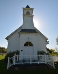
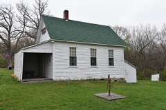
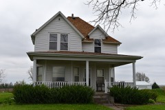
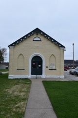
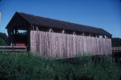
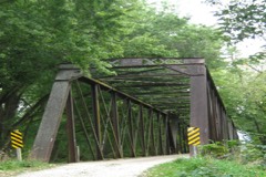
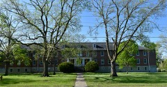
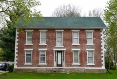
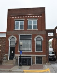
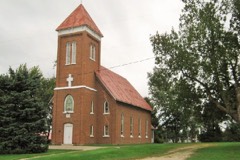
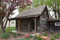
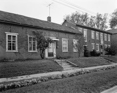
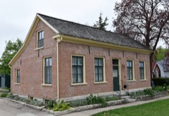
29 National Register listings published here.
Sources: the National Register database, National Park Service
39 topographic sheets cover 29 settlements here, and 29 properties are on the National Register of Historic Places.
29 National Register listings published here.
Sources: the National Register database, National Park Service
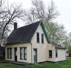
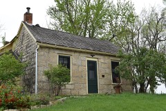
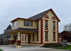
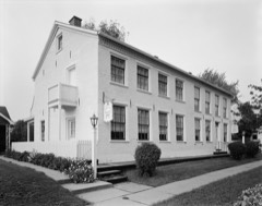
Every property in this county listed on the National Register of Historic Places, with the year it was listed and the federal nomination document.
Every wildfire the federal occurrence database records inside this county: 47 of them, burning about 420 acres. None started naturally and none was recorded as arson. Each settlement page carries the fires within five miles of it.
| Reported cause | Fires |
|---|---|
| Debris and open burning | 34 |
| Missing data/not specified/undetermined | 11 |
| Equipment and vehicle use | 1 |
| Smoking | 1 |
The five largest, by the area the report gives. None of them was recorded as arson.
| Date | Cause | Size | Reported by | Name on the report |
|---|---|---|---|---|
| 15 March 2009 | Missing data/not specified/undetermined | 120 acres | Iowa Department of Natural Resources | not named |
| 21 December 2020 | Missing data/not specified/undetermined | 40 acres | Iowa Department of Natural Resources | not named |
| 30 March 2014 | Debris and open burning | 40 acres | Iowa Department of Natural Resources | not named |
| 27 February 2016 | Debris and open burning | 20 acres | Iowa Department of Natural Resources | VIRGINIA TOWNSHIP |
| 30 March 2014 | Debris and open burning | 20 acres | Iowa Department of Natural Resources | not named |
| 12 April 2014 | Debris and open burning | 15 acres | Iowa Department of Natural Resources | not named |
| 9 April 2014 | Debris and open burning | 15 acres | Iowa Department of Natural Resources | not named |
| 23 November 2008 | Missing data/not specified/undetermined | 14 acres | Iowa Department of Natural Resources | not named |
Every settlement page carries the fires within five miles of it - see the settlement index below.
The NOAA Storm Events Database holds 713 reports for this county, causing no deaths, 31 injuries and about $133,056,500 in recorded property damage. Each settlement page carries the reports that name it.
| Kind of event | Reports |
|---|---|
| Thunderstorm Wind | 236 |
| Hail | 196 |
| Heavy Rain | 108 |
| Flood | 65 |
| Tornado | 47 |
| Flash Flood | 37 |
| Funnel Cloud | 17 |
| Lightning | 7 |
The most serious of them, by death, then injury, then recorded damage. The accounts are quoted exactly as the forecast office filed them.
| When | Event | Place named | Harm | What the report says |
|---|---|---|---|---|
| July 2018 | Tornado (EF3) | Pella | 13 hurt, $120,000,000 | Tornado developed about 3 miles north of Pella and moved southeast for its entire length. The tornado initially remained in rural areas just north and northeast of the town producing crop, tree and minor structural damage to houses. The tornado began to intensify just northeast of town and shifted a house off of its foundation. The tornado then encountered the Vermeer facility on the east side of town producing EF3 damage to one of the large buildings along with tossing numerous cars about the facility. 13 injuries occurred at the Vermeer facility with 6 requiring transport to the hospital. The tornado then turned slightly eastward before passing into Mahaska county. |
| May 2008 | Tornado (EF2) | Columbia | 10 hurt, $750,000 | Several homes were damaged or destroyed, two mobile homes were destroyed. Considerable tree damage was reported. The EF2 damage occurred in the Attica area, along with 10 injuries. The tornado moved out of Marion County into Mahaska County. |
| June 1986 | Thunderstorm Wind | not stated | 6 hurt | no account filed |
| November 2015 | Tornado (EF1) | Knoxville Arpt | 1 hurt, $350,000 | A high-end EF-1 tornado touched down southwest of Knoxville and traveled through the southeast side of town. Damage occurred along its path through town. One injury was reported. |
| August 2019 | Thunderstorm Wind | Red Rock | 1 hurt, $20,000 | Law enforcement reported a semi blown over on mile long bridge north of Knoxville, including a reported serious injury. Time estimated from radar. |
| June 1997 | Thunderstorm Wind | Knoxville | $1,000,000 | no account filed |
| July 2015 | Flood | Pleasantville | $500,000 | Law Enforcement reported Iowa Highway 92 remained closed due to water flowing over it, west of Pleasantville. In addition several secondary roads across the county remain closed with water flowing over them. Around 200 to 300 homes in the Pleasantville area had some degree of water damage as well. |
| June 2008 | Flood | Bussey | $500,000 | no account filed |
| June 2015 | Flood | Swan | $300,000 | Several roads remained under water and sustained damage. Forty-five road closures occurred due to flooded roadways. |
| May 2007 | Flood | Melcher | $300,000 | no account filed |
| July 2015 | Flash Flood | Knoxville | $250,000 | Emergency Manager reported several feet of water in VA hospital building. |
| April 2007 | Flood | Pleasantville | $250,000 | no account filed |
| May 1988 | Tornado (F1) | not stated | $250,000 | no account filed |
| August 1986 | Tornado (F1) | not stated | $250,000 | no account filed |
| October 1984 | Tornado (F1) | not stated | $250,000 | no account filed |
| May 1962 | Tornado (F2) | not stated | $250,000 | no account filed |
| June 2000 | Flash Flood | Knoxville | $200,000 | no account filed |
| July 2015 | Flood | Pleasantville | $150,000 | Law Enforcement reported that several secondary roads across the southern portion of the county remain closed due to water over the road. The Emergency Manager reported that 200 to 300 homes in the Pleasantville area sustained some degree of water damage. |
| April 2010 | Thunderstorm Wind | Otley | $150,000 | Multiple homes with hail damaged siding, windows knocked out, garage with two walls blown out, and a machine shed roof was blown off. Two large trees were also twisted. |
| May 2007 | Flash Flood | Knoxville | $150,000 | no account filed |
| June 1998 | Thunderstorm Wind | Knoxville | $150,000 | no account filed |
| June 1997 | Thunderstorm Wind | Pleasantville | $150,000 | no account filed |
| August 2018 | Thunderstorm Wind | Knoxville Arpt | $100,000 | A large egg laying building was destroyed south of Knoxville along Highway 14. The storm moved the south end of the building roughly 40 feet off of its foundation. The walls were anchored into the concrete floor. Time estimated from radar. |
| October 2018 | Flood | Pella | $100,000 | Emergency manager reported multiple gravel roads remain closed due to water over them or washed out throughout the county. |
| June 2015 | Flood | Bussey | $100,000 | Cedar Creek at Bussey crested at 31.19 feet at 4:00 PM CST on 25 June. |
| July 2015 | Flash Flood | Pleasantville | $100,000 | Emergency Manager reported that the police and fire departments are working on an incident where water is coming into the main floor of a local home. |
| July 2015 | Flash Flood | Dunreath | $100,000 | Law Enforcement reported numerous county roads washed out throughout the county. |
| July 2015 | Flash Flood | Donnelly | $100,000 | Department of Transportation reported flooding on Iowa Highway 5 at mile marker 66 and 67. Delayed report. |
| July 2015 | Flash Flood | Bussey | $100,000 | A road was damaged from floodwaters. |
| December 2015 | Flood | Swan | $100,000 | Many county roads were closed across portions of the county from flooding with rises on local streams and creeks. |
| April 2012 | Thunderstorm Wind | Pershing | $100,000 | Garage attached to a house was destroyed with part of the roof of the house taken off. Debris from the house strewn east from the house about 100 yards. Garage door faced west and looks to have failed first. |
| April 2012 | Thunderstorm Wind | Knoxville Arpt | $100,000 | Roof blown off of a house with the garage blown down. |
| June 2011 | Flash Flood | Knoxville | $100,000 | EM reported several streets flooding with 8 to 10 inches of flowing water. |
| June 2011 | Flood | Bussey | $100,000 | no account filed |
| July 2010 | Flood | Bussey | $100,000 | no account filed |
| March 2008 | Flood | Swan | $100,000 | no account filed |
| July 2008 | Hail | Knoxville | $100,000 | no account filed |
| May 2004 | Flash Flood | Countywide | $100,000 | no account filed |
| May 2004 | Flash Flood | Countywide | $100,000 | no account filed |
| May 2002 | Flash Flood | East Portion | $100,000 | no account filed |
| June 1998 | Flash Flood | Knoxville | $100,000 | no account filed |
| June 2017 | Tornado (EF1) | Pleasantville | $75,000 | Tornado moved into Marion County from Warren County. The tornado remained in rural portions of the county south and east of Pleasantville with the tornado lifting just southwest of Otley. Several rural residences received light damage with much tree damage along the path. |
| June 2017 | Hail | Columbia | $75,000 | Multiple patrol cars and EMA vehicles were damaged by large hail up to baseball size. Some reports coming in of damages to homes, buildings, etc from hail. Most reports of hail from southern 1/3 of Marion County from Melcher-Dallas to west of Attica. |
| April 2012 | Thunderstorm Wind | Knoxville | $75,000 | Trees were blown down along with dime size hail reported. |
| September 2007 | Tornado (EF1) | Pella | $75,000 | Tornado touched down in Marion County, then tracked northeast into Mahaska County. |
| June 2010 | Flood | Bussey | $75,000 | no account filed |
| September 2000 | Thunderstorm Wind | Knoxville | $75,000 | no account filed |
| March 2019 | Flood | Percy | $50,000 | County reported multiple rural roads closed due to flooding. |
| August 2018 | Thunderstorm Wind | Tracy | $50,000 | Emergency manager reported that a large tree fell on a residence, causing significant damage to the roof and interior rooms. Time estimated from radar. |
| March 2017 | Tornado (EF1) | Nepas | $50,000 | NWS storm survey confirmed a tornado touchdown approximately 5 miles west of Knoxville. An outbuilding was heavily damaged in this area and significant roof damage occurred to a residence. This is consistent with winds of 90 to 100 mph - or EF1 damage. |
| July 2015 | Flash Flood | Pleasantville | $50,000 | Department of Transportation reported flooding on Iowa Highway 92 at the 144 mile marker. Delayed report. |
| June 2014 | Thunderstorm Wind | Pella | $50,000 | Large limbs blown down and at least one home damaged. |
| July 2014 | Flash Flood | Knoxville | $50,000 | Law enforcement reported water on the roads in front of the Knoxville Racetrack The water was up to the bottoms of the cars. |
| July 2011 | Thunderstorm Wind | Pella | $50,000 | Roof blown off of a building. |
| June 2011 | Flash Flood | Pella | $50,000 | Thunder Creek over 240th Pl with the road closed due to the water. Deputy reported it looked like white water rapids. |
| June 2010 | Thunderstorm Wind | Melcher | $50,000 | Grain bins destroyed, roof damage, and trees down on a farm. |
| June 2010 | Flash Flood | Pleasantville | $50,000 | Coal Creek was rising and had closed paved Highway G40. Water from the creek was also over Highway 92, but traffic was still moving. Numerous rural gravel roads in western Marion County were under water. |
| August 2010 | Flash Flood | Harvey | $50,000 | Six inches of water reported running through the streets of Harvey. |
| June 2008 | Flash Flood | Hamilton | $50,000 | Numerous secondary roads were under water from flooded creeks. |
| June 2008 | Flash Flood | Knoxville | $50,000 | Roads were closed at McKimber Drive and 170th with water running over the road. |
The Survey's mineral resources record lists 32 workings inside this county. 7 still produce and 25 are closed or unrecorded. Each settlement page carries the workings within five miles of it.
| Commodity | Workings |
|---|---|
| Stone, Crushed/Broken | 8 |
| Sand and Gravel, Construction | 8 |
| Zinc | 5 |
| Clay | 3 |
| Flagstone | 3 |
| Limestone, Dimension | 2 |
| Gypsum-Anhydrite | 1 |
| Bituminous | 1 |
| Sulfur-Pyrite | 1 |
| Stone, Crushed/Broken, Limestone, Dimension | 1 |
The least common of them first, because a county's hundredth gravel pit says nothing its first ten did not.
| Where | Site | Commodity | Status | Recorded |
|---|---|---|---|---|
| Durham Pelletizing Plant | Gypsum-Anhydrite | Producer | ||
| Iowa Fuel & Minls. Coal Prep. Plant | Bituminous, Sulfur-Pyrite | Plant | ||
| Unknown | Stone, Crushed/Broken, Limestone, Dimension | Past Producer | ||
| Unknown | Limestone, Dimension | Past Producer | ||
| Unknown | Limestone, Dimension | Past Producer | ||
| Iowa Brick and Tile Co. Pit | Clay | Past Producer | ||
| Oskaloosa Clay Products Co. Pit | Clay | Past Producer | ||
| Red Rock Quarry | Flagstone | Past Producer | ||
| Unknown | Flagstone | Past Producer | ||
| Unknown | Flagstone | Past Producer | ||
| Wright Brickyard | Clay | Past Producer | ||
| Drill Hole | Zinc | Past Producer | Sphalerite | |
| Drill Hole | Zinc | Past Producer | Sphalerite | |
| Drill Hole | Zinc | Past Producer | Sphalerite | |
| Occurrence | Zinc | Past Producer | Sphalerite | |
| Occurrence | Zinc | Past Producer | Sphalerite | |
| Army Corps of Engineers Sand Pits | Sand and Gravel, Construction | Past Producer | ||
| Battistello | Sand and Gravel, Construction | Producer | ||
| Dingeman Pit | Sand and Gravel, Construction | Past Producer | ||
| Durham Mine | Stone, Crushed/Broken | Producer | ||
| Durham Quarry | Stone, Crushed/Broken | Past Producer | ||
| Durham Quarry | Stone, Crushed/Broken | Past Producer | ||
| Harvey Pit #151 | Sand and Gravel, Construction | Producer | ||
| Melcher Quarry and Mill | Stone, Crushed/Broken | Producer | ||
| New Harvey Plant | Sand and Gravel, Construction | Producer | ||
| Pella Pit and Plant | Sand and Gravel, Construction | Past Producer | ||
| Quarry No. 1 | Stone, Crushed/Broken | Past Producer | ||
| Server Quarry | Stone, Crushed/Broken | Past Producer | ||
| Unknown | Sand and Gravel, Construction | Past Producer | ||
| Unknown | Sand and Gravel, Construction | Past Producer | ||
| Vanderkraats Quarry | Stone, Crushed/Broken | Past Producer | ||
| Witzenberg Quarry | Stone, Crushed/Broken | Past Producer |
Named settlements recorded in the Geographic Names Information System, each with the topographic sheets covering it. Villages, hamlets and abandoned places alike. Each is shown with the nearest named watercourse or landform and the survey quadrangle it falls on.
Dallas township · 50049 · On Wildcat Creek · Melcher-Dallas quadrangle
10 sheets, 1924 to 1984
No longer a settlement
Summit township · 50214 · On Brush Creek · Otley quadrangle
11 sheets, 1909 to 1984
No longer a settlement
Knoxville township · 50138 · On Butcher Creek · Knoxville SW quadrangle
10 sheets, 1909 to 1984
No longer a settlement
Knoxville township · 50138 · On Butcher Creek · Knoxville SW quadrangle
10 sheets, 1909 to 1984
Summit township · 50219 · On Wildcat Creek · Otley quadrangle
11 sheets, 1909 to 1984
No longer a settlement
Washington township · 50138 · On Long Branch · Melcher-Dallas quadrangle
10 sheets, 1924 to 1984
Lake Prairie township · 50219 · Pella quadrangle
11 sheets, 1910 to 1982
No longer a settlement
Red Rock township · 50237 · Pleasantville quadrangle
9 sheets, 1910 to 1984
No longer a settlement
Red Rock township · 50228 · On Sugar Creek · Pleasantville quadrangle
9 sheets, 1910 to 1984
No longer a settlement
The vanished settlements of Marion County: the places named above that are no longer on the map.