 Block
From the record
18 National Register listings published here.
Sources: the National Register database, National Park Service
35 topographic sheets cover 35 settlements here, and 18 properties are on the National Register of Historic Places.
18 National Register listings published here.
Sources: the National Register database, National Park Service
Every property in this county listed on the National Register of Historic Places, with the year it was listed and the federal nomination document.
| Photograph | Property | Type | Listed | Reference |
|---|---|---|---|---|
 | Thaddeus Binford House | building | 1984 | 84001286 |
 | Dobbin Round Barn | building | 1986 | 86001459 |
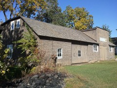 | Matthew Edel Blacksmith Shop and House | building | 1983 | 83000391 |
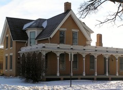 | Glick-Sower House | building | 1993 | 93000331 |
| Frederick and Mary Grumme House | building | 2026 | 100012698 | |
| Home Oil Service Station | building | 2025 | 100011924 | |
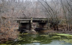 | Le Grand Bridge | structure | 1998 | 98000499 |
| Louis F. and Emma M. (Edler) Wohlert House-Emma Wohlert Maternity Home | building | 2024 | 100011083 | |
 | Marshall County Courthouse | building | 1972 | 72000478 |
 | Marshalltown Downtown Historic District | district | 2002 | 01001463 |
| Minerva Creek Bridge | structure | 1998 | 98000497 | |
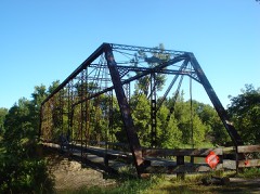 | Quarry Bridge | structure | 1998 | 98000498 |
| August and Josephine Riemenschneider Farmstead | building | 2022 | 100007464 | |
| State Center Commercial Historic District | district | 2002 | 02001034 | |
 | Robert H. Sunday House | building | 1988 | 88002141 |
 | Watson's Grocery | building | 1998 | 98001271 |
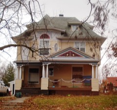 | C. H. Whitehead House | building | 1979 | 79000916 |
 | Leroy R. Willard House | building | 1976 | 76000794 |
Every wildfire the federal occurrence database records inside this county: 71 of them, burning about 507 acres. None started naturally and 1 was recorded as arson. Each settlement page carries the fires within five miles of it.
| Reported cause | Fires |
|---|---|
| Missing data/not specified/undetermined | 51 |
| Debris and open burning | 15 |
| Railroad operations and maintenance | 2 |
| Arson/incendiarism | 1 |
| Equipment and vehicle use | 1 |
| Smoking | 1 |
The five largest, by the area the report gives. None of them was recorded as arson.
| Date | Cause | Size | Reported by | Name on the report |
|---|---|---|---|---|
| 24 April 2018 | Missing data/not specified/undetermined | 45 acres | Iowa Department of Natural Resources | not named |
| 21 March 2009 | Missing data/not specified/undetermined | 41 acres | Iowa Department of Natural Resources | not named |
| 10 April 2010 | Missing data/not specified/undetermined | 40 acres | Iowa Department of Natural Resources | 2534 STARRY GROVE ROAD, MARSHALLTOWN, IA 50158, IO |
| 18 March 2006 | Missing data/not specified/undetermined | 25 acres | Iowa Department of Natural Resources | not named |
| 27 March 2012 | Debris and open burning | 25 acres | Iowa Department of Natural Resources | not named |
| 30 March 2020 | Debris and open burning | 25 acres | Iowa Department of Natural Resources | not named |
| 7 October 2011 | Missing data/not specified/undetermined | 20 acres | Iowa Department of Natural Resources | 2417 MARSH AVE, IA |
| 8 March 2020 | Missing data/not specified/undetermined | 20 acres | Iowa Department of Natural Resources | not named |
Every settlement page carries the fires within five miles of it - see the settlement index below.
The NOAA Storm Events Database holds 528 reports for this county, causing no deaths, 49 injuries and about $240,878,000 in recorded property damage. Each settlement page carries the reports that name it.
| Kind of event | Reports |
|---|---|
| Thunderstorm Wind | 210 |
| Hail | 150 |
| Heavy Rain | 50 |
| Tornado | 38 |
| Flood | 34 |
| Flash Flood | 23 |
| Funnel Cloud | 19 |
| Lightning | 4 |
The most serious of them, by death, then injury, then recorded damage. The accounts are quoted exactly as the forecast office filed them.
| When | Event | Place named | Harm | What the report says |
|---|---|---|---|---|
| July 2018 | Tornado (EF3) | Marietta | 22 hurt, $200,000,000 | This tornado developed northwest of Marshalltown west of the little hamlet of Marietta. The tornado traveled southeast on the western side of the Iowa River producing extensive crop and tree damage. The tornado strengthened quickly and took on a wedge appearance as it entered northwest Marshalltown. The tornado tracked more easterly as it entered town producing widespread EF1 and EF2 damage. The tornado went directly through the business district of Marshalltown with EF2 and EF3 damage to many structures including the county courthouse which lost the spire off the clock tower. The tornado continued east through housing areas before encountering the Lennox plant on the east side of town, producing EF3 damage once again. The tornado began to weaken rapidly after this point and dissipated near power plant located on the east side of town. The tornado produced a total of 22 direct injuries. An additional indirect injury resulted during the clean-up of storm debris when a tree fell on a man. |
| April 1981 | Tornado (F2) | not stated | 9 hurt, $2,500,000 | no account filed |
| June 1951 | Tornado (F3) | not stated | 7 hurt | no account filed |
| April 1961 | Tornado (F3) | not stated | 6 hurt, $2,500,000 | no account filed |
| May 1962 | Tornado (F2) | not stated | 5 hurt, $250,000 | no account filed |
| May 1989 | Tornado (F4) | not stated | $25,000,000 | no account filed |
| March 2019 | Flood | St Anthony | $2,000,000 | Iowa DOT reported Iowa 14 closed between US 30 and County Road E27. Other secondary roads across the county were also reported closed due to flooding. Many roads and some bridges were damaged from the flooding. The bridge on 140th St. was a total loss. |
| July 2011 | Thunderstorm Wind | Marshalltown | $500,000 | Extensive damage reported in Marshalltown. Trees over roads, trees on homes, gas leaks, and structural damage. |
| April 1994 | Tornado (F1) | State Center | $500,000 | no account filed |
| June 2007 | Lightning | St Anthony | $350,000 | no account filed |
| August 2015 | Flood | Marshalltown | $250,000 | The Iowa River at Marshalltown crested at 19.98 feet on 31 August 2015 at 8:30 PM CDT. |
| May 2013 | Flash Flood | Luray | $250,000 | Marshall County dispatch reports flooded roads in Marshalltown and the northern part of the county. Major Highways 14 and 146 are under water and closed with numerous stranded vehicles in Marshalltown. |
| May 2013 | Flood | Minerva | $250,000 | no account filed |
| June 2010 | Flood | Minerva | $250,000 | no account filed |
| May 2004 | Flash Flood | Countywide | $250,000 | no account filed |
| March 2019 | Flood | St Anthony | $200,000 | Iowa DOT reported Iowa 330 between the south edge of Albion and Marshalltown Boulevard are closed in both directions due to flooding. Estimated 1 to 2 days before re-opening. |
| June 2014 | Thunderstorm Wind | Marshalltown | $200,000 | A dugout at a school was destroyed by high winds. Power was out through much of the town. |
| May 2013 | Flash Flood | Luray | $200,000 | Lots of street flooding in town. Many roads in Marshall County under water. |
| June 2014 | Tornado (EF1) | St Anthony | $150,000 | This is a multiple segment tornado with three segments that passed through portions of Story, Marshall and Hardin counties. This is the second segment in Marshall county. After turning to the east and entering Marshall County, the tornado rapidly widened and intensified just after crossing County Highway S57. Severe damage occurred to a 500 yard wide stretch of trees along Minerva Creek along and north of 120th St. (part of the damage was likely attributable to RFD). The tornado continued east just north of 120th St. and completely destroyed a farm outbuilding, depositing the remnants of the building in the surrounding trees to the north and east. Very strong RFD winds caused widespread tree and building damage for over a mile south of the tornado path along this section of the track. Turning northeast, the tornado tracked across open farmland for the next 2.5 miles, grazing one farmstead in the process. The narrowing tornado directly hit a farmstead south of the 105th St. and Fariman Ave. intersection, with mostly low EF1 tree damage sustained. The tornado then continued into Hardin county. |
| July 2011 | Thunderstorm Wind | Luray | $150,000 | One to two miles of topped trees along the Haverhill blacktop just south of Marshalltown. |
| June 2000 | Tornado (F1) | State Center | $150,000 | Intermittent track |
| June 2007 | Flash Flood | Marshalltown | $150,000 | no account filed |
| May 2019 | Hail | Marshalltown | $100,000 | Trained spotter reported ping pong ball sized hail ongoing. |
| May 2017 | Thunderstorm Wind | Marshalltown | $100,000 | Emergency manager reported tree on a large propane tank near Liscomb on Oaks Ave, many trees and power lines down in Marshalltown, traffic lights down in Marshalltown, and a barn down. |
| December 2015 | Flood | St Anthony | $100,000 | Many county roads were closed across portions of the county from flooding with rises on local streams and creeks. |
| June 2014 | Thunderstorm Wind | Liscomb | $100,000 | A large machine shed was blown down. |
| May 2013 | Flash Flood | Haverhill | $100,000 | Marshall County Sheriff reports that Highway 14 remained closed due to flooding north of Marshalltown. Highway 330 south of Albion is also closed. |
| August 2004 | Tornado (F1) | Albion | $100,000 | Tornado touched down near Albion and tracked into notheast Marshall County. Tree and structural damage was reported along the path. |
| June 2008 | Flood | Minerva | $100,000 | no account filed |
| June 2008 | Flood | Minerva | $100,000 | no account filed |
| April 2007 | Flood | Marshalltown | $100,000 | no account filed |
| August 2004 | Thunderstorm Wind | Marshalltown | $100,000 | no account filed |
| September 2000 | Thunderstorm Wind | Marshalltown | $100,000 | no account filed |
| May 1998 | Hail | State Center | $100,000 | no account filed |
| June 1998 | Flood | Marshalltown | $100,000 | no account filed |
| June 2002 | Flash Flood | Countywide | $75,000 | no account filed |
| June 2000 | Thunderstorm Wind | State Center | $75,000 | no account filed |
| June 1998 | Thunderstorm Wind | Marshalltown | $75,000 | no account filed |
| June 2019 | Flash Flood | Liscomb | $50,000 | Emergency manager reported 4 plus inches of rain and flash flooding including basements filling due to an already high water table. |
| September 2018 | Flood | Dunbar | $50,000 | Marshall County 911 reported the shoulder washed out of Hwy 146 south of 290th St. |
| April 2015 | Thunderstorm Wind | Le Grand | $50,000 | A machine shed was destroyed and debris was blown 600 feet to the northwest. |
| December 2015 | Flood | Marshalltown | $50,000 | The Iowa River crested at 20.43 feet on 15 December 2015 at 14:15 UTC. |
| June 2014 | Tornado (EF0) | Bangor | $50,000 | This is a multiple segment tornado with two segments that passed through portions of Marshall and Hardin counties. This is the first segment in Marshall county. As the first tornado from this supercell began to occlude and pull NE, a second tornado appears to have formed a mile to the south and east. A path of more intense damage was noted on a survey that began just north of Marble Road between Eastman and Fredrick Ave. The tornado grazed three farmsteads, causing mostly tree and some outbuilding damage. As the tornado moved into an area with more trees around mile three of its path, convergent wind patterns were noted on the ground survey to the north and south of the track, with a 100-150 yard wide path through a line of trees along a creek east of U Ave. After crossing Ingram Ave, the tornado caused roof damage to at least one outbuilding. The tornado then moved in Hardin county. |
| June 2014 | Flash Flood | Quarry | $50,000 | Fast moving water flowing down an entire street. |
| July 2011 | Thunderstorm Wind | Marshalltown | $50,000 | Measured winds on personal weather station. Damage included fences down, trees snapped, and siding ripped from houses. |
| July 2011 | Thunderstorm Wind | Albion | $50,000 | Numerous large trees down with a couple on the house. Outbuilding damage at the residence as well. A funnel cloud also was reported. |
| July 2011 | Thunderstorm Wind | La Moille | $50,000 | Power poles snapped in half near Highway 30 and the 330 Junction. |
| June 2008 | Flash Flood | Marshalltown | $50,000 | Many city streets were under water from heavy rain. |
| June 2008 | Flash Flood | Luray | $50,000 | Numerous county roads were flooded. Many streets in Marshalltown were flooded with water also reported over Highway 146 south of Le Grand. |
| August 2004 | Tornado (F1) | Melbourne | $50,000 | Tornado had an intermittent track and may have infact been three tornadoes that developed in rapid succesion. |
| March 2010 | Flood | Minerva | $50,000 | no account filed |
| March 2007 | Flood | Marshalltown | $50,000 | no account filed |
| August 2004 | Thunderstorm Wind | Marshalltown | $50,000 | no account filed |
| July 2003 | Hail | Marshalltown | $50,000 | no account filed |
| March 2002 | Thunderstorm Wind | Le Grand | $50,000 | no account filed |
| June 1998 | Flood | Marshalltown | $50,000 | no account filed |
| May 1998 | Hail | State Center | $50,000 | no account filed |
| June 1998 | Thunderstorm Wind | Marshalltown | $50,000 | no account filed |
| April 1997 | Thunderstorm Wind | Haverhill | $50,000 | no account filed |
| April 1994 | Hail | Marshalltown | $50,000 | no account filed |
The Survey's mineral resources record lists 25 workings inside this county. 5 still produce and 20 are closed or unrecorded. Each settlement page carries the workings within five miles of it.
| Commodity | Workings |
|---|---|
| Sand and Gravel, Construction | 14 |
| Stone, Crushed/Broken | 8 |
| Limestone, Dimension | 2 |
| Flagstone | 1 |
The least common of them first, because a county's hundredth gravel pit says nothing its first ten did not.
| Where | Site | Commodity | Status | Recorded |
|---|---|---|---|---|
| Unknown | Flagstone | Past Producer | ||
| Corrick Quarry | Limestone, Dimension | Past Producer | ||
| Unknown | Limestone, Dimension | Past Producer | ||
| Ash Quarry | Stone, Crushed/Broken | Past Producer | ||
| Ferguson Mine | Stone, Crushed/Broken | Producer | ||
| Ferguson Quarry | Stone, Crushed/Broken | Producer | ||
| Le Grand Quarry | Stone, Crushed/Broken | Producer | ||
| Rockton Quarry | Stone, Crushed/Broken | Past Producer | ||
| South Le Grand Quarry | Stone, Crushed/Broken | Past Producer | ||
| Timber Creek Quarry | Stone, Crushed/Broken | Past Producer | ||
| Unknown | Stone, Crushed/Broken | Past Producer | ||
| Clemons Pit and Plant | Sand and Gravel, Construction | Producer | ||
| Humphreys Pit | Sand and Gravel, Construction | Past Producer | ||
| Lacy Pit | Sand and Gravel, Construction | Past Producer | ||
| Marshalltown Sand Plant | Sand and Gravel, Construction | Producer | ||
| Nichols Sand and Gravel Pit | Sand and Gravel, Construction | Past Producer | ||
| Olson Farm Pit | Sand and Gravel, Construction | Past Producer | ||
| Ruth Pit | Sand and Gravel, Construction | Past Producer | ||
| Slappey Pit | Sand and Gravel, Construction | Past Producer | ||
| Unknown | Sand and Gravel, Construction | Past Producer | ||
| Unknown | Sand and Gravel, Construction | Past Producer | ||
| Unknown | Sand and Gravel, Construction | Past Producer | ||
| Unknown | Sand and Gravel, Construction | Past Producer | ||
| Unknown | Sand and Gravel, Construction | Past Producer | ||
| Unknown | Sand and Gravel, Construction | Past Producer |
Named settlements recorded in the Geographic Names Information System, each with the topographic sheets covering it. Villages, hamlets and abandoned places alike. Each is shown with the nearest named watercourse or landform and the survey quadrangle it falls on.
Minerva township · 50051 · On South Minerva Creek · State Center quadrangle
9 sheets, 1954 to 1993
Minerva township · 50051 · On Middle Minerva Creek · State Center quadrangle
9 sheets, 1954 to 1993
Greencastle township · 50078 · On South Timber Creek · Gilman quadrangle
8 sheets, 1954 to 1984
Le Grand township · 50158 · On Davisons Creek · Le Grand quadrangle
12 sheets, 1954 to 1984
Taylor township · 50158 · On Anson Creek · Marshalltown quadrangle
12 sheets, 1954 to 1984
Marietta township · 50158 · On Little Minerva Branch · LaMoille quadrangle
9 sheets, 1954 to 1993
Marion township · 50158 · On Nickolson Creek · Le Grand quadrangle
12 sheets, 1954 to 1984
No longer a settlement
Timber Creek township · 50158 · On Middle Timber Creek · Laurel quadrangle
8 sheets, 1954 to 1984
The vanished settlements of Marshall County: the places named above that are no longer on the map.