 Block
From the record
4 National Register listings published here.
Sources: the National Register database, National Park Service
55 topographic sheets cover 23 settlements here, and 4 properties are on the National Register of Historic Places.
4 National Register listings published here.
Sources: the National Register database, National Park Service
Every property in this county listed on the National Register of Historic Places, with the year it was listed and the federal nomination document.
| Photograph | Property | Type | Listed | Reference |
|---|---|---|---|---|
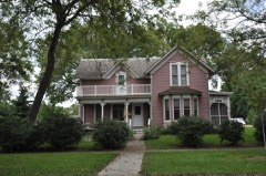 | Charles M. and Emma M. Fischer Fleshman House | building | 1993 | 92001743 |
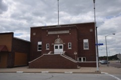 | Hawarden City Hall, Fire Station and Auditorium | building | 2009 | 09000107 |
 | Sioux County Courthouse | building | 1977 | 77000559 |
 | Zwemer Hall, Northwestern College | building | 1975 | 75000698 |
Every wildfire the federal occurrence database records inside this county: 47 of them, burning about 1,243 acres. 1 started naturally and none was recorded as arson. Each settlement page carries the fires within five miles of it.
| Reported cause | Fires |
|---|---|
| Missing data/not specified/undetermined | 22 |
| Debris and open burning | 12 |
| Equipment and vehicle use | 10 |
| Smoking | 2 |
| Natural | 1 |
The five largest, by the area the report gives. None of them was recorded as arson.
| Date | Cause | Size | Reported by | Name on the report |
|---|---|---|---|---|
| 3 June 2006 | Missing data/not specified/undetermined | 350 acres | Iowa Department of Natural Resources | not named |
| 16 March 2015 | Missing data/not specified/undetermined | 214 acres | Iowa Department of Natural Resources | not named |
| 12 April 2014 | Missing data/not specified/undetermined | 160 acres | Iowa Department of Natural Resources | not named |
| 30 April 2018 | Natural | 90 acres | Iowa Department of Natural Resources | not named |
| 11 September 2009 | Missing data/not specified/undetermined | 80 acres | Iowa Department of Natural Resources | not named |
| 30 September 2020 | Equipment and vehicle use | 66 acres | Iowa Department of Natural Resources | not named |
| 22 April 2014 | Debris and open burning | 60 acres | Iowa Department of Natural Resources | not named |
| 15 March 2009 | Missing data/not specified/undetermined | 40 acres | Iowa Department of Natural Resources | not named |
Every settlement page carries the fires within five miles of it - see the settlement index below.
The NOAA Storm Events Database holds 690 reports for this county, causing 2 deaths, 4 injuries and about $26,187,250 in recorded property damage. Each settlement page carries the reports that name it.
| Kind of event | Reports |
|---|---|
| Hail | 256 |
| Thunderstorm Wind | 223 |
| Flood | 116 |
| Tornado | 47 |
| Flash Flood | 41 |
| Heavy Rain | 3 |
| Lightning | 2 |
| Funnel Cloud | 2 |
The most serious of them, by death, then injury, then recorded damage. The accounts are quoted exactly as the forecast office filed them.
| When | Event | Place named | Harm | What the report says |
|---|---|---|---|---|
| June 2024 | Flood | Chatsworth | 1 killed, $6,500,000 | Rainfall amounts across Sioux County from June 20-22 ranged from 2 to 7 inches, with the highest amounts across the northern half of the county. Farther north and upstream, up to 12 inches of rain fell across portions of southeast South Dakota and northwest Iowa. This rainfall resulted in extensive overland flooding and major to record flooding along the Big Sioux, Rock, West Branch Floyd, and Floyd Rivers, and Burr Oak Creek. ||Large sections of Rock Valley and Hawarden were evacuated as flood waters inundated both cities. An estimated 200 people were rescued during the peak of the flooding. An estimated 60 businesses were impacted by flood water in Rock Valley and Hawarden. County-wide, 700 to 800 housing units were impacted by flood water, 150 of which were declared a total loss. Rock Valley Public and Christian Schools were also flooded and sustained severe damage. ||Countless county roads and bridges were covered in water and damaged. Preliminary damage assessments estimate loss to public infrastructure to be 6.5 million dollars. ||One direct fatality occurred in Rock Valley when a man was pinned by debris from a collapsed foundation and subsequently drowned when water filled the basement. ||The majority of overland flooding subsided by June 25, but river flooding continued through the end of the month. For additional information on river flooding, please see other flood entries for Sioux County. |
| July 2005 | Thunderstorm Wind | Sheldon | 1 killed, $50,000 | Thunderstorm winds flipped over a camper, twisted swing sets, blew down power poles, and caused widespread tree damage. Several trees were blown down, including one which fell on a tent, killing a participant in a bicycle ride across Iowa. Several roads were blocked by fallen trees and limbs. Wind blown debris damaged siding on several houses. |
| July 2010 | Thunderstorm Wind | Maurice | 4 hurt, $200,000 | Thunderstorm winds destroyed one home and damaged at least 20 others. Homes that were damaged had broken windows, had parts of roofs and siding that were blown away, or had roofs damaged by falling trees. tree damage was widespread, and there were also downed power lines and power outages. One person was injured by broken glass, and three others were injured by flying debris, with one of the injured hospitalized.|The winds destroyed a large hog confinement structure. |
| May 2014 | Tornado (EF1) | Middleburg | $3,000,000 | A tornado damaged 3 farmsteads in including damage to at least one house. The greatest damage was to structures and vehicles at a dairy farm. |
| August 1979 | Tornado (F2) | not stated | $2,500,000 | no account filed |
| July 1978 | Tornado (F2) | not stated | $2,500,000 | no account filed |
| September 1968 | Tornado (F3) | not stated | $2,500,000 | no account filed |
| August 2023 | Flash Flood | Sioux Center | $1,500,000 | Water ponding in the area of Central Park overflowed roadways and entered the Sioux Center Fire Department building. Two homes suffered the collapse of basement walls from the high water. Water also inundated a transformer which cut off power to seven homes in the northwest part of town. Seven trailers were evacuated due to high water in Westbrook Village on the northwest edge of town. More than two dozen vehicles were stranded in high water. Damage costs are rough estimates. |
| June 2014 | Flood | Hull | $1,000,000 | Repeated heavy rains caused record flooding of the Rock River. Several homes, businesses, roads, farmland, and other low areas were flooded, forcing some people to evacuate their homes and rely on Red Cross and other volunteer assistance for several days. The flooding was severe in Rock Valley, where the river crested at a record 6.68 feet above flood stage on June 17th, and where a levee break added to flooding in the town. |
| November 2005 | Tornado (F1) | Hospers | $800,000 | A tornado destroyed the wall and part of the roof of a business in Hospers, and caused minor damage to contents in the building. |
| March 2019 | Flood | Chatsworth | $610,000 | Flooding resulted in extensive damage to public infrastructure including numerous county and township roads, culverts, and some bridges. |
| June 2014 | Flood | Rock Vly | $500,000 | Repeated heavy rains caused record flooding of the Big Sioux River. Farmland and other lowlands including numerous roads were flooded, especially along the river in southwestern Sioux County, near and south of where the flooding Rock River empties into the Big Sioux. Some roads were damaged, and some secondary roads were washed out. Several homes and farm buildings were flooded and damaged. The river crested at a record 12.92 feet above flood stage at Hawarden on June 17th. |
| May 2008 | Tornado (EF2) | Rock Vly | $500,000 | A tornado damaged numerous trees, including large trees uprooted, blew windows out of a home, destroyed a metal shed, blew two windows and part of a wall out of a metal building, damaged at least three grain bins, destroyed or damaged numerous outbuildings and small sheds, blew down or snapped off at least 15 power poles, bent a metal light pole, tipped one wagon and blew the top off another, blew down a barb wire fence and pushed fence posts almost to the ground, destroyed a hog barn, and flattened corn stubble, before crossing the county line into Lyon County. Contents inside several damaged or destroyed buildings and sheds were also damaged, especially on one farm where damaged buildings housed a farm and trucking business. |
| July 1994 | Thunderstorm Wind | Hawarden | $500,000 | no account filed |
| July 1994 | Thunderstorm Wind | Boyden | $500,000 | no account filed |
| July 2019 | Thunderstorm Wind | Rock Vly | $400,000 | Downburst winds removed the roof and most walls from a home at the corner of 8th Avenue and 12th Street. Debris from this home damaged a downstream home toward the east. A utility pole and several trees were snapped off, which started a small fire. |Several other homes had some lesser collateral roof or siding damage within a three block stretch toward the east and southeast. |
| June 1996 | Hail | Sioux Center | $300,000 | no account filed |
| June 1990 | Tornado (F0) | not stated | $250,000 | no account filed |
| July 1987 | Tornado (F2) | not stated | $250,000 | no account filed |
| July 1999 | Thunderstorm Wind | Hawarden | $200,000 | no account filed |
| August 2023 | Flash Flood | Sioux Center | $100,000 | A no travel advised order was put out with numerous roads under significant flowing water up to mid-vehicle depth, including 2nd Avenue SE near New Age Church and 4th Avenue SE near Children's Park. Property damage costs are rough estimates. |
| March 2009 | Thunderstorm Wind | Hull | $100,000 | Thunderstorm winds blew off the roof of a metal building, caused roof damage to homes and businesses, and caused widespread tree damage. The winds also blew down power lines and 10 power poles over a mile and a half stretch just southwest of Hull, causing power outages affecting at least 1,600 electrical customers in and near the towns of Hull and Boyden. |
| March 2009 | Thunderstorm Wind | Hawarden | $100,000 | Thunderstorm winds destroyed a snack shack. The winds also caused roof and siding damage to several homes and businesses, with some of the damage due to tree debris becoming embedded in buildings. The winds blew out windows in several buildings, and caused widespread tree damage. |
| August 2001 | Tornado (F1) | Sioux Center | $100,000 | A tornado blew down power lines and poles, caused tree damage, flattened corn, and destroyed two machine sheds on a farm. Equipment inside the machine sheds was damaged. |
| August 2023 | Thunderstorm Wind | Maurice | $50,000 | A very old barn collapsed under the weight of a more modern roof. The structure fell to the southeast, most likely in relation to rear flank downdraft wind on the backside of tornado producing mesocyclone. Property damage costs are a rough estimate. |
| September 2021 | Thunderstorm Wind | Boyden | $50,000 | The doors of a school bus garage building were blown in by thunderstorm winds, which resulted in failure of the most of the roof and an exterior wall. Property damage costs are a rough estimate. |
| June 2014 | Flood | Fairview | $50,000 | Persistent moderate to heavy rain caused flooding of fields and other lowlands, including several roads, homes, and businesses. This flooding lasted for almost two days, and was aggravated locally by additional storms during that time. Some roads were damaged or washed out. |
| May 2013 | Flash Flood | Mc Nally | $50,000 | Heavy rainfall of several inches caused widespread flooding of streets and roads, including Iowa Highway 60 between Alton and Hospers. Basements and lower levels of some homes and businesses were flooded. |
| May 2013 | Flood | Hospers | $50,000 | Heavy rain caused record flooding on the Floyd River. Significant farmland was flooded and crops were destroyed or deemed to need replanting. Other lowlands along the river were flooded, and several roads were flooded. The basements or lower levels of numerous homes and business were flooded, especially in Alton. The river crested at a record 7.19 feet above flood stage at Alton on May 27th. |
| July 2010 | Flash Flood | Middleburg | $50,000 | Heavy rainfall of up to 6 inches caused flash flooding of numerous roads, including Iowa Highway 18. Numerous homes had flooded basements and other water damage. |
| July 2009 | Thunderstorm Wind | Hull | $50,000 | Thunderstorm winds destroyed a small outbuilding and a 40 by 60 foot steel storage building. The winds caused damage to businesses and homes, much of it caused by flying debris from the storage building. A vehicle in the storage building was also damaged. Other storage buildings, including several at a storage business, were severely damaged. The winds also caused tree damage, including several trees blown down. |
| April 2002 | Thunderstorm Wind | Hawarden | $50,000 | Thunderstorm winds rolled a semi truck and crumpled a storage tank. |
| August 2001 | Tornado (F1) | Sioux Center | $50,000 | A tornado damaged several small farm buildings, and peeled the middle part of the roof off a large hog confinement building. |
| July 1997 | Thunderstorm Wind | Orange City | $50,000 | Thunderstorm winds damaged trees and power lines, resulting in power outages lasting several hours. |
| July 1998 | Thunderstorm Wind | Hull | $50,000 | no account filed |
| April 1994 | Thunderstorm Wind | Orange City | $50,000 | no account filed |
| April 1994 | Thunderstorm Wind | Sioux Center | $50,000 | no account filed |
| April 1994 | Thunderstorm Wind | Rock Valley | $50,000 | no account filed |
| May 1998 | Tornado (F0) | Rock Vly | $30,000 | no account filed |
| October 1998 | Lightning | Hawarden | $30,000 | no account filed |
| September 2021 | Thunderstorm Wind | Hull | $25,000 | A large construction shed was lifted and thrown into a nearby corn field. Property damage costs are a rough estimate. |
| March 2009 | Thunderstorm Wind | Chatsworth | $25,000 | Thunderstorm winds blew a camper over and blew shingles off roofs. The winds also caused tree damage, including several trees blown down. |
| July 2009 | Thunderstorm Wind | Ireton | $25,000 | Thunderstorm winds uprooted or split several trees, and blew down numerous branches, including some branches 6 inches in diameter. Several homes were damaged by falling trees, tree debris, and directly by the wind which damaged roofs. Corn and soybean crops were damaged in the area, but the amount of crop damage was not known. |
| July 1992 | Tornado (F1) | not stated | $25,000 | no account filed |
| July 1978 | Tornado | not stated | $25,000 | no account filed |
| June 1966 | Tornado (F2) | not stated | $25,000 | no account filed |
| March 1963 | Tornado (F1) | not stated | $25,000 | no account filed |
| May 2012 | Thunderstorm Wind | Alton | $20,000 | Thunderstorm winds damaged trees and power lines, and blew down a grain bin and cattle shed. The peak gust was measured by Iowa RWIS equipment. |
| September 1995 | Thunderstorm Wind | Ireton | $20,000 | Thunderstorm winds caused tree damage, and damaged a house when a large tree was blown over onto it. |
| August 1996 | Thunderstorm Wind | Sioux Center | $20,000 | no account filed |
| August 2021 | Hail | Rock Vly | $10,000 | Hail resulted in the death of several birds, stripped corn, and holes in the siding of a house. Property damage costs are a rough estimate. Crop damage is an estimate from insured losses. Information provided by the United States Department of Agriculture. |
| June 2020 | Thunderstorm Wind | Rock Vly | $10,000 | Six to nine inch diameter tree limbs taken down with power outages in Rock Valley. Property damage costs are rough estimates. |
| June 2020 | Flash Flood | Rock Vly | $10,000 | Street flooding occurred to a couple feet of depth. Property damage costs are rough estimates. |
| July 2019 | Thunderstorm Wind | Lebanon | $10,000 | Ten mature trees blown down. Several more have tops snapped off. Machine shed doors blown in and back wall blown out, with debris spread into the field. |
| September 2019 | Flood | Hawarden | $10,000 | After excessive two-day rainfall during September 10-12 (7.81 inches at Dell Rapids, generally 3 to 4 inches around Sioux Falls, 4.72 inches at Canton), the Big Sioux River above Hawarden (gage site HWDI4) reached the third highest stage on record of 12.33 feet above flood stage on September 15. Significant amounts of the agricultural flood plain were inundated, and numerous roads were closed including South Dakota Highway 46, Iowa Highway 10 and South Dakota county road 13. |
| September 2019 | Flood | Fairview | $10,000 | After excessive two-day rainfall during September 10-12 (7.81 inches at Dell Rapids, generally 3 to 4 inches around Sioux Falls, 4.72 inches at Canton), the Big Sioux River at Fairview (gage site FVWS2) reached the highest stage on record of 11.14 feet above flood stage on September 14. Significant amounts of the agricultural flood plain were inundated. |
| September 2019 | Flood | Rock Vly | $10,000 | After excessive two-day rainfall during September 10-12 (4.72 inches at Luverne and 3.43 inches at Rock Rapids), the Rock River at Rock Valley (gage site RKVI4) reached a minor crest of 0.79 feet above flood stage on September 14. Significant agricultural land was flooded along with several county roads. |
| August 2009 | Lightning | Fairview | $10,000 | Lightning struck a house and started a fire. The fire started in a wall between two rooms, with fire and smoke damage resulting. |
| June 2002 | Thunderstorm Wind | Orange City Arpt | $10,000 | Thunderstorm winds blew over a construction trailer and caused tree damage. |
| May 2000 | Thunderstorm Wind | Hawarden | $10,000 | Thunderstorms winds caused tree damage and minor damage to buildings. |
The Survey's mineral resources record lists 114 workings inside this county. 15 still produce and 99 are closed or unrecorded. Each settlement page carries the workings within five miles of it.
| Commodity | Workings |
|---|---|
| Sand and Gravel, Construction | 114 |
The least common of them first, because a county's hundredth gravel pit says nothing its first ten did not.
| Where | Site | Commodity | Status | Recorded |
|---|---|---|---|---|
| Alton Pit | Sand and Gravel, Construction | Unknown | ||
| Cambrier | Sand and Gravel, Construction | Past Producer | ||
| Chatsworth Pit | Sand and Gravel, Construction | Producer | ||
| Fairview-Hodgman | Sand and Gravel, Construction | Past Producer | ||
| Floyd Gravel | Sand and Gravel, Construction | Past Producer | ||
| Frank Uden | Sand and Gravel, Construction | Past Producer | ||
| Groth Pit | Sand and Gravel, Construction | Past Producer | ||
| Harkness | Sand and Gravel, Construction | Producer | ||
| Hawarden | Sand and Gravel, Construction | Producer | ||
| Hawarden Pit & Plant | Sand and Gravel, Construction | Producer | ||
| Hudson Pit | Sand and Gravel, Construction | Past Producer | ||
| Hymans Hudson/Ostercamp | Sand and Gravel, Construction | Producer | ||
| Hymans Sioux Center | Sand and Gravel, Construction | Producer | ||
| Hymans-Fairview | Sand and Gravel, Construction | Producer | ||
| Hymans-Hawarden | Sand and Gravel, Construction | Producer | ||
| Hymans-Vander Esch | Sand and Gravel, Construction | Producer | ||
| Johnson Pit | Sand and Gravel, Construction | Past Producer | ||
| L G Everist | Sand and Gravel, Construction | Past Producer | ||
| L G Everist | Sand and Gravel, Construction | Past Producer | ||
| Maudlin Sheldon | Sand and Gravel, Construction | Producer | ||
| Maudlin-Fairview | Sand and Gravel, Construction | Past Producer | ||
| Maudlin-Fairview | Sand and Gravel, Construction | Past Producer | ||
| N Bloemendaal | Sand and Gravel, Construction | Past Producer | ||
| North Alton Pit | Sand and Gravel, Construction | Past Producer | ||
| Oelrich Fm | Sand and Gravel, Construction | Past Producer | ||
| Old County Pit | Sand and Gravel, Construction | Past Producer | ||
| Old County Pit | Sand and Gravel, Construction | Past Producer | ||
| Old State Pit | Sand and Gravel, Construction | Past Producer | ||
| Old State Pit | Sand and Gravel, Construction | Past Producer | ||
| Rock Valley Cement | Sand and Gravel, Construction | Producer | ||
| Ruppert Bros | Sand and Gravel, Construction | Past Producer | ||
| Schumacher Pit | Sand and Gravel, Construction | Past Producer | ||
| Sheldon Pit | Sand and Gravel, Construction | Past Producer | ||
| Sioux City | Sand and Gravel, Construction | Producer | ||
| Sioux River Pit | Sand and Gravel, Construction | Producer | ||
| Sioux-Armstrong Pit | Sand and Gravel, Construction | Past Producer | ||
| Sioux-East Anderson Pit | Sand and Gravel, Construction | Past Producer | ||
| Sioux-Heitritter Pit | Sand and Gravel, Construction | Past Producer | ||
| Sioux-Kuiper Pit | Sand and Gravel, Construction | Past Producer | ||
| Sioux-Loverink | Sand and Gravel, Construction | Past Producer | ||
| Sioux-Miller Pit | Sand and Gravel, Construction | Past Producer | ||
| Sioux-Shoemaker Pit | Sand and Gravel, Construction | Past Producer | ||
| Sioux-Vandeweerd Pit | Sand and Gravel, Construction | Past Producer | ||
| Sioux-Vanwoodenberg Pit | Sand and Gravel, Construction | Past Producer | ||
| Sioux-West Anderson Pit | Sand and Gravel, Construction | Past Producer | ||
| Solberg Pit | Sand and Gravel, Construction | Past Producer | ||
| Unknown | Sand and Gravel, Construction | Past Producer | ||
| Unknown | Sand and Gravel, Construction | Past Producer | ||
| Unknown | Sand and Gravel, Construction | Past Producer | ||
| Unknown | Sand and Gravel, Construction | Past Producer | ||
| Unknown | Sand and Gravel, Construction | Past Producer | ||
| Unknown | Sand and Gravel, Construction | Past Producer | ||
| Unknown | Sand and Gravel, Construction | Past Producer | ||
| Unknown | Sand and Gravel, Construction | Past Producer | ||
| Unknown | Sand and Gravel, Construction | Past Producer | ||
| Unknown | Sand and Gravel, Construction | Past Producer | ||
| Unknown | Sand and Gravel, Construction | Past Producer | ||
| Unknown | Sand and Gravel, Construction | Producer | ||
| Unknown | Sand and Gravel, Construction | Past Producer | ||
| Unknown | Sand and Gravel, Construction | Past Producer | ||
| Unknown | Sand and Gravel, Construction | Past Producer | ||
| Unknown | Sand and Gravel, Construction | Past Producer | ||
| Unknown | Sand and Gravel, Construction | Past Producer | ||
| Unknown | Sand and Gravel, Construction | Past Producer | ||
| Unknown | Sand and Gravel, Construction | Past Producer | ||
| Unknown | Sand and Gravel, Construction | Past Producer | ||
| Unknown | Sand and Gravel, Construction | Past Producer | ||
| Unknown | Sand and Gravel, Construction | Past Producer | ||
| Unknown | Sand and Gravel, Construction | Past Producer | ||
| Unknown | Sand and Gravel, Construction | Past Producer | ||
| Unknown | Sand and Gravel, Construction | Past Producer | ||
| Unknown | Sand and Gravel, Construction | Past Producer | ||
| Unknown | Sand and Gravel, Construction | Past Producer | ||
| Unknown | Sand and Gravel, Construction | Past Producer | ||
| Unknown | Sand and Gravel, Construction | Past Producer | ||
| Unknown | Sand and Gravel, Construction | Past Producer | ||
| Unknown | Sand and Gravel, Construction | Past Producer | ||
| Unknown | Sand and Gravel, Construction | Past Producer | ||
| Unknown | Sand and Gravel, Construction | Past Producer | ||
| Unknown | Sand and Gravel, Construction | Past Producer | ||
| Unknown | Sand and Gravel, Construction | Past Producer | ||
| Unknown | Sand and Gravel, Construction | Past Producer | ||
| Unknown | Sand and Gravel, Construction | Past Producer | ||
| Unknown | Sand and Gravel, Construction | Past Producer | ||
| Unknown | Sand and Gravel, Construction | Past Producer | ||
| Unknown | Sand and Gravel, Construction | Past Producer | ||
| Unknown | Sand and Gravel, Construction | Past Producer | ||
| Unknown | Sand and Gravel, Construction | Past Producer | ||
| Unknown | Sand and Gravel, Construction | Past Producer | ||
| Unknown | Sand and Gravel, Construction | Past Producer | ||
| Unknown | Sand and Gravel, Construction | Past Producer | ||
| Unknown | Sand and Gravel, Construction | Past Producer | ||
| Unknown | Sand and Gravel, Construction | Past Producer | ||
| Unknown | Sand and Gravel, Construction | Past Producer | ||
| Unknown | Sand and Gravel, Construction | Past Producer | ||
| Unknown | Sand and Gravel, Construction | Past Producer | ||
| Unknown | Sand and Gravel, Construction | Past Producer | ||
| Unknown | Sand and Gravel, Construction | Past Producer | ||
| Unknown | Sand and Gravel, Construction | Past Producer | ||
| Unknown | Sand and Gravel, Construction | Past Producer | ||
| Unknown | Sand and Gravel, Construction | Past Producer | ||
| Unknown | Sand and Gravel, Construction | Past Producer | ||
| Unknown | Sand and Gravel, Construction | Past Producer | ||
| Unknown | Sand and Gravel, Construction | Past Producer | ||
| Unknown | Sand and Gravel, Construction | Past Producer | ||
| Unknown | Sand and Gravel, Construction | Past Producer | ||
| Unknown-Maudlin | Sand and Gravel, Construction | Past Producer | ||
| Van Gelder-Hiemstra Pit | Sand and Gravel, Construction | Producer | ||
| Van Zee S&G | Sand and Gravel, Construction | Past Producer | ||
| Vankikerxis | Sand and Gravel, Construction | Past Producer | ||
| Vanwoudenberg | Sand and Gravel, Construction | Past Producer | ||
| Western Eng | Sand and Gravel, Construction | Past Producer | ||
| Wielenga | Sand and Gravel, Construction | Past Producer | ||
| Yanzee | Sand and Gravel, Construction | Past Producer |
Named settlements recorded in the Geographic Names Information System, each with the topographic sheets covering it. Villages, hamlets and abandoned places alike. Each is shown with the nearest named watercourse or landform and the survey quadrangle it falls on.
Logan township · 51011 · On Sixmile Creek · Chatsworth quadrangle
18 sheets, 1898 to 1986