Block
From the record
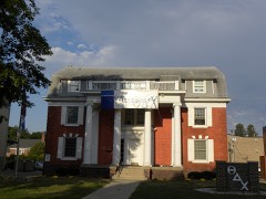
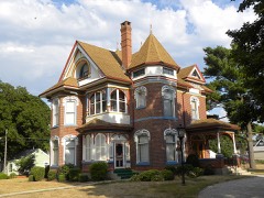
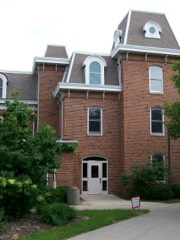
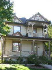
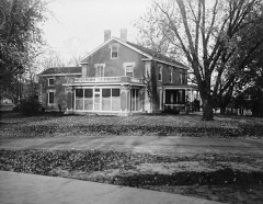
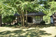
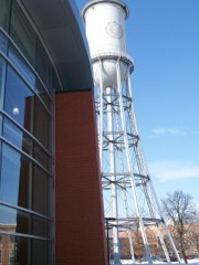
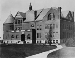
37 National Register listings published here, 1 of them a National Historic Landmark.
Sources: the National Register database, National Park Service
39 topographic sheets cover 24 settlements here, and 37 properties are on the National Register of Historic Places.
37 National Register listings published here, 1 of them a National Historic Landmark.
Sources: the National Register database, National Park Service
Every property in this county listed on the National Register of Historic Places, with the year it was listed and the federal nomination document.
Every wildfire the federal occurrence database records inside this county: 167 of them, burning about 760 acres. 4 started naturally and 5 were recorded as arson. Each settlement page carries the fires within five miles of it.
| Reported cause | Fires |
|---|---|
| Missing data/not specified/undetermined | 88 |
| Debris and open burning | 48 |
| Equipment and vehicle use | 12 |
| Smoking | 6 |
| Arson/incendiarism | 5 |
| Natural | 4 |
| Railroad operations and maintenance | 3 |
| Misuse of fire by a minor | 1 |
The five largest, by the area the report gives. None of them was recorded as arson.
| Date | Cause | Size | Reported by | Name on the report |
|---|---|---|---|---|
| 31 March 2014 | Natural | 100 acres | Iowa Department of Natural Resources | not named |
| 16 April 2016 | Debris and open burning | 65 acres | Iowa Department of Natural Resources | CAMBRIDGE/UNION TOWNSHIP |
| 26 April 2018 | Debris and open burning | 51 acres | Iowa Department of Natural Resources | not named |
| 9 October 2011 | Missing data/not specified/undetermined | 42 acres | Iowa Department of Natural Resources | CAMERON SCHOOL RD AND 505TH AVE, IA |
| 5 April 2016 | Debris and open burning | 33 acres | Iowa Department of Natural Resources | CAMBRIDGE/UNION TOWNSHIP |
| 11 April 2014 | Debris and open burning | 30 acres | Iowa Department of Natural Resources | not named |
| 5 April 2016 | Debris and open burning | 20 acres | Iowa Department of Natural Resources | NEVADA FIRE DEPT. |
| 21 March 2009 | Missing data/not specified/undetermined | 20 acres | Iowa Department of Natural Resources | not named |
Every settlement page carries the fires within five miles of it - see the settlement index below.
The NOAA Storm Events Database holds 1,101 reports for this county, causing 1 death, 32 injuries and about $106,975,780 in recorded property damage. Each settlement page carries the reports that name it.
| Kind of event | Reports |
|---|---|
| Thunderstorm Wind | 390 |
| Hail | 325 |
| Heavy Rain | 175 |
| Tornado | 64 |
| Flash Flood | 64 |
| Flood | 53 |
| Funnel Cloud | 17 |
| Lightning | 13 |
The most serious of them, by death, then injury, then recorded damage. The accounts are quoted exactly as the forecast office filed them.
| When | Event | Place named | Harm | What the report says |
|---|---|---|---|---|
| May 1953 | Tornado (F3) | not stated | 1 killed | no account filed |
| September 2005 | Tornado (F1) | Ames | 8 hurt, $150,000 | A tornado touched down in the central Campas Area of ISU. Eight injuries occurred, one serious enough to require hospitalization. |
| June 1950 | Tornado (F3) | not stated | 5 hurt | no account filed |
| May 2024 | Tornado (EF2) | Cambridge | 2 hurt, $3,200,000 | This tornado moved into Story County from Polk County. The tornado was quite wide at this point nearing 1000 yards wide at times. Along Highway 210 southeast of Cambridge, 8 large wooden and relatively new higher voltage power poles were snapped. Trees were obliterated along 315th Street east of Cambridge. Additional EF2 damage occurred 620th Avenue where numerous outbuildings were destroyed. A house was completely removed from its foundation at the intersection of 270th Street and Woods Rd and was tossed across 270th Street. However, the house was undergoing a remodel at the time and had no anchorage to the pour concrete foundation, hence the EF2 rating at this location. Damage to a house along 250th Street southeast of Nevada was extensive with the house shifted off the foundation and much of the interior savaged by flying debris and mud. All the outbuildings at this location were destroyed with the debris strewn far downwind. Another brick house at the intersection of Highway 30 and 650th avenue had extensive damage with only the front of the house still intact. These last two houses had high end EF2 damage and it appears this is where the tornado was strongest. EF2 damage was still found downstream for several more miles but was not as extensive as what had been seen just southeast and east of Nevada. The last extensive damage with the tornado occurred along 160th Street between 710th and 720th Avenue where a house lost half of its roof and then hit a hog house about a half a mile later. The tornado then weakened and dissipated shortly before reaching 150th Street. Two additional injuries occurred in Story County with this tornado. |
| April 1999 | Tornado (F1) | Slater | 2 hurt, $800,000 | no account filed |
| April 1994 | Thunderstorm Wind | Huxley | 2 hurt, $500,000 | no account filed |
| August 1965 | Tornado (F2) | not stated | 2 hurt, $25,000 | no account filed |
| July 2018 | Lightning | Colo | 2 hurt | Two men were taken to the hospital after being struck by lightning at a golf course. Both men were injured and then released the following day from the hospital. One suffered nerve damage and the loss of hearing on one of his ears. |
| May 2004 | Lightning | Nevada | 2 hurt | no account filed |
| November 2005 | Tornado (F2) | Ames | 1 hurt, $250,000 | Tornado moved from Boone County into Story County. One minor injury occurred on the west side of Ames. |
| March 1990 | Tornado (F3) | not stated | 1 hurt, $250,000 | no account filed |
| September 2001 | Thunderstorm Wind | Slater | 1 hurt, $75,000 | no account filed |
| April 1999 | Thunderstorm Wind | Story City | 1 hurt, $40,000 | no account filed |
| August 2003 | Thunderstorm Wind | Story City | 1 hurt, $37,000 | no account filed |
| June 2005 | Thunderstorm Wind | Nevada | 1 hurt, $10,000 | no account filed |
| September 2001 | Thunderstorm Wind | Nevada | 1 hurt, $10,000 | no account filed |
| August 2010 | Flood | Ames | $50,000,000 | Hilton Coliseum reported 4 to 6 feet of water inside flooding the stadium and basketball floor. Cy Stephens Auditorium also reports water in the mechanical building up to the 1st floor. |
| May 1989 | Tornado (F4) | not stated | $25,000,000 | no account filed |
| March 1991 | Tornado (F3) | not stated | $2,500,000 | no account filed |
| March 1990 | Tornado (F2) | not stated | $2,500,000 | no account filed |
| June 1996 | Flash Flood | Story City | $1,500,000 | no account filed |
| September 2018 | Lightning | Zearing | $1,000,000 | A local photographer came across a smoldering wind turbine that had been struck by lightning overnight. It also had previous damage from a tornado earlier in the year. |
| August 2010 | Flood | Ames | $1,000,000 | no account filed |
| November 2005 | Tornado (F1) | Roland | $580,000 | Tornado developed in Story County and moved into Hamilton County. |
| August 2010 | Flash Flood | Story City | $500,000 | Story City police reported widespread flooding throughout Story City. Had multiple reports of basement flooding with water backing up into them. |
| July 2010 | Thunderstorm Wind | Ames | $500,000 | Story County Emergency Manager reports widespread significant tree damage in and around Ames. Some trees uprooted and others snapped off. Empty grain bins and outbuildings damaged across the county. A tree fell on a shed at Iowa State University. |
| May 1998 | Hail | Colo | $500,000 | Ground covered 4 inches deep between Colo and Collins |
| August 2010 | Flood | Ames | $500,000 | no account filed |
| April 2007 | Flood | Ames | $500,000 | no account filed |
| July 2009 | Thunderstorm Wind | Nevada | $300,000 | Three modular homes and three mobile homes on a sale lot were destroyed. |
| August 2015 | Flood | Ames Arpt | $250,000 | The South Skunk River at Ames US 30 crested at 24.29 feet on 30 August 2015 at 3:15 AM CDT. |
| August 2015 | Flood | Gilbert | $250,000 | The South Skunk River at Ames W. Riverside Road crested at 17.10 feet on 29 August 2015 at 5:45 PM CDT. |
| August 2015 | Flood | Ontario | $250,000 | Squaw Creek at Ames Lincoln Way crested at 10.69 feet on 29 August 2015 at 5:30 PM CDT. |
| May 2014 | Hail | Ames | $250,000 | Several reports via TV and social media of golf ball hail in Ames. |
| May 2013 | Flash Flood | Zearing | $250,000 | Many roads in the east part of the county experiencing flooding. Water over parts of Highway 65 in Zearing. |
| May 2013 | Flash Flood | Iowa Center | $250,000 | Several roads were washed out by flash flooding. |
| May 2012 | Thunderstorm Wind | Ames | $250,000 | Garage doors were blown in with gutters torn off of an apartment complex in north Ames. |
| August 2010 | Flood | Cambridge | $250,000 | Significant flooding reported in the town of Cambridge. |
| May 2008 | Flash Flood | Ontario | $250,000 | Numerous roads were under water around the county, especially across the north. Lincoln Highway and E-18 were under water in places. |
| May 2008 | Flood | Kelley | $250,000 | Numerous roads were under water, including E-18 and Lincoln Highway. |
| May 2004 | Flash Flood | Countywide | $250,000 | no account filed |
| June 2001 | Flash Flood | Countywide | $250,000 | no account filed |
| July 2000 | Hail | Ames | $250,000 | no account filed |
| June 1998 | Flash Flood | Ames | $250,000 | no account filed |
| June 1974 | Tornado (F2) | not stated | $250,000 | no account filed |
| June 1969 | Tornado (F1) | not stated | $250,000 | no account filed |
| June 1967 | Tornado (F2) | not stated | $250,000 | no account filed |
| May 1962 | Tornado (F2) | not stated | $250,000 | no account filed |
| May 1959 | Tornado (F2) | not stated | $250,000 | no account filed |
| March 2019 | Flood | Story City | $200,000 | Numerous secondary roads closed in Story County due to flooding. The EM also reported R77 closed due to flooding south of the town of Roland at 170th. |
| April 2018 | Thunderstorm Wind | Story City | $200,000 | Emergency manager reported that 130th Street from Highway 69 to 550th Street blocked due to power poles and lines down. |
| April 2018 | Thunderstorm Wind | Story City | $200,000 | Emergency manager reported significant damage to 2 buildings and a tree blown down near a house. A semi-trailer was blown over at a warehouse. |
| July 2018 | Flood | Kelley | $200,000 | Low lying areas still flooded across portions of the county along with water over some secondary roads and some damage to secondary roads from previous flash flooding. The emergency manager also reported minor damage to the park in Maxwell from flooding, moderate damage to secondary roads with some damage to bridges and trails across the county. |
| May 2003 | Hail | Ames | $175,000 | no account filed |
| August 2003 | Thunderstorm Wind | Story City | $150,000 | no account filed |
| July 1999 | Thunderstorm Wind | Ames | $150,000 | no account filed |
| September 2019 | Thunderstorm Wind | Maxwell | $100,000 | The Emergency manager reported a swath of corn blown down between Collins and Maxwell. |
| June 2018 | Flood | Ontario | $100,000 | Squaw Creek at Ames Lincoln Way crested at 12.19 feet on 15 June 2018 at 10:15 UTC. |
| June 2015 | Thunderstorm Wind | Ames Arpt | $100,000 | Numerous trees up to 8 inches in diameter snapped off with larger trees uprooted. Most of the damage concentrated SW of the airport and University Ave. A stop sign was snapped off at that intersection as well. |
| June 2015 | Thunderstorm Wind | Ames Arpt | $100,000 | Small sheds at the Lowes store were destroyed with numerous trees damaged. The trees were snapped off at the base. |
The Survey's mineral resources record lists 17 workings inside this county. 4 still produce and 13 are closed or unrecorded. Each settlement page carries the workings within five miles of it.
| Commodity | Workings |
|---|---|
| Sand and Gravel, Construction | 12 |
| Stone, Crushed/Broken | 3 |
| Bituminous | 1 |
| Sulfur-Pyrite | 1 |
| Limestone, Dimension | 1 |
The least common of them first, because a county's hundredth gravel pit says nothing its first ten did not.
| Where | Site | Commodity | Status | Recorded |
|---|---|---|---|---|
| Iowa State Univ. Coal Prep. Plant | Bituminous, Sulfur-Pyrite | Producer | ||
| Onion Creek Quarries | Limestone, Dimension | Past Producer | ||
| Ames Mine | Stone, Crushed/Broken | Producer | ||
| Ames Mine | Stone, Crushed/Broken | Producer | ||
| Central Iowa Mine | Stone, Crushed/Broken | Past Producer | ||
| Ames Pit | Sand and Gravel, Construction | Producer | ||
| Boyd Pit | Sand and Gravel, Construction | Past Producer | ||
| Cook Pit | Sand and Gravel, Construction | Past Producer | ||
| E. Aarthun Pit | Sand and Gravel, Construction | Past Producer | ||
| Old Roberson Pit | Sand and Gravel, Construction | Past Producer | ||
| Peterson Pit | Sand and Gravel, Construction | Past Producer | ||
| Unknown | Sand and Gravel, Construction | Past Producer | ||
| Unknown | Sand and Gravel, Construction | Past Producer | ||
| Unknown | Sand and Gravel, Construction | Past Producer | ||
| Unknown | Sand and Gravel, Construction | Past Producer | ||
| Unknown | Sand and Gravel, Construction | Past Producer | ||
| Unknown | Sand and Gravel, Construction | Past Producer |
Named settlements recorded in the Geographic Names Information System, each with the topographic sheets covering it. Villages, hamlets and abandoned places alike. Each is shown with the nearest named watercourse or landform and the survey quadrangle it falls on.
Indian Creek township · 50161 · On East Indian Creek · Maxwell quadrangle
8 sheets, 1954 to 1984
Indian Creek township · 50161 · On East Indian Creek · Maxwell quadrangle
8 sheets, 1954 to 1984