 Block
Ontario, Iowa
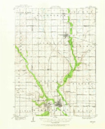
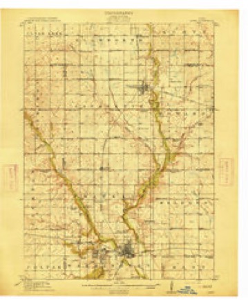
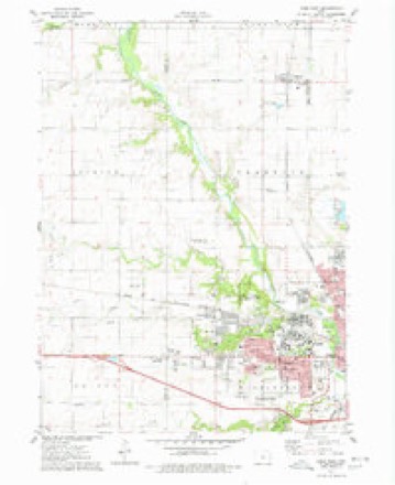
16 topographic sheets cover this place, the earliest surveyed in 1912 and the latest in 1993. It stands in Franklin Township. It lies in ZIP code area 50014. It stands on Onion Creek. The Survey maps it on the Ames West quadrangle.
Topographic sheets covering this place
7 surveys from 16 printed sheetsMatched by testing this settlement's coordinate against the published boundary of every sheet in the United States Geological Survey's historical collection. Each opens the scanned sheet at the Survey.
- 1912 USGS Ames quadrangle1:62500, 3 printings
- 1914 USGS Ames quadrangle1:62500, 3 printings
- 1954 USGS Waterloo quadrangle1:250000, 4 printings
- 1955 USGS Waterloo quadrangle1:250000, 2 printings
- 1975 USGS Ames West quadrangle1:24000, 2 printings
- 1985 USGS Ames quadrangle1:100000
- 1993 USGS Ames quadrangle1:100000
Fires near this place
21 since 2009Regional context, not property-specific evidence. The federal wildfire occurrence database lists 21 fires within 5 miles of Ontario between 2009 and 2020, burning about 89 acres in total. None started naturally. None was recorded as arson. Distance is straight-line from the map coordinates, so a fire counted here may appear on a neighbouring settlement's page as well.
| Reported cause | Fires |
|---|---|
| Missing data/not specified/undetermined | 21 |
The most recent of them, most recent first, with the day each was reported and the service that recorded it.
| Date | Cause | Size | Reported by | Name on the report |
|---|---|---|---|---|
| 15 August 2012 | Missing data/not specified/undetermined | under an acre | Iowa Department of Natural Resources | not named |
| 12 June 2012 | Missing data/not specified/undetermined | 1.0 acres | Iowa Department of Natural Resources | not named |
| 8 May 2011 | Missing data/not specified/undetermined | 1.0 acres | Iowa Department of Natural Resources | 615 ROOKWOD DR., AMES, IA |
| 17 May 2014 | Missing data/not specified/undetermined | under an acre | Iowa Department of Natural Resources | not named |
| 7 April 2011 | Missing data/not specified/undetermined | 7.0 acres | Iowa Department of Natural Resources | 50809 180TH ST., GILBERT, IA |
| 27 April 2018 | Missing data/not specified/undetermined | 1.0 acres | Iowa Department of Natural Resources | not named |
| 2 April 2011 | Missing data/not specified/undetermined | under an acre | Iowa Department of Natural Resources | 180TH & GRANT AVE, GILBERT, IA |
| 13 April 2011 | Missing data/not specified/undetermined | 1.0 acres | Iowa Department of Natural Resources | 4943 GRANT AVE, AMES, IA |
Settlements close enough to share some of these fires:
Mines and quarries near this place
7 within 5 milesRegional context, not property-specific evidence. The federal mineral resources record lists 7 workings within 5 miles of Ontario: 4 producers, 3 past producers. 4 still produce. What was taken out: Sand and Gravel, Construction, Stone, Crushed/Broken, Bituminous, Sulfur-Pyrite. Distance is straight-line from the map coordinates, so a quarry counted here may appear on a neighbouring settlement's page as well.
| Where | Site | Commodity | Status | Recorded |
|---|---|---|---|---|
| Iowa State Univ. Coal Prep. Plant | Bituminous, Sulfur-Pyrite | Producer | ||
| Onion Creek Quarries | Limestone, Dimension | Past Producer | ||
| Ames Mine | Stone, Crushed/Broken | Producer | ||
| Ames Mine | Stone, Crushed/Broken | Producer | ||
| Ames Pit | Sand and Gravel, Construction | Producer | ||
| Old Roberson Pit | Sand and Gravel, Construction | Past Producer | ||
| Unknown | Sand and Gravel, Construction | Past Producer |
Storms near this place
60 of 66 shownRegional context, not property-specific evidence. The National Weather Service names Ontario in 66 storm reports between 2007 and 2025: 22 hail, 20 heavy rain, 12 thunderstorm wind, 6 flood. No death or injury is recorded in these reports. Each account below is quoted exactly as the forecast office filed it, from the NOAA Storm Events Database, and each date opens the federal record of that event.
| When | Event | Place named | Harm | What the report says |
|---|---|---|---|---|
| August 2015 | Flood | Ontario | $250,000 | Squaw Creek at Ames Lincoln Way crested at 10.69 feet on 29 August 2015 at 5:30 PM CDT. |
| May 2008 | Flash Flood | Ontario | $250,000 | Numerous roads were under water around the county, especially across the north. Lincoln Highway and E-18 were under water in places. |
| June 2018 | Flood | Ontario | $100,000 | Squaw Creek at Ames Lincoln Way crested at 12.19 feet on 15 June 2018 at 10:15 UTC. |
| December 2015 | Flood | Ontario | $50,000 | Squaw Creek crested at 10.36 feet on 15 December 2015 at 06:30 UTC. |
| March 2023 | Hail | Ontario | $20,000 | Hail caused some siding damage. |
| July 2016 | Thunderstorm Wind | Ontario | $20,000 | Trained spotter reported a few trees and power lines down across Ames. Also a report of a tree on a car on the west side. Time radar estimated. |
| August 2021 | Lightning | Ontario | $10,000 | Story County emergency manager reported lightning striking a house causing a small fire with fire department investigating to confirm. |
| July 2019 | Flood | Ontario | $10,000 | Law enforcement reported flooding causing road closures across portions of the county. |
| May 2018 | Hail | Ontario | $10,000 | Law enforcement reported ping pong ball sized hail. |
| September 2016 | Flash Flood | Ontario | $10,000 | Law enforcement reported portions of Lincoln Way and Grand Ave flooded. Other streets impacted include South Dakota and Mortensen, Arizona and Ontario and numerous other roads. Depth of water estimated to be 3 to 4 feet deep. |
| May 2014 | Thunderstorm Wind | Ontario | $10,000 | Trees down along Franklin Ave on the west side of Ames. |
| May 2008 | Heavy Rain | Ontario | $10,000 | Rainfall of 2.73 inches was measured in Ames during the past hour and one half. |
| May 2018 | Hail | Ontario | $5,000 | Trained spotter reported nickel sized hail, a few quarters as well. |
| July 2009 | Thunderstorm Wind | Ontario | $5,000 | no account filed |
| August 2007 | Thunderstorm Wind | Ontario | $5,000 | no account filed |
| May 2014 | Thunderstorm Wind | Ontario | $3,000 | Large tree limbs down. |
| May 2014 | Thunderstorm Wind | Ontario | $2,000 | Two to four inch limbs down at Lee Park. |
| July 2016 | Thunderstorm Wind | Ontario | $1,000 | Public reported 4 to 5 inch diameter tree down via social media. Delayed report and time radar estimated. |
| July 2008 | Thunderstorm Wind | Ontario | $1,000 | no account filed |
| March 2025 | Hail | Ontario | - | Reported by mping. |
| March 2025 | Hail | Ontario | - | Reported on mping. |
| April 2024 | Hail | Ontario | - | Report via mping. |
| April 2024 | Hail | Ontario | - | Variety of hail with largest up to quarter sized. |
| June 2024 | Thunderstorm Wind | Ontario | - | Trees down on the west side of Ames. Time estimated by radar. |
| March 2023 | Hail | Ontario | - | Received via email, time estimated by radar. |
| March 2023 | Hail | Ontario | - | Golfball sized hail covering the ground. |
| March 2023 | Hail | Ontario | - | Hail began around 250pm and lasted through 254pm CDT. Largest stones with one inch in diameter and accumulated on flat surfaces and in drifts due to strong south winds. |
| March 2023 | Hail | Ontario | - | Report from mping. |
| March 2023 | Hail | Ontario | - | Report from mping. |
| July 2023 | Heavy Rain | Ontario | - | Event total of 3.30 inches. |
| October 2023 | Funnel Cloud | Ontario | - | Video of weak funnel aloft with no apparent connection to the ground. |
| August 2022 | Heavy Rain | Ontario | - | A 24 hour rainfall total of 3.02 inches. |
| July 2022 | Thunderstorm Wind | Ontario | - | Large tree limbs down in west Ames. Relayed by Broadcast media. |
| June 2022 | Heavy Rain | Ontario | - | A 24 hour rain total of 3.27 inches. |
| August 2021 | Thunderstorm Wind | Ontario | - | Reports of numerous tree branches and some larger trees down. |
| July 2020 | Heavy Rain | Ontario | - | NWS Employee reports 2.45 inches of rain over a 30 to 45 inute time period. |
| March 2019 | Flood | Ontario | - | Squaw Creek at Lincoln Way Ames crested two times during the period of flood. The first crest was 10.70 feet on 14 March 2019 at 13:30 UTC and the second crest was 10.75 feet on 14 March 2019 at 16:00 UTC. |
| July 2019 | Flash Flood | Ontario | - | Trained spotter reported the intersection South Dakota and Mortensen Rd impassable. Also noted that other areas on the west side of Ames had a lot of water. |
| May 2019 | Flood | Ontario | - | Emergency manager reported water over 500th Ave, north of Ontario Street. |
| May 2018 | Hail | Ontario | - | Public reported quarter sized hail. |
| May 2018 | Hail | Ontario | - | Trained spotter reported nickel sized hail along Cameron School Road in NW Ames. Report came via amateur radio. |
| May 2018 | Hail | Ontario | - | Trained spotter reported nickel sized hail. |
| June 2018 | Thunderstorm Wind | Ontario | - | Broadcast media reported tree down along Hyland Drive just west of Iowa State University campus. Time estimated from radar. |
| June 2018 | Hail | Ontario | - | Local fire department reported ping pong ball sized hail. Time estimated from radar. |
| July 2018 | Heavy Rain | Ontario | - | CoCoRaHS observer recorded heavy rainfall of 3.55 inches over the last 24 hours. |
| June 2018 | Hail | Ontario | - | Public reported quarter sized hail. |
| July 2018 | Heavy Rain | Ontario | - | Coop observer recorded heavy rainfall of 3.02 inches over the last 24 hours. |
| July 2018 | Heavy Rain | Ontario | - | CoCoRaHS observer recorded heavy rainfall of 3.55inches over the last 24 hours. |
| June 2018 | Heavy Rain | Ontario | - | CoCoRaHS observer recorded heavy rainfall of 2.79 inches. |
| June 2018 | Heavy Rain | Ontario | - | An NWS employee recorded heavy rainfall of 2.73 inches. |
| June 2018 | Heavy Rain | Ontario | - | NWS employee reported heavy rainfall of 3.60 inches. |
| June 2018 | Heavy Rain | Ontario | - | An NWS employee reported heavy rainfall of 4.45 inches. |
| September 2016 | Heavy Rain | Ontario | - | Trained spotter reported heavy rainfall of 4.02 inches. Rainfall ongoing at report time. |
| September 2016 | Heavy Rain | Ontario | - | CoCoRaHS observer reported heavy rainfall of 5.41 inches over the last 24 hours. |
| September 2016 | Heavy Rain | Ontario | - | NWS employee reported heavy rainfall of 3.88 inches since rain began at 8pm. |
| September 2016 | Flash Flood | Ontario | - | Broadcast media reported standing water in places with others covered with flowing water on Lincoln Way. A manhole cover was also reported blown off on Stange Road and an underpass flooded at Grand Ave. |
| August 2015 | Heavy Rain | Ontario | - | Trained spotter reported heavy rainfall of 2.18 inches event total. |
| August 2015 | Heavy Rain | Ontario | - | NWS employee measured heavy rainfall of 4.44 inches for 24 hour storm total. |
| July 2015 | Heavy Rain | Ontario | - | Public reported heavy rainfall with a total of 1.94 inches. |
| August 2010 | Heavy Rain | Ontario | - | Rainfall since 2100 CST was 3.86 inches. |
Nearest settlements
The eight closest, with where each one stands in the county. Distances are straight-line, computed from the Geographic Names Information System coordinates.
| Map | Place | Distance | Sheets |
|---|---|---|---|
| Ames | 3.3 miles | 16 | |
| Homestead Colony | 4.2 miles | 16 | |
| Bloomington | 5.2 miles | 16 | |
| Gilbert | 5.2 miles | 16 | |
| Zenorsville | 5.3 miles | 16 | |
| Kelley | 5.9 miles | 11 | |
| Midvale | 8.3 miles | 11 | |
| Shipley | 9.8 miles | 11 |
Provenance
This settlement is recorded in the Geographic Names Information System as feature 459872. The sheet list is computed by point-in-boundary test against the United States Geological Survey's historical topographic inventory. Both are works of the United States government and carry no copyright under 17 U.S.C. 105.
Wildfire. Short, Karen C. 2022. Spatial wildfire occurrence data for the United States, 1992-2020 [FPA_FOD_20221014]. 6th Edition. Fort Collins, CO: Forest Service Research Data Archive. https://doi.org/10.2737/RDS-2013-0009.6 Collected with United States Government funding and usable without additional permissions or fees.
Mines and quarries. USGS Mineral Resources Data System (MRDS) https://mrdata.usgs.gov/mrds/ A work of the United States government, no copyright under 17 U.S.C. 105.
Storms. NOAA National Centers for Environmental Information, Storm Events Database https://www.ncei.noaa.gov/stormevents/ A work of the United States government, no copyright under 17 U.S.C. 105. Narratives are quoted verbatim from the National Weather Service report and are not edited or summarised.