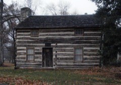
Block
From the record
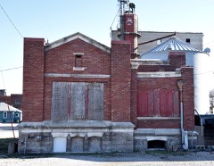
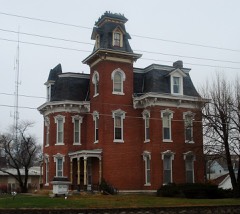
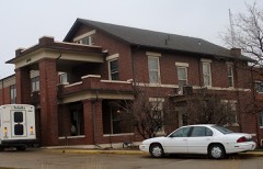
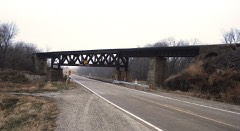
20 National Register listings published here.
Sources: the National Register database, National Park Service
19 topographic sheets cover 22 settlements here, and 20 properties are on the National Register of Historic Places.
20 National Register listings published here.
Sources: the National Register database, National Park Service
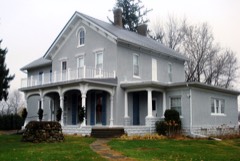
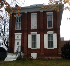
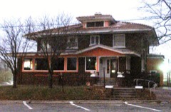
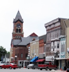
Every property in this county listed on the National Register of Historic Places, with the year it was listed and the federal nomination document.
Every wildfire the federal occurrence database records inside this county: 57 of them, burning about 411 acres. None started naturally and none was recorded as arson. Each settlement page carries the fires within five miles of it.
| Reported cause | Fires |
|---|---|
| Debris and open burning | 37 |
| Missing data/not specified/undetermined | 14 |
| Equipment and vehicle use | 3 |
| Smoking | 2 |
| Recreation and ceremony | 1 |
The five largest, by the area the report gives. None of them was recorded as arson.
| Date | Cause | Size | Reported by | Name on the report |
|---|---|---|---|---|
| 9 April 2014 | Debris and open burning | 60 acres | Iowa Department of Natural Resources | not named |
| 11 April 2015 | Debris and open burning | 40 acres | Iowa Department of Natural Resources | not named |
| 10 April 2009 | Missing data/not specified/undetermined | 40 acres | Iowa Department of Natural Resources | not named |
| 4 March 2017 | Debris and open burning | 22 acres | Iowa Department of Natural Resources | not named |
| 14 March 2017 | Debris and open burning | 18 acres | Iowa Department of Natural Resources | not named |
| 12 February 2012 | Missing data/not specified/undetermined | 15 acres | Iowa Department of Natural Resources | not named |
| 12 April 2017 | Debris and open burning | 15 acres | Iowa Department of Natural Resources | not named |
| 18 April 2014 | Debris and open burning | 15 acres | Iowa Department of Natural Resources | not named |
Every settlement page carries the fires within five miles of it - see the settlement index below.
The NOAA Storm Events Database holds 371 reports for this county, causing no deaths, 29 injuries and about $69,669,500 in recorded property damage. Each settlement page carries the reports that name it.
| Kind of event | Reports |
|---|---|
| Thunderstorm Wind | 175 |
| Hail | 101 |
| Flash Flood | 29 |
| Flood | 27 |
| Tornado | 26 |
| Heavy Rain | 6 |
| Lightning | 3 |
| Funnel Cloud | 3 |
| Winter Weather | 1 |
The most serious of them, by death, then injury, then recorded damage. The accounts are quoted exactly as the forecast office filed them.
| When | Event | Place named | Harm | What the report says |
|---|---|---|---|---|
| May 1998 | Tornado (F3) | Washington | 28 hurt, $9,000,000 | no account filed |
| April 1965 | Tornado | not stated | 1 hurt, $250,000 | no account filed |
| May 1988 | Tornado (F2) | not stated | $25,000,000 | no account filed |
| June 1998 | Thunderstorm Wind | Countywide | $21,000,000 | no account filed |
| May 1988 | Tornado (F2) | not stated | $2,500,000 | no account filed |
| June 1984 | Tornado (F2) | not stated | $2,500,000 | no account filed |
| May 2000 | Hail | Washington | $2,000,000 | no account filed |
| August 2010 | Flash Flood | Wellman | $1,000,000 | Heavy rains resulted in flash flooding in and around Wellman, IA during the morning of August 3. Major flooding was observed on Smith Creek on the south edge of town. County Road W 38 had to be closed due to the flood waters. Much of the town, including the fire station and water treatment plant, was under water. Some residences had 8 to 10 feet of water in their basements. Some water rescues were performed. The flood water was still about a foot deep in parts of town, especially near the fire station, during the late morning hours. |
| May 2012 | Tornado (EF2) | Noble | $500,000 | The tornado began near 120th street near Wayland in Henry County and moved into Washington County near Noble and lifted near Crawfordsville. The tornado was on the ground for approximately 10 minutes in Washington County. Damage along the path of the tornado included: several farm outbuildings destroyed, roof damage to homes, trees snapped, and power poles damaged. The most severe damage occurred near and to the northeast of Noble (Washington County) where several turkey farms sustained extensive damage and two large wooden truss power poles were snapped off. Two homes between Noble and Crawfordsville had the roof removed as well as the exterior walls on the upper floor. One of the homes had a car lofted and tumbled across the yard. |
| June 2010 | Flood | Wellman | $500,000 | Heavy rains during the second and third weeks of June resulted in the English River at Kalona going above the moderate flood stage level of 16 feet on June 12 around 11 pm. It crested above the major flood stage around 19 feet around 7 pm June 15. It fell below the moderate flood stage on the evening of the 17th. It crested for a second time at 16.8 feet at 1 pm June 19. It fell below moderate flood stage the morning of June 20. It rose back above the moderate level on the 23rd, cresting at 17.4 feet at 1 am June 24. It finally fell and stayed below the moderate flood stage level around 2 am June 26. |
| May 2010 | Flood | Wellman | $500,000 | Heavy rains during the second week of May resulted in the English River at Kalona going above the moderate flood stage level of 16 feet on May 13 around 330 am. It crested around 17.2 feet around 1 pm May 13. It fell below the moderate flood stage level around 130 pm May 15. |
| August 2010 | Flood | Wellman | $500,000 | no account filed |
| August 2009 | Flood | Wellman | $500,000 | no account filed |
| April 2013 | Flash Flood | Wellman | $250,000 | Several rounds of heavy rain resulted in flash flooding across much of Washington County from the mid morning of April 17 through the early morning of April 18. |
| June 2011 | Flash Flood | Wellman | $250,000 | Heavy rains resulted in flash flooding over much of the northern half of Washington County during the early morning of June 15. Highway 218 was closed in both directions near mile marker 74 due to water over the highway and vehicles in water in ditches. Several other county roads including Vine Ave, Ginkgo Ave south of Wellman, 12th Street in Washington, several underpasses in Washington, and 170th Street west of Riverside Rd were closed due to flooding. Some of the county roads were washed out. |
| June 2009 | Flood | Riverside | $250,000 | Heavy rains during the middle of the month resulted in the Iowa River at Lone Tree going above the moderate flood stage level of 16.5 feet on June 22nd around 830 am. It crested around 16.6 feet around 1230 pm June 22. It fell below the moderate flood stage level around 2 pm June 22. |
| June 2009 | Flood | Wellman | $250,000 | Heavy rains during the middle of the month resulted in the English River at Kalona going above the moderate flood stage level of 16 feet on June 21st around 930 pm. It crested around 17.64 feet around 6 am on June 22. It fell below the moderate flood stage level around 930 pm June 22. |
| August 2010 | Flood | Rubio | $250,000 | no account filed |
| May 1987 | Tornado (F1) | not stated | $250,000 | no account filed |
| April 1981 | Tornado (F0) | not stated | $250,000 | no account filed |
| June 2008 | Flood | Wellman | $198,000 | no account filed |
| August 2003 | Hail | Brighton | $150,000 | Lasted 20 minutes |
| June 2010 | Flood | Riverside | $125,000 | Heavy rains during the third week of June resulted in the Iowa River at Lone Tree going above the moderate flood stage level of 16.5 feet on June 16 around 12 am. It crested around 17.0 feet around 11 am June 16. It fell below the moderate flood stage level around 930 pm June 16. |
| August 2010 | Flash Flood | Wellman | $100,000 | Heavy rains resulted in flash flooding of several streets in Washington, IA during the morning of August 10. Some cars were stalled out in the flood waters. In addition, several county roads were closed due to the flood waters. Many of the gravel roads were damaged or washed out. |
| June 2010 | Flash Flood | Wellman | $100,000 | Heavy rains resulted in flash flooding in Wellman, IA and Kalona, IA during the morning of June 23. Streets and basements were flooded. |
| June 2009 | Flash Flood | Washington | $100,000 | Heavy rains have resulted in flash flooding in Washington, IA during the evening of June 21 and early morning hours of June 22. The basement of a residence was flooded. |
| June 2009 | Flash Flood | Riverside | $100,000 | Heavy rains have resulted in flash flooding of in the vicinity of Riverside, IA during the evening of June 21 and early morning hours of June 22. Flood waters on Highway 218 near Riverside, IA around 1100 pm June 21 forced its closure. In addition, several creeks near Riverside flooded Highway 22. |
| June 2007 | Flash Flood | Ainsworth | $100,000 | Extreme flooding and soil super-saturation caused basement wall of 2 homes to cave-in, leaving holes 12 to 18 feet wide in the basement walls. |
| July 2007 | Tornado (EF1) | Washington | $100,000 | A tornado touched down on the east side of town. It moved south and lifted approximately one half mile south of town.||A car dealership and nearby storage garage were damaged in Washington. A car and small pickup truck were reported to be briefly lifted and dropped. Numerous tree limbs and branches were down throughout town.| |
| April 2003 | Hail | Riverside | $100,000 | no account filed |
| May 2003 | Thunderstorm Wind | Brighton | $100,000 | no account filed |
| May 1996 | Thunderstorm Wind | Washington | $100,000 | no account filed |
| August 2010 | Flood | Riverside | $75,000 | no account filed |
| August 2016 | Flash Flood | Haskins | $50,000 | A trained spotter reported that a nearby railroad tracks were completely washed out. A farmer that lived nearby reported more than 6 inches of rain. The time of the event was estimated using radar. |
| June 2015 | Tornado (EF1) | Noble | $50,000 | An NWS Storm Survey determined that a tornado touched down 1.8 miles northwest of Wayland and was on the ground for 1.38 miles before lifting 0.9 miles north of Wayland. The tornado caused damage primarily to farm outbuildings and trees along its path with a rating of EF-1 and peak winds estimated at 100 MPH. |
| August 2010 | Lightning | Washington | $50,000 | Lightning struck an apartment building at 311 E Main Street in Washington, IA during the evening of August 13 resulting in a fire. Fire-fighting crews were dispatched at 1004 pm CDT. |
| July 2003 | Thunderstorm Wind | Washington | $50,000 | 15 inch diameter tree down |
| August 2003 | Thunderstorm Wind | Washington | $50,000 | Many trees down along with a power pole. Power out due to downed lines and a blow transformer. |
| April 2003 | Heavy Rain | Kalona | $30,000 | Street flooding |
| May 2011 | Lightning | Ainsworth | $25,000 | Lightning struck an old abandoned farm house setting it on fire during the early morning of May 25. The house was a complete loss. |
| June 2009 | Thunderstorm Wind | Ainsworth | $25,000 | Wind gusts estimated to be 60 mph blew over a parked semi truck near the junction of Highway 218 and Highway 92 near Ainsworth, IA around 440 pm June 27. |
| July 2007 | Thunderstorm Wind | Kalona | $25,000 | A corn field was flattened near town and some farm buildings were damaged near Highway 22 and Highway 1. |
| April 2006 | Thunderstorm Wind | Washington | $25,000 | Damage was first noted by law enforcement on a farmstead on 220th Street. The owners report the loss of the porch roof with windows blown out of the house. A machine shed had a wall caved in with power lines down. |
| April 2006 | Tornado (F2) | Washington | $25,000 | Rated F2 |
| July 2000 | Thunderstorm Wind | Kalona | $25,000 | A local newspaper reported thunderstorm winds blew down large trees and power lines throughout the town, and damaged a grain elevator and business sign. |
| November 1975 | Tornado (F2) | not stated | $25,000 | no account filed |
| April 1973 | Tornado (F1) | not stated | $25,000 | no account filed |
| May 1970 | Tornado (F2) | not stated | $25,000 | no account filed |
| September 2013 | Thunderstorm Wind | Washington | $20,000 | Law Enforcement reported that trees were down along with roof and vehicle damage at the Washington Golf and Country Club. The time of this event was estimated from radar. |
| June 1997 | Thunderstorm Wind | Wellman | $20,000 | One home struck by several large trees. |
| May 1996 | Thunderstorm Wind | Washington | $20,000 | no account filed |
| May 2017 | Thunderstorm Wind | Wellman | $15,000 | The local law enforcement reported a roof was off a shed, a garage, and hog and horse structures. Another garage was torn off a house. Trees and power lines were down with one tree down on a road. |
| June 2010 | Flash Flood | Washington | $10,000 | Heavy rains resulted in flash flooding of E Washington Street and W 3rd Street in Washington, IA during the late morning of June 15. The flood waters receded by 12 pm. |
| August 2009 | Flash Flood | Clay | $10,000 | Heavy rains resulted in flash flooding of several city streets and county roads in the southwestern part of Washington County during the afternoon and early evening of August 26. Several streets in Brighton, IA were flooded with the water at least 6 inches deep. Some residences in Brighton experienced flooding in their basements. In the Rubio, IA vicinity, several county roads were inundated with water. County officials also contributed to this report. |
| April 2006 | Thunderstorm Wind | Haskins | $10,000 | Straight line winds destroyed a barn on the Rick Gerot farm. |
| September 2005 | Hail | Washington | $10,000 | Also reported by spotters. |
| July 1999 | Thunderstorm Wind | Ainsworth | $10,000 | Thunderstorm downburst winds tore the roof off a house in Ainsworth. |
| August 2000 | Thunderstorm Wind | Washington | $10,000 | no account filed |
| May 2011 | Thunderstorm Wind | Wellman | $5,000 | Wind gusts estimated to be 60 mph blew down some tree limbs and power lines in Wellman, IA at 948 am CDT May 29. |
| June 2007 | Thunderstorm Wind | Washington | $5,000 | A roof of a mobile home was blown off. It then struck another mobile home nearby. Delayed report. |
The Survey's mineral resources record lists 18 workings inside this county. 3 still produce and 15 are closed or unrecorded. Each settlement page carries the workings within five miles of it.
| Commodity | Workings |
|---|---|
| Stone, Crushed/Broken | 17 |
| Sand and Gravel, Construction | 1 |
The least common of them first, because a county's hundredth gravel pit says nothing its first ten did not.
| Where | Site | Commodity | Status | Recorded |
|---|---|---|---|---|
| Riverside Plant and Pit | Sand and Gravel, Construction | Past Producer | ||
| Coppock Quarry | Stone, Crushed/Broken | Producer | ||
| Duesenbury Quarry | Stone, Crushed/Broken | Past Producer | ||
| Grace Hill Quarry | Stone, Crushed/Broken | Past Producer | ||
| Old Brighton Quarries | Stone, Crushed/Broken | Past Producer | ||
| Old State Quarry | Stone, Crushed/Broken | Past Producer | ||
| Richardson Quarry | Stone, Crushed/Broken | Past Producer | ||
| Slater Quarry | Stone, Crushed/Broken | Past Producer | ||
| Unknown | Stone, Crushed/Broken | Past Producer | ||
| Unknown | Stone, Crushed/Broken | Past Producer | ||
| Unknown | Stone, Crushed/Broken | Past Producer | ||
| Unknown | Stone, Crushed/Broken | Past Producer | ||
| Unknown | Stone, Crushed/Broken | Past Producer | ||
| Wellman Quarry | Stone, Crushed/Broken | Past Producer | ||
| West Chester Quarry | Stone, Crushed/Broken | Producer | ||
| Whitstine Quarry | Stone, Crushed/Broken | Past Producer | ||
| Wilson-Brighton Quarry | Stone, Crushed/Broken | Past Producer | ||
| Young America Mine and Mill | Stone, Crushed/Broken | Producer |
Named settlements recorded in the Geographic Names Information System, each with the topographic sheets covering it. Villages, hamlets and abandoned places alike. Each is shown with the nearest named watercourse or landform and the survey quadrangle it falls on.
Iowa township · 52327 · Riverside quadrangle
8 sheets, 1958 to 1984
No longer a settlement
Lime Creek township · 52356 · Kinross quadrangle
7 sheets, 1958 to 1984
No longer a settlement
The vanished settlements of Washington County: the places named above that are no longer on the map.