 Block
Washington, Iowa
7 topographic sheets cover this place, the earliest surveyed in 1958 and the latest in 1984. It stands in Washington Township. It lies in ZIP code area 52353. The Survey maps it on the Washington quadrangle. 7,352 people lived here at the 2020 count. It stands 761 feet above sea level.
Research this city
On record in Washington
Buildings and businesses the archive holds for this place. Each opens its own page, with the source record it came from.
On the National Register 12 of 16 shown
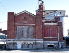 H.A. Baxter Coal Company Historic Districtlisted 2015
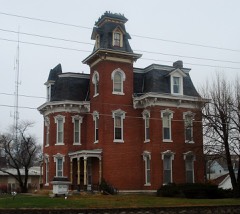 Blair Houselisted 1973
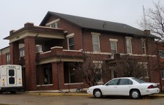 Brookhart, Smith Wildman and Jennie (Hearne), Houselisted 2005
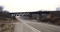 CM and StP Railroad Underpasslisted 1998
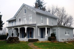 Jonathan Clark Conger Houselisted 1974
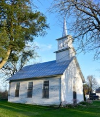 Gracehill Moravian Church and Cemeterylisted 1977
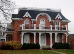 Joseph Keck Houselisted 1978
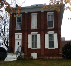 Kurtz Houselisted 1977
 McCleery Calendar Factorylisted 2015
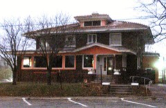 Winfield Smouse Houselisted 1983
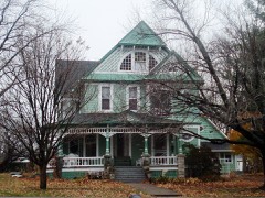 Frank Stewart Houselisted 1987
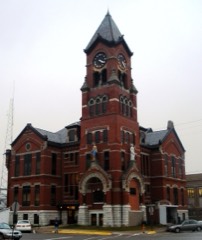 Washington County Courthouselisted 1981
Population over time
2 figuresWashington grew from 7,266 to 7,352 between 2010 and 2020. These are the recorded population figures Wikidata holds for this place, reached through the Geographic Names Information System number this page is keyed on rather than by name, so they belong to this place and not to another of the same name. Most are census counts, but not all are: an early figure may be a founding or settlement estimate, and an estimate published within five years of a census is left out. The change column is computed, and is left blank where more than 20 years separate a figure from the one before it, because a gap that long is not a change between two counts.
| Year | People | Change |
|---|---|---|
| 2010 | 7,266 | |
| 2020 | 7,352 | +86 (+1%) |
Topographic sheets covering this place
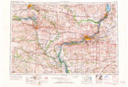
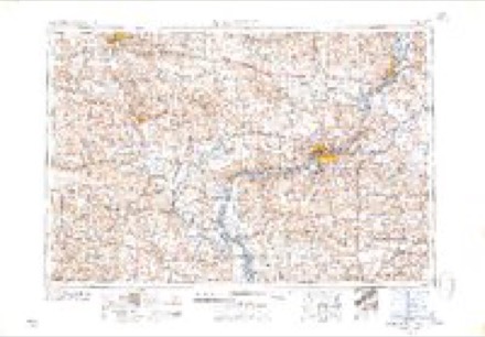
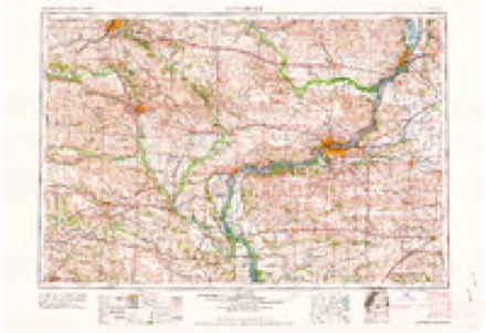
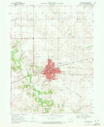
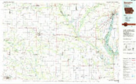
5 surveys from 7 printed sheetsMatched by testing this settlement's coordinate against the published boundary of every sheet in the United States Geological Survey's historical collection. Each opens the scanned sheet at the Survey.
- 1958 USGS Davenport quadrangle1:250000, 2 printings
- 1961 USGS Davenport quadrangle1:250000
- 1962 USGS Davenport quadrangle1:250000
- 1969 USGS Washington quadrangle1:24000
- 1984 USGS Muscatine quadrangle1:100000, 2 printings
Fires near this place
3 since 2008Regional context, not property-specific evidence. The federal wildfire occurrence database lists 3 fires within 5 miles of Washington between 2008 and 2017, burning about 12 acres in total. None started naturally. None was recorded as arson. Distance is straight-line from the map coordinates, so a fire counted here may appear on a neighbouring settlement's page as well.
| Reported cause | Fires |
|---|---|
| Missing data/not specified/undetermined | 2 |
| Debris and open burning | 1 |
The most recent of them, most recent first, with the day each was reported and the service that recorded it.
| Date | Cause | Size | Reported by | Name on the report |
|---|---|---|---|---|
| 17 April 2010 | Missing data/not specified/undetermined | 5.0 acres | Iowa Department of Natural Resources | WEST CENTRAL OF SECTION 10 OF DUTCH CREEK TWP, WAS |
| 25 March 2008 | Missing data/not specified/undetermined | 6.0 acres | Iowa Department of Natural Resources | not named |
| 24 March 2017 | Debris and open burning | 1.0 acres | Iowa Department of Natural Resources | not named |
Settlements close enough to share some of these fires:
Mines and quarries near this place
1 within 5 milesRegional context, not property-specific evidence. The federal mineral resources record lists 1 working within 5 miles of Washington: 1 producer. All of them still produce. What was taken out: Stone, Crushed/Broken. Distance is straight-line from the map coordinates, so a quarry counted here may appear on a neighbouring settlement's page as well.
| Where | Site | Commodity | Status | Recorded |
|---|---|---|---|---|
| Young America Mine and Mill | Stone, Crushed/Broken | Producer |
Storms near this place
60 of 101 shownRegional context, not property-specific evidence. The National Weather Service names Washington in 101 storm reports between 1996 and 2026: 54 thunderstorm wind, 26 hail, 8 flash flood, 5 tornado. The reports record 28 injuries. Each account below is quoted exactly as the forecast office filed it, from the NOAA Storm Events Database, and each date opens the federal record of that event.
| When | Event | Place named | Harm | What the report says |
|---|---|---|---|---|
| May 1998 | Tornado (F3) | Washington | 28 hurt, $9,000,000 | no account filed |
| May 2000 | Hail | Washington | $2,000,000 | no account filed |
| June 2009 | Flash Flood | Washington | $100,000 | Heavy rains have resulted in flash flooding in Washington, IA during the evening of June 21 and early morning hours of June 22. The basement of a residence was flooded. |
| July 2007 | Tornado (EF1) | Washington | $100,000 | A tornado touched down on the east side of town. It moved south and lifted approximately one half mile south of town.||A car dealership and nearby storage garage were damaged in Washington. A car and small pickup truck were reported to be briefly lifted and dropped. Numerous tree limbs and branches were down throughout town.| |
| May 1996 | Thunderstorm Wind | Washington | $100,000 | no account filed |
| August 2010 | Lightning | Washington | $50,000 | Lightning struck an apartment building at 311 E Main Street in Washington, IA during the evening of August 13 resulting in a fire. Fire-fighting crews were dispatched at 1004 pm CDT. |
| July 2003 | Thunderstorm Wind | Washington | $50,000 | 15 inch diameter tree down |
| August 2003 | Thunderstorm Wind | Washington | $50,000 | Many trees down along with a power pole. Power out due to downed lines and a blow transformer. |
| April 2006 | Thunderstorm Wind | Washington | $25,000 | Damage was first noted by law enforcement on a farmstead on 220th Street. The owners report the loss of the porch roof with windows blown out of the house. A machine shed had a wall caved in with power lines down. |
| April 2006 | Tornado (F2) | Washington | $25,000 | Rated F2 |
| September 2013 | Thunderstorm Wind | Washington | $20,000 | Law Enforcement reported that trees were down along with roof and vehicle damage at the Washington Golf and Country Club. The time of this event was estimated from radar. |
| May 1996 | Thunderstorm Wind | Washington | $20,000 | no account filed |
| June 2010 | Flash Flood | Washington | $10,000 | Heavy rains resulted in flash flooding of E Washington Street and W 3rd Street in Washington, IA during the late morning of June 15. The flood waters receded by 12 pm. |
| September 2005 | Hail | Washington | $10,000 | Also reported by spotters. |
| August 2000 | Thunderstorm Wind | Washington | $10,000 | no account filed |
| June 2007 | Thunderstorm Wind | Washington | $5,000 | A roof of a mobile home was blown off. It then struck another mobile home nearby. Delayed report. |
| April 2006 | Thunderstorm Wind | Washington | $5,000 | First discovered by law enforcement. Owners report a utility shed was flattened and scattered across the property. |
| July 2003 | Heavy Rain | Washington | $5,000 | in 90 minutes |
| May 2000 | Thunderstorm Wind | Washington | $5,000 | A house trailer being transported was blown onto it's side by high winds. |
| April 2006 | Thunderstorm Wind | Washington | $4,000 | Power lines were downed on 220th Street just west of County W61 by a downburst from the mesocyclone of the Washington tornado or a rear flank downdraft. Winds estimated at 61 knots (70 mph). |
| March 2006 | Hail | Washington | $3,000 | just west of town |
| July 2003 | Heavy Rain | Washington | $2,000 | in 10 minutes |
| August 2000 | Thunderstorm Wind | Washington | $2,000 | Tree downed on power line. |
| May 1999 | Thunderstorm Wind | Washington | $2,000 | Severe winds tore the metal roof from a welding shop and blew it into a neighboring business. |
| June 1998 | Thunderstorm Wind | Washington | $1,500 | Thunderstorm winds toppled trees across the city. |
| July 2006 | Thunderstorm Wind | Washington | $1,000 | 2 to 3 inch diameter branches down |
| October 2004 | Thunderstorm Wind | Washington | $1,000 | Measured at Sheriff Department. KAWG AWOS about 2 miles southeast recorded a gust of 49 knots from 1940-1950 CST. |
| June 2000 | Thunderstorm Wind | Washington | $1,000 | no account filed |
| April 2026 | Tornado (EF1) | Washington | - | An EF1 tornado with estimated max winds of 100-105 mph begun roughly 3 miles east-northeast of West Chester, IA. Along its 5.3 mile path, it snapped several power poles and tree trunks, along with ripping sheet metal roofs off of farm outbuildings. A semi truck was also tipped over near the intersection of State Highway 1 and 92, which can be associated with a localized wind surge south of the tornado. |
| March 2025 | Thunderstorm Wind | Washington | - | Wind measured at the Washington county EOC. |
| March 2025 | Thunderstorm Wind | Washington | - | A machine shed and cattle shed were destroyed, both of these buildings had open sides to the south. The time was estimated from radar information and Washington Airport AWOS equipement. |
| March 2025 | Thunderstorm Wind | Washington | - | A measured 74 MPH wind gust was recorded north of Washington on G36. |
| July 2025 | Flash Flood | Washington | - | Law Enforcement Officers reported several street in Washington were flooded. Several streets in Washington were flooded. |
| July 2025 | Flash Flood | Washington | - | A trained spotter and law enforcement reported that an underpass on 2nd Ave is flooded and impassable. |
| May 2024 | Thunderstorm Wind | Washington | - | Numerous branches down down, on the south side of town, along with a couple of trees. The time was based on radar data. |
| May 2024 | Thunderstorm Wind | Washington | - | A large tree was blown down. The time was estimated by radar data. |
| July 2024 | Thunderstorm Wind | Washington | - | A public report that a neighbors fence was blown over as well as a weighted basketball hoop. The time of the event was estimated using radar. |
| June 2023 | Thunderstorm Wind | Washington | - | A tree was blown down, onto a power line. |
| July 2023 | Thunderstorm Wind | Washington | - | Several trees down in the city. One large tree fell on a house and vehicle. |
| May 2023 | Hail | Washington | - | Report from Mping. |
| July 2021 | Hail | Washington | - | Received a public report of three quarter inch hail. |
| June 2021 | Hail | Washington | - | Penny size hail was reported. |
| June 2021 | Hail | Washington | - | CBS2 Meteorologist storm chasing reported lots of quarter size hail and few half dollar size. |
| June 2021 | Thunderstorm Wind | Washington | - | A few large limbs blown down, along with the roof blown off a baseball clubhouse. |
| June 2018 | Thunderstorm Wind | Washington | - | Large tree branches blown down. |
| May 2018 | Hail | Washington | - | Received an amateur radio report of nickel sized hail six miles southwest of Washington on Highway 1. |
| May 2018 | Thunderstorm Wind | Washington | - | A delayed report was received from the public of a small tree down. |
| August 2018 | Thunderstorm Wind | Washington | - | A trained spotter reported trees down in the city of Washington. |
| May 2017 | Thunderstorm Wind | Washington | - | The Washington Airport AWOS sensor measured this wind gust. |
| July 2016 | Thunderstorm Wind | Washington | - | The county emergency manager reported some trees were down in the city of Washington. |
| July 2016 | Thunderstorm Wind | Washington | - | The AWOS site at Washington reported a 54 Kt wind gust. |
| July 2014 | Hail | Washington | - | A trained spotter reported dime to possibly nickel sized hail. |
| July 2014 | Hail | Washington | - | A COOP Observer reported dime sized hail. The time of the event was estimated using radar. |
| August 2014 | Thunderstorm Wind | Washington | - | Wind gusts estimated to be 60 mph blew down a two inch diameter tree branch in a neighbor's yard around 1245 am CDT September 1/1145 pm CST August 31. Some loose objects in the area were also blown around during the storm. |
| July 2014 | Hail | Washington | - | The Washington Fire Department reported half inch diameter hail with a few that were quarter sized. Time of the event was estimated using radar. |
| June 2014 | Thunderstorm Wind | Washington | - | Wind gust measured by AWOS. |
| June 2014 | Thunderstorm Wind | Washington | - | Wind gust measured by AWOS. |
| June 2014 | Thunderstorm Wind | Washington | - | Winds were measured by an AWOS station. |
| May 2013 | Thunderstorm Wind | Washington | - | A COOP observer reported 3 inch diameter tree limbs down. |
| June 2013 | Thunderstorm Wind | Washington | - | A trained spotter reported that trees were down in town, corn was blown over, and a small metal outbuilding was destroyed. |
Nearest settlements
The eight closest, with where each one stands in the county. Distances are straight-line, computed from the Geographic Names Information System coordinates.
| Map | Place | Distance | Sheets |
|---|---|---|---|
| Havre | 5.4 miles | 7 | |
| Titu | 5.5 miles | 7 | |
| Eureka (historical) | 5.5 miles | 7 | |
| West Chester | 7.2 miles | 7 | |
| Ainsworth | 7.5 miles | 7 | |
| Grace Hill | 7.7 miles | 7 | |
| Haskins | 8.5 miles | 7 | |
| Lexington | 9.1 miles | 7 |
Elsewhere
Matched on this settlement's Geographic Names Information System number rather than its name, so it cannot be a different place of the same name in another state.
| Wikipedia article on Washington | An encyclopaedic summary. Its text is share-alike, so it is linked here rather than copied. |
| Wikidata item Q989456 | The structured record the population and elevation above come from. Public domain (CC0). |
Provenance
This settlement is recorded in the Geographic Names Information System as feature 462686. The sheet list is computed by point-in-boundary test against the United States Geological Survey's historical topographic inventory. Both are works of the United States government and carry no copyright under 17 U.S.C. 105.
Wildfire. Short, Karen C. 2022. Spatial wildfire occurrence data for the United States, 1992-2020 [FPA_FOD_20221014]. 6th Edition. Fort Collins, CO: Forest Service Research Data Archive. https://doi.org/10.2737/RDS-2013-0009.6 Collected with United States Government funding and usable without additional permissions or fees.
Mines and quarries. USGS Mineral Resources Data System (MRDS) https://mrdata.usgs.gov/mrds/ A work of the United States government, no copyright under 17 U.S.C. 105.
Storms. NOAA National Centers for Environmental Information, Storm Events Database https://www.ncei.noaa.gov/stormevents/ A work of the United States government, no copyright under 17 U.S.C. 105. Narratives are quoted verbatim from the National Weather Service report and are not edited or summarised.